Leaving Milford Sound – the Routeburn Track to Key Summit

On our way out of Milford Sound we plan to hike a piece of the Routeburn Track, one of the finest of NZ’s “Great Walks” (multi-day tramps).  It’s turning out to be a beautiful sunny day – we don’t know whether to cheer or curse our fate of yesterday (post of April 17, Milford Sound).  We decide to cheer – hard to stay grumpy on a sunny day!

The Routeburn track has an interesting twist.  Remember we took two – admittedly leisurely – days to drive to Milford Sound from just above Queenstown (post of April 13, Fiordland National Park and Milford Sound – Getting There) .  On the other extreme, tour buses from Queenstown drive to Milford Sound and back in one very long day.  The interesting story is that one can use the Routeburn Track to walk from Queenstown to (just above) Milford Sound over the Southern Alps in just 2 (long) days; it’s only 20 miles!  So why not build a short highway across the mountains to link the two tourist destinations?  The answer is twofold – one, Milford Sound already gets plenty of tourists in spite of the travel hurdles.  Two, if they built the highway, the city of Te Anau (Gateway to Milford Sound) would cease to exist.  So NZ wisely embraces the status quo.

The Routeburn track is very green and pretty, as one might expect from the rainfall.

As you can see in that last picture above, the banks of the trail (horizontal and vertical!) are solid with moss and ferns.  Other areas have banks that are chock-a-block full of lichen.  Sometimes the ferns are a solid mass going up the hillsides, just a forest of ferns (picture not shown).  It’s all very colorful!

Occasionally we encounter small waterfalls.

After an hour or so of steady upward climb, Ginger decides this is not her day to hike and turns back.  I’m 9DSC_0046feeling great and will push on.  Soon thereafter the trail to Key Summit splits from the Routeburn.  I take the Key Summit trail which heads up even more steeply.  Soon the forest ends abruptly, the view opens up, and I’m hiking past sub-alpine plants.  The picture to the left, below, looks back at the valley where we started, the other picture is the increasingly pretty view ahead.
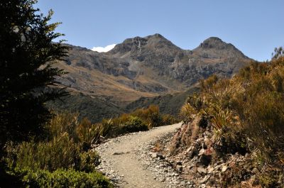
The flora is interesting, with a fuzzy ground cover and a number of small wildflowers like the genetian.

Finally I’m at the top, and it’s quite a pretty view from this small summit, with mountains absolutely surrounding it.  The small tarns and yellow ground cover/grass add to the beauty!

Looking more closely, I see that there is also a lot of red here, adding to the very pleasing palette of colors.  There’s red algae in some of the tarns, red lichen on the rocks, and a thick red moss on most of the tree trunks and limbs.  I’m loving the feast of colors!

The trail doesn’t really stop here; it seems to wander off in several directions, including a “nature walk”.  I decide to wander as well, going up, of course.  There’s a hill ahead.  One of the advertised “sights” from the Key Summit is the view of three valleys that intersect here, the great conjunction.  You can sense – if not see – them in the pictures below; the first picture shows a valley over the left side of the summit, the next showing that valley joining another and falling away, the third picture showing the joining valley over the right side of the summit, and the last picture hinting at the third valley that’s coming in, but the view is blocked by the hill ahead.
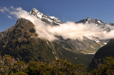
Lake Marian in the cirqueAs I’m walking up the hill, I come to an opening with a bench, and a sign saying there’s a view of Lake Marian.  Sure enough, there’s a glacial cirque with a lake – always a pretty sight!  Alas, there is just a snippet of the lake showing.  As I’m watching, a guide with a customer shows up and says the trail continues up the hill for a better view.  I’m on it!  However, there is no obvious trail anywhere, things seem to Pretty tarnsend here.  As I walk up the hill, a trail does emerge – a footpath, really, and not used much.  I do pass some more quite beautiful tarns.  After some climbing the steep footpath then leaves the open tundra to go into a forest of short trees with the red moss.  The trail becomes almost hidden in the plants, and then becomes nothing but mud and roots and hauling yourself up by grabbing tree trunks – you really have to want to go here!  It is also taking me longer than anticipated.

Finally I’m out of the woods, and there is a good view of Lake Marian!  It looks like a pretty fabulous place to pitch a tent, over there.

A further benefit is the view up the hill; down in the valley there’s a big lake – probably

Lake Gunn that we visited yesterday.  Key Summit is definitely a pretty place!

Alas, I have taken longer than planned, the long-suffering Ginger is patiently (?) waiting (lucky for me she keeps her Kindle in the car), so even though the path continues up, I’d better go back.  More’s the pity!  The problem with a day hike into NZ’s multi-day Great Walks is that you do the tough vertical climbing to get to the pretty areas,  then once there, with easier hiking and all the best views still ahead, you turn around and go back down.  Still, the half-loaf is worth it (and I didn’t have to carry a heavy backpack).

Below are two pictures taken on the way down of the pretty tarns and the red ground cover with berries.

On our way back out Milford Road, we stop at Lake Gunn to see it in the sun – it’s a pretty place, with very clear water.  For comparison I’ve included our picture of Lake Gunn from yesterday.

The valleys are also much prettier in sun.

That’s it for Milford Sound!  Hope you enjoyed the trip up Routeburn.  Next stop, the Scottish city of Dunedin.

Milford Sound

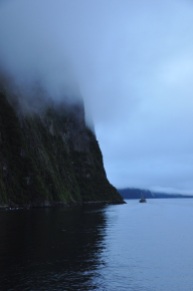
Milford Sound is a famous landmark of NZ.  People fly over by plane, or travel by bus or car, or even hike in over the Southern Alps.  It is said that one needs to see Milford Sound on repeat visits: in the sun, in the rain, and under a blanket of snow.  Why one should see it in the rain is not intuitive, but my travel book says that shortly after a big downpour every cliff sports a waterfall (and the place looks even more magical as ethereal mist descends).  I say this to lift our spirits, because it is raining steadily, and the “ethereal mist” is pretty damn depressing.  I know that the famous and massive Mitre Peak is staring me straight in the face in the left picture, but someone ate it.  Still, the view has a somewhat oriental charm to it, just not the OhMyGosh! view I was hoping for.

There are some nice views before departing – a white heron fishing, a near-by waterfall – but note my difficulty in keeping my lens dry.  The minimalism of traveling does not permit many photographic accessories.  A lens hood or underwear, that’s the choice.

Finally we’re off, along with 58 other hardy souls looking a little long-in-the-face as well.  The boat is nice, although its large picture windows are not going to work for taking good photos from inside.  I’ll have to brave the elements outside, and dash inside to clean my lens – along with a lot of other photographers, but everyone plays nice.  The first views are certainly atmospheric; big mountains diving straight into the water, and tall waterfalls appearing out of the clouds.  In gray.  Sigh!  For perspective, look at the other cruise ship in the last picture.

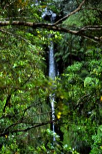
As we motor out, there certainly are waterfalls!  When we get closer to them, there is still some color through the rain and mist, thank goodness.  They’re pretty, take a look.

Part of what is happening here is the presence of many “hanging valleys”.  In the ice age, mile-thick glaciers rumbled cross-wise across mountains and valleys, churning a trough a mile deep.  When the glaciers left, leaving nearly vertical cliffs at the trench edges, the rivers traveling down those valleys now had no choice but to hurtle lemming-like off the cliffs into the waiting Sound (fiord).  In Milford Sound, only a half-mile wide, the effect is impressive; the peaks, we are told, go up 3000 feet (alas, in the fog we only see about 100 feet of that!), and the water of the Sound is over 1000 feet deep.  Where we float, the sides of the glacier-sheared mountains are near-vertical.  What that means for us is that the cruise ships can get within a few feet of the mountainside with no fear of hitting anything, and they do that at the waterfalls with some glee.  Which you’ll see below, as we approach a single waterfall.

I saw what was going to happen and quickly bailed into the cabin, as did ginger (in the blue raincoat).  The prow went into the waterfall; the kid and dad got soaked!  And I mean drowned-rat soaked!  They were dripping their own cascades as they sloshed into the cabin.

There are more waterfalls, which are just everywhere.  It’s like the world has sprung a leak.

I hope you’re enjoying the beauty of these waterfalls!  It’s raining, and I’m having to dash in and out of the cabin to dry my lens.  Soon my lens cloth and then handkerchief are as damp as the lens, and I’m just pushing the wet and smear around.  Reality is probably clearer than what you see in these pictures – but fear not, the mist and fog you see in the pictures may be augmented by my wet lens, but for sure it is really there!

We do another close-encounter with a waterfall, shown below.  The waterfall is truly beautiful, but this time everybody retreats at the last minute.  No takers to experience becoming one with the waterfall!  Which just goes to prove that if history is close enough in time, humanity can learn from its mistakes.

That waterfall was a pretty one!  Alas, you only get to see the static view; the moving view was so much better, with the changing patterns of falling water and those white trails on the water surface zinging out at us at high speed, almost scarily.

We’re heading for a small bay where we’ll moor for the night – what little light we had is beginning to fade.

Surprise, we get to go out and explore before dinner!  On the water.  A few choose to go out in kayaks by themselves.  A couple of young ladies decide to go swimming (!).  We, along with many others, choose to go out in small rubber boats with a guide.  A good choice!  The perspective is slightly  different this close to the water, and we get to see some wildlife here at the end of the day – a NZ pigeon (large, beautiful tree-dwelling birds!), a seal practicing his diving technique, and – lucky us! – a Fiordland crested penguin coming home to his nest!  He is very cute as he hops up the rocks to his burrow.  The last picture is of our bay as twilight deepens.

Well, the day was beautiful in spite of the rain, and the waterfalls were other-worldly, but we are disappointed; the mountains should be towering above us, cathedral-like, for thousands of feet, and we see only glimpses beyond 100 ft up.  Our captain says there is a good chance the clouds will lift by morning.  We cross our fingers and go to sleep.  The late-night passengers take pictures of seals that climb on board at the lower level and sleep on the deck!

The morningThe morning brings the same low cloud cover.  Today we will head first to the mouth of the Sound (the Tasman Sea), and then head for home.  There is a chance the clouds will lift for the trip home!  In fact, the rain has stopped and things are looking lighter, especially up ahead, and certainly the views are brighter and sharper!

As we approach the Tasman Sea, we have clear skies!  As in, practically no clouds overhead at all!  There is hope!

Looking back at the low-lying funkOf course, looking backward, there is still nothing but truncated mountains as far as the eye can see.  Can the funk go away in time?  As we move further out into the Tasman Sea and look back, the cloud situation is amazingly and frustratingly apparent.  In the pictures below, look at those beautiful, commanding mountains towering above the cloud cover!  Yes!  And look at how thin that layer of low-lying white cloud is!  And look at the sun trying to shine through!  This could work!!

Well, it’s hopeful!  As we enter the Sound, the low-lying cloud cover is dauntingly there, but there are also luminous areas where the sun struggles to break through, as shown in the first image below.  As we venture further into the Sound, everything gets clearer and brighter.  The last image, looking backward, shows real sun shinning on where we were.

As we retrace our path of yesterday, we revisit the waterfall close-encounter.  The waterfall is definitely a little smaller, but the view is now even more beautiful, the colors brighter, the rocks more clearly defined.  It is again a magical view in NZ.

As we travel on, it becomes clear that we will not escape our fate of a low cloud ceiling.  The funk is lifting behind us, but not in front, and time is running out.  It is a little frustrating, knowing how thin the obscuring cloud cover is!

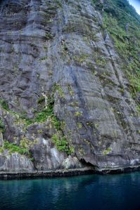
Horizontal scar marks from the glacier that formed the SoundWe do pass an interesting part of the Sound, where a protruding wall shows the scour marks of the glacier from so many millions of years ago.  Showing its age with wrinkles, it is.

Well, the weather continues to toy with us as we near our harbor destination; the ever-present cloud cover is getting lighter, but persists, restricting our view to just a few hundred feet up.

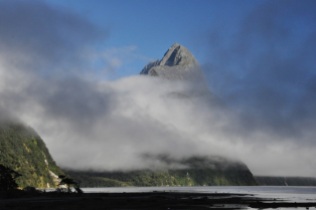
Mitre Peak at Milford Sound HarborAnd then we’re at the Milford Sound Harbor and disembark.  We disembark to, of course, the lifting of the funk, at least here.  Well, better late than never, I guess.  Ladies and gentlemen, we present finally, Mitre Peak in all its glory.  OhMyGosh!

Just for comparison, let us show you the before (yesterday) and after (today) pictures of the harbor, and you can judge what we missed!  The before pictures are the first two pictures  from this post.

Well, OK, I groused all through this post about what we missed, didn’t I?  My apologies.  I, of course, wanted it all.  Even so, it was pretty spectacular, wasn’t it?

Next post – Fiordland and the Routeburn Track!

Fiordland National Park and Milford Sound – Getting there

In our March 26th post (Aoraki/Mt. Cook National Park), I remarked that the South Island reportedly has most of the superlative sights in NZ.  Many of those sights lie in Fiordland, New Zealand’s largest, most remote and wildest national park.  It is a region of stunning beauty, boasting some of the tallest waterfalls in the world; its glacier-scoured lakes are the deepest in the country, some nearly 15oo feet deep; its coastline sports 14 glacier-carved fiords, some nearly 25 miles long.  (Note:  the fiords were misnamed as “sounds” by early sailors; a fiord is formed when a glacier grinds its way to the sea [and then melts]; a sound is a sea-drowned river valley).  Fiordland is also an isolated, almost inaccessibly wild land, bordered by the Southern Alps on one side and by steep fiords on the other.  It endures enormous rainfall –  it rains more than 200 days a year.  Milford Sound, where we’re headed, gets 27 feet of that wet stuff annually.  Of its 14 fiords, only 2 (Milford and Doubtful) are relatively easy to visit.  The Maori visited Fiordland but did not live there.  In 2001 the total human population of this vast land was 48 souls.  If you include border towns like Te Anau, the population today is still under 2000.   Isolated, yes, but there’s probably a correlation between low human population and the large numbers of the infamous sand fly (called “black fly” in the US), a tiny, blood-sucking critter with an incredibly vicious bite – they’re more like flying piranhas than insects.  This inhospitable remoteness does have some benefits: some of the animals and plants of the ancient super-continent Gondwana still exist here (eg. living brachiopods, unchanged in 300 million years); and in 1950 the takahe, a flightless bird that had been believed to be extinct for 50 years, was rediscovered in Fiordland.

We can’t wait to see this area.  We spent a bunch of money for an overnight cruise on Milford Sound; now we have to get there.  The plan is to high-tail it to the gateway town of Te Anau, spend the night, and get an early start for a leisurely trip along the 70 miles of Milford Road, billed as one of the world’s finest drives, before boarding our 60-person cruise ship.

We pass near Queenstown, which looks gorgeous in the distance. From the Crown Range

Saddle I think we see vineyards nearby.  Oh yeah, we’ll be back soon to visit!

The trip to Te Anau goes past the very long, very deep and very pretty Lake Wakatipu, then

travels over picturesque fields and mountains.  Te Anau, on the edge of the Fiordland, is much more impressive.  After we wander the town, take in a “fly over Fiordland” documentary (soooooooo much cheaper than paying for the fly-over itself!), and have dinner at a fancy Italian restaurant, there is just time enough to capture a few pictures

of the area as the sun sets.  The impressive views suggest a fabulous tomorrow!  Equally Our restored B&B monasteryfabulous was our B&B; it’s a restored monastery, beautifully done inside.  We were there for too little time to really appreciate it; for example, the outdoor mega-size chess set, the free port and gay laughter we could hear in the upstairs lounge as we went to bed….. darn it, can’t do it all!

The next morning is disappointingly overcast, with rain clouds on the horizon; looks like we’re going to get one of those 200 days of rain.  Drat!  And sure enough, clouds and rain are our companions through some magnificent valleys.  I think the views would be spectacular in shimmering sunlight, but it is still beautiful in the mist.

A popular tour-bus stop (Milford Sound is such a tour-bus mecca!) is Mirror Lakes, right by the highway.  We stop too.  In good weather there are outstanding reflections of the Earl Mountains.  Even in the rain, the view and color is nice.  The cute duck is a NZ Scaup.

We go further to Lake Gunn and decide to do the 2 mile nature walk.  Glad we did – it’s a good insight into the effects of 27 feet of rain!  The walk is a riot of mosses of every kind growing on everything, and plants growing on top of the mosses!  Trees are a vertical extension of the forest floor!  It’s beautiful, as you can see in the many images below, but we were afraid to stand still for long.

We continue, up and up, to the Homer Tunnel, carved nearly a mile through the solid stone of a glacial cirque.  The tunnel was quite an engineering feat, started in 1935 and finished in 1953.  It took so long in part because the downward angle quickly ran into water and in part because of interruptions by several avalanches and WWII.  What is novel to us is that it’s a one-lane road!  While we wait for our turn to go through, we are entertained by the numerous waterfalls pouring down – and the inquisitive and highly intelligent kea, the world’s only alpine parrot.

While we watch a kea on a car roof, it grabs a hard plastic cover over the tailgate hinge and rips about a fourth of it off!  As it works on the remainder, we inform the inhabitants that their car is being eaten.  The man steps out holding a short piece of 2×4 (be prepared?) and swats at the parrot, which nimbly hops to the front of the roof, out of swinging distance, but still on the roof!  Catch me if you can!  I am impressed, and hurry back to my car to make sure the gremlins aren’t there.  The redeeming virtue of the parrots is that they’re so cute!  They walk like sailors newly on land, a rolling gait, and appear fearless.

Inside the Homer TunnelFinally, after a 15 minute wait, it’s our turn, and off we go into the tunnel.  It looks old!  The stop lights governing traffic into this tunnel are only used in summertime; in wintertime, it’s every man for himself, which could mean backing out a loooong way.  I’m betting there are spirited “rock scissors paper” games when 2 cars meet.  Of course in wintertime chains are required, avalanches are a problem, and then you have to wait while maintenance workers in helicopters drop dynamite on the snow overhangs.  Maybe the stoplight wasn’t so bad!

Homer Tunnel exit, with waterfallsWe exit the Homer Tunnel into a whole lot of waterfalls coming from a massive cirque.  Just for perspective, the tunnel exit is the roofed structure in the lower left of the picture.  Waterfalls are absolutely everywhere;  it would be crazy to show close-ups, so just enjoy the overviews as we drive down!


Finally, we visit another tour-bus stop, The Chasm, where the Cleddau River scours rocks into interesting shapes as it falls nearly vertically down a deep, narrow channel.

We’ve now arrived at Milford Sound.  Rainy and overcast!  There were many other hikes to take from the Milford Road, but they were longer and we ran out of time; we board the cruise ship shortly at 4pm and just have time to take a quick look around.  Next post – The famous Milford Sound!