SW Ireland Tour VI – An Aran Island, Inisheer

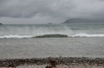
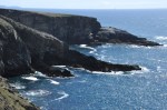
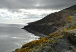
For our last outing we take a boat from Doolin to one of the Aran islands, Inisheer.  Hey, I didn’t realize the Cliffs of Moher were visible from the Doolin harbor!  Cool.

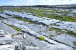
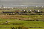
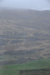
What we see as we approach Inisheer is the incredible number of stone fences that apparently needed to be built to clear the land.  It’s a staggering amount of stone!  As we dock we are greeted by a lone dolphin, happy to see us!

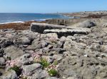
The many stone walls on the Aran Islands are often built in a unique style, I think due to the small plots that they enclose.  In this “Aran ‘gap’ style”, the walls periodically The Aran "gap" style fence with upright stonesinclude tall upright stones, the spaces between them filled with smaller stones.  This construction allows a farmer who wants to move livestock to dismantle a short section of wall as a temporary gate, and then easily rebuild it.  It also allows the winter gale winds to blow through the gaps in the wall, rather than blow the wall over.

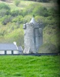
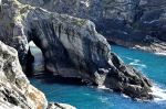
One of the sights on Inisheer is the An Plassy, a freighter that wrecked offshore in 1960 (the crew was rescued with the help of the islanders) and was then washed ashore in a

gale a few weeks later.

There is “old stuff”  in Inisheer as well, the oldest being the ruins of St. Caomhan’s, a church that was nearly buried by drifting sand dunes.  From the grass-stabilized top of the sand dune (now a cemetery), you can see that only the very tip of the roof would have been visible before excavation.  Little is known of St. Caomhan, the patron saint of Inisheer,

who lived in the 500’s.  The church was built in the 900’s, and a century later the nave was widened.  The crude construction is pretty cool.  The alter, at the other end of the church,

Tomb of St. Caomhan
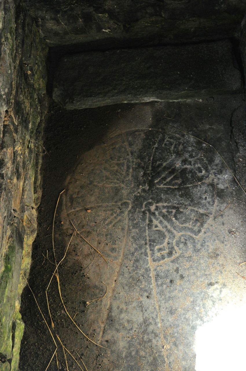
has a carved stone above it.  Nearby is the reputed gravesite of St. Caomhan.  Local folklore claims that if you spend the night sleeping on the tomb, your particular illness will be cured (my guess is that sleeping there would be sufficiently uncomfortable that afterwards other parts hurt worse).

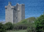
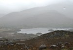
A final point of interest is O’Brien’s Castle, the ruins of which dominate the hilltop and are visible from most of the island.  This small castle was built as a tower house refuge around 1400 by the O’Brien clan whom we’ve met before (“Southwest Ireland Tour II – Mizen Head and Killarney National Park“, July 8, 2015).  The castle sits inside the low

wall of a much older Iron Age ring fort.  The (hated) Cromwell’s army attacked the castle

in 1652, leaving the ruins seen today.

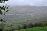
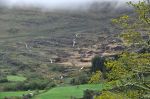
This hilltop is an excellent vantage point to view the island and see the incredible number of stone walls that surround the small plots of land; it was obviously easier to build walls

with the stones than carry those suckers down to the beach.

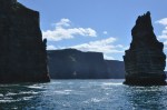
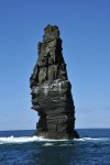
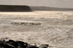
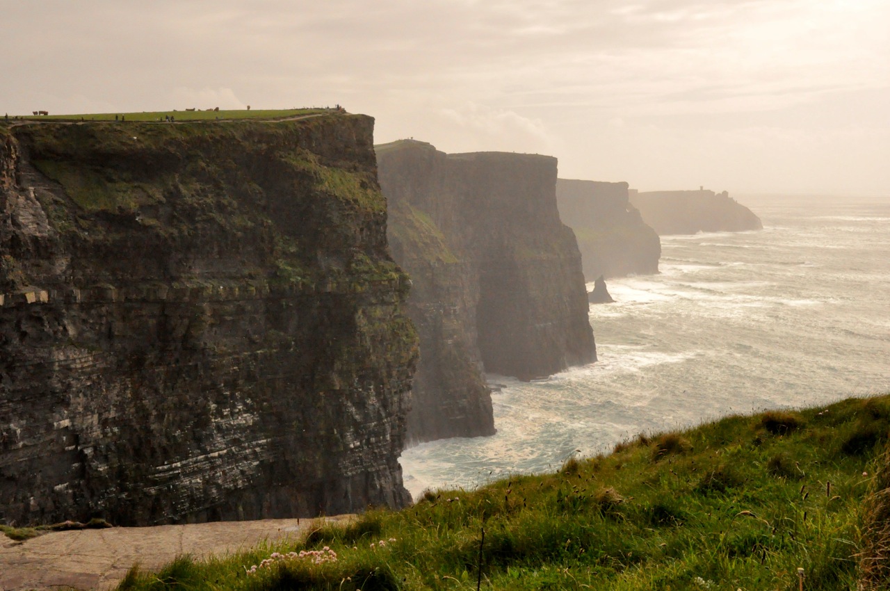
On the way back to Doolin we get an up-close view of the Cliffs of Moher from the sea.

Even better, we get a good look at some nesting sea birds — kittiwakes, razorbillls, guillemots and puffins.  Puffins!  How cool is that!  First, take a look at one of the nesting

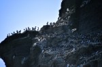
sites on this chunk of rock.  It’s a high-rise bird condo!  Each type of bird seems to roost with its own kind (birds of a feather!) but they also have very close neighbors of other

species, as shown in the right figure where kittiwake gulls (on nests) are the upstairs neighbors of the guillemots.  Note that all these birds are nesting!  The guillemots only come to land to breed, and, unlike the kittiwake, make no nest; their single egg is incubated on the bare rock ledge.  Also note the two darker birds in that right picture above; those are razorbills, a species related to guillemots but with a very different beak.   They also only come ashore to breed.  The bird condo houses some species of birds that

I can’t identify – the picture above, on the right, shows two unidentified black birds defending their nest.

The highlight, though, was getting to see puffins!  They were a minority of the bird population, and hard to photograph, but there were quite a few of them in the water,

hunting for dinner with the other birds.  Beautiful!  Ah – that last picture, from the internet, is just to show you how spectacular they really are.

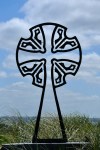
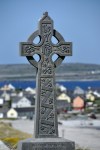
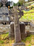
And so the Ireland/music tour winds down.  I’d like to share one last set of pictures with you, of Irish crosses mostly from Skibbereen and Inishmore.   The Irish cross is beautiful, full of Celtic artwork.

Our last professional music event featured a young and gorgeous lady named Tara Howley.  She blew us away with her awesome multiple talents on the concertina, fiddle

and Irish pipes (!!); she also sang ballads with the voice of an angel.

Our very last music event was definitely not professional; after Tara finished playing, the group gathered and each of us had a chance to perform if we so wished.  Of particular note was the penny whistle concert; Jackie Manning of Small Potatoes had taught a bunch of us to play this simple instrument – which is not so simple!!  If any finger does not completely cover its hole on the penny whistle, the instrument squeaks loudly.  So you can imagine how our plucky ladies sounded, with very little time to practice.  Also of note was Len’s

songwriting skill.  Len, along with several others in our group, had suffered through a debilitating stomach bug early in the tour.  His song, “There was a salad in (name of restaurant)”, sung to the tune of “House of the Rising Sun”, was a show stopper.  And of course the Small Potatoes performed, also a great treat!

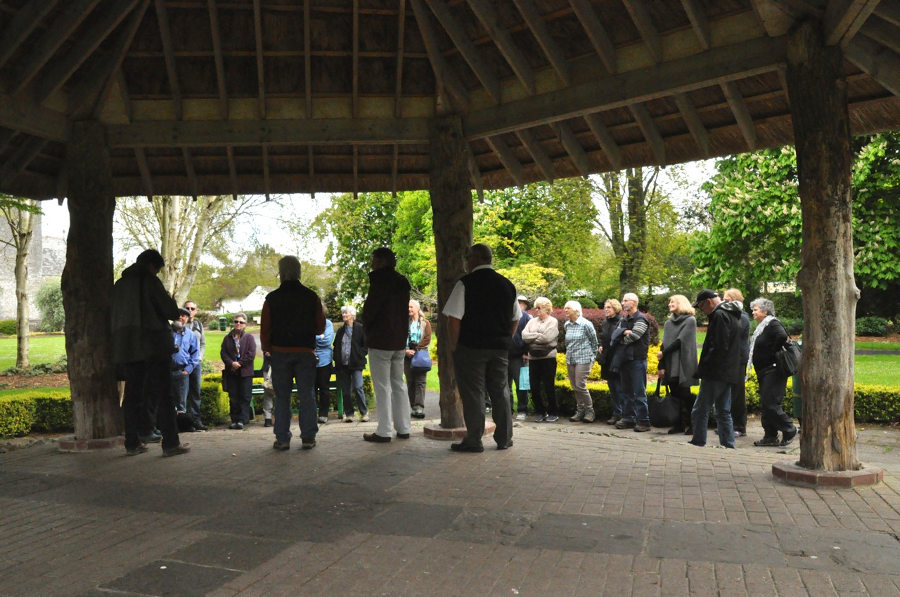
Thus ends the great South West Ireland Tour with the Small Potatoes.  We saw many

sights, heard great traditional Irish music, drank good beer (Murphy’s was best!) and Irish whiskey (the more expensive it is, the better it really does taste!), had a good time, and met

some wonderful people who were soooooooo knowledgeable about music.  The picture on the right shows us all, on the last day before leaving.

As noted in the first post of our Ireland tour, we’re out of sync with our travels.  We interrupted our posts about our travels in bonny Scotland to write and share this section on Ireland with our new-found tour friends.  The next post will cover our last two days in Ireland.  We visited Bunratty Castle and Limerick with two good friends from Ohio who went on the Ireland tour with us.  After that we’ll pick up where we left off in beautiful Scotland.

SW Ireland Tour V – The Burren and the Poulnabrone portal tomb

Today we’re off to The Burren, a limestone plateau that an officer of Oliver Cromwell’s army described in 1650 as “a savage land, yielding neither water enough to drown a man, nor a tree to hang him, nor soil enough to bury him“.

First we stop for lunch and a fascinating lecture on the role of the Irish (and Irish Americans) in the preservation of folk music/ballads.  Cool stone building, too!

The Burren is one of the finest examples of a “karst” landscape in the world.  This sedimentary rock was formed under the sea, then uplifted, glacier scoured and earthquake-fractured.  Neolithic farmers cleared the trees, promoting soil erosion and stone exposure.  Rainwater expanded hairline fractures in the stone to form deep criss-

crossing crevices (grikes).  That structure, combined with an unusually temperate climate (45 to 60°F), has made the Burren renowned for its remarkable variety of plants.  The moist and variable micro-climates of the grikes support Mediterranean, alpine, and even arctic plants side by side.  Mediterranean orchids, alpine mountain avens and gentian, and arctic ferns all grow here.  Some of them, such as the Irish orchid (first picture below), are

in bloom.  One of the interesting aspects of the Burren is its modern use as pasture land.  Are you nuts, you say?  Pasturing on karst?  Did you see the pictures above??  According to the comments by that officer in Cromwell’s army, “… and yet their cattle are very fat; for the grass growing in turfs of earth … that lie between the rocks … is very sweet and nourishing.”  While most of Ireland is too cold for grass to grow in winter, cattle can graze in the Burren ’til spring.  So the ancient tradition that dates back to Neolithic times is still in use today, and cattle are herded here from all over Ireland for winter grazing.  In addition to producing fat cows, winter grazing is also good for the Burren ecology – it prevents regrowth of scrub and woodland, thus minimizing disturbance to the Burren’s rich flora.

But the Burren is much more than just plants!  There are more than 90 megalithic tombs (large stone above-ground burial chambers) and a number of stone ring forts that were constructed here more than 5,000 years ago in the Neolithic late stone age.  The sites may have had functions in addition to burials; they were constructed at a time that corresponds with the establishment of the first farming communities, and thus may have played a part in territorial and community identity.  We are visiting the Poulnabrone portal tomb, one of the finest and most visited.  It consists of 2 tall portal stones flanking the entrance to a rectangular stone-lined chamber, 2 slightly smaller supporting stones, and a single large capstone.

Often a mound of loose stone (cairn) and earth would have surrounded the tomb on 3 sides, stabilizing the chamber, with the space below the capstone forming an entrance; I Hypothesized scenario for tomb buildingfound a possible scenario for creating these types of tombs as shown to the left.  However, for the Poulnabrone, the cairn was originally no higher than it is today, creating the dramatic tomb structure you see now.  Obviously it was built well, since it stands here after 5 millennia (pretty cool!), but how it was built is not known.  Excavation of the Poulnabrone revealed at least 33 individuals were buried in the chamber – infants, children and adults, both male and female, over a period of perhaps 500 years.  Likely the bones, highly fragmented, were initially buried or allowed to decompose elsewhere before being transferred to the tomb around 3800 BC.  Personal possessions buried with the dead included a polished stone axe, a decorated bone pendant, stone beads, quartz crystals, flint weapons, and fragments of pottery.  A thousand years later (~1700 BC), a newborn baby was buried in the portico, just outside the entrance.  The labor required to construct the tomb and its continued use over such a long period of time suggests that this portal tomb, with a dominating presence on the limestone landscape, served a powerful symbolic role – a territorial marker or a center for ceremony and ritual.  We were very impressed!

Time for some traditional Irish music, and Doolin is renowned for that !  As we return to Doolin we pass a much smaller portal tomb near the road, several tower houses (and castle?), and a stormy sea.  Ireland is certainly picturesque.

Stacked peat logs in DoolinAs we walk to our dinner/pub to hear Blackie O’Connell on the Irish pipes, we pass a big stack of peat logs, drying out.  Pretty impressive!  Although I don’t know how anything dries out in Ireland.

Blackie O’Connell did not disappoint!  He was fabulous on the Irish pipes, as was the fiddle player that was with him, Eoghan Neff.  There

were amazing notes coming from that fiddle that I’ve never heard before!  He was awesome.  The guitar player, Cyril, was also quite good.  This trio is a Doolin band called “Foolin In Doolin”.  The next night was a different restaurant/pub but with some of the

same players (Blackie and Cyril), plus a ballad singer (Geraldine).

Well, this is a small post, but enough for now.  Tomorrow, our last day of the tour, we take a boat to the nearby Aran Island of Inisheer – where there is much to see.


Southwest Ireland Tour IV – Slea Head and Cliffs of Moher

We’re off to the coast at Slea Head, the westernmost part of Ireland.  We pass another ruined tower house – they look so cool and King-Arthur-romantic!  Well, cool-looking

now, but then they were a defensive solution to marauders who wanted to rob or kill you, a sobering thought that takes the edge off romanticism.  The times were tough.  And speaking of tough, one of the enduring memories we’ll take from Ireland is the ubiquitous stone fences separating plots of land, attesting to the difficult conditions that early farmers

had to face!  First there was need to clear the rocky land, and the stone fences are monuments to that effort, a physical “tip of the hat – you’re welcome” from the ancestors.  Then there was the law requiring the land to be subdivided for each male child; before the famine each little plot would have had a house and a family on it.  Before the famine of 1845 there were 40,000 people on this peninsula.  Even today it’s home to just 10,000.

As shown below, the coast at Slea Head was indeed attractive, although not as dramatic as Mizen Head (Southwest Ireland Tour II – Mizen Head and Killarney National Park“, July

8, 2015).  This harsh yet starkly beautiful area was the setting for two period films of note, Far and Away (Cruise, Kidman) and Ryan’s Daughter (Mitchum, Miles).

In the pictures above you can see glimpses of Great Blasket Island in the background.  The island was home to a small number of hardy Irish families for centuries.  Life was difficult, the land poor, the weather stormy, and there was neither priest nor pub nor doctor.  Each family had a cow, a few sheep, a plot of potatoes, and fishing skills.  Because they were not entirely dependent on the potato, they survived the famine relatively unscathed. They spoke only the Irish language (which was banned on the mainland).  Considerably isolated, they became a living symbol of a traditional Irish Gaelic culture.  In the 1920’s and 30’s, several of them wrote books (in the Irish language, of course) that recorded much of the islands’ traditions and way of life (e.g., Twenty Years A-Growing by M. O’Sullivan).  The author’s inspirational and vivid storytelling won international acclaim, and the books were translated into many languages.  Although at one time the island

was home to 160 people, over time it dwindled to 22.   In 1953 the government moved them to the mainland, and today the island is uninhabited.

Smerwick Harbor from BallyferriterThe next day is a mostly free (collapse) day, and I and 2 others decide to hike from Ballyferriter to the nearby beach at Smerwick Harbor.  It’s a gorgeous bay, but expansive – and difficult to capture in a single photo.  My only picture of a good portion of the bay comes from a shot out our hotel window over the roofs across the street – not ideal, and not all of the bay, but you get the idea.  Here in Ireland every place seems to have some history associated with it.  When Catholic Ireland once again took up arms against Protestant England (this time Queen Elizabeth I) in 1580, a force of 600 Italian and Spanish troops sent by the Pope to aid the rebellion surrendered to the English at this bay – and were promptly massacred.  Our hike will hopefully be less newsworthy, but it is windy!  The bay is full of whitecaps, and when the waves break in a timed sequence along their front, streamers of mist are blown in the air in an enchanting linear choreography.

In the charming town of Dingle we engage in the noble effort of learning more about triple-distilled Irish whiskey.  This intellectual endeavor is made all the more difficult

due to its intense nature; you can’t study too much without your head spinning.  Breaks are needed, and lucky for us we have an early music concert scheduled at the 300-year-old O’Sullivan’s Court House Pub.  Dingle was re-introduced to the world by the movie Ryan’s Daughter.  It has evolved into a major tourist destination, in part due to its scenic and historical location, but mostly due to its music scene.  Among traditional musicians the town is renowned as a good place to get work (“40 Euros a day, tax-free, plus drink”), and pubs with music are everywhere.  O’Sullivan’s Court House Pub is not the most Ginger entering O’Sullivan’s Court House Pubfamous in Dingle, but it does have homey charm.  There’s a video on its website that offers “a small taste of the music and craic you can find every night” (for you newbies, “craic” means “fun, enjoyable conversation and atmosphere”).  The link below will take you to that video in a separate tab if you want to sample this traditional music (and a spontaneous dance) – Link to O’Sullivans Court House Pub website.  The pub interior is shown below in the upper picture.  The concert starred Brenden Begley, and he was amazing.  He’s the guy on the left in the lower right picture, playing the accordion.  His son is in the middle, and

Tommy O’Sullivan, the pub owner, is playing the guitar.  I’m not a big fan of accordion music, but Brendon made me change my mind.  He was fabulous, and knees were bouncing all over the room.

Back at Ballyferriter, we’re treated to a bit of a sunset on this ever-cloudy isle.

The next morning we’re off to County Clare and the Cliffs of Moher, one of Ireland’s most visited attractions.  We pass more ruined towers – in the first picture there’s even a

tower remnant on a very precarious rock in the center of the photo.  Definitely picturesque!  We have lunch at the seaside town of Lahinch; the day is stormy, and the sea

is absolutely raging, beautifully so.  As we travel on, we see another ruined tower house, and then the ruins of a castle-estate; they’re everywhere!

A few miles away is the ruin of Leamaneh Castle with an interesting history (and a tie-in with our destination, the Cliffs of Moher).  The castle was originally a 5-story defensive tower house, built around 1480 by the reigning King of Thomond, scion of the O’Brien family – and a direct descendent of Brian Boru (Boru is considered to be the greatest of the ancient Irish kings; in 1002 he united Ireland for a decade).  You can still see the outlines of that tower house on the right side of Leamaneh Castle in the pictures below.

One of the grandsons who inherited this O’Brien stronghold was hung for fighting against the English, and the tower went to one of his grandsons, who married the newly widowed, and newly rich, flaming-red-haired Maire McMahon in 1639.  They had 8 children, and around 1648 they expanded the tower into a comfortable 4-story mansion.  Maire accompanied her husband on raids against English settlers, but in 1651 he was mortally wounded fighting Cromwell’s English army.  Maire, realizing that the punishment for rebellion would be the forfeiture of their property, married a Cromwellian soldier and thus retained her estates.  Where there’s a will ….

And now, the Cliffs of Moher.  The name Moher comes from the old Irish word for “ruined The Cliffs of Moherfort”; a 1st Century BC fort stood here until the 1800’s.  The cliffs are 700 feet at their highest, and stretch for 5 miles.  On a  clear day you can see all the way to the Blasket Islands in the adjacent (but way further south) Dingle Peninsula – but not today!  It’s threatening rain and incredibly windy.  But still so very beautiful!

So why did we spend so much time talking about the O’Briens?  Because a descendent, Cornelius O’Brien, was a man ahead of his time, believing that the development of tourism would benefit the local economy.  In 1835 he built what is now called O’Brien’s Tower on

the highest point of the cliffs as an observation tower for the hundreds of tourists who visited during that time.  Now it’s a million tourists a year.  And it is a beautiful place,

all cliffs and crashing sea.  While we’re walking around, the sky turns darker and more threatening, as reflected in the series of cliff pictures below.  Still beautiful, of course, but

the fierce wind is getting ever stronger, and the temperature is dropping.  We make a run for the bus and hop in just as the deluge hits.  Good timing!

Sorry about the long post, but hope you enjoyed the pictures.  Next post: The Burren, and a 5,000 year-old tomb.


Southwest Ireland Tour III – Ancient Christianity

Today we’re visiting some ancient sites, starting with Lathair Mhainistreach an Riaisc, otherwise known as the Reask Monastic Site.  Although it’s a ruin, consisting mostly of low stone walls and some inscribed standing stones, it nevertheless illustrates well the layout of a small monastery during the Early Medieval period (the 500’s).  The monastery consisted of a square oratory (small church) and several clochans (bee-hive shaped huts,

some conjoined, in which the monks lived).  The buildings were dry stone masonry – intricately stacked stone fitted together using no mortar; the stone walls would have been slowly cantilevered inward until closure, as we’ll see shortly at the Gallarus Oratory.  On the premises are several inscribed standing stones, some shown below.  The largest and

most impressive (it’s almost 6′ tall), called the Reask Stone, is decorated with an encircled, equal-arm cross, below which are spiral designs.  On the left side, inscribed vertically, are the initials DNE (the “D” looks like “d” to me), short for the Latin Domine (“Lord”).  Some other inscribed stones with crosses are shown above.  The early beginnings of Christianity were certainly a far cry from the magnificent stone Catholic cathedrals that were to come 7 or so centuries later!!

Also found at the site were pieces of Roman amphorae that would have held wine, and a kiln for drying grain and corn – for the monks themselves, and for the locals for a 10% tithe.  After the site was abandoned, the area around the oratory was used as a children’s burial ground.  Pictures of the walls of  the oratory and a conjoined hut are shown below.

We’re now off to the nearby Gallarus Oratory, but first we pass an Irish “fort”.  It is not An Irish ringfort; a circular earthen bank surrounded by a ditchimpressive!  These forts, or ringforts, date from the late Iron Age (~500 BC) to early Christian times. They’re simply a circular earth bank with ditches in front, sometimes topped with wooden palisades; thatch or wooden dwellings would have been located in the center.  The forts survived untouched over the centuries because they were believed to be “fairy forts” imbued with Druid magic; it was safer not to disturb them.

The Gallarus Oratory is one of Ireland’s best-preserved early-Christian churches, built and used by The Gallarus Oratoryfarmers somewhere between the 500’s and 900’s AD.  The visitor’s center says about 700 AD.  The Oratory has such an austere beauty about it, enhanced by its simple architecture.  Shaped somewhat like an upside-down boat, the structure is corbel vaulted – layers of local stone carefully fitted and overlapped using no mortar, each course projecting slightly inward from the course below, and eventually meeting at the apex to close the roof.  The walls were also built with the stones slightly tilted to the outside, resulting in a structure that is still waterproof today; water has to travel uphill to


get in.  The church has not needed restoration – it has withstood the formidable Atlantic storms for some 1300 years with only a slight sagging in the roof!   We are blown away by the workmanship, which we’ll show below.  Hard to believe how well everything fits

together!  Just for perspective, the left picture below shows Ginger leaving the church.  The

door had two projecting stones with holes, which once held a door.  A carved stone marker is also nearby, shown above.  Like most of Ireland, the area suffered from attacks by successive invaders. Vikings and Anglo-Normans burned, pillaged and destroyed the settlements around Gallarus and the oratory was abandoned.

Next on the list, and about a mile away, is the Kilmakedar Church.  A monastery was

founded at this site by a local saint who died in 636.  This church was built in the middle 1100’s and was an attempt by English King Henry II (with the Pope’s blessing) to extend English authority over the fractious Irish territorial kings and to reform the Irish church by replacing the old monastic settlements.  The church consisted of a nave and chancel, the chancel being an addition in the later 1100’s.  The architecture is a mixture of Romanesque forms such as chevrons (zig-zags) and diamond shapes, together with native

Irish structural features such as stone projections at the ends of the church.  One of the doors is a classic round-arched Romanesque doorway, but with sides that slope inwards like older Irish churches.  Inside the church, by the chancel arch, is a stone from the 500’s

carved with the Latin alphabet, the letters DNI (representing Domini), and a small cross.  There is a nice little video of this church at this link,Romanesque Church in the Dingle. Outside the church, a densely populated graveyard holds a large-stone early Christian cross, a much older ogham stone, and an early sundial.  The ogham stone is fascinating.

It had already stood there for 900 years when the church was built.  Those slash marks on the side of the stone are Morse-code-like letters from an early Irish language (Primitive Irish) used from The Ogham alphabet200 – 600 AD.  The picture to the left shows some of the marks and their English alphabet equivalents.  This stone marked a pre-Christian grave.  About 400 of these stones survive in Ireland and Wales.  There are several theories about who created the language: either (1) Irish scholars to provide a secret means of communication in opposition to the authorities of Roman Britain (who would know Latin), or (2) the early Christian communities in Ireland who wanted to write short messages and inscriptions but found the sounds of Primitive Irish too difficult to transcribe into Latin, thus requiring a unique alphabet.

The sundial is also intriguing.  Whose idea was that?  In a region of Ireland where it rains 225 days out of the year, why a sundial?!  But there it is, needing only the horizontal stick

to measure the time of day … in the graveyard … on a rare sunny day ….  Perhaps it was a way to know when a church service would begin?  It may be somewhat odd, but it is still an amazing relic of the long ago past.

From here we’re off to see some scenery, so this is a good time to close this post.  In the next post we’ll drive to the coast at Slea Head, the westernmost part not only of the Dingle Peninsula but Ireland itself.  Then we’re off to County Clare to visit the famous Cliffs of Moher!


Southwest Ireland Tour II – Mizen Head and Killarney National Park

We’re off to the dramatic cliff scenery of Mizen Head, Ireland’s most southwesterly point.  We pass a restored tower house and a gorgeous beach, and then we’re at the Mizen

Head Visitor Center.  Historically, Mizen head was important because transatlantic shipping Those buildings clingiing for dear life to the crest are the Mizen Head Signal Stationroutes passed nearby and ships had to contend with treacherous offshore rocks –   “offshore rocks” may not sound very scary, but we’re talking jagged pinnacles, some jutting up 100 ft, lying 6 or more miles out and surrounded by deep water – not a friend to shipping!  The Mizen Head Signal Station, those white buildings clinging desperately to the headland crest, was once permanently manned; now it’s a museum with displays relating to the site’s strategic significance for transatlantic shipping and communications, including Marconi’s pioneering development of wireless (radio wave) communication at the turn of the century.

Visible off shore, 9 miles away, is the Fastnet Lighthouse with its own history.  The rock itself was called “The Teardrop of Ireland” because it was the last sight of the Emerald Isle for emigrants sailing to America.  The original lighthouse was built of cast-iron in the mid 1800’s, but when a similar lighthouse in the area was destroyed in a violent storm, the decision was made to replace the Fastnet with something more structurally sound.  The current lighthouse was built at the turn of the century using an ingenious design of

dovetailed interlocking stones to create a single monolithic structure that could withstand the wild Atlantic weather (see diagram above).  Not long after it was built, Marconi fastened aerials to it to help prove that transatlantic messaging would work.  The lighthouse is still going strong after 115 years.

Mizen Head is beautiful, a place of pounding surf and rocky cliffs diving into the sea.  Exploring here is also great exercise – the paths are either a steep up or a steep down.

There’s a cool bridge on the way to the signal station, the rock is gorgeous, and the views impressive.  Whales and dolphins are sometimes sighted here, but not today.

The cliffs in the other direction are also impressive, with the Fastnet Lighthouse visible in the far distance.  The sea has carved out rock arches from the cliffs, and one path leads

steeply down down down down down to a good view.  But the bus is about to leave!  So I have to run down, snap a couple of quick photos, and (OMG) run back up, and up, and (wheeze) up and (WHEEZE) up; you’d better enjoy those pictures!

We’re headed off for lunch at Crookhaven, a small fishing village.  We pass abandoned houses from various ages, suggesting life was not so easy here, and gorgeous beaches,

suggesting this hard life nevertheless had some pretty nice perks.  Lunch at the water’s edge is crab again (yum), and a pint of hard-earned Murphy’s; the view isn’t bad either!

Those are signal towers in the left image above, a system of in-line-of-sight signal towers built by the English to warn if Napoleon was coming by sea (he never came).

After lunch we’re off to get our feet wet at Barley Cove Beach, and then back to Skibbereen

to experience Irish road bowling.  It is what it sounds like, and it’s a serious Irish sport that’s particularly popular in County Cork.  The sport traces its history back to the 1600’s, and it has a national championship and even a world championship.  It’s played on public streets with a heavy iron-and-steel ball not much bigger than a baseball.  With a running wind-up, the ball is launched underhand down the road and, as in golf, the ball is played

again from where it stops.  There is a predetermined course, and somewhat like golf the winner is the one who takes the fewest throws to cross the finish line.  A professional bowler showed us how it’s done – the ball went way down the road to where those “catchers” are waiting – and then a bunch of us took turns trying our hand (the catchers moved closer).  Based on our results, we need more practice before we form America’s Team.

I haven’t talked much about the music, but here are two performers.  John Spillane, there on the left, was a treat;  he’s heavily involved in bringing back the Irish language, primarily

through music that he researches and resurrects.  His second Irish language album, Irish Songs We Learned at School, sold double platinum.  Micheal Murphy, there in the center of the right picture, has a beautiful voice and also did his best to teach the group an Irish line dance.  Luckily no one was seriously injured.  Thanks for the two pictures, Len!

The next day we’re off to County Kerry and the Dingle Peninsula.  First stop is Molly Molly Gallivan’s cottageGallivan’s cottage and farm museum that’s near the top of a mountain pass.  Molly’s Cottage is over 200 years old.  The single story thatched roof section on the left of the picture is original; the right side of the building was raised and a slate roof added in the early 1900’s.  The museum provides a good insight into the simple country life of rural Ireland in the 1800’s.  Alas, it’s raining so hard that we have to forgo the farm tour, but there is a video that’s still quite interesting.  Molly was widowed with seven Molly's poitin (whiskey) stillsmall children and had to make the farm support them.  Which she did with incredible industry!  She sold some of her farm produce on the local market, along with baked goods and hand-spun woolens.  What really helped, however, was her illicit home-brewed poitin (whiskey); it’s still being made, I might add, and is available for purchase.

I’ve been diligent in taking photos of the surrounding scenery, in spite of the rain (although it’s darn hard to keep the lens dry!).  Of course, just as we’re ready to leave the sun comes out, and of course I need to take more photos.  So here you have the pretty

scenery, before and after.

The final leg of our trip to the Dingle peninsula takes us through the edge of Killarney National Park, along a small piece of one of the major sights of Ireland, the scenic Ring of Kerry.  Alas, this tour does not take that day-long loop around the bigger, more famous, and more visited peninsula; instead, we are going a bit further north to the also-historic

Dingle Peninsula and its small-town-charming Dingle, famous for its traditional music pubs.

We actually pass through Dingle; we’ll be staying in the even smaller village of Ballyferriter.  Below is the view from our hotel window, and our private concert by some

local musicians.

Next post – visit to some ancient early-Christian sites, the fabulous Gallarus Oratory and Kilmakedar Church.


Southwest Ireland Tour and Traditional Irish Music I

We’ve been on the road for over two years now, but this is our very first tour ever.  The lure that attracted us is that this tour will highlight traditional Irish music (read: pubs!), and will be led by one of our favorite singer-songwriter duos, Small Potatoes (The link below lets you sample their wonderful music in a new window – http://www.smallpotatoesmusic.com/waltz.html).  We’re touring south-west Ireland with 20 other music “groupies” like us, hailing Most of our tour group, starting outfrom California to Virginia, Minnesota to Texas; most of us are shown in this picture, just before we seriously hit the road.  I should mention the other, non-musical attraction of Irish pubs: triple-distilled Irish whiskey to sample, and real Guinness beer (which is apparently different and better in Ireland).  Let the trip begin!

We’re heading to County Cork.  In the picture above we’re in Adare, an Irish town with a lot of charm, as shown in the pictures below.

One of the disadvantages of a tour is that the bus has an agenda; it’s going A to B, and not stopping when I want to take a picture.  Shooting through the window will have to do.  We whiz by some green, green countryside – and an amazing number of ruined castles.

Yeah, the first two pictures are the same castle, but isn’t it interesting?

Ginger and I lunched on crab sandwiches in the town of Kinsale, near the southern coast – crabmeat in Ireland seems to be a staple and is fabulous.  And then on to Skibbereen.

At this point it’s worth presenting just a little Irish history.  There is good reason why the southern Irish have no great love for England, and why today southern Ireland is a separate country.  The English horribly persecuted the Catholic Irish in the south.  If you were Catholic (about 80% of south Ireland), you could not vote, you could not hold political office or important positions like sheriff, lawyer or judge, you could not own a gun or join the army, you could not speak the Irish language or play Irish music, you could not buy land, you could not send your children to a foreign school, you could not live within a walled city, and you were required to pay tithes to the Protestant Church of England; good land that your family had owned or rented (at onerous prices) for generations was often confiscated and you were forced to the island periphery where land was poor (and forced to move too early to harvest and too late to replant).  If you were fortunate enough to own land, it had to be divided equally among all your sons when you died.  After a few generations, Irish Catholics were among the poorest people in Europe, possessing almost nothing.  However, although they were living off of small parcels of poor land, potatoes could grow in poor soil, and just one acre planted in potatoes could (and did) provide food for a small family.  The population of Ireland grew from 5 million in 1800 to 8 million in 1841, but 3 million of  those people were wholly dependent on the potato for food.  Then the blight destroyed the potato crops.  The Irish population decreased by 25%; a million died of starvation or disease, and a million emigrated.  Yet over the five years of this potato famine, grain continued to be exported from Ireland to England; the government refused to stop exports, fearing that it might upset the market.

“Oh son, I loved my native land, with energy and pride, Til a blight came over all my crops, my sheep and cattle died;  My rent and taxes were to pay, I could not them redeem, And that’s the cruel reason why I left old Skibbereen.”  Skibbereen was the epicenter of this horror, with some of the most harrowing suffering endured by famine victims.  Between

8,000 to 10,000, unidentified souls are buried in the Abbeystrewery graveyard.  The famine story is told well at the Skibbereen Heritage Center museum; as shown above, the mass graveyard is more than simple; it’s just a flat, grass-covered surface.  The coffin-less burial pit somehow looks small for the large number interred there.

The famine was a watershed in Irish history, a dividing line between the Irish and the British Crown that eventually led to Irish independence.

We next visited Bronze Age Ireland – the really cool Drombeg Stone Circle – with burial remains dating between 1100-800 BC.  That’s old!   This is one of Ireland’s most famous

stone circles, and the site has quite a view!  The circle is comprised of 17 pillar stones graded in height from the two 6′ portal stones to the opposing recumbent alter stone, which has two cup-shaped depressions, one with an oval carving around it.  They’re impressive stones; in medieval times, people believed that the stones had been arranged by an earlier race of giants.  The center of the circle contained a buried inverted pottery vessel covering the remains of a cremated youth.  The reason for these ceremonial circles is long-forgotten; currently they are believed to have been solar observatories used in planning critical crop-planting cycles.  On the winter solstice, the sun sets at a point on the horizon that lines up with the axis of the two portal stones and the alter.  The picture on

the right shows Ginger ceremonially toeing that axis.

This location has more than the stone circle.  Nearby is the “fulacht fiadh” (an ancient cooking place) and two conjoined huts.  The picture on the left below shows the proximity of these structures, with the Drombeg stone circle in the upper left.  The picture on the right shows the fulacht fiadh (background) and the hut foundations (foreground).

Fulacht fiadh are the most common archaeological sites in Ireland, numbering over 4,500 (County Cork has 2,000 of them).  They are commonly found with small hut sites like this one.  The fulacht fiadh were built near a water source (or boggy ground) and near a source of wood and stone.  They consist of a mound of stones, a hearth to heat the stones, and a trough, often lined with stone, which was filled with water into which the heated stones were rolled.  Experiments show that 70 gallons of cold water could be heated to boiling

in 18 minutes.  It is believed that meat (as in, a deer) was then cooked in the water.  However, no remains of foodstuffs have been found at these sites; other theories are that the sites were used for bathing, for the washing and dyeing of cloth, for leather working, or even for the brewing of beer.

The huts may also have had a food processing function.  One of the huts contains a

stone-lined feature believed to be a roasting oven, and a pathway links the huts to the fulacht fiadh.

The countryside at Drombeg Stone CircleEnough for one post!  One last look at the countryside.  The rain has stopped, the clouds have lifted, and it has become a sunny, gorgeous day in Ireland.

Next post – Mizen Head, Ireland’s most southwesterly point.