Abel Tasman National Park and Golden Bay

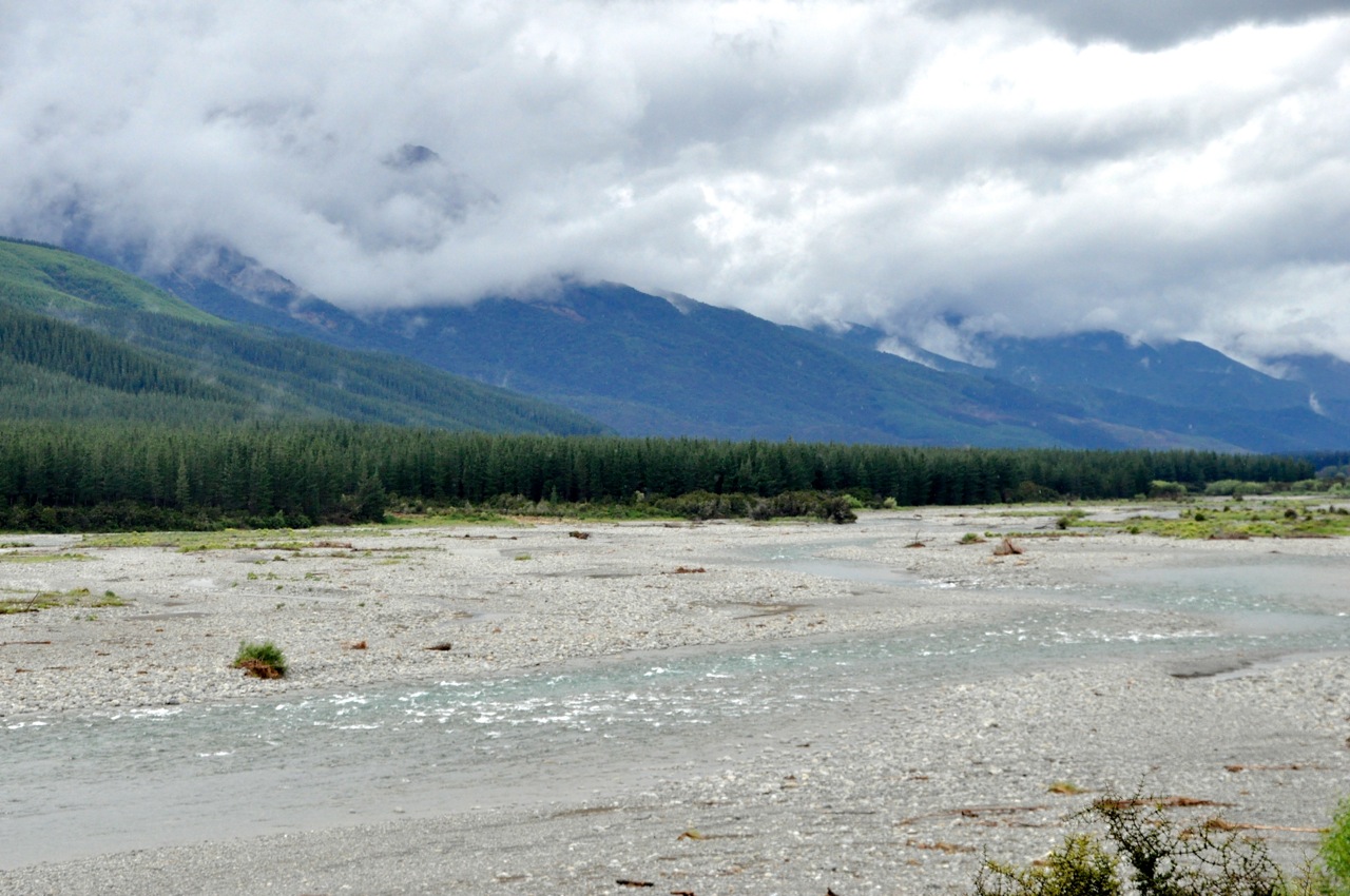
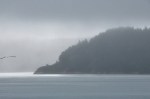
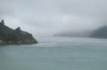
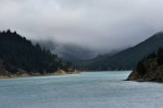
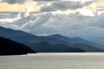
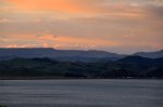
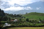
Abel Tasman is NZ’s smallest national park but has an international reputation that draws tons of visitors, mostly to see the coastline. My guidebook says it is fabulously beautiful, with golden sandy beaches, crystal-clear water, lush bushland, granite outcrops and an abundance of wildlife.  Most people hike and kayak and swim and snorkel along the coast, and most of this occurs from the very accessible east side.  We plan to do that too, but for now we’re going to do the road-less-traveled and hike Abel Tasman from the west side, as well as visit Golden Bay.  Golden Bay is at the northwest tip of the South Island, and is backed by the mountains of Kahurangi National Park on 3 sides, with the bay on the 4th.  It is far less accessible, with access in or out being a single, very narrow, very twisty road over a mountain called “Takaka Hill”.  Some hill.  Oh, and because it’s the only road supplying some 6 towns, there’s truck traffic.  LOTS of truck traffic.  LOTS of very BIG truck traffic!  Not to mention lumber trucks carrying big tree sections.  Luckily, we don’t know this, so off we go.  It’s 70 miles away; later, when we look it up, travel time is estimated to be 2 hours.  There is not one straight stretch of road.  The steering wheel is either hard right or hard left, with very little time between the two positions.  A couple of times on severe switchbacks I was afraid I might rear-end myself.  It is, however, quite pretty.  Stopping is usually out of the question, but there are a few spots to pull over.  Alas, I have the camera on the wrong white balance setting, and the pictures are impossibly blue.  Here is one shot going in, and another at the same location

on the way out days later.  NZ is amazing in its ability to have the same view be mesmerizingly and captivatingly different from one moment to the next.

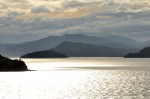
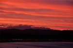
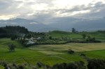
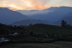
Coming down Takaka Hill, the Golden Bay ocean (left image) and plain (right image) are

gorgeous, although it’s hard to tell from the Picasso Blue Period I’m in.  Closer to the bottom of the hill, without the blue, you can see that this is a pretty place.

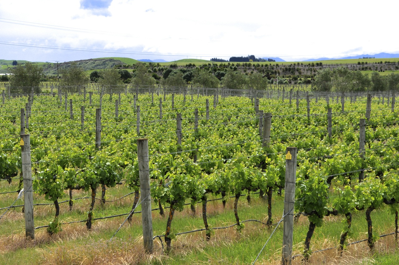
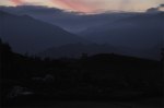
These pictures are from the valley floor near the city of Takaka.

Well, as luck would have it, our plans to kayak and horseback ride on Golden Bay are quashed – the continuous lean-in and lean-out jostling as we wound up and down Takaka Hill have done a number on Ginger’s neck; she can hardly turn it, so we’ll have a few quiet days instead.  She does mention, in a gentle way, that perhaps we might take the curves a little bit more slowly the next time (in my defense: we pulled over more times than numerous to let faster cars go by; but the lady makes a strong argument!).

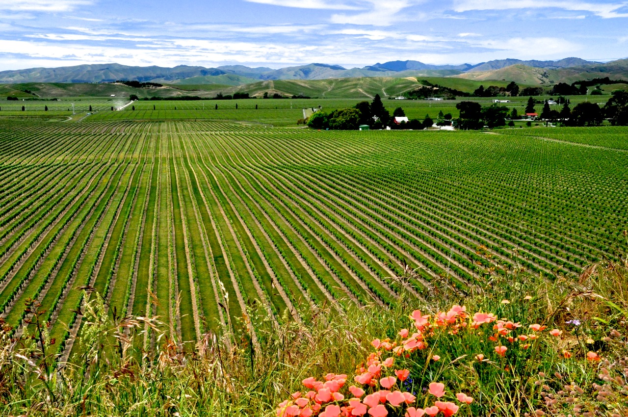
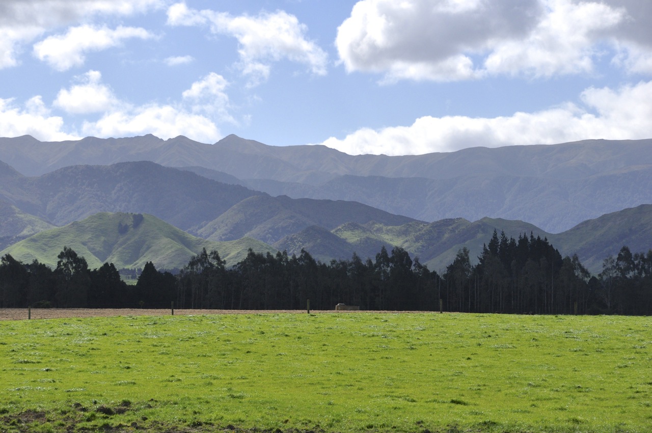
We’re holed up in a cottage outside of town up a gravel road and on a hill.  It’s a simple place with spectacular views (and a lot of spiders, but we rectify that).  Staying here isn’t so bad.  Nearest neighbors are sheep, which come regularly to inquisitively check on us and to baaaaa quietly.  Cows off in the distance give a far-away moooo.   The “boring” view is straight ahead to the water of the bay, which changes color by the hour.  The flax plants attract Tui, which visit throughout the day to feast on its nectar; Tui are amazing birds with their otherworldly, indescribable, transfixing sounds and amazing dark iridescent feathers set off by that white throat ornament.  We love them.

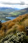
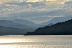
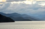
The major delight is the ever-changing Provence-like light on the hills.  The pastoral view is stunning, changing hour-by-hour from one stunning to a different stunning.  The Impressionist painters would have given their left ear for this light.  Not a bad place for us to crash.  I’ll show you some examples below.

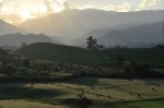
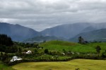
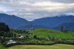
Wow.  And wow again.  Of course, the entire 180° view is better than the snippet shown here, but this gives you a good idea of the incredible beauty.  I’ll also add a couple of pictures of the amazing shade-on-shade color from the layers of receding mountains.

Needless to say, the stars out here are also breathtaking.  It’s hard to see stars in today’s overly lighted world, but here in the country darkness, looking at the blazing glory of the infinite universe, it’s beautiful and humbling.  And guess what?  Orion is upside down, standing on his head with his shield for balance, I guess.  It would be interesting to see what the constellations would look like had they been drawn from the southern hemisphere.

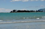
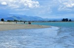
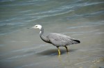
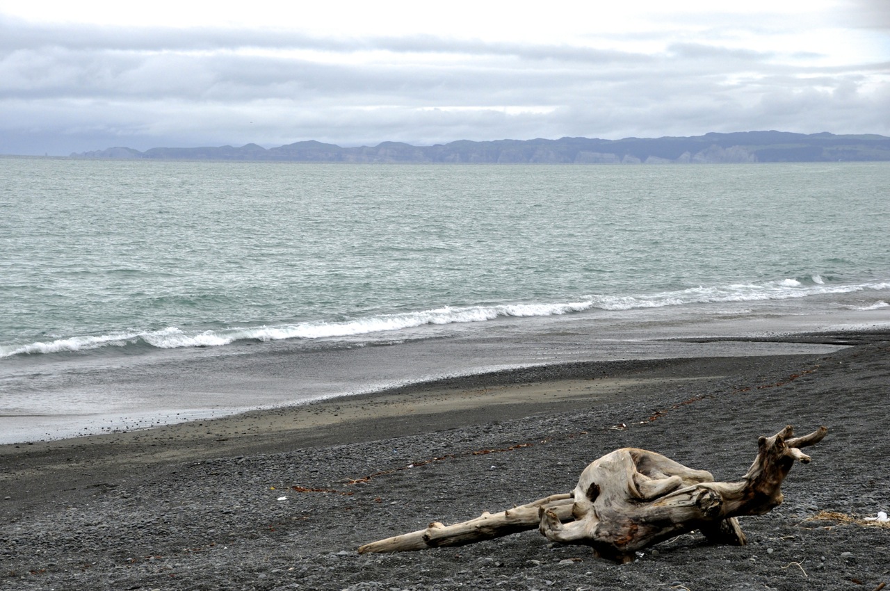
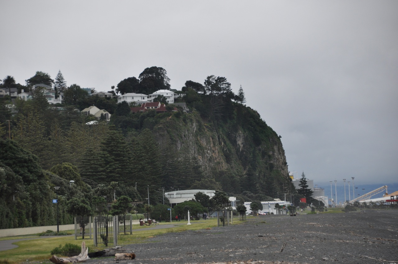
As Ginger recovers, we take a short walk on one of the beaches.  We choose a nearby beach Kiwis love their water
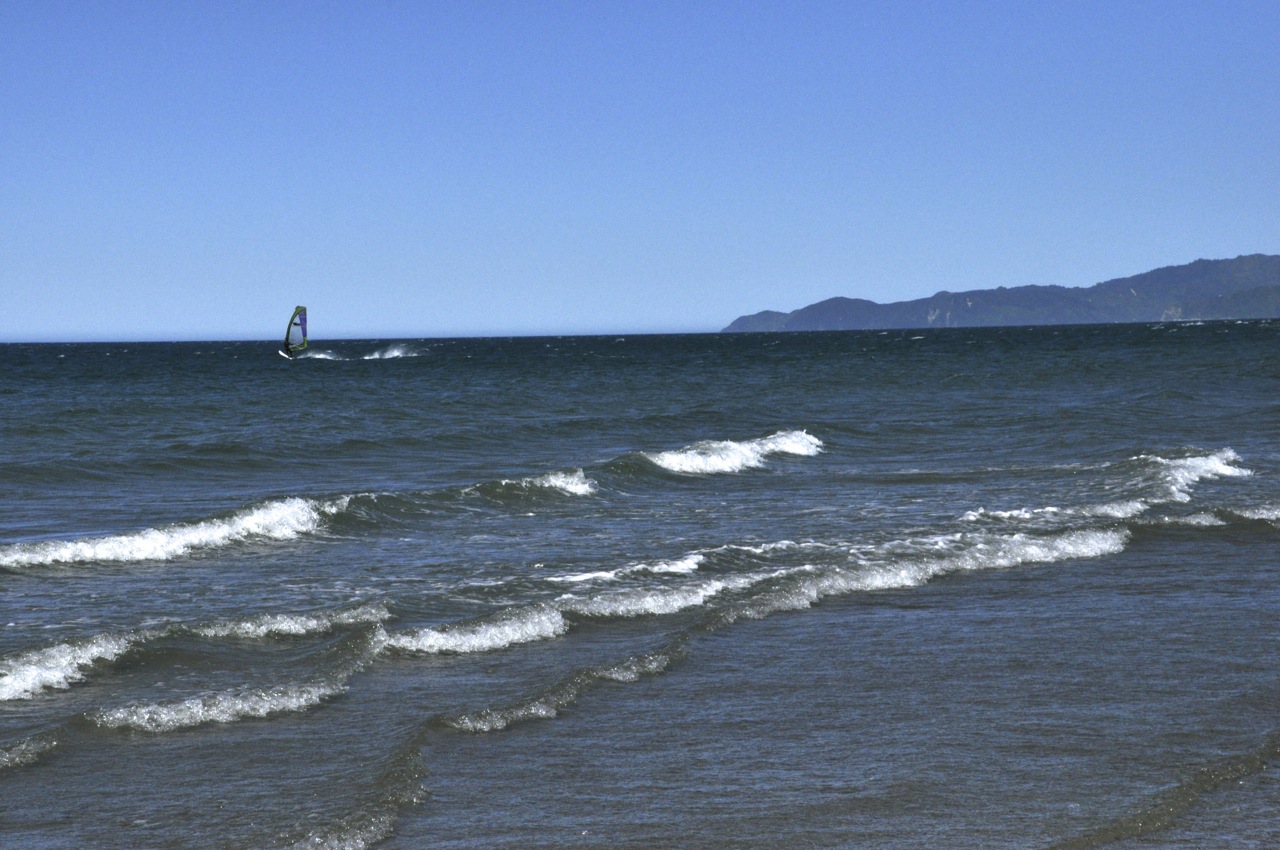
randomly, and we practically have it to ourselves.  Another couple is strolling off in the distance, and a windsurfer is zooming around on this somewhat windy day.  Kiwis do love their water sports!  The water is swimming-pool cool, very comfortable for wading or swimming.  One of the nice touches to a NZ beach is the combination of

beach AND mountains.  It adds to the viewing interest, although the rhythm and sound of the incoming waves don’t really need additional help for our enjoyment.  Not to mention Periwinkle graveyardthe sea shells and pretty polished rocks and interesting driftwood from the very hard and dark wood of some of the NZ trees.

At last Ginger is better, and we have time for a hike in Abel Tasman. We’re entering from the very tail end of the Coast Track.  It’s an up-and-down hike to the first bay, Whariwharangi, and the “up” is probably the Wainui Bay
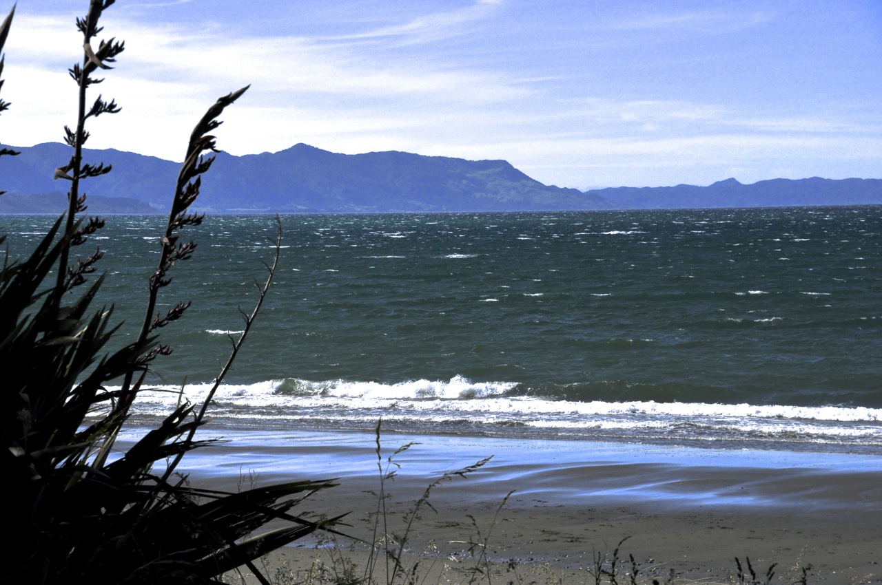
highest climb of the entire Coast Track.  The good news is that the grade is not especially steep.  We’ll see how far we get.

We start from Wainui Bay, which is itself not too shabby (picture to left).  The trail immediately starts climbing, giving a good overview of the bay, as shown below.

And the trail continues to climb.

The trail circles above a small bay, but there is no obvious way down to it.

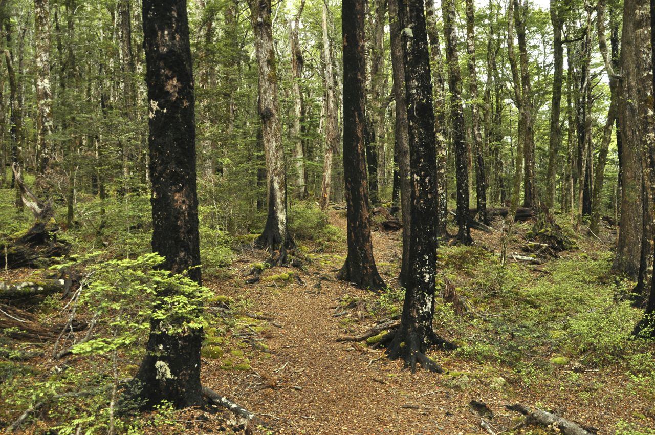
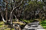
We wind through what the Kiwis call “bush” – the original wild cover of NZ (left image below).  The reasonably wide trail is mostly a single, or sometimes two, dirt footpaths in medium-tall grass (right image).  The grass sometimes bends over, obscuring the footpath; it doesn’t seem to be a heavily used trail.

The hillside
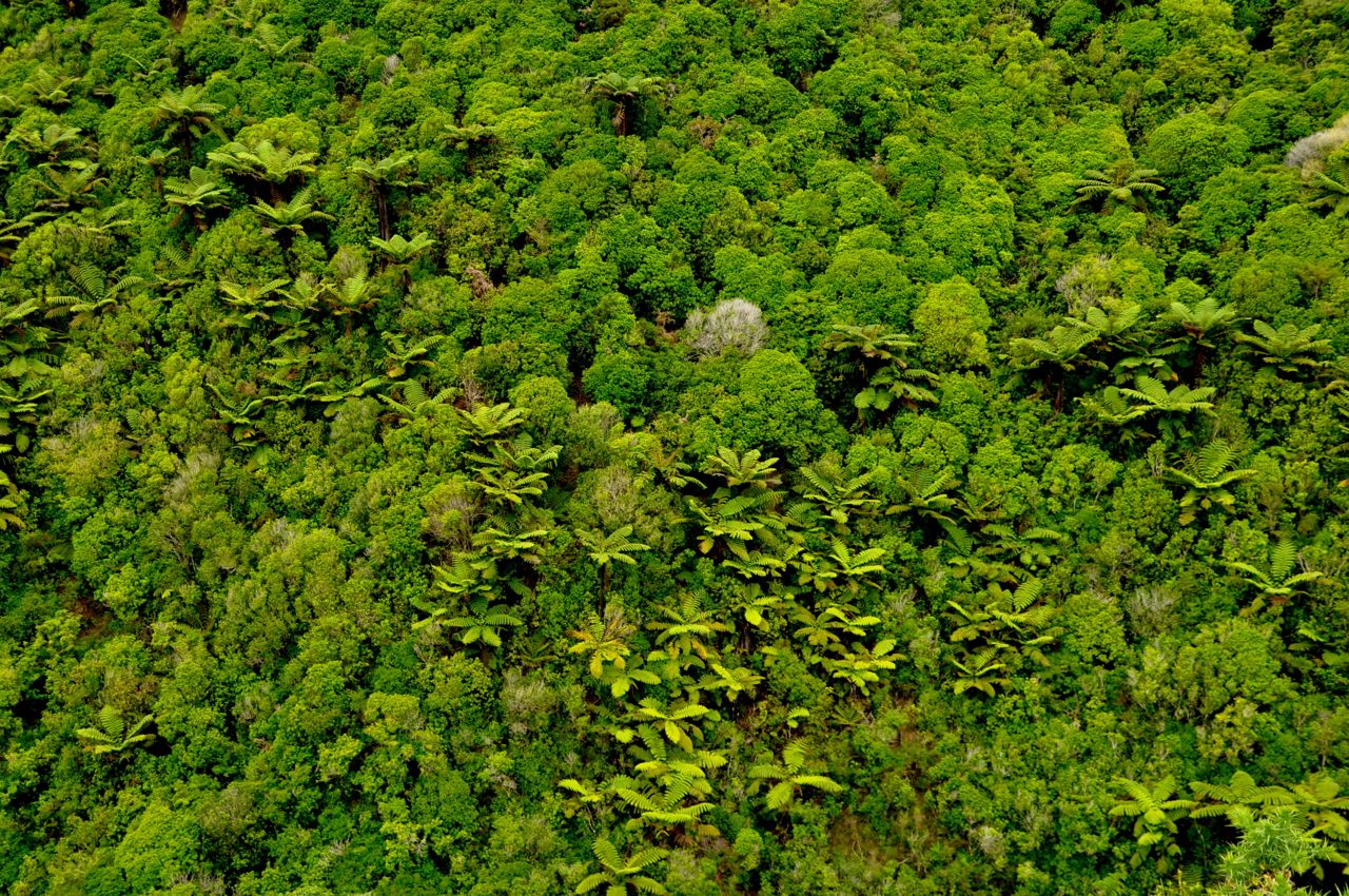
The bush itself is interesting.  It is solid, a mass.  It would be hard to walk through without a path.  The picture shows an adjacent hillside.

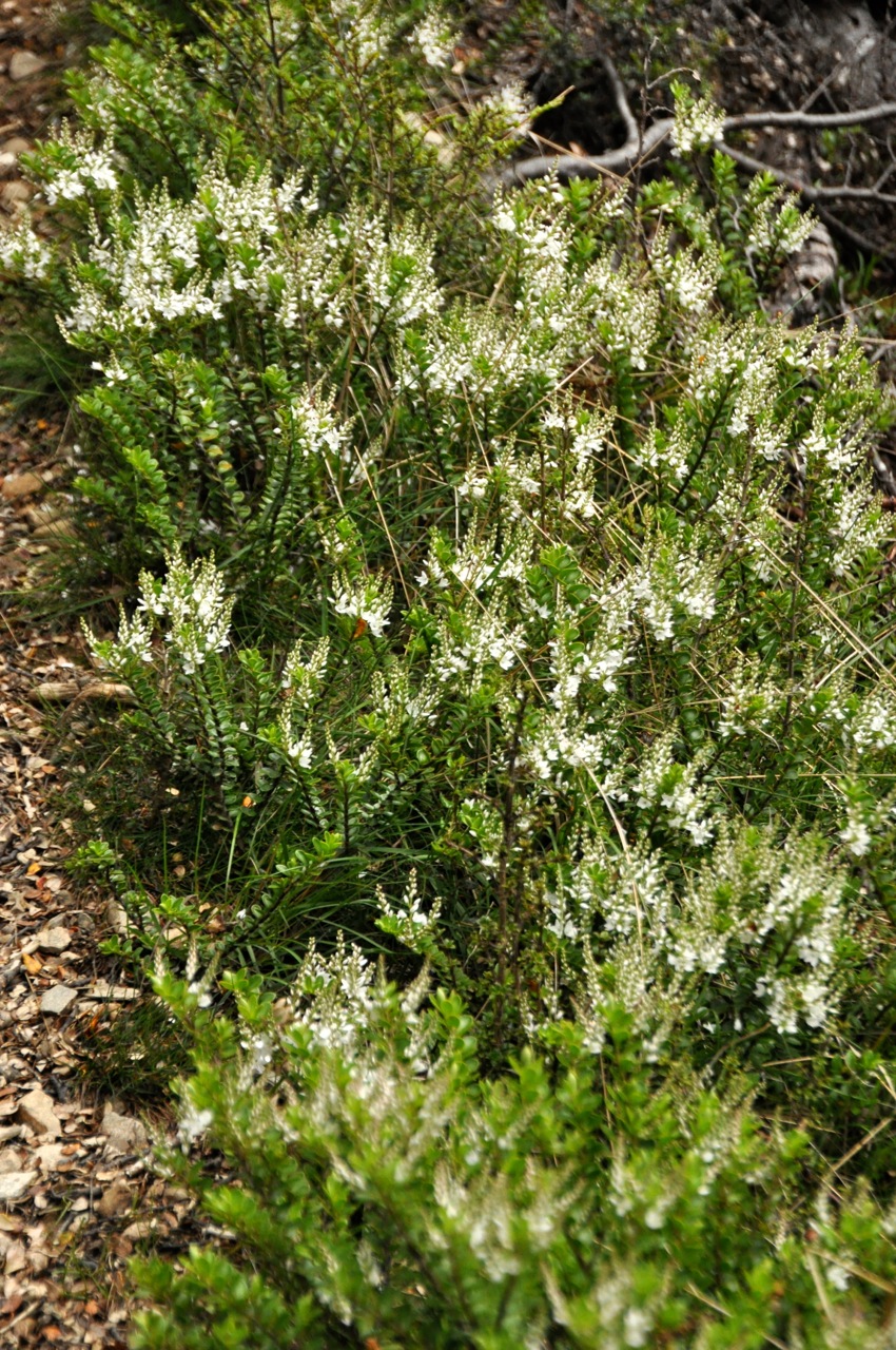
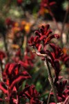
The flowers along the trail are gay, bright and pretty.   Most are small, but frequently one encounters impressive lupine  (yellow or pink) and the commanding I-am-so-pretty

foxglove, in pink and in white.

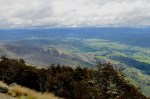
Before we get to the top of the climb, Ginger decides she has had enough and turns back.  The Trail downI’m convinced that the top is not far off, and decide to press ahead.  Sure enough, the top is not far.  This coastal track intersects with an inland track, and the trail is now considerably better – not just a footpath, it’s wide.  Off in the distance is the ocean, and Whariwharangi Bay (shown below), and from here it’s all downhill.  Close but no cigar.  Another time.  Gotta catch up with Ginger.ar Away

Next stop will be Nelson Lakes National Park, in the boonies.  Time to do some real hiking!

Nelson Lakes National Park

Nelson Lakes National Park is centered around 2 glacial lakes, Rotoiti (“little lake”) and Rotoroa (“long lake”), nestled in mountains at the northern limit of the Southern Alps.  We’re spending our time at Rotoiti because it has a town there, St Arnaud, population around 100.  The only town that’s close to this park.  I’m guessing it won’t be too crowded there.  The trip

down is pretty, with mountains and meadows.  A river along the route is a beautiful pale  A turquoise riverturquoise, apparently from glacier run-off.  Most rivers here look like a fisherman’s paradise; too bad we don’t fish!  I can see the pleasure in the skill needed to hook a fish (and then eating it), but I just can’t see me standing still that long in between events.  I could be hiking, with changing views!

Lake Rotoiti is clearly glacial.  In the picture below, one is looking down the glacial bore; the Lake Rotoiti mountains have eroded into a slant, but the effect of the mountains popping up suddenly on two sides is impressive.

Our first walk is around a nearby peninsula that juts into the lake.  It’s an attractive walk.  The path, as shown, is bordered  by a huge variety of mosses and lichens in a great

variety of colors.  There are also quite a few predator boxes!  As we mentioned in an earlier Predator boxpost (Oct 20, NZ Birds, Birds, Birds), early NZ had no mammals except bats, and therefore no predators of birds.  Bird evolution filled this mammal void, resulting in ground-dwelling flightless types.  The introduction of predators was devastating.  NZ is engaged in a huge effort to protect and expand its surviving native birds, much of it with volunteer effort.  In particular there is a strong ongoing program to eradicate introduced mammals like rats and stoats.  We meet three fellows servicing these traps, and one stays to answer our questions.  He says the aim is to effectively eliminate rats from NZ.  I’m incredulous; I think rats and cockroaches will be the ultimate last survivors on this planet.  No no, says our fellow.  Over the last several years their group has killed 12,000 predators in the Nelson Lakes area alone (!), resulting in a substantial growth in the bird population.  Technology will prevail, he says.  Already the new traps are more sophisticated, with gas-cartridge-driven reciprocating bolts killing multiple predators per box, and technology will improve more in the future.  Hmmm, says me.  Maybe.  Thinking about it later, maybe there is a chance; killing is something we humans are good at, after all.  What is heartwarming is the magnitude and commitment of this government/private-citizen initiative, going strong with much enthusiasm and success.  How long has it been since the US has asked its citizens to join in a cause, and gotten a huge response?

We continue our walk, and notice the beech tree trunks are black!  Very black.  I mean, they’re pretty, Black Beech Treesin fact striking, but what is this black stuff?  Are the trees rotting??  It’s a fascinating story, really.  If one looks closely at the black coating, there are also a whole lot of very fine, white, almost silvery hairs extending several inches from the black surface, many with a tiny drop of liquid at the end, as shown in the pictures below.

What is this, you say?  Would you believe those filaments are insect anuses expelling a sweet liquor that feeds a black tree-covering fungus and also supports entire animal ecosystems?  Butt manna?  No?  Would you believe the trees have a virus, those filaments are dripping beech proboscises, and the trees have the flora equivalent of the Black Plague, explaining the trunk color?  Which crazy answer is correct?  Neither you say?  Actually the first.  Mother Nature does have a giggle at times.  Each whitish filament is the anus of a tiny scale insect that lives under the bark of the beech tree and sucks the sap; the insect extracts what it needs from the sap and then excretes a super-concentrated sugar solution through its incredibly long anus. The black fungus feeds on the sugar solution that dribbles down the tree, but it is not alone.  Entire animal ecosystems depend on the sap: Wasp feedingbirds such as the Tui and the Bellbird, bats, lizards, and other insects.   Non-native wasps (like the one in the picture) can completely coat the beech trunks, denying the birds, and so at certain times of the year the predator-trap people switch from killing rats to killing wasps.  One bird, a type of parrot called the weka, absolutely depends on the sap to kick-start its reproductive cycle.  All that from just a little scale insect shaking its booty and pooping a sugar solution!  Y’know, it’s hard to make this stuff up.

This hike was the warm-up.  Tomorrow we climb Mt. Roberts, the mountain to the right of the lake in the left

picture, and straight ahead in the right picture.  It will be tough; it’s a 6 mile loop, but also a 2,000 foot ascent.  We’ll go up the Pinchgut Track, which is labeled “steep”.  The trail name itself is slightly foreboding.  Ginger will see how far she gets.

The trail in beech forestThe trail starts off in a beech forest.  It’s pretty.  Soon we start a gentle climb.  The first overview, the picture to the left, below, shows the peninsula we walked yesterday, and behind it the bustling town of St Arnaud.  It’s there, honest, right at the base of the peninsula.  We’re choosing to climb Mt Roberts rather than the Saint Arnaud Range (the

range on the other side of the lake) for two reasons.  The trail to Mt. Robert zig-zags in and out of the beech forest, so there are early views; for the Saint Arnaud range, you’re in the forest until you’re above the tree-line.  Second, both yesterday and today there are clouds obscuring the top of the Saint Arnaud range (picture above right), whereas Mt. Robert is relatively clear.  There is something dispiriting in climbing to a mountain top and not being able to see a hand in front of your face.  As an aside, from the picture above right, do you notice the angle of the mountain we’re climbing?  The climb quickly stopped being gentle.

The trail on the hillside is crushed gravel, as shown below.  The footing is good, and that is needed!  Not only is the trail steep, but the wind is gusting and can blow you a bit.  Ginger

has been setting walking goals for herself – to the next switchback before stopping – but the switchbacks often stop where they have to, at nasty points with very steep drop-offs.  Maybe you can tell from the picture, above right, that you’re not looking down a cliff face, but it’s sure darn close to vertical!  You would not want the wind to blow you off trail!  I suggest to Ginger that maybe she should set her goal to be the next switchback plus about 20 feet.  She sees the point and quickly agrees.

The view is opening up and we can see the vista off to the side.  It’s impressive!  However,

also impressive are the ominous clouds heading somewhere in a big hurry.  It’s also getting quite chilly, especially with the wind.  We have jackets, of course; good thing.  The trail periodically re-enters the forest, however briefly.  The beeches are perhaps even more

picturesque; they have a coating now of lichen decorating the branches.  The trees are also quite a lot shorter as we climb higher.  Note in the picture on the right, above, that this trail is steep!  The picture on the left, below, gives you a feeling for the exposure and the

steepness of this climb; and there is Ginger, still going up!  And up.  And up.  Below is another view of the steepness of the climb.  Note that I am looking almost straight down

on the just-walked trail below me!  Oh yeah, this is steep.  And there is Ginger, still truckin’.  We do take time to notice the varied and colorful moss and lichen, and the

birdlife – like the very tiny tomtit.  The trail does however continue to go up.  And up.

flowersWe stop to smell the roses, figuratively.  Surely we’ll find the top soon?   The trees are getting shorter and shorter, the light brighter and brighter.  We’re stopping a lot now; Ginger is struggling, her legs are shaky, and it’s cold and windy.  I’m a bit concerned, but she is determined to get to the top, so off we go.  The forest has changed; moss is everywhere, even climbing high up tree trunks.  The lichen hangs everywhere, looking otherworldly.   The trees get shorter and shorter, a good sign.

Stunted treesAnd then looking up it looks pretty open, and then we’re out!  The views are quite spectacular.  The clouds are whipping by just above our heads.  Happily there is a hut nearby (how about that!), and we huddle inside out of the wind to have a late lunch.

Clouds obscure St ArnaudLooking over at the Saint Arnaud range, I’m glad we did Mt. Robert.  The top is indeed in the clouds.  And the view of the range from here is pretty spectacular, don’t you agree?  The wind is present here on Mt. Robert, but it looks like a gale over there with the boiling, roiling clouds.

Well, we’re near the top but the trail keeps going up – thankfully, not as steeply.  The views are great in all directions, although the rounded nature of the top does block some of the view.  Take a look!

We keep hiking until we get to the top and the trail starts down.  I’ll share the views!

Now comes the hard decisions.  It’s getting late, there’s a chance of rain and storm, Ginger is pretty tired, and her knees ad hips are bothering her.  We’re at the top of the climb, but we’ve taken the steep-but-short route up and have only gone 2.5 miles of the 6 mile loop.  It’s all downhill in both directions, but it’s shorter downhill the way we came up – and we know the route; there will be no surprises.  Discretion wins, and we decide to bail and take Ginger, comin downthe known and short route down.  I’ll close with the triumphant Ginger, comin’ down.

We make it down just fine, no problems.  In celebration of conquering this hard climb, I take Ginger out to dinner to St. Arnaud’s fanciest restaurant, where she has a steak, several glasses of good New Zealand wine, and finishes with a big smile.  As they say here, “No problem, mate”!

Next: Back to Nelson – we’ve decided to rent a house there.

The City of Nelson – location, location, location

Nelson is NOT a big city (population 56,000, not counting the seagullsNelson Resident) and has no famous attractions, but it’s a popular tourist destination.  Why is that, you ask?   Besides having New Zealand’s sunniest climate, it is within a few hours drive of some great outdoor attractions – the Golden Bay region and three national parks:  Abel Tasman, Nelson Lakes and Kahurangi.  Not to mention a nearby cluster of excellent wineries and the studios of contemporary artists.  Sounds good to us!

The way to Nelson from Picton takes us through the harbor city of Havelock, the world Havelock restaurantcapital for farming NZ’s green-lipped mussels.  I love mussels, and had my first bucket of them at the Bay of Islands (blog of Sept 29).  A bucket of mussels ended up being like only 12 of them – they’re huge, and tough, and I haven’t ordered them since.  A crushing disappointment!  But here we are in the epicenter of musseldom, so I am going to try again.  Ginger demurs.  Havelock is smaller than tiny, and the restaurant choice is pretty obvious (picture), so off we go.

The mussels come, and as you can see, they are not your Prince Edward little guys.  They’re big, ugly brutes.  Mind, when they’re small they’re kinda cute; but when they’re big Green-lipped musselsyou’re staring at body parts that do not look particularly appetizing.  I try them, hopefully, and yep.  They’re tough.  Not all parts, mind you, but in that mix some serious chewing is required, and I confess it takes away from the pleasure.  I eat this bucket, but the thrill is gone.  Luckily there are other fish in the sea.  Speaking of that, scallops in NZ are also different.  They’re not much bigger than bay scallops in size and come not only with the white disk of muscle meat we’re all familiar with, but also with an attached red-colored gland that contains the eggs and is about the same size as the muscle.  That new part has a totally different texture and taste, but nevertheless the package is tasty.

Nelson, like most small cities in NZ, is a sleepy town; all stores close at 5 or 6, supermarkets Nelson, Sundayclose at 9, streets are largely deserted in the evenings.  The bar scene is more lively, and Friday and Saturday the music plays quite loudly until midnight, when it stops abruptly.  Sunday mornings it’s a ghost town (see picture).  The town itself gives me the feeling that I’m in a Western movie; surely I’ll find horses hitched out front and the bars will have swinging doors.  That’s not the case, but that’s the feeling.

The city does have an interesting cathedral (Christ Church), perched high on a hill.  Gothic in nature, it has good acoustics (I stumbled onto a choral rehersal!) and some beautiful stained glass.

The Nelson Saturday market is impressive, both for its food and for its art.  Below is a small sampling.  Look at that metal fish!  Made of washers and nails.  And those turned bowls and huge burls!  Beautiful.

Nelson has a great beach that goes on forever, and the water is shallow for quite a ways out with occasional sand bars.  Notice the very attractive turquoise hue to the water!  It is stunning.  As you might imagine, there are great seafood restaurants on the waterfront.  Shown is Ginger enjoying lunch, wine and a good view at a wharf restaurant in a nearby suburb.  Just below the restaurant, a local is enjoying lunch as well – a white-faced heron.

Totally NOT

Totally NOT

There are a lot of shallow inlets to the bay, and when the tide is out, the water is out of sight.  We haven’t explored this intriguing effect; eg, walking and wading a mile or more out could be very interesting for shell-hunting and the like. We could probably walk beyond sight of mainland; but what happens when the tide starts coming in?  How fast can you wade?  We have a lot to learn about the sea and tides before we get too adventurous.

Early on I mentioned the wineries.  There are about 25 wineries here, many with excellent Tasman Wineryreputations.  The ones we tried in the restaurants were yummy.  Definitely time for some more winery tours!  Study, study, study.

I also mentioned a strong artist community in Nelson.  There is a big ceramics group here – our main interest – but glass blowing is also a strength.  Let me show you some amazing vases from Hoglund Art Glass.  As in, Wow!

I will close Nelson with a quick note of its small but beautiful gardens containing – like most cities in NZ – roses and flowering bushes and water and streams and – as shown here – very interesting trees.

Next: On to Golden Bay and Abel Tasman National Park.

Marlborough – the Sound, the Wine

There is a certain excitement in leaving the familiar and going to the new.  The pulse quickens.  The Unknown.  The New Page starting to turn.  We are leaving the North Island, which we thought was beautiful, and heading to the South Island, which everyone says is much more beautiful.  We know the South Island has taller mountains.  And Glaciers.  Fjords.  And a lot fewer people.  We hear the wise advice, to always have a full gas tank; civilization is not always nearby.  The smell of adventure is in the air.

Fog is there too.  The first picture is Wellington in the (virtual) rear-view mirror of the ferry.  The right picture is a bit further out, the North Island becoming a foggy memory; literally.

The ferry across the Cook Strait is supposed to be gorgeous.  The route leaving Wellington Harbor passes by land masses on both sides, but that world progressively shrinks as we

enter a foggy cocoon.   Except for the physical presence of the ferry, reality is reduced to an eerie gradient of blue, a cold penetrating wind, and a discomforting sense of sightlessness.  This fog is a tourist’s nightmare.  To get to Picton, our South Island destination, we will pass through the narrow channels of Marlborough Sounds, described as a profusion of spectacular bays, inlets, islands and peninsulas rising abruptly from the water.  It would be a shame to pass through it and yet miss seeing it.

After hours of this cold and formless world,  craggy land masses emerge suddenly from the mist.  At last we can see something!  As we travel on, the view seems to get better.  It

fades in and out, but there is hope.  Perversely, behind the ferry the fog is lifting, the sky showing, the light better.  For perspective, the white boat in the right picture is another

huge car-carrying ferry behind us.

And then the fog mostly lifts, and we have our first real view of the Marlborough Sounds.  The ferry is moving toward the setting sun, the light reflects off the water, and the effect is a bit ethereal.  I could have done better with the circular polarizing lens that I left in storage, a victim of paring down to “the minimum things one needs to carry through life” (we have learned something about this topic; perhaps a good subject for a future reflective post?).  The Sound is spectacular, the sea is liquid mercury, the cloud patterns and colors endlessly varied!  Repetitive waves of mountains beckon to the horizon.  Come, follow me.

We like these pictures, and editing them down to just a few is too hard, so rather than

pick and choose we’re posting them all.  Hope they’re not too repetitive.

The Good LifeWe pass some real outposts, homes obviously with zero road access and zero neighbors to make noise.  Intriguingly pioneer; the homes are surely too small to be getaways for the rich and famous.

All too quickly we arrive at Picton (left picture), a small town that looks much more inviting the next day in sunshine (right picture).  We were impressed by the number of yachts and sailboats in their harbor, which appeared to be about equal to the number of residents.  When I asked if there really was one boat per person, the disappointing answer was no, the boats are mostly owned by wealthy NZ’ers and stored here unused for all but a couple weeks in summer.  Like the world over, the really wealthy seem to own too much that sits unused – and somewhat flaunted.

There are apparently some great hikes along the backbone of the Sound – the Queen Charlotte track – as well as opportunities to hike just pieces of it via water taxis or kayak trips.  Alas, I have sprained my ankle multiple times lately (just a few days ago in Wellington); it isn’t healing very fast and is weak and susceptible, so we’ll do hikes another time.  Parenthetically, getting old sucks.  We’re also anxious to get to Nelson, which we suspect could well become our “roost” city.  We do take a ride along part of the Queen Charlotte drive, which skirts the southernmost Sound.  There is not one straight stretch of road to be had on this drive, but the views are nice, with a lot of hidden, enticing bays.

Before we run off to Nelson, however, there is business to attend to.  We are very close to the Marlborough wine region, the region that put New Zealand wines on the map and redefined Sauvignon Blanc.  This is not to be missed.  And not only for the wines!  The region, with its sheltering mountains and abundant sunshine, is strikingly beautiful.

Our B&B wasn’t too bad either – these images show just a part of their garden.

Let me show you some of the wineries.  There are about 50; unfortunately we didn’t get to all of them. I was somewhat constrained by Ginger’s insistence that I stay sober enough to drive, and we only had 1 1/2 days there.  This definitely calls for a return trip!  This picture shows the Brancott wineryBrancott Estate, the country’s largest winery.  The picture is a bit misleading: the vineyards actually continue to the right and left to give a 180º view, going to the mountains.  In spite of the immensity of the vineyard (they employ 5 separate vintners), they produce very good inexpensive wines, as well as some really good single-vineyard reserve wines.  We were impressed, but not nearly as much as when we tasted the wines of other nearby wineries (many of them boutique).  What you get with the smaller wineries is closer to perfection.  Machine harvesting works, but grapes are damaged, all grapes are accepted, etc.  The smaller wineries can pay much closer attention, damage nothing, select only the best fruit, etc.  And it shows in the wines.  All this attention is, of course, labor intensive; you can can watch the workers in the fields adding their sweat to the wine’s nourishment.

Let me show you some of the wineries we liked.  Like Cloudy Bay, available even in Ohio.

Oh my gosh, a winery we’ve never heard of, and that may be producing the best wines in NZ:  the tiny Hans Herzog Estate, making fabulous wines and still experimenting with single rows of unusual grapes on their tiny acreage.

This is Highfield Estate, a beautiful winery that’s looking a bit neglected, but is still producing fabulous stuff – and in a fabulous location!  It’s currently up for sale due to the death of one partner.  His kids aren’t interested, nor are the offspring of the surviving 85-year-old Japanese partner.  Anyone in for forming a co-op to buy a winery????

Wither Hills – a big winery, but producing some great wines.  Check out the pipette there – we’re doing a Pinot Noir barrel tasting.

OK, I know, I’m boring you.  But I must mention Fromm, and Te Whare, and Seresin.

‘Nuff for now.  We’re off to Nelson!

Napier, Hawke’s Bay, and …. Martinborough?

Hawke's Bay

Hawke’s Bay

We were pretty excited about visiting Napier.  Not only is it the premier city on Hawke’s Bay and close to one of NZ’s premier wine-producing regions, but it is “the world’s best-preserved collection of small-scale Art Deco architecture”.  When a 1931 earthquake leveled the city (and raised it 6 feet, and created 100 square miles of new land from the ocean), Napier rebuilt in the style of the times, Art Deco.  From my travel guide book, Napier has “a stylistic uniformity rarely seen, ranking it alongside Miami Beach as one of the world’s largest collections of Art Deco buildings.”  We love Art Deco, and couldn’t wait – and boy were we disappointed!!  It’s a relatively small town (54,000), and the qualifier in the 2nd sentence of this paragraph was “small-scale Art Deco.”  Yep.  No building is taller than 2 stories, we’re talking about a couple of city blocks, no metal anywhere, and the buildings look pretty small-town normal, with only some rather

Napier, Hawke's Bay, New Zealand

Napier, Hawke’s Bay, New Zealand (Photo credit: Sandy Austin)

unexciting painted flourishes in the Art Deco style; and maybe a kind-of-Art-Deco sconce here and there; that’s it.  After living in Art-Deco-rich Cincinnati, we know Art Deco, and this is not it.  Phooey!  I took no pictures in my disappointment; to the right is an example of a Napier “Art Deco” building that I took from the internet.

Adding insult to injury, our apartment was a disaster.  One of the lessons of traveling is that the internet lies.  Descriptions of places to stay use pictures that can be enormously misleading.  Reviews can be helpful when they exist, but some sites must allow “cherry-picked” reviews.  Our Napier apartment had glowing reviews.  Not possible!  One thing we Napier Residential arealearned is that Napier is very hilly.  Turn your back to the bay, and this is what you see.  The cliff in the picture to the left is a bit misleading; most of the (several!) hills are very steep and pointy and only approximate a cliff face.  For example, the picture below is the view from our apartment – across a gulf to the opposing hill, too steep to build on Backyard view(houses on top).  The streets navigating these vertical neighborhoods are very narrow, very twisty, and very maze-like.  Our apartment was 2 tiny rooms in the back of a house, the house near the top of a hill, the road to the house being above the house roof.  Our rooms were in the back of the house (further down the hill), so the very vertical uneven stone steps went forever down to our dwelling.  Our dwelling had a very tiny bedroom with a horrible bed, a living room/kitchen that was no larger, and a bathroom from the kitchen/living room that was a high step up to an elevated alcove.  Not only could you sit on the throne, you could lord it over the place.  I think the word is “kluge”.  We paid good money for this place (up-front).  Somehow we managed to cook a bunch of meals in cramped quarters without killing each other.  Particularly aggravating was the parking arrangement; I had asked about parking (it was not mentioned on the internet) and was told it was on-street parking, always available, perfectly safe, and very convenient.  What was not said was that the street was very narrow, the parking spot located just after a tight curve, and the street got narrower as one went down the hill (don’t go there, we were told).  It was impossible to turn the car around!  There were a few houses with short driveways on the “wide” part of the street, but they had metal posts in the middle of their driveway that they could raise to keep people out.  Clearly we weren’t the first tenants!  So turning around was a half-hour back-and-forth wiggle utilizing portions of driveways, sweating bullets not to scrape the car.   Just backing the car up the hill and around the curve was even harder.  Finally, the internet description said the apartment had a washing machine, but lied; the apartment was far too small to include one.  As it turned out, when I inquired, the apartment’s washing machine was the landlord’s washing machine, so that deception worked out OK – the landlord did our laundry for us.  A requirement for doing long-term travel, dear reader, is to have a good sense of humor.  Or lots of money for fancy digs.

Making up for our Napier disappointments were some fabulous sunsets and Hawke’s Bay wines.  First a sunset.  Not too shabby, eh?

The wines of Hawke’s Bay are impressive!  There are 70+ wineries here in one of NZ’s largest (and much exalted) wine regions.  With a climate similar to Bordeaux, these mostly Hawke's Bay Vinesboutique wineries (those producing just a few thousand cases or less) produce fine Chardonnay and lots of Merlot (that they often blend with their hard-to-fully-ripen Cabernet Sauvignon).   Of interest to me is their new emphasis on Syrah, which can be wonderfully peppery in these soils.  I loved it!  The Syrahs reminded me of the California Zinfandel wines of old – big fruit up front, pepper on the finish.

A general theme for NZ wine production is to grow vines in a valley between good-sized mountains that block the cool ocean Hawke's Bay Mountainsbreezes – and to have crappy gravel/limestone soil (the best wines here come from an area called Gimblett Gravels, where the soil is mostly a white color).  The need for mountains, however, is a nice plus; not only do the taste buds get to enjoy the wine, but the eyes get to feast on the mesmerizing and timeless mountains.

The wineries here are usually anything but big production: the vines are weeded by hand, the grape bunches are hand-picked, then hand-picked over, then gently pressed.  Many wineries are organic, most are “self-sustaining”, meaning limited/no use of pesticides or herbicides, encouraging beneficial insects, etc.  The business is labor-intensive, often family-owned and operated, CJ Paskand the wines are usually rather expensive – $30 – $50.  They are also very, very good.  The high-end Chardonnay at Church Road was amazing, as was their Sauvignon Blanc.  Probably one of the best wines we’ve had here in NZ is the Declaration (high end) Syrah from CJ Pask.

And then came the BIG surprise!  On the way to Wellington there is a small wine region that I never heard of, a region that doesn’t seem to have a name but is close to the small town of Martinborough.  Hey, it’s wine, so of course we stopped.  Work, work, work.  This Martinborough region is very compact, something like a dozen small wineries and most of them one can walk to.  It’s the North Island’s coolest, driest, and most wind-prone grape region, but produces outstanding Pinot Noir, Cabernet Sauvignon, Chardonnay, and Riesling.  We loved them.  WindbreaksThe wineries deal with the wind by using a lot of very tall windbreaks – this is very common in NZ – as shown.  Normally the windbreaks are perfectly pruned, sides and top, and since they are like 20-30 feet tall, I have no idea how they do it!

It’s a pretty region as well.

Let me show you some of the wineries.  This is Vynfields.

Here’s one of our favorites, Martinborough Vineyard.

Finally, a lunch at Poppies vineyard.

Our favorite wines from this region were Margrain, Martinborough Vineyard, Murdock James and Coney Wines.

As you may have noticed, this post is out of sequence – we did this region on our way to Wellington, whereas the last post was already about Wellington (& Weta).  I initially ignored this part of our trip because it wasn’t too exciting, but I decided it really should be there.  Next post continues with Wellington, a fascinating city not to be ignored.

Wellington City and WOW!

This post will go on and on about the city of Wellington, but if you get bored and think of exiting, I suggest you first scroll down and look at the WOW (World of WearableArt) stuff.  It’s amazingly Kiwi.

We were thinking that Wellington would be our “roost” city to stay for several months –Wellington until we heard that the wind roars down the Sound and intensifies as it squeezes between the skyscrapers.   Residents say there is no better place on earth than Wellington on a nice day – but notice the qualifier!  Indeed, we encountered some pretty stiff winds; turn a corner and suddenly you are leaning at a 45º angle.  The wind is actually a real nuisance – like hanging clothes to dry and hoping they’ll still be there when you get back.

Wellington IS a cool city, in spite of the wind.  It’s the 2nd largest city in NZ (400,000) and seat of the NZ government.   Skyscrapers snuggle around a pretty harbor, residential houses climb the surrounding hills, and every nook exudes  hip/arty culture.  Interesting sculpture/architectural features are just about everywhere (look at that bridge in the

background), along with coffee houses, gardens, cable car, etc.

Below is some of the interesting architecture.

Of course there is the harbor right there, looking very picturesque all the time with the clouds scuttling by overhead a la San Francisco –

but what really is fun is all the sculpture and playful architectural elements.  It’s delightful!  The Kiwis just don’t have a buttoned-down mentality.  Examples:

And then there are the delightful building interiors where restaurants spill out into the central halls, and a cable car climbs a hillside – very nice.

The cable car goes to Wellington’s very impressive and extensive gardens which occupy basically an entire hill.  One takes the cable car up and walks down.  Here are just a few pictures.

Parliament was really interesting.  The government is housed in 3 buildings, one a modern “beehive” conical structure that houses the executive branch,  joined to a drab Edwardian neoclassical building where the parliament meets, and that joined to a bright and sunny

gothic revival library.  Sadly one was not allowed to take pictures inside; the parliament building in particular is quite attractive, all in multi-hued matt-finished gray marble Parliament marblethat you can see on the outside walls.  We watched their Parliament in action from the balcony.  It is the English system, the ruling coalition vs the opposition, and it was quite fascinating.  Among other things, they were “debating” the coalition’s granting of NZ’s internet infrastructure upgrade to a single company, and it was a cat fight!  Questions were put to the minister in charge, and during her answers there were catcalls, shouts, objections, questions – all completely drowning out her answers.  It was all very rude.  I expected to see people start throwing things at each other, but it just remained verbally rude.  I am not sure progress was made.  Sound at all familiar????  Of interest was the earthquake-proofing they did to the Parliament building.  They drilled holes through the foundation to regularly insert large rubber/spring spacers, then at a distance half-way up the spacer they completely sawed through the remaining foundation horizontally so that the entire upper building was severed from its foundation and instead floated on the spacers.   Goodness.

I loved Old St. Paul’s Cathedral.  It was built in 1866 in the English Gothic style, but with a twist.  For the interior, imagine one of the great gothic stone cathedrals of Europe, only now imagine it made out of wood (!), and then shrink it to a more modest scale.   It’s unique and quite beautiful, with lovely stained glass windows from the 18oo’s.  It was almost demolished to build its modern successor; like the US, NZ struggles to preserve its history.

OK, now on to the good stuff!  Wellington has a very good museum, the Te Papa.  It’s big Ammonite, 140 M years– we didn’t see it all – but we enjoyed it thoroughly.  I’ll start with some of the natural history stuff, such as the 140 million-year-old ammonite there on the left, already a fossil before Gondwanaland split up.  Next to it is the much younger Ginger ….  There were great exhibits on volcanoes and sea life and such, but also on lesser-known NZ fauna such as Weta insectthe weta, a large grasshopper-like insect (insects, really – there are variants) that first appeared about 190 million years ago; today they are found mostly in caves, although some species live in trees and shrubs.  We could have taken a cave tour to see them in the flesh when we visited the glowworm caves in Waitomo (earlier post), but somehow being in a dark cave with large creepy crawleys scurrying around was not a compelling Tuatara, living dinosaurargument to part with more money.  Then there’s the Tuatara, the sole survivor of a family of reptiles that died out with the dinosaurs.  No one knows how long these lizards  live – some in captivity are well over 100 years and still going strong.  Usually these endangered guys are transferred to predator-free islands along with kiwi birds.  Speaking of which, the museum had a skeleton of a kiwi pregnant Kiwi, with eggwith egg, which helps explain why there is only one egg laid per couple … and maybe suggests that predators aren’t the only reason they’re endangered.  I’ll end the natural history show-and-tell with a picture of the NZ carnivorous snail.  What, you say?  A meat-eating snail?  It’s going to chase down its prey?  The name is Powelliphanta, and it Carniverous land snailIS a big snail, but rather than attacking gazelles it sticks to things like earthworms.  I must admit, it tickles me to think of the earthworm wiggling like mad with the snail in hot pursuit….

The Maori exhibit was also good, although there is a certain sameness to Maori exhibits.   The details are in fact different, but the overall form and content of the things they did were remarkably similar among the many warring tribes on the islands.

The NZ art was interesting.  I’ve added some I liked:

OK, finally, what I found most interesting of all in Te Papa – the World of WearableArt (WOW).  This is a yearly international event, started on the South Island in Nelson.  It grew in size in stature, WOW and then Wellington (four times larger) on the North Island co-opted it, to the dismay of Nelson.  The exhibit at Te Papa is relatively small; near Nelson there is a museum largely devoted to WOW, which we visited later.  The images I’m showing are from both locations, but mostly from Te Papa.  As it turns out, you are not permitted to take pictures of the exhibits.  I didn’t realize that at Te Papa and was happily snapping away when The Rules were pointed out to me by the museum staff.  Same rule at the Nelson museum, where I only got a couple of hurried shots from the door when Ginger wasn’t looking.  The attire is amazing and crazy and inventive, from every imaginable material, such as a dress made entirely of wood.  Or metal.  The attire below is kitchen

stuff, spoons and the like.  The one below is made entirely from zippers.  These WOW Zippersthings are worn by models at the WOW fashion show, often displayed within an equally inventive program of skits or dance (such as a campy Flash Gordon-like or Barbarella-like satire for the bra part of WOW [shown with great glee below]).   Let me quote from the Nelson museum: “To watch such a visual feast over two hours is exhilarating.  The show is a colorful fusion of dance, lighting, music, garments and performance.  It’s an indulgence for all senses.”  Or a quote from a Jeff Kohen of Denver: “For me it’s like leaving earth.  It’s like a really good acid trip.  It’s Carnivale meets Mardi Gras meets Haute Couture meets I don’t know – a Peter Gabriel concert, all showing on Broadway, directed by Salvador Dali.”

There were TV loops of some of the shows (like the Flash Gordon skit), supporting the zany entertaining wild crazy nature of this event.  It looked like a lot fun!  Here are more outfits.  This one, of wood, was by a carpenter in Alaska, his first WOW entry (2006).

This one from India combines felting with laser cutting (2010).

The rest I’ll just show in a lump.

OK, my favorite!  The bra wearable art.  Save the best for last!  This is a topic that catches WOW bras my interest, and some of the bras are brilliant.  I particularly like the bra on the left – maybe you can’t tell that the bra is a pair of churches (with lit-up rose windows).  A comment on breasts as a place of worship.  Hmmm.  I’m not a religious man, but the idea needs study.  I took this picture just before being told not to take pictures, so alas, that is all the (live) bra photos.  As I said earlier, the Nelson museum didn’t allow photos.  However, a book in the museum was devoted to the topic, and I will share some pictures taken from WOW Bras bookthat book.  Apparently many of these bras were featured in the Flash Gordon routine I talked about, which was shown on a TV loop.  Flash and his men descend to the stage inside an amazingly accurate and always laughable Flash Gordon rocket.  The planet is populated by females wearing bra art, of course, but a tentacled monster has captured the leader of the Amazon-like tribe.  The lady is rescued, and everybody dances and sings, then Flash and the leader jet off together to the jubilation of the adoring residents.  Beyond campy!  And apparently Flash’s buddies have decided to stay behind ….  Below are some pictures of bras that give you the idea of this art and all that it comments on.  And I believe there is some social commentary here!

I particularly like the clever bra strap in the first picture.  There are of course many others, but this is enough on Wellington!  Next post is the trip to the South Island.  We thought the North Island was beautiful.   Everyone says we haven’t seen anything yet.