We’re making a mad (long) dash between Queenstown and the West Coast’s Fox Glacier, so there’s not too much time to observe the sights along the way – short hikes only. We will take a last look at Queenstown as we leave it.


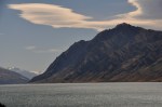
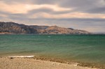
Note the landing strip in the last picture, which you saw in the video from the previous post (June 24, “Queenstown, Arrowtown and the Routeburn“). After leaving the mountains, the road passes the pretty Lake Hawea and the northern part of Lake Wanaka. As usual, New Zealand’s water/mountain/cloud combos are special – a visual treat. Lake Hawea pictures are below.

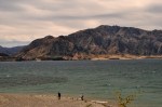


 To the left is a view of the northern reaches of Lake Wanaka (I showed some of its southern parts in an earlier post – April 7, “Wanaka and the Rob Roy Valley“).
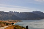
HAAST PASS
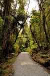
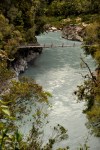
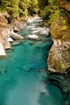
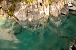
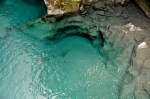
The Haast Pass goes though the upper regions of Mt. Aspiring National Park (visited in the Rob Roy trip mentioned above). It’s a pretty area; the road follows an old greenstone trading route and the cascading Haast River. We take time to do some short walks, such as the Blue Pools Walk below. Note how unbelievably clear the water is! We see large fish (not shown) that seem to be practically swimming in air.

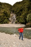
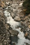
Another short walk was to Fantail Falls. Yes the waterfall is pretty, as is the associated stream-in-a-hurry, but look at the river rocks! Even the rocks in NZ are gorgeous!

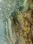


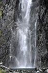
We also visit the impressive Thunder Creek Falls. Again, there are attractive veined rocks. The surrounding forest wasn’t too bad either.


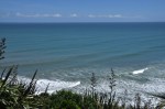
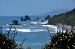
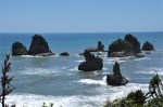
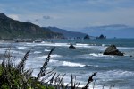
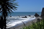
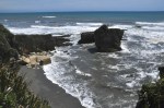
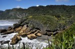
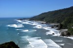
We finally arrive at the stormy West Coast and make a beeline for Fox Glacier. As I noted in an earlier post, the West Coast is stormy and wet, getting 12-30 feet of rain a year. It is not sunny today, and one can certainly tell which way the wind blows!

FOX GLACIER
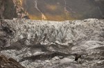
 Within a few horizontal miles the terrain drops from 10,000 feet to a rain forest just above sea level, and both the Fox and Franz Josef glaciers creak down the steep incline at world-record pace, aided by the snow pack on top getting about 120 feet of new snow each year. It should look something like that picture to the left, but the sky is all swirling cloud, visibility is limited, and we’re behind a mountain. What we do see from afar is impressive enough, though!


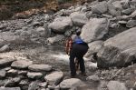
We learn that it is supposed to rain tomorrow; if we want to see the glacier, now is the time (and it’s getting late). So off we go. The glacier has receded nearly 2 miles since 1750, and that’s the walk ahead of us.


As we slog along, we are greeted by a number of small waterfalls and creeks coming down from the mountains.


Again, the rocks along the trail are veined and beautiful! Even the little pieces of gravel are too pretty to resist taking a piece home.


We arrive at trail’s end and find that Kea (alpine parrots) are already there, trying to help us get closer by untying barricade lines and eating warning signs. Two of them are working the warning signs together, one trying to eat it from the top, one from below. They really seem to be gremlins, disguised as pretty birds.


As it turns out, we can’t get very close to the glacier – two teenagers were recently killed when pieces broke off and buried them (they’re still there, impossible to retrieve). The glacier also makes a right-angle turn, and we can only see up to that point. Still it’s impressive enough, and pretty as the sun sets.


Nothing to do but hike out in the increasing gloom – and gather pretty rocks, of course.


One last look back, from a higher vantage point on the way out.


The weatherman got it right, and the next day it’s raining. I had wanted to do a 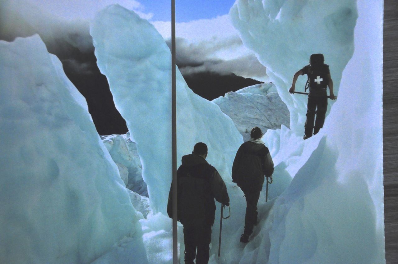 guided 4-hour glacier walk, such as shown in this picture from a brochure, but we are short on time, the ladies are far from enthusiastic, and the rain clinches the “nope”. Instead we’ll do the popular Lake Matheson Walk, with it’s iconic view of Mt Cook and Mt. Taman reflected in its water. Or in our case, the reflected rain clouds?
In spite of the drizzle, it’s a lovely walk, with mountains in every direction.


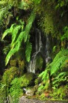
Then it’s into the woods to drip our way through the ferns and mosses.


As shown in the first picture below, the “iconic view” of Mt Cook and Mt. Taman is not reflected in the lake today, alas. Near the end of the walk the rain clears briefly, and we do get a reflection; just not of the big mountains. Still, it’s worth the price of admission.


FRANZ JOSEF GLACIER
 Franz Josef is nearby, so we’re there quickly, and the rain has come with us. We start the hike to the glacier, and discover there’s a benefit to this wet stuff; there are a lot of waterfalls along the trail, and nice ones at that! They’re not huge waterfalls, but hey, I’ll take small and picturesque!

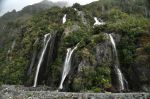
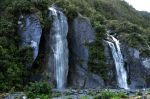
 Further along the trail we encounter a region with a multitude of waterfalls cascading down the cliff face. Although most of the waterfalls come prettily in and out of view on their way down, the falls on the far right remains in sight quite a distance and is impressive indeed, as shown in the pictures below.


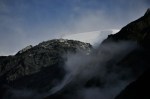
As we hike further in, the dark cliffs and gray skies become a bit forbidding if not downright sinister.


Another waterfall or two, and then we’re there.


We are looking at one BIG front of ice! It’s very impressive.


Surprisingly, some of the clouds suddenly clear, and we have patches of blue sky! How about that!


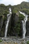
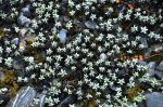
On the way out, we see another waterfall that was hidden behind one of the cliff walls. Also some cute wildflowers. As the sky clears – which it’s doing quickly – the force of the wind up there on the top is revealed in the sweeping curved sculpture of snow peeking above the mountains. It may not be friendly up there! We pass again the twin waterfalls shown earlier, still very pretty.


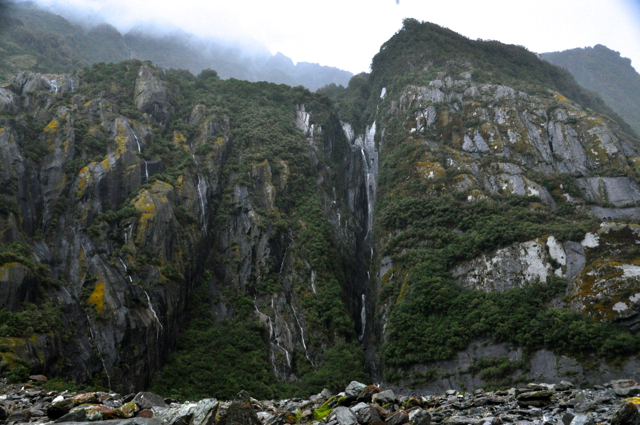
 Finally, a look back – in sunlight! – at the glacier with its scoured-out valley and waterfalls on both sides. Hopefully you’re impressed!
Oh, and one last picture below of snow on a mountain top, with an appealing shape. 
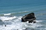
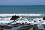
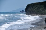
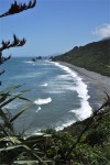
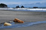
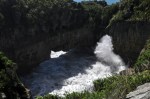
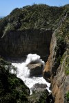
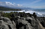
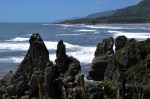
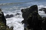
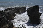
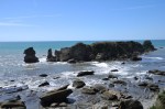
The next day, it is time to head “home” to Nelson. Below is a last shot of this pretty area of Franz Josef – and just for good measure, a picture of the ladies enjoying sculpture on the beach in Hokitika (notice the crashing waves in the background!).


Next stop – back to the Nelson area, and Abel Tasman National Park.