We’re off to visit Tongariro National Park up in the mountains. Volcanic mountains. I’m particularly interested in the Tongariro Alpine Crossing, regarded as NZ’s best day hike – and certainly its most popular. Although it’s a day hike, it’s a long one – 12 miles in length with a 2400 ft elevation change. You get dropped off at one end and picked up at the other, so you have to complete the climb in the allotted hours. At this time of the year, however, the hike is iffy – it’s dangerous if you’re caught on the trail in a storm, and all but impassable in snow. We’ll see what it’s like when we get there.
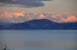
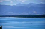
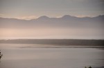
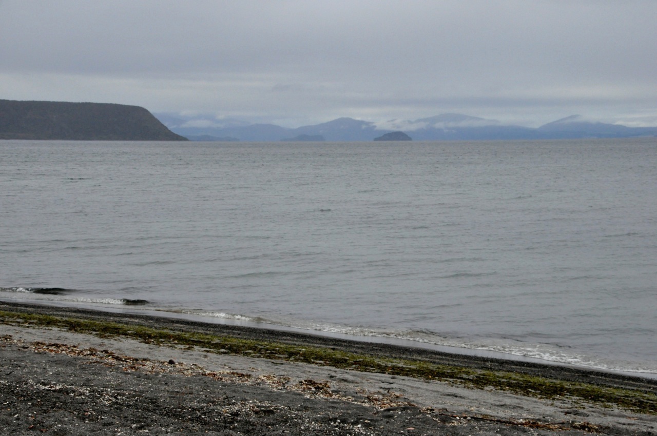
To get to Tongariro National Park we swing by the southern part of Lake Taupo, NZ’s  largest lake (it’s huge). I showed you this lake before (Nov 6, 2013; “Rotorua – Geothermal Wonderland“). If you remember, this enormous lake used to be a monster volcano that massively blew in 186 AD, blackening the skies of China and turning the sky of Rome blood-red, half a world away. The fact that this huge lake is a caldera is astonishing. The Tongariro National Park is located in this same area of intersecting tectonic plates, and its (much smaller) volcanoes have erupted regularly. The Tongariro Alpine Crossing traverses this region of active volcanoes, one of which played the part of Mount Doom in Lord of the Rings.
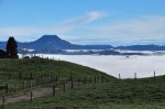
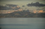
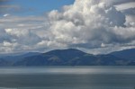
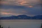
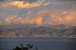
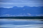
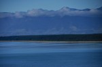
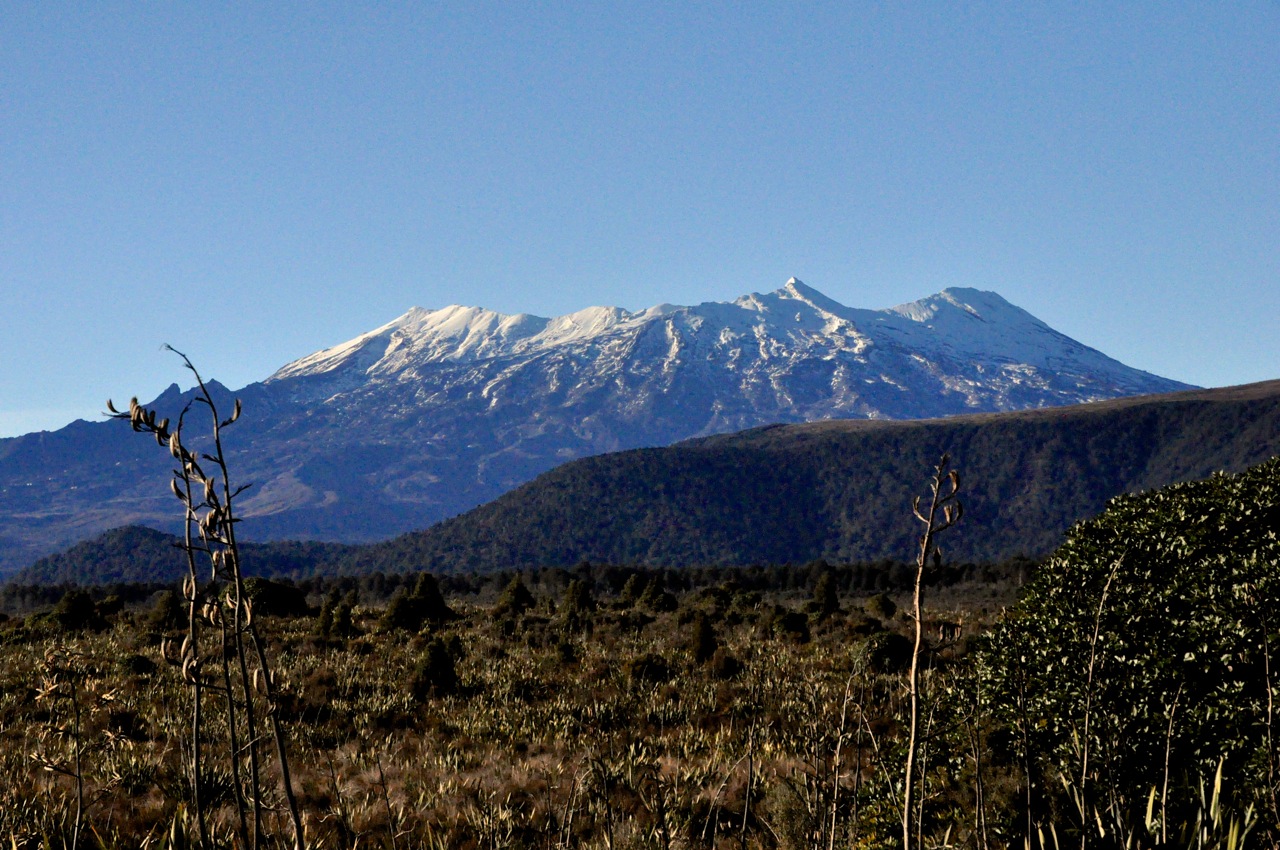
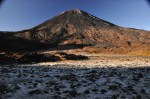
We’re staying in a fancy place at Whakapapa Village (an interesting name – NZ uses the  Maori pronunciation for names, and “wh” is pronounced as an “f”). We’re at the Chateau Tongariro, a very elegant heritage hotel built in 1929 in Great Gatsby style. It’s fantastic. That mountain in the background is Mt. Ruapehu, a ski destination in wintertime but also an active volcano (recent eruptions in 1995, 1996, & 2007 – occasionally emptying its crater lake down the mountainside). The volcano is best seen from the other side, shown below. The absence of Mt. Ruapehu’s top is impressive, yes?
The interior of Chateau Tongariro is as elegant as the outside, with attentive staff to make you comfortable (“Would you like me to start a fire in the fireplace? A cup of tea, perhaps?”). High tea in that interior was a treat, and of course there’s a bar right there. You feel rich just sitting in one of those chairs. This Chateau is in the middle of nowhere, mind you, so keeping it going is an amazing feat.
It’s competing with hostels with bunk beds, so maybe that helps.
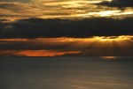
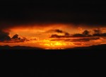
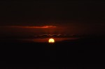
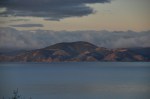
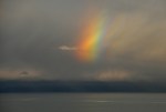
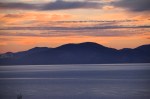
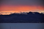
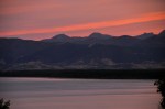
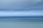
The view from the Chateau is amazing. A wide expanse of lawn leads your eye to gentle hills and picturesque mountains, with Mt. Ngauruhoe (Mt. Doom) looming in the background; at sunset, this magnificent scenery is painted in gorgeous shades of pink and orange. Wow!
Just before we arrived here, the Tongariro Alpine Crossing was closed, the tour operators no longer operating their drop-off/pick-up service due to heavy snow, and subsequently rain and fog. In the height of the summer season, the Alpine Crossing is packed, with up to 700 people per day crossing in conga lines from both sides, but this is an iffy time of the year and the crowds are gone. Since I don’t have winter clothes or crampons with me, Ginger is not going to let me take this hike unless the weather is perfect – and guess what – the weather is perfect! Most of the snow is gone, the route is clear, and the ranger says I should have no trouble, especially if I wear Ginger’s tights (temperatures are below freezing). Whoopeeee! So off I go! Ginger will hike the nearby trail to Taranaki Falls while I’m doing my thing.
 I decide to take the 2nd departure at 8am rather than 7, when the temperature will be warmer – but I’ll have an hour less to make the hike. Still, at an estimated traverse time of 6-8 hours, and pick-up at 3pm and 4pm, I should be fine. We start out with the sun rising behind the mountains, so we’re in shadow; frost and snow is here-and-there. Notice how flat the trail starts! I am not deceived.
The trail is actually flat for quite a while, but then takes off steeply. A waterfall comes into
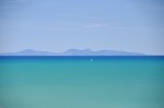
view; it may not look like much in this picture, but it’s deceiving – those rocks at the bottom are about people-size! Mt. Ngauruhoe looms ahead; in the other direction, Mt. Egmont (Mt. Taranaki in Mauri) “peaks” (pun) over the hill from the distant Egmont National Park. Yep, Mt. Egmont is a volcano too, classified as “active but quiescent (last eruption, 1755)”. It has it’s own movie fame as the backdrop to The Last Samurai.
 We’re still going up steeply. Notice how wonderful/ functional the trail is! I’ve made good progress – the car park is visible at the end of that middle ridge to the left of the people. Speaking of people, I expected to be pretty lonely on the trail, and I am not! As it turns out, with the bad weather, hikers holed up for a week and now everybody is out while the hiking is possible. It’s not crowded, mind you, and having some company is nice.
It’s still quite frosty in the shadows, as you can see on the plants and the smooth old lava flows. The frost makes the interesting vegetation even more attractive. I’m now pretty much at the base of Mt. Ngauruhoe, which rears up impressively. I’ve climbed about a 1000 ft in elevation; oh good, only 1400 more to go!
Another waterfall comes into view, and then we really start to climb. The vegetation disappears; this is definitely volcano land.
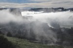
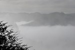
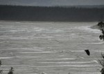
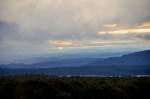
I’m getting higher, and the trail now has steep drop-offs at the edges! Notice the fog-filled valley off in the distance – I’ll get to that in the next post, stay tuned.
Finally I’m on the skirts of “Mt Doom”, and it is steep indeed. And pretty much lifeless. Mt. Doom indeed! An information board shows the history of recent eruptions, the last one only 40 years ago.
Mt. Ngauruhoe is impressive this close up. It has a red, angry lip, and small puffs of steam are escaping from the interior. I would so love to look down the crater of “Mt. Doom”,
but the side trail up is difficult scree, and more importantly, I don’t have the extra 3 hours. Next visit, right?
I’ve been hiking up this trail for hours now, and due to the bleakness of the landscape I can still see all the way back to the trailhead, ‘way down there! That is about to change, however; the trail levels out across an older crater called the South Crater, and I’ll soon be
trading this view for new ones. One last look at the impressive Mt. Egmont off in the distance.
The South Crater is blessedly flat, but I feel a certain uneasiness in this flatness surrounded by crater walls. There is a clear cognizance that I am walking in a caldera, and in years past this was not a good place to be! There is no danger, of
course, but funny how my pace has quickened. Must be the flatness, surely. And then the trail heads up again, up a crater wall and then along the crater ridge, with new views.
The trail is steep again! Steep enough that a cable is provided to allow navigation of a narrow ledge. The picture on the left doesn’t show the steep part; it was scary enough that I was not tempted to take a picture there, survival being foremost in my thoughts.
A look back (above right) shows Mt. Ngauruhoe and a part of the South Crater; the lower right picture shows a piece of Mt. Ngauruhoe behind a sign indicating a side trail to the smaller Mt. Tongariro, the namesake of this national park. The trail crosses a saddle between Mt. Ngauruhoe and Mt. Tongariro, a peak that I haven’t shown you because it’s less impressive. But hey, taking that summit is only an extra hour (or so)! How can I resist?? So off I go, up a ridge, as shown below.
It’s pretty steep climbing, but the overviews at the summit should be worth the effort. The picture above right presents a good view of the South Crater, giving you a better feeling for how big and impressive it is. Then, at the summit of Mt. Tongariro, the  world is at my feet. This is why I love climbing mountains! On a clear day, you can see forever, and with pounding heart and amazed eyes you revel in being alive. The picture to the left is my favorite view of Mt. Ngauruhoe. Now let’s look around to new views, ones we will be visiting shortly. First, the Blue Lake.
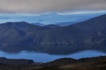
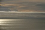
I plan to have a late lunch there at the lake (carrot reward; works for donkeys, doesn’t it?). If you look at that notch in the left image, it’s pretty spectacular. There’s this low-flying “cloud” below the notch (turns out it’s not your normal cloud), and the view beyond is the
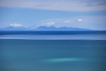
very beautiful Lake Taupo. The view is gorgeous!! I can see the horizon for most of the 360; the view is probably better than one of those $1 mil Space Shuttle tourist rides.
To get to that Blue Lake, I must first hike past the Red Crater and the Emerald Lakes; sounds colorful, doesn’t it? I can see some of the Emerald Lakes from here (below right).
Don’t they look cool? The picture on the left shows the way down … time to get truckin’.
I’m back on the Alpine Crossing Trail again, and apparently walking past the Red Crater,
but the view is confusing; I can’t really see a crater, but those walls are definitely red! In the left picture below you can see the “mini-mountain” that I have to climb; doesn’t it
look like this is the end of the trail? Some big monster ate the rest of the mountain? Any descent looks like it will be steep! When I get to the top, there is a nice view of my lunch site, the Blue Lake, and Lake Taupo behind that. Gorgeous! But concentrate: we’re going very down-down, quickly, to the Emerald Lakes. As you can see in the pictures below, the
Emerald Lakes are stunning – and the trail (indicated by the people on it) seems more fit for lemmings. The trail isn’t quite vertical, it’s more like a playground slide; it’s really steep, mostly sandy – a black sandy pumice – and there seem to be 2 choices to get down; going extremely slowly, which most people are doing, sometimes on their butt (this seems to be a collection point for people, it’s crowded), or falling/sliding/skating at great speed (involving some dodging). Either way, a lot of people are falling, so why go slow? Well, I only fell once, probably par for the course; broke the plastic protector over the viewing screen of my camera – happily, no real harm done.
I’m now at the Emerald Lakes, and they’re really pretty! As shown below, they exhibit a
variety of shades of green within the same lake, along with other colors like yellow and blue. Notice the steam coming from behind one of the lakes, top right picture; it’s proof we’re on a volcano, with Smaug under our feet! The bottom right picture shows one of the steam vents. Pretty cool! Anyone for spelunking?
Leaving the Emerald lakes, the trail goes up and provides a great view of the lake and the broad vista beyond. It’s a very beautiful area! Turning around, I finally see enough of
the Red Crater to discern that it is a crater. That last picture also shows the sliding-path down, which you might notice is very steep and downright vertical at some spots.
Once again I’m hiking across a caldera in volcano land – this one called the Central Crater (below). There is a creatively named North Crater, which you can see in the first picture of the Blue Lake that I showed earlier, but the trail doesn’t go across it. The
trail then goes up to the Blue Lake, pretty steeply, but the elevation affords a spectacular overview looking back. Look at those volcanoes all lined up in the picture on the right! The snow-covered peak behind Mt. Ngauruhoe is Mt. Ruapehu. It’s pretty clear where those tectonic plates are intersecting!
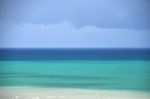
There’s not much view from the Blue Lake, other than the Blue Lake itself, but it’s pretty enough! The lake is not just blue; like the Emerald Lakes, the periphery of the Blue Lake
is a variety of colors. Lunch here is a nice respite. In addition to water, I’ve been carrying a Coke, and with lunch it tastes oh so very good! Must be the sugar. From here on, the trail will be all downhill – that’s the good news. The bad news, I’m not too much more than half-way across the Alpine Crossing.
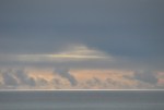
Leaving the Blue Lake, the trail goes to that notch in the mountains I pointed out from the
top of Mt. Tongariro. That low-flying “cloud” is still there, below the notch. And it’s a pretty active cloud, being blown around a bit; swirling, really. Eh, what? I’ve been in lots of clouds in mountains before, but it’s always been more of a creeping nebulous fog that surrounds all; not so well defined and discrete as this one. Walking further,
with the cloud still ahead, a sign portends the answer. Another volcano? Haven’t I left them? Around the next bend I am suddenly confronted by a mountainside going  down, seemingly forever, and covered in colorful vegetation – not your volcano scenario. It’s a looooooong mountainside, with amazingly long switchbacks terracing into the distance. The switchbacks go towards and then away from the cloud; sometimes the wind blows the cloud over the trail.
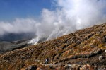
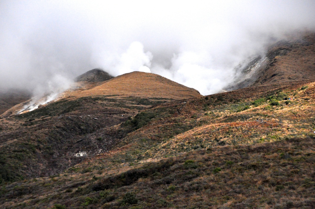
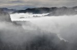
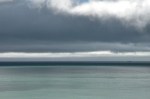
Still, the source of the cloud remains a mystery, until I encounter this sign, below left; the cloud must be steam escaping from somewhere, but there is nothing remotely resembling
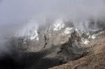
a volcano here. On a long leg away from the cloud source there does come into view a bleak area of the hillside that is emitting steam from small fumaroles, but it’s not much, and that steam just vaporizes into the air. However, on the long return toward the cloud, the wind shifts up the mountain and the cloud source is revealed. It’s still far away, but the side of the mountain is really smoking! As I get closer, steam is absolutely pouring from a large ravine in the mountain, with a long string of fumaroles venting from along the
top of the ravine. A very lifeless ravine, may I add. What is coming out of this volcano is steam, forming a harmless cloud that we walk in and out of multiple times. But I can imagine, in more exciting times, that the steam could be gray ash, and we can’t breathe, and retreat is impossible. I’m very happy that this mountain is a sleeping dog!
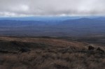
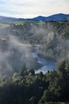
I’ve actually been running down many of these switchbacks; the distance markers suggest that I could make the 3pm shuttle if I hurry; otherwise I’ll have the better part of an hour to wait. However, the view from the trail is not bad! So I stop to take some pictures.
 This is a last look back at the cloud generation. It’s a lot of steam!!
Finally I’m finished with the switchbacks and long mountainside, and into forest primeval. The occasional markers giving distance to the car park say I can still make it by 3pm – really, I should have been closer by my reckoning – but as I run/walk down the trail, and the time marches along, it looks like it’s not going to happen. The markers have lied!! Ah well, the forest is pretty.
In discussions with others at the car park, waiting for the shuttle to show, there is universal agreement that the markers showing distance were very misleading. I will close  with a picture of a silver fern, the iconic symbol of NZ.
What a fabulous hike!


 The city market is located in a very impressive building with an equally impressive interior; the food displays are a riot of color, combined with jostling but polite people and barkers hawking their wares. I was particularly caught by the seafood on display. The images below are just a peek.


 Another gem was this engraving, but alas, I missed the artist.
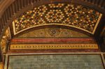


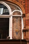
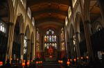
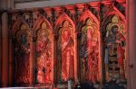
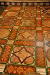
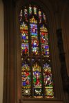
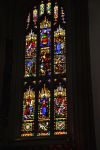
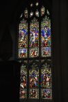
 Finally, a visit to Leeds Minster (Cathedral). As English churches go, the Leeds Minster is tiny and relatively new (a church has been here since before the 11th century, but several previous versions were destroyed by fire; this one was built in the 1840’s). Still, it is a very attractive church, with some preserved items from its past. The baptismal shown here is from the 1400’s (used until 1883). Earlier yet is the Leeds cross, dating to the 900’s. It was found built into the previous medieval church structure when the new church was begun. The cross would originally have stood outside the church, together with other crosses, likely as grave markers. The carvings juxtapose Christian and pagan


")


 from the \"mini-mountain\" crest")