Dunedin – Chinese Scholar Garden, and Polynesia

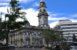
CHINESE SCHOLAR GARDEN

Chinese Garden bridge
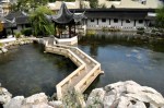
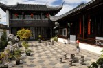
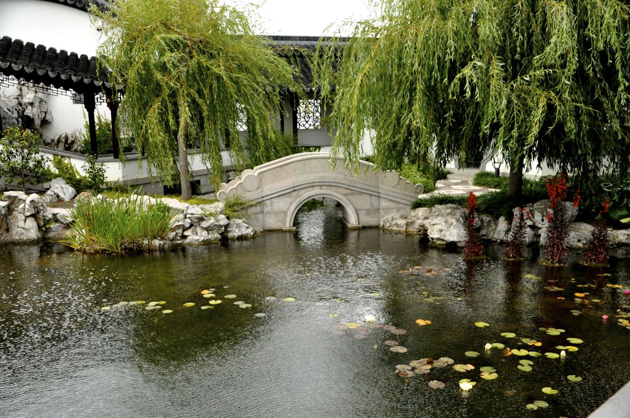
The Chinese Garden is a recent – and fabulous – addition to Dunedin.  It is one of only 3 Ming Dynasty scholars’ gardens outside China.  A scholar’s garden is the creation of a “spiritual utopia”, a contemplative space, an escape from daily concerns where one can re-connect with nature, the ancient way of life, one’s true self.  The gardens try to capture the look of traditional Chinese paintings and the imagery created in poetry.  To create this authentic garden, its wooden houses and structures were made in Shanghai using 4th century BC techniques – no nails, just mortise and tenon joints.  The granite plinths and facings were hand chipped, the columns free-standing and not pinned.  Terracotta roof tiles
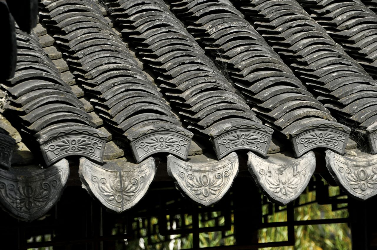
The buildings needed 380,000 terracotta roof tiles, handmade in Suzhou, China.  After being assembled in Shanghai, the buildings were taken apart and shipped to Dunedin, along with 970 tons of rock and 130 tons of granite.  Forty Chinese artisans from Shanghai did the installation in Dunedin.

The Chinese word for “landscape” literally Chinese garden mountain
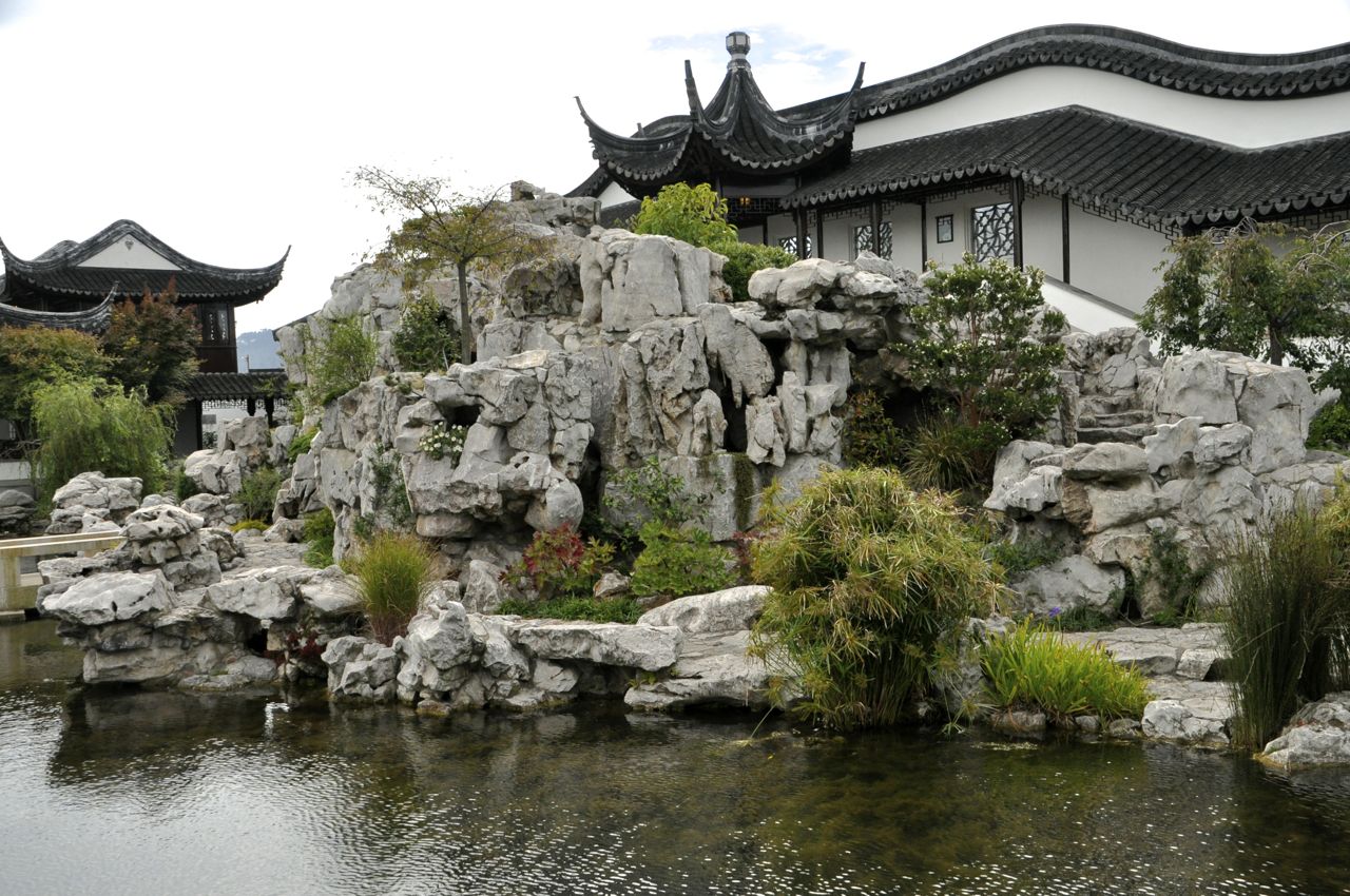
means “mountains and waters”, and the mountain built here is from prized Lake Tai rock (from near Suzhou), a rock that represents wisdom and immortality; during the Song dynasty this sculpted rock was the most expensive object in the empire.

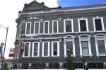
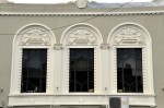
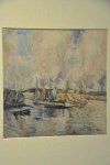
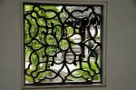
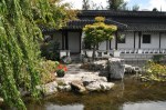
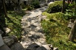
We felt this Scholar’s Garden was indeed a wonderful, soothing, contemplative, fabulous place.  By intent, there are visual surprises around every turn and corner (of which there are many!).  Beckoning niches, contrasting colors and textures, or repeating patterns are traps for your eye and give you pause.  Every window has a different intricate and marvelous grating.  Let us take you on a tour.  I’m just going to put a bunch of pictures below, as we walked around.

THE OTAGO MUSEUM – POLYNESIA and MELANESIA

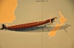
This is a small but interesting museum that covers a number of subjects, but we were mostly Polynesia/Melanesiacaught by the Polynesia/Melanesia wing – we really didn’t know much about the island regions of our world, and since we’re living in one of them, NZ, with Maori inhabitants, we thought we’d take a closer look.  For orientation, here’s a map.  As you can see, Polynesia is ‘way out there, specks floating in a big ocean!

Before starting the Polynesia section, we took a quick look at some very nice Maori carvings that the museum had.  They were made for a meeting house near Napier (North Island), and were carved in the 1870’s.  We’re impressed!

For us, there are two very fascinating aspects of Polynesia.  One is that the islands were settled one-by-one by seafarers using basically a canoe with a sail; these islands are anything but close, so the utter audacity of sailing off into the unknown is amazing.  A sail and a prayer – if not a death wish – for a family or couple!  I can see it now – “Hey sweetie, how about we sail off into that sunset and get away from here?  We’ll find an island just for us.  I mean, how big can the Pacific ocean be?  You bring the water, I’ll paddle.”  Yeah, not sure that pick-up line would work with Ginger.

The other fascinating aspect is the subsequent developmental changes (or their lack!) that occurred from a common culture.  The islands were far enough apart that there was no chance for communication early on and,  like Darwin’s finches, the cultures evolved in isolation.  Alas, the museum does not directly address this topic, but it’s visible in the displays.

Boats of the Pacific
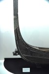
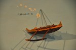
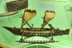
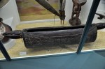
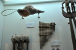
Let’s start with migration.  Polynesian culture goes back 3 or 4 thousand years in some areas, originating from Southeast Asia and Taiwan.  The far-flung areas we now call Polynesia were occupied by the late 1200’s AD.  The picture to the left shows typical boats from different regions, and mostly they are riffs on the same theme, with a couple of exceptions that I’ll show first.  China is the biggest exception – really not a Polynesian Typical Chinese shipplayer, but interesting nonetheless.  A very different boat!  China had a permanent navy in the 1100’s during the Song Dynasty, with 52,000 marines!  They were the leading maritime power in the early 1400’s, until subsequent emperors lost interest, eliminated their navy, and turned inward.  Their boats had a different purpose (not island hopping/fishing) and thus had nothing in common with Polynesian boats.  The other exception in this display is a Peruvian boatKon-Tiki-like boat/raft from Peru, but there is little evidence that South America contributed much to Polynesia (except possibly to Easter Island).  You may notice from the overall display at the start of this paragraph and in the pictures below that the New Zealand boat is different from most of its cohorts, having no sail and no outrigger.  Its evolution is likely due to the shore-hugging short-distance travel around these large two islands, though sails and outriggers would have been used for the initial ocean crossings.  You can also see that the war canoes of the Solomon Islands were very similar to that of the Maori, including the dramatically upraised prow.  The other boats all have  outriggers or a double hull, many have sails, and all are structurally similar.

Differences in tattooing
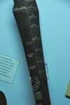
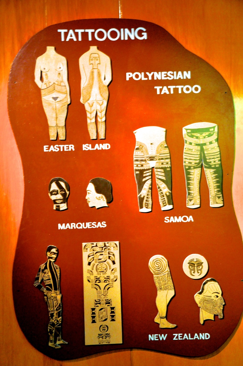
We thought the NZ Maori tattooing was extensive!  This painful process was primarily done on Maori males, the females usually just doing their chins.  For the Maori, tattooing was a mark of puberty as well as conveying information on a person’s lineage, tribe, occupation, rank, and exploits.  Well, as you can see in this display, tattooing is obviously a Polynesian thing!  And the Maori were conservative!  Look at the Easter Island women, or the Samoa or Marquesas extensive tattoos (Ouch)!  In these other cultures tattooing was also a mark of puberty, courage, rank and status.

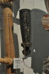
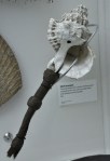
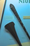
Decorative art such as combs and pendants, shown below, also show similarities across the island cultures, perhaps due to the similarity of available raw materials.  The particular designs used in ornamentation, who wore them and how they were worn, however, varied from island to island.  For instance, the pendants in the case below were decorated clam shells; it’s the same resource, but different cultures wore them on the chest, on the neck, or on the head.

Apparently house construction varied regionally across the islands, but there wasn’t much on display.  I have two for you below, one a picture (New Caledonia), one a display (Samoa).  Samoans were the “Architects of the Pacific”.  Their houses  were built without nails, screws or pegs.  The open sides of the house allowed free circulation of air, but blinds of woven palm leaves could be lowered.  Floors were of stone.

Breadfruit splitters, Marquesas vs Tahiti

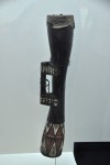
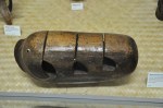
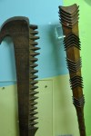
Tools had a lot of similarity.  When a particular need would be the same – say, splitting breadfruit – the solution on different islands was usually quite similar, as shown with these breadfruit splitters to the left from Marquesas and Tahiti.


Often differences in tools among the islands were directly related to the availability of raw materials, such as the adzes below in coral, stone and jade.


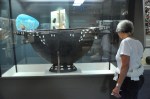
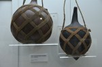
Not everything is easily compared between islands.  We’ll just show some bowls and interesting tools.

Music and celebrations are universal, as are drums and pipes.

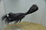
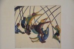
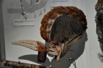
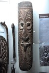
And where there is dance, there are masks.

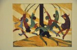
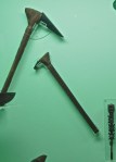
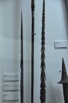
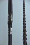
Finally, of course there is war.  Islands are not an escape; the Maori were a warrior culture, as we have seen in earlier posts.  When it came to war, the Polynesian islands diverged considerably, depending on the political culture.  Some islands became fully developed kingdoms with little warfare, others divided into constantly warring tribes, such as NZ’s Maori.  The primary force driving the culture one way or the other, in addition to population pressure, was geography.  On level islands, where communication was essentially unimpeded, warfare was not chosen.  On mountainous islands, with distinct boundaries like mountain ridges, warring groups were the norm.  How interesting is that!  Below are instruments of warfare, starting with the clubs.

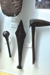
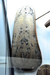
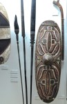
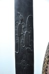
In addition to clubs, there were spears and shields.

Warrior from Tuvalu, an atoll
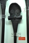
As a last picture, this is a Kiribati warrior from Tuvalu, an atoll.  Atolls, just a few feet above the sea, support very little life other than a few trees and coconut palms (water was obtained from holes dug in the coral).  With so few resources, humans struggled.  However, here is a well-dressed warrior, on an atoll where we have been told warfare is not likely to occur!  We don’t understand the need for armor, but the armor is in itself interesting; the cloth is coconut fiber decorated with shells.  The helmet and stomach guard are of fish skin.  Sharks teeth are used in the weapons. Quite a use of what you’ve got!

Well, I hope you enjoyed that long discourse on Polynesia and its insight into cultural evolution.  My take-away is that if the resources are pretty much the same, the evolution is pretty much the same.  If everyone lives on a flat area with few natural defenses, people make peace (conversely, it there are defensible borders, it becomes us-vs-them).  I also thought it was interesting to get an insight into stone-age cultures existing into the late 1800’s!

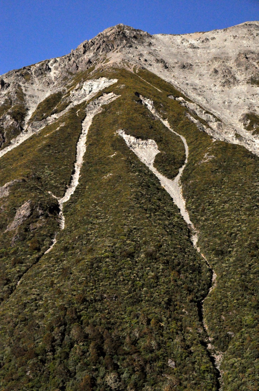
Next post – Christchurch!

Dunedin – Architecture and Art

Dunedin is the largest city in the southern half of the South Island, with a population of 120,000 (20% of which are students).  Called the “Edinburgh of the South”, it was founded by Scottish settlers around 1850, who named it after home – DunEDIN(BURGH).  Ten years later gold was discovered nearby, and this port city quickly became NZ’s most important, spurring a building boom that resulted in a legacy of harmonious Gothic Revival architecture fashioned from volcanic bluestone and creamy limestone.  This is a city post – Dunedin’s university, churches, architecture, and art museum.

THE UNIVERSITY OF OTAGO

Dunedin is home to NZ’s first university (1869).  We happen to be here during the University’s Orientation Week, a big mistake!  Classes are not yet in session, and students, newly liberated from parental control, have a lot of time for beer drinking and rowdy behavior. We have unwittingly booked a motel in a student area, our walls are thin, and loud top-of-your-voice street-side “conversations” go on until 3 or 4 in the morning.  Groan!

The University looks very much like an English university to us, although it’s on a considerably smaller scale.  In the pictures below, the darker stone is bluestone.

The details are fun – the carvings, the attractive windows, even downspouts are special.

THE CHURCHES

Every day we walk past this church that is not in our tour books – the Knox Church, it’s called, just a small Presbyterian church – but it is quite beautiful, reflecting the architecture of that time.

The most impressive church in Dunedin is St. Paul’s Cathedral, an Anglican church constructed in the early 1900’s entirely of Oamaru limestone (see post of Jan 20, Oamaru and Penguins).  It’s located on The Octagon, the central plaza of the city, laid out in 1846 and home to a number of well-preserved buildings.

Positively European, eh?  I’m a sucker for stained glass, and this church has a lot of it, all from the early 1900’s.

The final church is the First Church of Otago, touted as the most impressive of NZ’s earlier 19th century churches.  Praise is given to its wooden gabled ceiling and rose window, but we get there late and I am shooed out before I can even take a lo0k – just that quick picture from the door before I’m spotted.  I try to sweet-talk my way in, but it is not to be.  Still, the church is very impressive to look at, even from the outside.

THE ARCHITECTURE

First, let’s look at a grand building there in the Octagon near St. Paul’s Cathedral: the Municipal Chambers, built in the Italian Renaissance style in 1880, also from Oamaru limestone.  The lamp bases aren’t bad either!

Also on the Octagon is the Regent Theatre, home to the Royal NZ Ballet and other shows.  Built in 1874, its interior is a combination of 19th century fashion and 1920’s art deco – a stunning combination, I think; classical and classy!

Another turn-of-the-20th-century building is the Dunedin Railway Station, again built of bluestone and Oamaru limestone.  I think it’s fabulous.  Ginger is not so sure.

C’mon, isn’t this the most resplendent train station you’ve ever seen?  The interior is also quite amazing, with a foyer of tile and a porcelain mosaic floor.

Other historical municipal buildings are the court house and jail – which are physically connected for the sake of efficiency.  Not all of the historical buildings are in great shape (for example, the warehouse buildings below, right).

Some of the residential homes downtown are reminiscent of New Orleans buildings of the same period – maybe it’s all that wrought iron (but definitely not the turret).

Below are samples of downtown business buildings.

Finally, I wanted to share our experience visiting a cafe downtown.  We saw people shooting up, with big syringes, right there at tables out front, in broad daylight!  So, of course, we had to try it too.  Or at least Ginger had to, that junky in need of a (sugar) high.  You order, select from a variety of fillings, take a seat, and soon appears a warm, sugar-coated doughnut (shell) and a large syringe filled with jelly, lemon, chocolate…, whatever your “fix”.  Just to keep it low calorie, it comes with a side of whipped cream, too.  Messy, yummy, the ultimate do-it-yourself rush.  It is an interesting take on the jelly doughnut.

DUNEDIN PUBLIC ART GALLERY

It’s the oldest gallery  in NZ, converted from 6 Victorian buildings into a very modern, gleaming museum, right on The Octagon.  The foyer has a work entitled “Cones” by NZ sculptor Cones by Neil DawsonNeil Dawson (his work also appears in our posts from Christchurch and Wellington, but unacknowledged).  Also note the cool spiral staircase barely visible on the left, from Victorian times. The museum has a traveling interactive exhibit of works by Seung Yul Oh that was fun; certainly Ginger got into it!  The pictures below show some of the art from this exhibition.

The Wonder Wall The core museum starts with an interesting introduction, “Wonderwall”, an entire wall of some great art!  This is the “salon style” of art display from the 1600’s.  The large room is otherwise empty, except for a full-size replica of the amazing “The Wrestlers” from 3rd century BC Greece.  The austere room and The Wrestlers, copy of 3rd Century Greek statuefabulous art is striking, and intriguing.  One of the ideas behind this type of presentation is to invite comparisons.  I note that many of these paintings show people looking out at me, looking in at them.  Ooooookay.  A little different.  In looking at art, I’m used to mentally putting myself in the picture.  Here I seem to be the picture, the gallery looking at me!  Turnabout!  Here are some pictures I like, up close.

The picture below is a fascinating “out there” piece of art created by Anne Ferran, an Australian artist, during a two-month artist-in-residence program at the museum.  From

Anne Ferran, Australian, 2001

Anne Ferran, Australian, 2001

across the room, it looked like a ghostly 3-D construction or a hologram.  Up close, it’s a ghostly picture of an infant’s christening gown.  It’s called a “photogram”; I suspect it’s done with x-rays using x-ray film.

OK,  on to some other art that impressed me.  Another “out there” fascinating collection by an American, Robert Rauschenberg, worked with unusual juxtapositions/allusions in color lithography, examples below.

I was blown away by the works of Frances Hodgkins.  Working in watercolor at the end of Impressionism/ beginning of Modernism, she captured the optical effects of light on water, along with movement and stillness, that I find incredibly beautiful.  Examples below.

Finally, let me show you some amazing linocuts (a woodblock-like process, but using linoleum) from the 1930’s.  Each color required one block , necessitating simple, abstract designs.  Yet this very simple, static process produced such a sense of speed and movement!  Printing was done by hand – a piece of paper was placed on the inked tile and rubbed – thus producing very affordable art for this industrial age.  The prints are grouped by artist.

That’s probably enough for one post!  The next and last post on Dunedin will showcase the fabulous Chinese Scholar’s Garden and the fascinating Polynesian exhibit at the Otago Museum.

Leaving Milford Sound – the Routeburn Track to Key Summit

On our way out of Milford Sound we plan to hike a piece of the Routeburn Track, one of the finest of NZ’s “Great Walks” (multi-day tramps).  It’s turning out to be a beautiful sunny day – we don’t know whether to cheer or curse our fate of yesterday (post of April 17, Milford Sound).  We decide to cheer – hard to stay grumpy on a sunny day!

The Routeburn track has an interesting twist.  Remember we took two – admittedly leisurely – days to drive to Milford Sound from just above Queenstown (post of April 13, Fiordland National Park and Milford Sound – Getting There) .  On the other extreme, tour buses from Queenstown drive to Milford Sound and back in one very long day.  The interesting story is that one can use the Routeburn Track to walk from Queenstown to (just above) Milford Sound over the Southern Alps in just 2 (long) days; it’s only 20 miles!  So why not build a short highway across the mountains to link the two tourist destinations?  The answer is twofold – one, Milford Sound already gets plenty of tourists in spite of the travel hurdles.  Two, if they built the highway, the city of Te Anau (Gateway to Milford Sound) would cease to exist.  So NZ wisely embraces the status quo.

The Routeburn track is very green and pretty, as one might expect from the rainfall.

As you can see in that last picture above, the banks of the trail (horizontal and vertical!) are solid with moss and ferns.  Other areas have banks that are chock-a-block full of lichen.  Sometimes the ferns are a solid mass going up the hillsides, just a forest of ferns (picture not shown).  It’s all very colorful!

Occasionally we encounter small waterfalls.

After an hour or so of steady upward climb, Ginger decides this is not her day to hike and turns back.  I’m 9DSC_0046feeling great and will push on.  Soon thereafter the trail to Key Summit splits from the Routeburn.  I take the Key Summit trail which heads up even more steeply.  Soon the forest ends abruptly, the view opens up, and I’m hiking past sub-alpine plants.  The picture to the left, below, looks back at the valley where we started, the other picture is the increasingly pretty view ahead.

The flora is interesting, with a fuzzy ground cover and a number of small wildflowers like the genetian.

Finally I’m at the top, and it’s quite a pretty view from this small summit, with mountains absolutely surrounding it.  The small tarns and yellow ground cover/grass add to the beauty!

Looking more closely, I see that there is also a lot of red here, adding to the very pleasing palette of colors.  There’s red algae in some of the tarns, red lichen on the rocks, and a thick red moss on most of the tree trunks and limbs.  I’m loving the feast of colors!

The trail doesn’t really stop here; it seems to wander off in several directions, including a “nature walk”.  I decide to wander as well, going up, of course.  There’s a hill ahead.  One of the advertised “sights” from the Key Summit is the view of three valleys that intersect here, the great conjunction.  You can sense – if not see – them in the pictures below; the first picture shows a valley over the left side of the summit, the next showing that valley joining another and falling away, the third picture showing the joining valley over the right side of the summit, and the last picture hinting at the third valley that’s coming in, but the view is blocked by the hill ahead.

Lake Marian in the cirqueAs I’m walking up the hill, I come to an opening with a bench, and a sign saying there’s a view of Lake Marian.  Sure enough, there’s a glacial cirque with a lake – always a pretty sight!  Alas, there is just a snippet of the lake showing.  As I’m watching, a guide with a customer shows up and says the trail continues up the hill for a better view.  I’m on it!  However, there is no obvious trail anywhere, things seem to Pretty tarnsend here.  As I walk up the hill, a trail does emerge – a footpath, really, and not used much.  I do pass some more quite beautiful tarns.  After some climbing the steep footpath then leaves the open tundra to go into a forest of short trees with the red moss.  The trail becomes almost hidden in the plants, and then becomes nothing but mud and roots and hauling yourself up by grabbing tree trunks – you really have to want to go here!  It is also taking me longer than anticipated.

Finally I’m out of the woods, and there is a good view of Lake Marian!  It looks like a pretty fabulous place to pitch a tent, over there.

A further benefit is the view up the hill; down in the valley there’s a big lake – probably

Lake Gunn that we visited yesterday.  Key Summit is definitely a pretty place!

Alas, I have taken longer than planned, the long-suffering Ginger is patiently (?) waiting (lucky for me she keeps her Kindle in the car), so even though the path continues up, I’d better go back.  More’s the pity!  The problem with a day hike into NZ’s multi-day Great Walks is that you do the tough vertical climbing to get to the pretty areas,  then once there, with easier hiking and all the best views still ahead, you turn around and go back down.  Still, the half-loaf is worth it (and I didn’t have to carry a heavy backpack).

Below are two pictures taken on the way down of the pretty tarns and the red ground cover with berries.

On our way back out Milford Road, we stop at Lake Gunn to see it in the sun – it’s a pretty place, with very clear water.  For comparison I’ve included our picture of Lake Gunn from yesterday.

The valleys are also much prettier in sun.

That’s it for Milford Sound!  Hope you enjoyed the trip up Routeburn.  Next stop, the Scottish city of Dunedin.

Milford Sound

Milford Sound is a famous landmark of NZ.  People fly over by plane, or travel by bus or car, or even hike in over the Southern Alps.  It is said that one needs to see Milford Sound on repeat visits: in the sun, in the rain, and under a blanket of snow.  Why one should see it in the rain is not intuitive, but my travel book says that shortly after a big downpour every cliff sports a waterfall (and the place looks even more magical as ethereal mist descends).  I say this to lift our spirits, because it is raining steadily, and the “ethereal mist” is pretty damn depressing.  I know that the famous and massive Mitre Peak is staring me straight in the face in the left picture, but someone ate it.  Still, the view has a somewhat oriental charm to it, just not the OhMyGosh! view I was hoping for.

There are some nice views before departing – a white heron fishing, a near-by waterfall – but note my difficulty in keeping my lens dry.  The minimalism of traveling does not permit many photographic accessories.  A lens hood or underwear, that’s the choice.

Finally we’re off, along with 58 other hardy souls looking a little long-in-the-face as well.  The boat is nice, although its large picture windows are not going to work for taking good photos from inside.  I’ll have to brave the elements outside, and dash inside to clean my lens – along with a lot of other photographers, but everyone plays nice.  The first views are certainly atmospheric; big mountains diving straight into the water, and tall waterfalls appearing out of the clouds.  In gray.  Sigh!  For perspective, look at the other cruise ship in the last picture.

As we motor out, there certainly are waterfalls!  When we get closer to them, there is still some color through the rain and mist, thank goodness.  They’re pretty, take a look.

Part of what is happening here is the presence of many “hanging valleys”.  In the ice age, mile-thick glaciers rumbled cross-wise across mountains and valleys, churning a trough a mile deep.  When the glaciers left, leaving nearly vertical cliffs at the trench edges, the rivers traveling down those valleys now had no choice but to hurtle lemming-like off the cliffs into the waiting Sound (fiord).  In Milford Sound, only a half-mile wide, the effect is impressive; the peaks, we are told, go up 3000 feet (alas, in the fog we only see about 100 feet of that!), and the water of the Sound is over 1000 feet deep.  Where we float, the sides of the glacier-sheared mountains are near-vertical.  What that means for us is that the cruise ships can get within a few feet of the mountainside with no fear of hitting anything, and they do that at the waterfalls with some glee.  Which you’ll see below, as we approach a single waterfall.

I saw what was going to happen and quickly bailed into the cabin, as did ginger (in the blue raincoat).  The prow went into the waterfall; the kid and dad got soaked!  And I mean drowned-rat soaked!  They were dripping their own cascades as they sloshed into the cabin.

There are more waterfalls, which are just everywhere.  It’s like the world has sprung a leak.

I hope you’re enjoying the beauty of these waterfalls!  It’s raining, and I’m having to dash in and out of the cabin to dry my lens.  Soon my lens cloth and then handkerchief are as damp as the lens, and I’m just pushing the wet and smear around.  Reality is probably clearer than what you see in these pictures – but fear not, the mist and fog you see in the pictures may be augmented by my wet lens, but for sure it is really there!

We do another close-encounter with a waterfall, shown below.  The waterfall is truly beautiful, but this time everybody retreats at the last minute.  No takers to experience becoming one with the waterfall!  Which just goes to prove that if history is close enough in time, humanity can learn from its mistakes.

That waterfall was a pretty one!  Alas, you only get to see the static view; the moving view was so much better, with the changing patterns of falling water and those white trails on the water surface zinging out at us at high speed, almost scarily.

We’re heading for a small bay where we’ll moor for the night – what little light we had is beginning to fade.

Surprise, we get to go out and explore before dinner!  On the water.  A few choose to go out in kayaks by themselves.  A couple of young ladies decide to go swimming (!).  We, along with many others, choose to go out in small rubber boats with a guide.  A good choice!  The perspective is slightly  different this close to the water, and we get to see some wildlife here at the end of the day – a NZ pigeon (large, beautiful tree-dwelling birds!), a seal practicing his diving technique, and – lucky us! – a Fiordland crested penguin coming home to his nest!  He is very cute as he hops up the rocks to his burrow.  The last picture is of our bay as twilight deepens.

Well, the day was beautiful in spite of the rain, and the waterfalls were other-worldly, but we are disappointed; the mountains should be towering above us, cathedral-like, for thousands of feet, and we see only glimpses beyond 100 ft up.  Our captain says there is a good chance the clouds will lift by morning.  We cross our fingers and go to sleep.  The late-night passengers take pictures of seals that climb on board at the lower level and sleep on the deck!

The morningThe morning brings the same low cloud cover.  Today we will head first to the mouth of the Sound (the Tasman Sea), and then head for home.  There is a chance the clouds will lift for the trip home!  In fact, the rain has stopped and things are looking lighter, especially up ahead, and certainly the views are brighter and sharper!

As we approach the Tasman Sea, we have clear skies!  As in, practically no clouds overhead at all!  There is hope!

Looking back at the low-lying funkOf course, looking backward, there is still nothing but truncated mountains as far as the eye can see.  Can the funk go away in time?  As we move further out into the Tasman Sea and look back, the cloud situation is amazingly and frustratingly apparent.  In the pictures below, look at those beautiful, commanding mountains towering above the cloud cover!  Yes!  And look at how thin that layer of low-lying white cloud is!  And look at the sun trying to shine through!  This could work!!

Well, it’s hopeful!  As we enter the Sound, the low-lying cloud cover is dauntingly there, but there are also luminous areas where the sun struggles to break through, as shown in the first image below.  As we venture further into the Sound, everything gets clearer and brighter.  The last image, looking backward, shows real sun shinning on where we were.

As we retrace our path of yesterday, we revisit the waterfall close-encounter.  The waterfall is definitely a little smaller, but the view is now even more beautiful, the colors brighter, the rocks more clearly defined.  It is again a magical view in NZ.

As we travel on, it becomes clear that we will not escape our fate of a low cloud ceiling.  The funk is lifting behind us, but not in front, and time is running out.  It is a little frustrating, knowing how thin the obscuring cloud cover is!

Horizontal scar marks from the glacier that formed the SoundWe do pass an interesting part of the Sound, where a protruding wall shows the scour marks of the glacier from so many millions of years ago.  Showing its age with wrinkles, it is.

Well, the weather continues to toy with us as we near our harbor destination; the ever-present cloud cover is getting lighter, but persists, restricting our view to just a few hundred feet up.

Mitre Peak at Milford Sound HarborAnd then we’re at the Milford Sound Harbor and disembark.  We disembark to, of course, the lifting of the funk, at least here.  Well, better late than never, I guess.  Ladies and gentlemen, we present finally, Mitre Peak in all its glory.  OhMyGosh!

Just for comparison, let us show you the before (yesterday) and after (today) pictures of the harbor, and you can judge what we missed!  The before pictures are the first two pictures  from this post.

Well, OK, I groused all through this post about what we missed, didn’t I?  My apologies.  I, of course, wanted it all.  Even so, it was pretty spectacular, wasn’t it?

Next post – Fiordland and the Routeburn Track!

Fiordland National Park and Milford Sound – Getting there

In our March 26th post (Aoraki/Mt. Cook National Park), I remarked that the South Island reportedly has most of the superlative sights in NZ.  Many of those sights lie in Fiordland, New Zealand’s largest, most remote and wildest national park.  It is a region of stunning beauty, boasting some of the tallest waterfalls in the world; its glacier-scoured lakes are the deepest in the country, some nearly 15oo feet deep; its coastline sports 14 glacier-carved fiords, some nearly 25 miles long.  (Note:  the fiords were misnamed as “sounds” by early sailors; a fiord is formed when a glacier grinds its way to the sea [and then melts]; a sound is a sea-drowned river valley).  Fiordland is also an isolated, almost inaccessibly wild land, bordered by the Southern Alps on one side and by steep fiords on the other.  It endures enormous rainfall –  it rains more than 200 days a year.  Milford Sound, where we’re headed, gets 27 feet of that wet stuff annually.  Of its 14 fiords, only 2 (Milford and Doubtful) are relatively easy to visit.  The Maori visited Fiordland but did not live there.  In 2001 the total human population of this vast land was 48 souls.  If you include border towns like Te Anau, the population today is still under 2000.   Isolated, yes, but there’s probably a correlation between low human population and the large numbers of the infamous sand fly (called “black fly” in the US), a tiny, blood-sucking critter with an incredibly vicious bite – they’re more like flying piranhas than insects.  This inhospitable remoteness does have some benefits: some of the animals and plants of the ancient super-continent Gondwana still exist here (eg. living brachiopods, unchanged in 300 million years); and in 1950 the takahe, a flightless bird that had been believed to be extinct for 50 years, was rediscovered in Fiordland.

We can’t wait to see this area.  We spent a bunch of money for an overnight cruise on Milford Sound; now we have to get there.  The plan is to high-tail it to the gateway town of Te Anau, spend the night, and get an early start for a leisurely trip along the 70 miles of Milford Road, billed as one of the world’s finest drives, before boarding our 60-person cruise ship.

We pass near Queenstown, which looks gorgeous in the distance. From the Crown Range

Saddle I think we see vineyards nearby.  Oh yeah, we’ll be back soon to visit!

The trip to Te Anau goes past the very long, very deep and very pretty Lake Wakatipu, then

travels over picturesque fields and mountains.  Te Anau, on the edge of the Fiordland, is much more impressive.  After we wander the town, take in a “fly over Fiordland” documentary (soooooooo much cheaper than paying for the fly-over itself!), and have dinner at a fancy Italian restaurant, there is just time enough to capture a few pictures

of the area as the sun sets.  The impressive views suggest a fabulous tomorrow!  Equally Our restored B&B monasteryfabulous was our B&B; it’s a restored monastery, beautifully done inside.  We were there for too little time to really appreciate it; for example, the outdoor mega-size chess set, the free port and gay laughter we could hear in the upstairs lounge as we went to bed….. darn it, can’t do it all!

The next morning is disappointingly overcast, with rain clouds on the horizon; looks like we’re going to get one of those 200 days of rain.  Drat!  And sure enough, clouds and rain are our companions through some magnificent valleys.  I think the views would be spectacular in shimmering sunlight, but it is still beautiful in the mist.

A popular tour-bus stop (Milford Sound is such a tour-bus mecca!) is Mirror Lakes, right by the highway.  We stop too.  In good weather there are outstanding reflections of the Earl Mountains.  Even in the rain, the view and color is nice.  The cute duck is a NZ Scaup.

We go further to Lake Gunn and decide to do the 2 mile nature walk.  Glad we did – it’s a good insight into the effects of 27 feet of rain!  The walk is a riot of mosses of every kind growing on everything, and plants growing on top of the mosses!  Trees are a vertical extension of the forest floor!  It’s beautiful, as you can see in the many images below, but we were afraid to stand still for long.

We continue, up and up, to the Homer Tunnel, carved nearly a mile through the solid stone of a glacial cirque.  The tunnel was quite an engineering feat, started in 1935 and finished in 1953.  It took so long in part because the downward angle quickly ran into water and in part because of interruptions by several avalanches and WWII.  What is novel to us is that it’s a one-lane road!  While we wait for our turn to go through, we are entertained by the numerous waterfalls pouring down – and the inquisitive and highly intelligent kea, the world’s only alpine parrot.

While we watch a kea on a car roof, it grabs a hard plastic cover over the tailgate hinge and rips about a fourth of it off!  As it works on the remainder, we inform the inhabitants that their car is being eaten.  The man steps out holding a short piece of 2×4 (be prepared?) and swats at the parrot, which nimbly hops to the front of the roof, out of swinging distance, but still on the roof!  Catch me if you can!  I am impressed, and hurry back to my car to make sure the gremlins aren’t there.  The redeeming virtue of the parrots is that they’re so cute!  They walk like sailors newly on land, a rolling gait, and appear fearless.

Inside the Homer TunnelFinally, after a 15 minute wait, it’s our turn, and off we go into the tunnel.  It looks old!  The stop lights governing traffic into this tunnel are only used in summertime; in wintertime, it’s every man for himself, which could mean backing out a loooong way.  I’m betting there are spirited “rock scissors paper” games when 2 cars meet.  Of course in wintertime chains are required, avalanches are a problem, and then you have to wait while maintenance workers in helicopters drop dynamite on the snow overhangs.  Maybe the stoplight wasn’t so bad!

Homer Tunnel exit, with waterfallsWe exit the Homer Tunnel into a whole lot of waterfalls coming from a massive cirque.  Just for perspective, the tunnel exit is the roofed structure in the lower left of the picture.  Waterfalls are absolutely everywhere;  it would be crazy to show close-ups, so just enjoy the overviews as we drive down!


Finally, we visit another tour-bus stop, The Chasm, where the Cleddau River scours rocks into interesting shapes as it falls nearly vertically down a deep, narrow channel.

We’ve now arrived at Milford Sound.  Rainy and overcast!  There were many other hikes to take from the Milford Road, but they were longer and we ran out of time; we board the cruise ship shortly at 4pm and just have time to take a quick look around.  Next post – The famous Milford Sound!

Wanaka and the Rob Roy Valley

Wanaka

Wanaka is a resort town just an hour north of its better-known neighbor Queenstown, but happily it is not at all like that over-caffeinated tourist mecca.  Wanaka is quieter, with less crowds, less partying, and with far fewer stores hawking testosterone-fueled activities.  I admit Queenstown is prettier (which I’ll show you in a post soon), but Wanaka is pretty enough, Landis Passand a nice place to chill out for a week.  Getting there from Mt Cook takes us through Landis Pass, which is austerely beautiful.  Wanaka itself snuggles up against the lake of the same name, with the high and jagged peaks of Mt. Aspiring National Park visible in the far distance.  The pictures below show you the lake from Wanaka’s long beach (under different weather conditions, I might add!).

Downtown WanakaDowntown Wanaka is mostly a couple of streets with more cafes than anything else, displaying its touristy but low-key personality.  There really isn’t much to do in Wanaka other than chill, but it is a nice spot both for chilling and as a base to explore outlying attractions such as the nearby Rippon Vineyard, Central Otago’s oldest vineyard.   For perspective, it was established in 1982, nearly a decade before most of New Zealand’s Rippon Vines (nice location!)wineries (it’s amazing how young NZ is, in every respect).   If you begin to suspect that we have chosen this region for it’s wines, you’re partly right.  The Central Otago wine region is very far south, at a latitude where grapes would not be expected to do well.  However, the surrounding high mountains apparently retain heat and the valley reaches some of the highest, albeit very variable temperatures, in NZ .  This area produces some of the country’s best Pinot Noir (and Pinot Gris).  A number of small but very good wineries are located near the hamlet of Bannockburn, and an

example of this area is shown above.  One particular winery, Mt. Difficulty, was amazing  – magnificent wines, very pricey, but we bought a few bottles anyway.  Didn’t someone tell us that life’s too short to drink cheap wine?  We also had an incredible and memorable lunch in their restaurant overlooking the vines – fabulous duck with their fabulous wines is about as good as it gets.  Some of the wineries in his region are very boutique – for example, Gate 20 Two, making great wines and selling them from their home – their “cellar door”, New Zealand-speak for tasting room, is from a desk in the foyer of their house!

Looks fabulous!We decide to do a nearby hike, to Diamond Lake.  On the way we see Kiwis enjoying life up in the air, on paragliders.  They glide and soar wherever they want, and it is clear they could stay up there forever; must be good updrafts.  I’m envious, really, but there is something comforting about having feet in contact with earth, and hiking is good too.

The hike to the lake is flat, and the lake (picture above) is nice, but the overlook beckons.  Unfortunately it is up, and up, using the ubiquitous D.O.C. stairs, and Ginger hates it;

which she voices more Diamond Lake from abovethan once, but gamely carries on.  The overview of Diamond Lake and the nearby mountains is very nice indeed, and worth the climb.  However, the trail Lake Wanakakeeps going, beckoning us on.  Alas, it also keeps going up, and after awhile Ginger has had enough – but not before we get a nice overview back towards Wanaka.

On the hike we’ve also observed some interesting plants and birds along the trail, as shown below.

Rob Roy Valley

Mt. Aspiring National Park is one of NZ’s largest and is Wanaka’s outdoor playground.  Today we’re off to hike the Rob Roy Valley, listed as “an easy route into a dramatic alpine landscape that includes snowfields, glaciers, sheer rock cliffs and waterfalls”.  Sounds great!  Of course, “easy” is one of those relative terms, isn’t it?

The hour ride to the trailhead is through grazing land surrounded by old dry mountains, with occasional impressive waterfalls.  The view straight ahead isn’t bad either, right

picture.  What we didn’t know then is that the glacier straight ahead is the one we’re going to hike to, and its kinda “up” more than “easy”.  Our road gives way to gravel for 2o miles, and it’s slow going because of the gravel, because we need to navigate past sheep, Not in a hurryand because we need to ford gulleys and streams – like 7 of them.  It’s not trivial!  We’re navigating water and good-sized rocks, and hey!  This is my car!  Not some rental!  Ginger offers suggestions on which rocks or holes to avoid, of course, in a stressed voice, which is very helpful.  Later we read the D.O.C. pamphlet, which says “The last 6 miles … is subject to washouts and flooded creeks which can make it impassable.”  I love the Kiwi understatement; I would think twice about doing this trip on a cloudy day, when getting into the park on this dead-end road was possible, but getting out after a rainfall was not.

At last we’re at the trailhead, and it’s pretty.  The valley floor and mountains are impressive, the rock-strewn Matukituki River is adding a merry song, and a waterfall drops out of a mountain to complete the picture.

Initially the hike is through an almost-flat wildflower-filled meadow bordered by the Matukituki river crashing into boulders.

We cross the river over a swing bridge and begin hiking along a beautiful trail that parallels the gorgeous Rob Roy Stream.  The trail is 5 miles up, and not terribly steep, but it is 5 miles up!  However, hiking beside merrily singing water in a very green, very varied beech forest is a delight, as the pictures show!

We finally come out of the forest and are greeted by a spectacular view of the Rob Roy Glacier on Mt. Alta.  Oh, maybe you notice the waterfall too?  It’s magnificent!

We disappear into forest again, and reappear with a better view of the waterfall.  The water is falling such a distance, it turns into mist at the end.  We’re captivated!

Nearing the trail endThen a bit more climbing up and down on a rocky trail like the one to the left, and we come to the view shown in the two images below ….  A wall of waterfalls pouring from the melting glaciers.  You need to mentally paste the two images together.

The mountains and waterfalls are truly amazing.  Alas, the trail ends here; we would have to bushwhack to get closer.  I’d love to do that, but it would mean fording the Rob Roy Stream, slowing the earth’s rotation to get more light hours, etc.,etc., so I must be content.  Below are close-up photos of the waterfalls.  It’s hard to know how tall they are, but I’m guessing some of them must be hundreds of feet high.

We’re starting to lose light, so it’s time to go.  As we start to hike out, I’m not quite ready to stop looking, so here are a few more views of my favorite two waterfalls.

The trail on the way back now has slanted light, and it’s as pretty as ever.  Maybe prettier.

The slanting light of early evening transforms the Matukituki Valley into a play of color and shadow.

The trip out is through the cow pasture, with one cow guarding the gate.  Happily, no bull is in sight.   We moo a greeting and are allowed to leave.

However, it isn’t over yet!  There are more pretty sights on the way out –

and hurdles to overcome.

We thought it was a gorgeous hike.  Hope you liked it too.

Next post, Milford Sound!

Aoraki/Mt. Cook: Tasman Glacier and Hooker Valley

This morning we’re doing that rare thing, for us – taking a commercial tour.  We want to get up close and personal with a glacier, so we’ve booked a bus-hike-boat trip on Tasman Lake where we hope to see some icebergs that have calved from the Tasman Glacier, and hopefully get a close look at the glacier itself.
The weather in this national park is notoriously fickle.  Often a pall of low-lying clouds and rain hangs over the valley, but today it’s supposed to be clear.  From our bedroom balcony the day is starting out cloudy, but as seen below the views are still gorgeous (What a

wonderful wake-up view!).  Fingers crossed for clear skies, we hop on the bus and head toward the glacier.

Tasman glacier moraine plainA short bus ride later we arrive at the trail head (Blue Lakes Trail) and take an easy 20 minute hike across the valley floor.  The sky is clearing, but the land is desolate as far as the eye can see.  As Ginger noted in the previous post, the plain is the moraine from the retreating glacier, the debris is about a mile deep(!), and the fill is very loose.  So in spite of high rainfall, the water just drains through, effectively creating desert conditions on the surface.  It might as well be a moonscape, just gray rock, gravel and dust.

Tasman LakeWe top a moraine wall and there it is – Tasman Lake, an ominous gray color that we weren’t expecting.  The guide tells us the color is from rock flour, ground up rock particles that haven’t settled out yet.  We’ve seen rivers of gray glacial run-off, but never a whole lake of it!  It definitely adds to the forbidding nature of the landscape.  An interesting side note – the river that flows out of Lake Tasman empties into Lake Pukaki (see previous post); on the way, the water sheds the larger rock particles, leaving smaller ones that scatter light to give Lake Pukaki its other-wordly blue color.  Pretty amazing to give the very long and large Pukaki Lake that color, seemingly throughout.

Tasman lake, virtually opaque and with a temperature just above freezing, is devoid of any life and looks it with its cadaverous grayness, but the surrounding mountains and playful clouds are beautiful.  The last two images below show the back side of Mt Cook and its hanging glaciers.

Boat to the glacier frontWe’re heading off to the glacier front in a boat just like this one, and we’ve managed to snag the front seat!  There are icebergs on the lake today, but the wind has blown them all back to the glacier end of the lake.  As part of the safety talk, we are instructed to put our hands in the water for about 30 seconds; it very quickly becomes painful, and we can’t wait to pull our hands out.  Take-away lesson:  do not fall in!

WaterfallAs we motor out, we pass a small waterfall coming out of the clouds.  Pretty, but the main attraction is dead ahead.  Impressive!  The glacier fills the valley floor from side to side; it is crowned with a layer of rock debris, but we can’t begin to estimate its height – the mountains around it are too large to give a sense of scale.  We can’t get too close because 1) a calving chunk could send waves that might dump us into that frigid water (the glacier moves forward at a speedy 9 inches a day), and 2) a piece of the underwater shelf that extends up to 200 feet from the glacier could break off, pop to the surface, and flip the boat.  Definitely undesirable but highly unlikely – but them’s the rules.  Still, we get reasonably near, as shown below.

It’s time to look at some icebergs up close.  First we haul out some little ones.

Our guide fishes one out and passes it around.  We spot a bigger one, and she lets Ron fish this one out, with Ginger hanging on to his belt to keep him in the boat.  The ice floating in the lake is about 300 years old – it has taken that long to move down the glacier escalator – and the ice exists as large, inch-sized crystals, which you can begin to see in the last image above.  The crystals were originally formed under high pressure and low temperature, but once free of the glacier and at lower pressure and higher temperature, the crystals grow and air pockets form, causing the ice to appear whiter.  Some examples of iceberg crystals are shown below.

We were tugging on the iceberg in the picture below when it started to roll, causing the guide to beat a hasty retreat, but the iceberg righted itself (darn!).  It did give us a look at some of the underside, which was perhaps closer to original crystal size.

The air bubbles in the ice were also interesting.

Finally, below are pictures of icebergs with their blue hue.

WaterfallWell, we didn’t see glacier-front calving or shelf flipping, but communing with the icebergs was interesting.  As we hike out to our waiting bus, we notice a nice waterfall on a side mountain that we had missed.  Dime a dozen, eh?

It’s early afternoon, so we decide to do at least part of a hike that we haven’t done (we’ve done most!).  The hike goes down the Hooker Valley to Hooker Lake and, at it’s end, the Hooker Glacier.  More of the same, really, so we won’t go too far.  First, however, another look at the majestic Mt. Cook!  And on the right, the Huddleston Glacier of Mt. Sefton.  Awesome!

Mueller Lake and the first swing bridgeThe Hooker Valley trail goes up before it goes down; in the first picture we’re looking down on Mueller Lake and the first of several swing bridges that we’ll have to cross.  Pictures from the hike follow.

Mountain chessAs we’re hiking out, Ginger comments that the bush on Mt. Wakefield looks a lot like a chess knight.  Yes, it does!

Tomorrow we leave this gorgeous place, but I take a few last shots of the mountains at night, and later, of Lake Pukaki as we depart.  This has definitely been one of the high points of our New Zealand sojourn.