Revisiting Nelson Lakes, with company

Brian and Janaki, Mt Roberts to the right
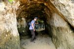
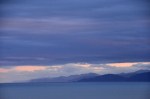
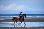
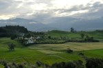
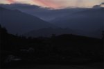
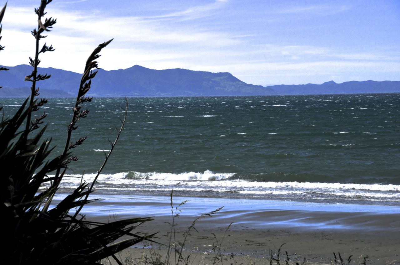
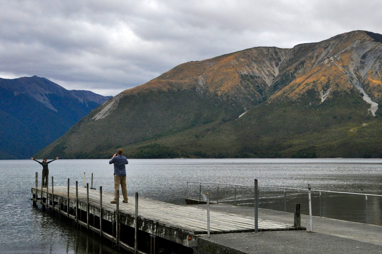
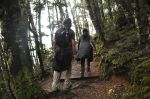
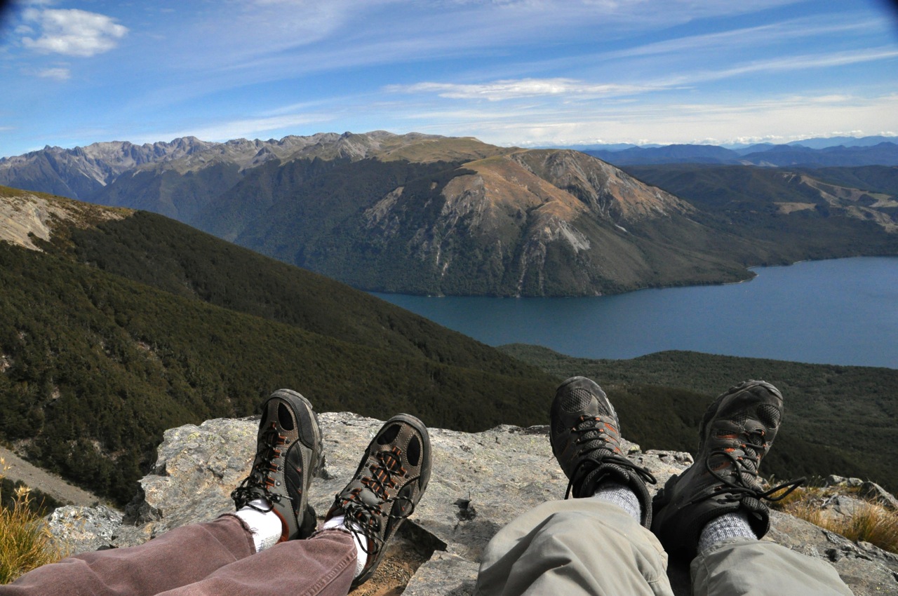
I’ve shown you Nelson Lakes National Park before (post of Dec 29 2013, “Nelson Lakes National Park“).  It’s a pretty area, nestled at the northernmost limit of the Southern Alps and serviced by the sleepy village of St. Arnaud, population 100.  This time we are revisiting with company – similar to our last post on Abel Tasman National Park.  First to visit is our son Brian and his girlfriend Janaki.  When last we were here, Ginger climbed the challenging Mt. Robert (that mountain on the right), a 2,000 foot ascent up the Pinchgut Track, correctly labeled “steep”.  Due to the lateness of the day and impending clouds, on that climb we had backtracked down the Pinchgut rather than complete the slightly longer 6 mile loop.  This time we plan to do the reverse climb, doing the 6 mile loop and only going down the Pinchgut.  Alas, when we get there, that trail head has signs saying it is temporarily closed.  Rats!  So off we go, once again up the Pinchgut.

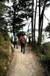
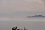
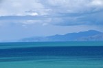
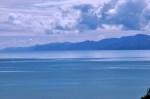
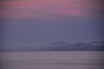
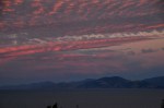
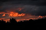
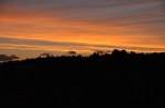
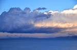
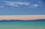
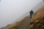
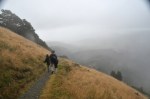
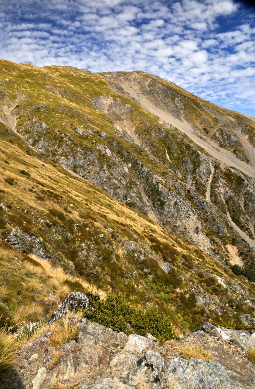
What makes the trip more interesting for us is that Janaki, bless her heart, has never hiked up a mountain, much less one that’s a hard 2ooo feet up.  The path starts gently, but rapidly turns into a series of steep switchbacks.  Early on, Ginger realizes that this is not her day to hike and decides it would be wise to turn back, particularly since she’s done this hike before.  The rest of us continue on,  but as we look out from the trail, we discover that the high clouds (visible in the first picture) are not quite so high anymore; they’re lower, and they’re coming our way.  Nooooooooooo!

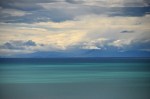
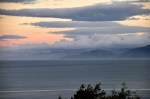
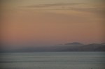
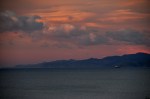
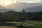
We keep climbing, and the clouds keep lowering.  As you may remember, the trail goes in and out of the woods, but when it comes out, the view below is increasingly and disappointingly obscured.  Janaki, however, is doing great and is plowing uphill just fine,

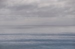
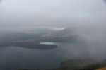
in spite of the impressive incline.  The view is crap, but the kids are enjoying being inside a cloud.  OK, but what about the view you’re missing?

Janaki and the view (or lack thereof) from the top
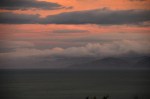
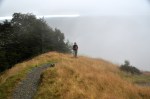
Finally we clear the woods for the last time and shortly we’re at the plateau top.  Yeah, the loop continues up a little further, but what’s the point?  The view won’t change!  So back down the Pinchgut we go, still stuck inside that darn cloud!  I’m grumbling in my beard, but the kids still think being in a cloud is cool.

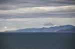
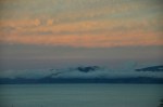
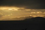
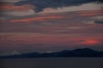
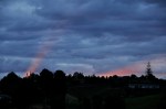
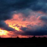
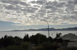
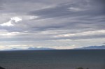
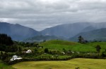
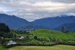
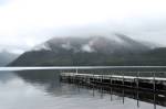
Just two final photos: the view back at the trailhead, with victorious climbers Brian and Janaki; and the view of the lake and the mountain from St. Arnaud, showing Mt. Robert being sat on by a cloud – which, on the right side of the mountain, funnels right down the Pinchgut track!

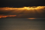
Those clouds are just mean!

………………………………………………………………………………………………………………………………………………………………………………………………….

The trail in a pretty birch tree forest
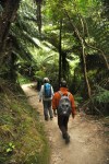
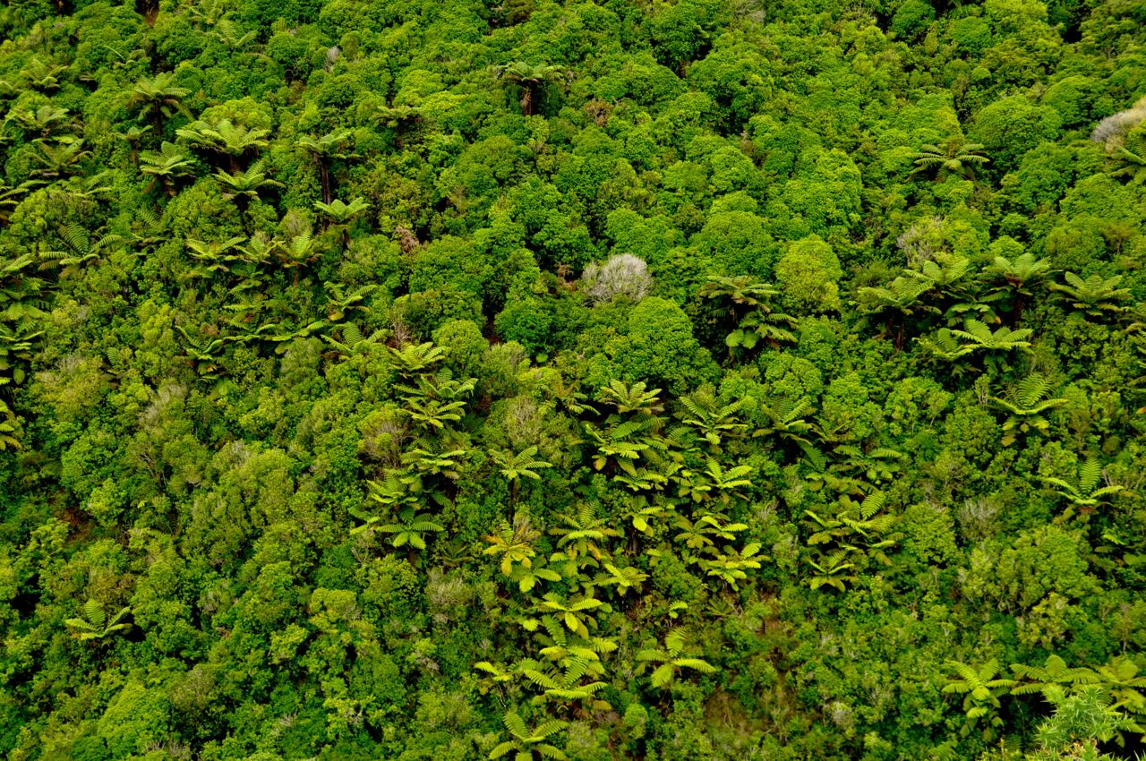
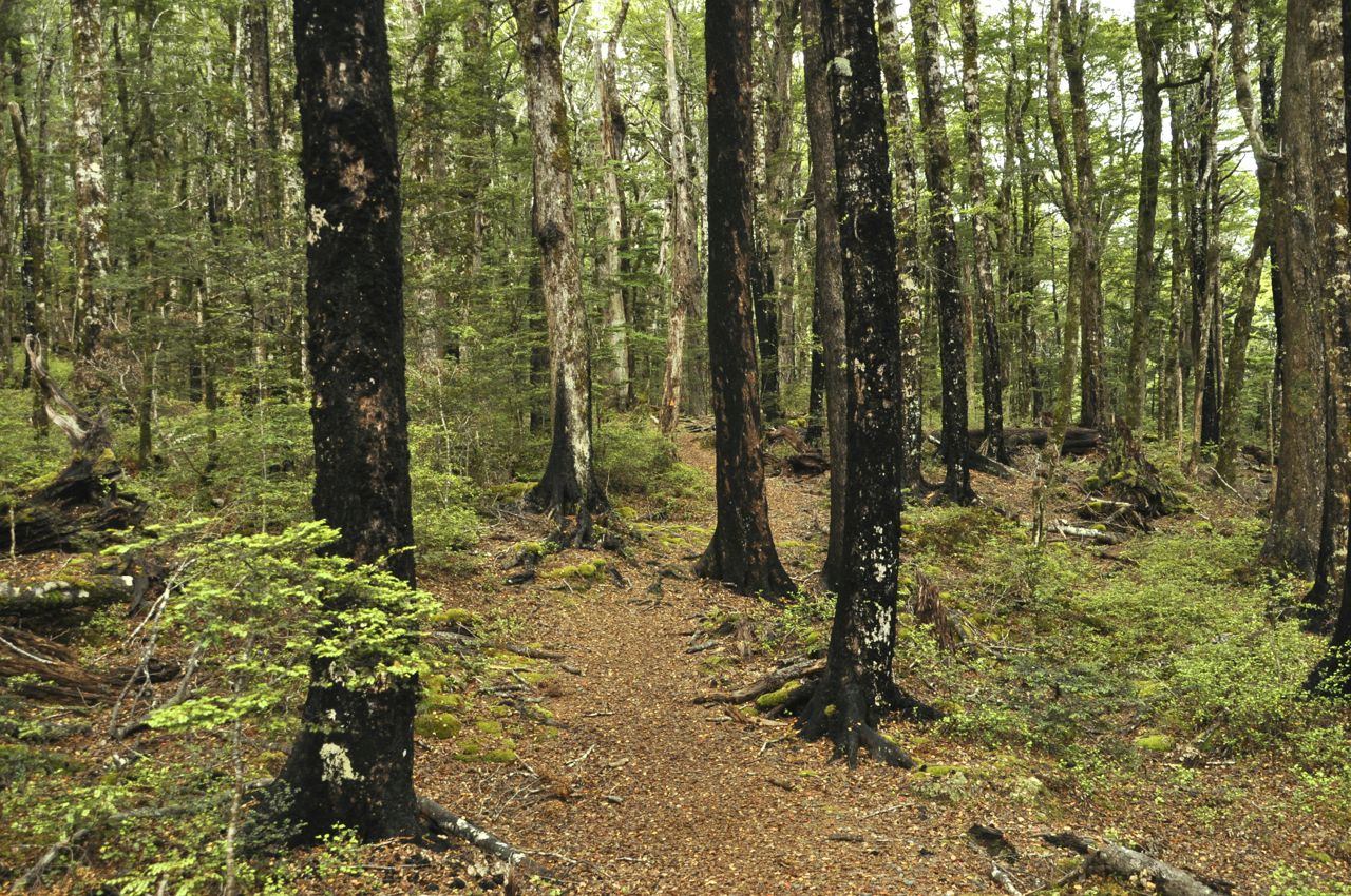
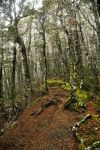
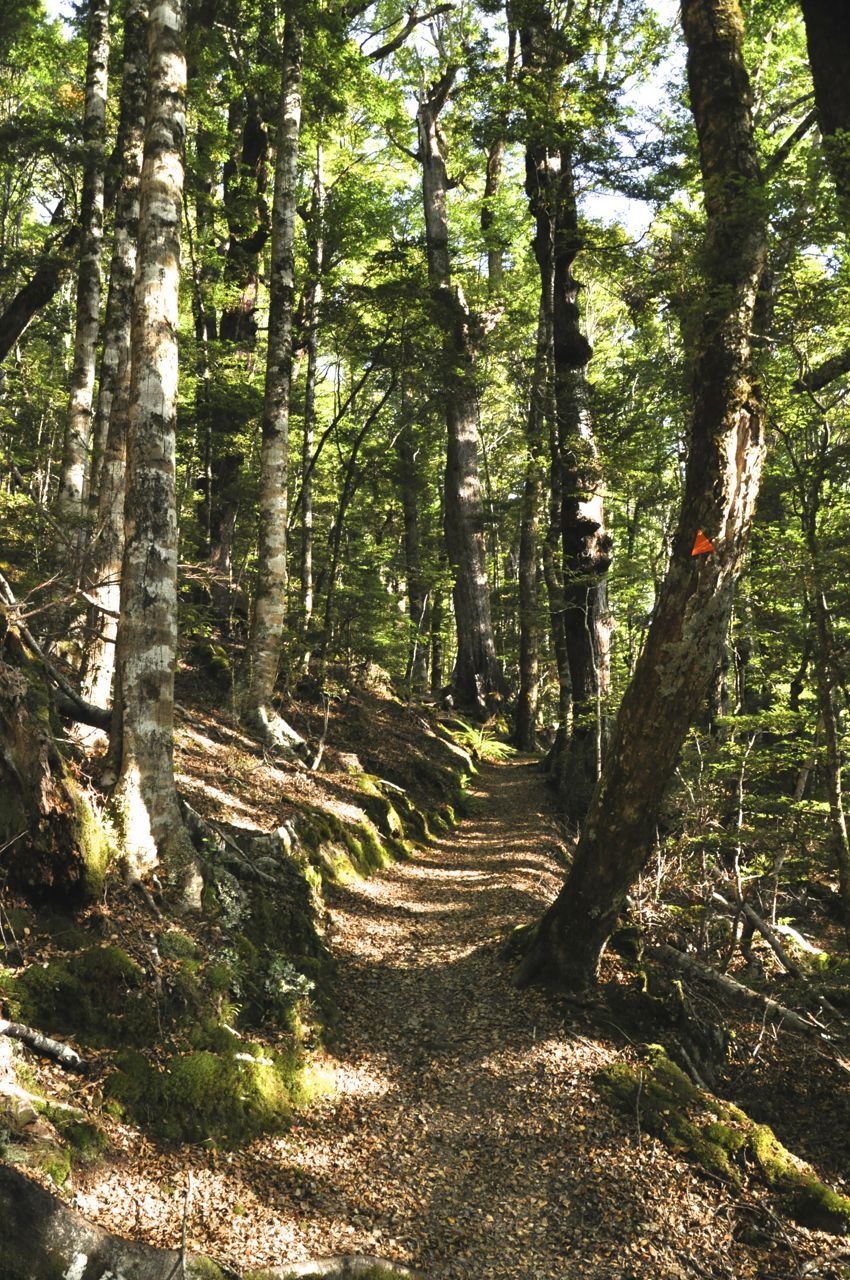
Next to visit Nelson Lakes is John Chang, our California friend.  This time we’ll climb the mountains on the other side of Lake Rotoiti, the St. Arnaud range; it’s a tougher climb, a longer and higher up-and-back.  A disadvantage of this climb is that, unlike Mt. Robert where the trail goes in and out of the woods, offering panoramic views as you go (if you’re not inside a cloud), this climb is all woods most of the way until you finally emerge onto treeless tundra.  At the start the trail is pretty smooth and gentle, and the birch forest is beautiful.  Soon, however, the trail heads up – rather steeply – and becomes rough, peppered with rocks and roots.

On the rocky outcrop with a view of Mt Roberts
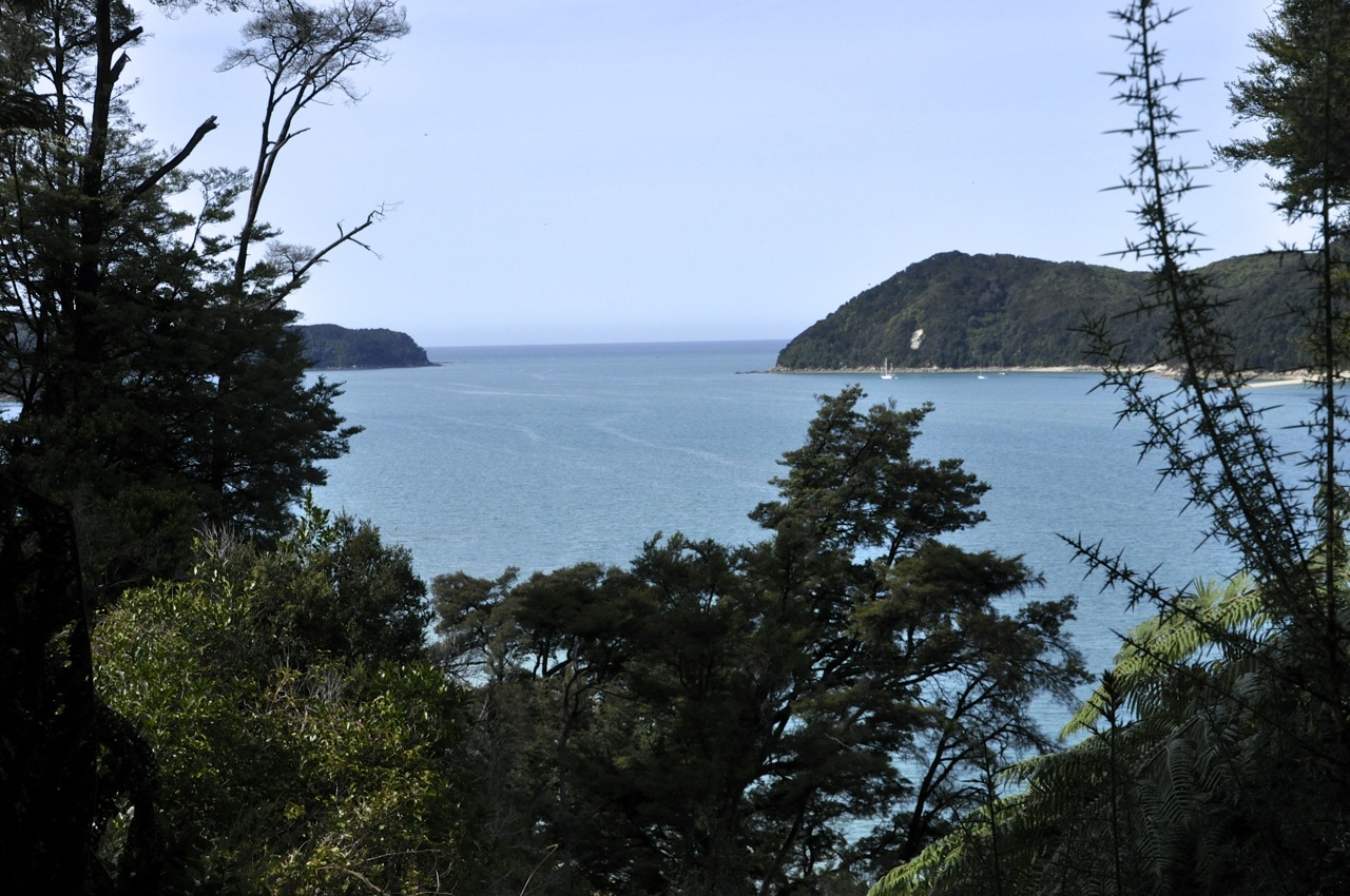
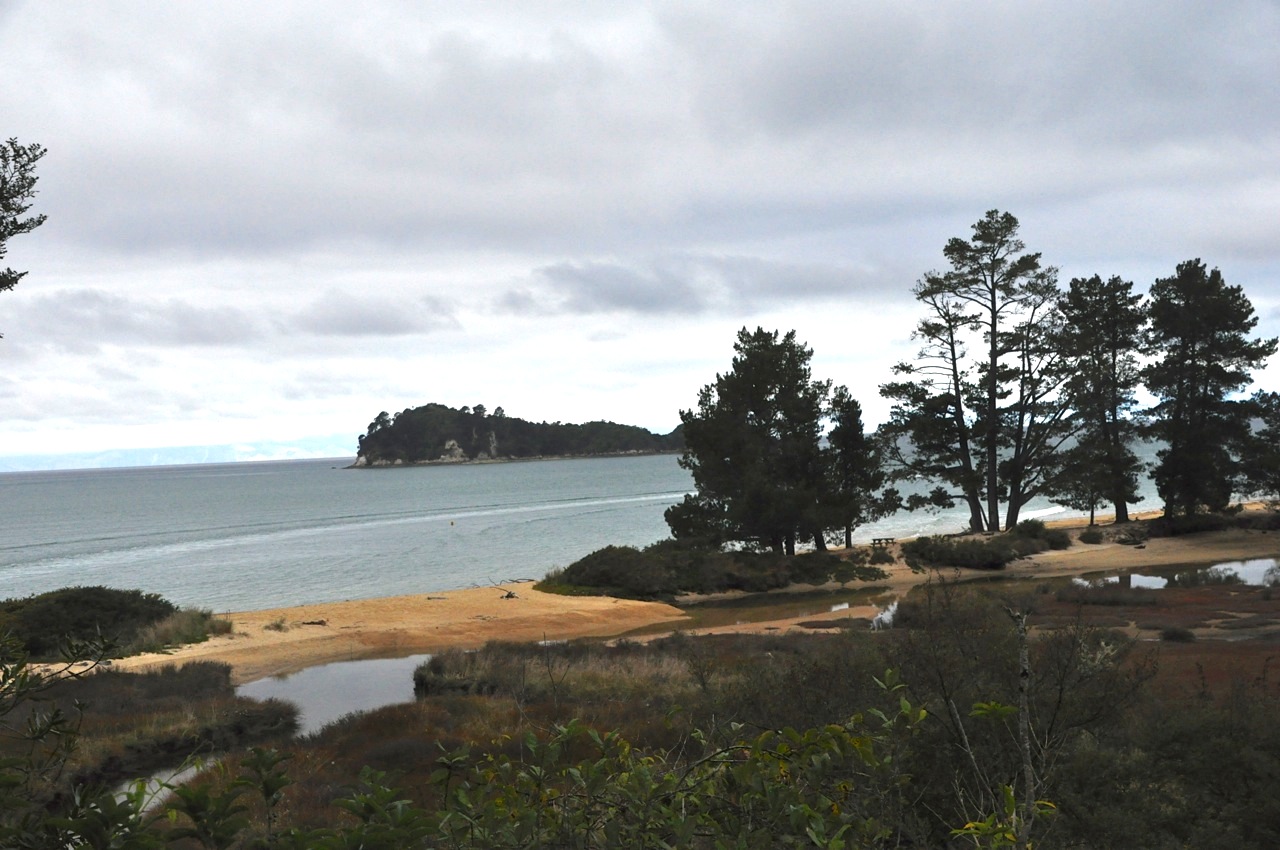
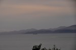
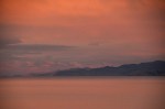
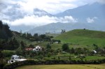
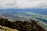
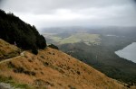
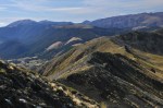
We finally clear the forest – we’ve been working hard! – and not far away is a rocky outcrop with a view.  This is the turn-around point for many climbers, and we decide to stop here for our well-earned lunch as we catch our breath and cool our heels.  It’s a pretty view, Mt Robert and Lake Rotoiti in front of us, and the valley heading north off to our right, as shown below.

The view up from our rocky outcrop
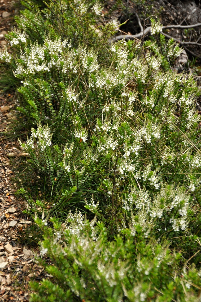
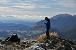
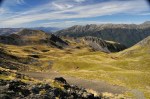
We, of course, will not be deterred from reaching the top.  No wimps, we!  You will note, however, from the picture to the side, that the terrain is wickedly steep.  We’ll actually be climbing up the mountain to the left of this picture, but it’s no less steep!  The picture below shows some pretty flora on the mountainside Pretty plants on the mountainsideas we hike up – I’m taking pictures of flowers, not catching my breath, honest!

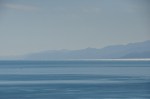
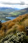
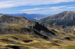
Going up the steep incline, we occasionally stop and turn around to catch the increasingly awesome view of our stoney outcrop, Mt Robert, Lake Rotoiti, St. Arnaud, and the mountains in the distance.Half-way up the steep part

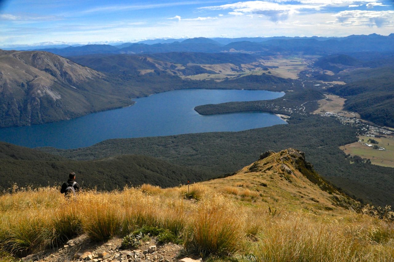
Near the top it gets really steep (it wasn’t before?) and we have to use our hands as well as our feet to go up; we’re crawling!  And then we’re there.

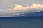
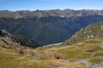
It’s bloomin’ Awesome!  Unlike Mt. Robert, this ridge top is sharp, so there is a nearly 360º view – including the other side of the mountain that we have never seen.  To start off, let me show you the view you’ve been seeing, that of Mt. Robert.  Note in the foreground that it looks like you’ll fall off a cliff if you take a step forward.  Yep, the climb up was steep!  The trail continues at a right angle along the ridge, but that must be for hikers spending the night somewhere.  We’re

happy not to be going further!  Pictures can’t capture the whole gorgeous scene, but I’ll show you a few.

A strange plant
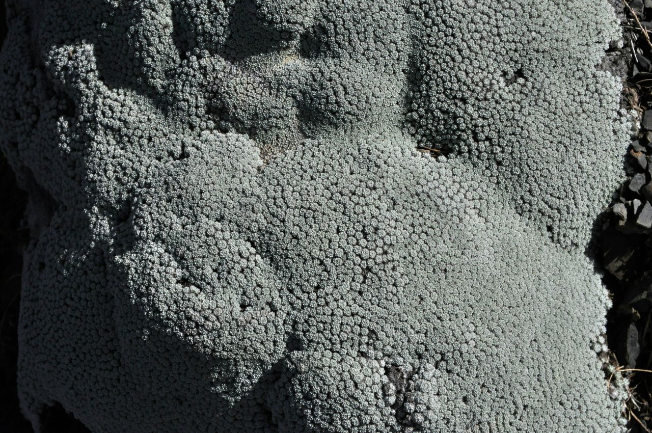
Some of the plants up here are pretty interesting – for example, this thing growing on the rocks.

Time to go back down, and Surprise!  Going down that steep part turns out to be more of a challenge than going up!  The pictures below don’t do the steepness any justice – pointing the camera downhill flattens the terrain.  We find that walking this section is impossible, sliding is not a great option, and the only thing that works is to sidestep/slide/fall without a lot of control, heading toward a big rock or clump of grass (hopefully anchored) to stomp on to arrest the downward momentum.  It’s more tricky than it sounds, and – ah – not always successful!

One last view of Mt Robert and Lake Rotoiti from above, and the tough trail going down.

We are, in fact, getting very tired navigating the hard trail, which is more step down and jump than walk a path.  Our legs are getting shaky and threatening to cramp, but The St Arnaud range; we hiked up the middle foldwe finally make it back, tired but happy.  Our hike took us up the middle fold of that St Arnaud range – reasonably impressive, yeah?

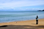
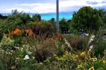
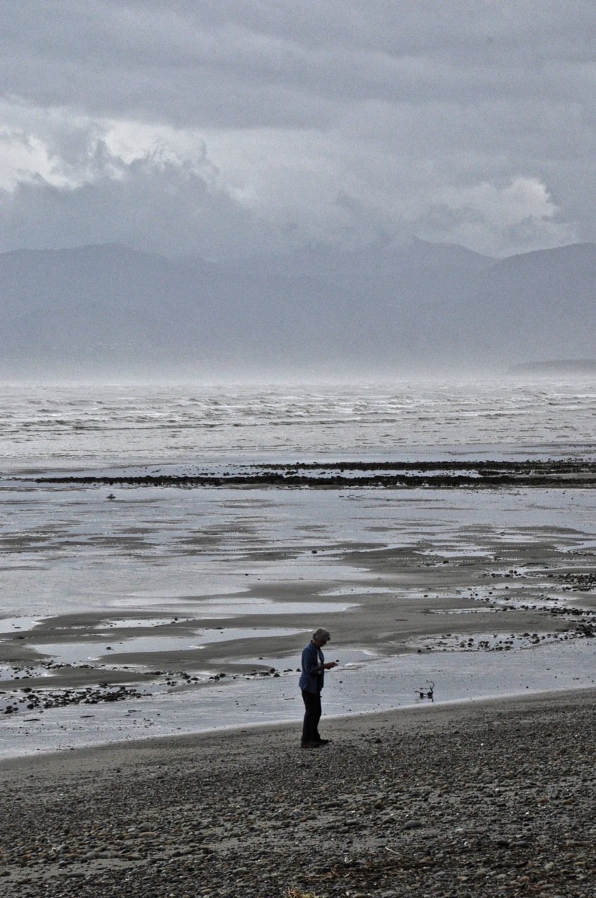
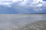
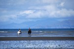
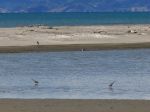
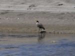
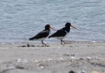
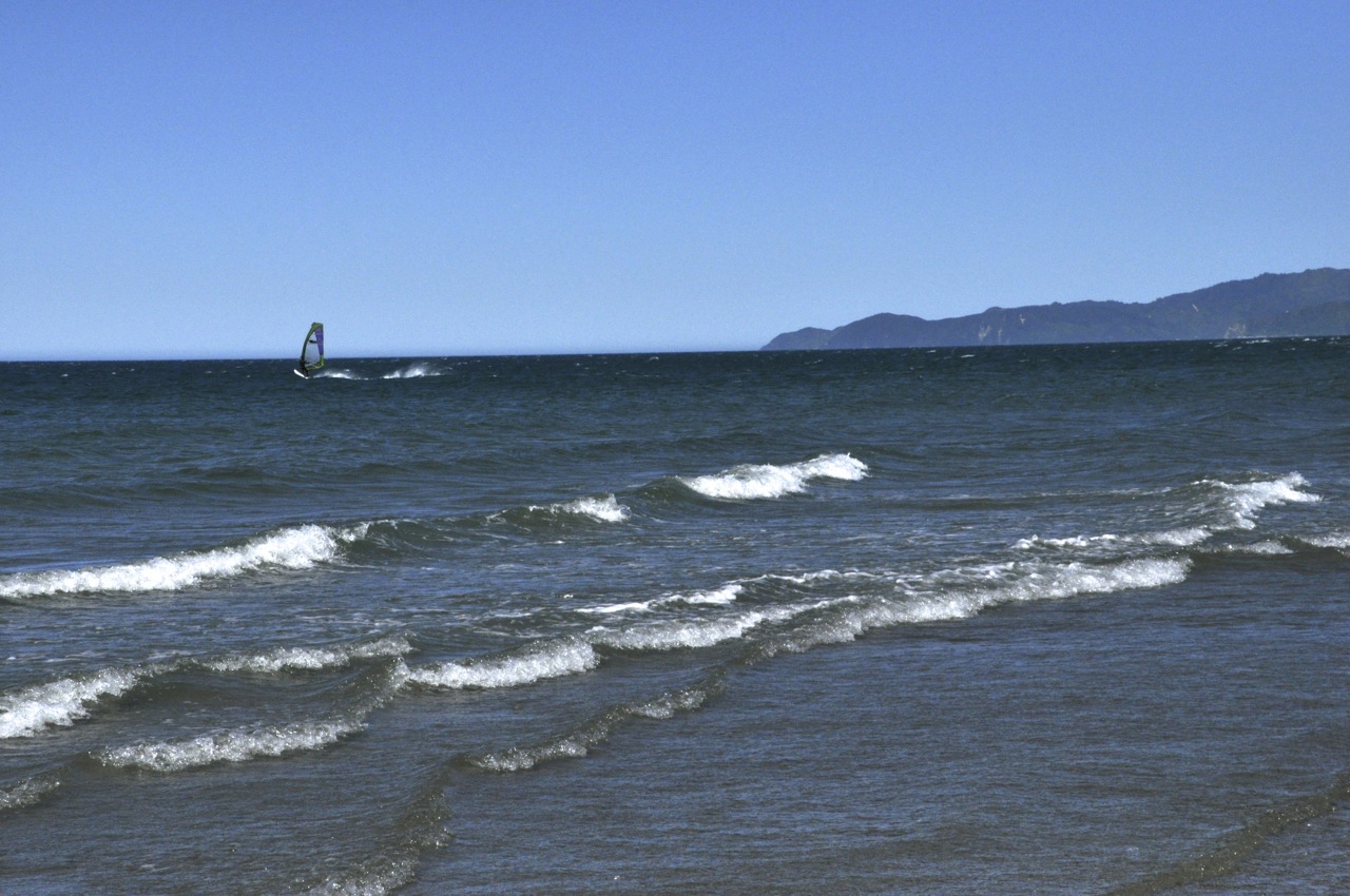
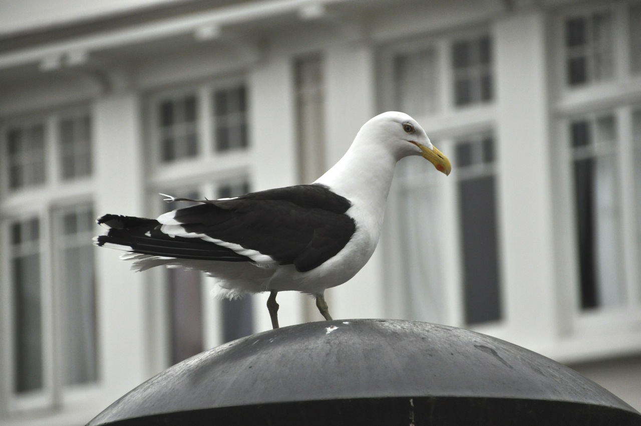
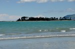
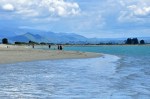
A final look at lake Rotoiti – and one of its inhabitants, an eel.

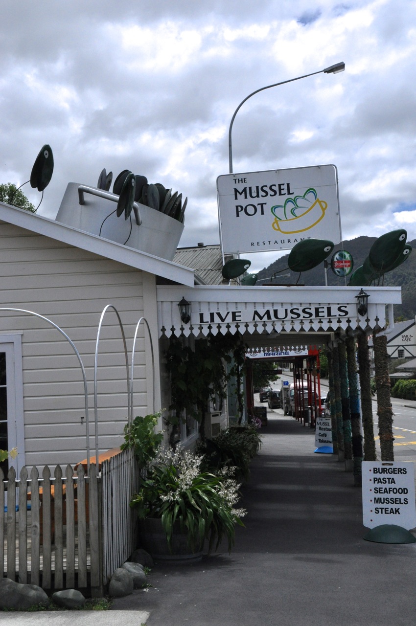
Next post – leaving the South Island.

Abel Tasman National Park

You may remember that, early in our sojourn on the South Island, we traveled to the west side of Abel Tasman National Park but only hiked a piece of one of the inland trails due to Ginger recovering from back issues (Dec 30, “Abel Tasman National Park and Golden Bay“).  We had no real views of the beaches that Abel Tasman is famous for; now we intend to do better!  This time we’ll approach the park from the east, take a trip by sea kayak, and hike the seaside trails above the beaches.  Abel Tasman is NZ’s smallest national park, and one of it’s most popular, with stunningly beautiful golden sandy beaches, crystal-clear water, lush green bushland, striking granite outcrops, and an abundance of wildlife.  Sounds good to us!  It is also only 20 miles away from our house, one of the many attractions that led us to this area.

I’m going to show you this pretty part of the world via three of our trips with visitors: my sister Linda, our son Brian with his girlfriend Janaki, and a good friend, John Chang.

SEA KAYAKING

Kaiteriteri beach, looking out to the Tasman BayOn our first foray, we take my sister sea kayaking from Kaiteriteri, a small village just south of the Park.  Looks nice and peaceful, doesn’t it?  After a brief lesson we gear up and, just us with guides, head into the park waters.  It’s really pleasant – all the short way to that island on the left, whereupon we enter Tasman Bay and encounter wave swells higher than the kayaks!  We’re going to Split Apple Rock, about an hour’s paddle away, but how to get there is an issue – we need to take the waves head on, but heading directly toward Split Apple Rock  Split Apple Rockputs the kayaks broadside to the waves; so we compromise and make an arc, taking the waves at an angle.  Tough paddling!!!  Our outing rapidly becomes hard work!  With great perseverance we make it to Split Apple, and calm water.  It’s a pretty place; the water is a beautiful color; the rocks are interesting; and we get to paddle through a small cave.

Then it’s time for a well-deserved lunch break, and we land at a nearby gorgeous beach.  Look at that water!

Groan, now we have to kayak back!  Thankfully, the waves and wind actually help us on the return, but the quiet bay is a welcome end to the trip.  In spite of waterproof jackets and kayak skirts, we find we’re thoroughly drenched; our muscles ache in places we didn’t know we had, and we’re beyond tired!  We’ll sleep like the dead tonight.  We decide we’ve have had enough of sea kayaking – at least in rough water!

ABEL TASMAN

Abel Tasman has a Coast Track and a number of Inland Tracks, but most people opt for the coastal route with its idyllic beaches.  To do the complete Coast Track  would take 3-5 days, but there are several water taxis that will take you to different drop-off points and pick you up at appointed times at the end of your hike, giving you 6 different choices for day hikes – although several of these hikes are time-critical due to sections of the trail being under water at high tide.  With Brian and Janaki now along, we decide to simply start at the beginning and hike until somebody decides it’s time to head back.

At the start, the tide is out – impressively ‘way out!  The tidal flats keep going, and the Tasman Sea is off in the distance, resulting in interesting bands of color.  I can picture

us lounging on that sandy beach and wading in the rivulets of that ephemeral land, but there is more to see that beckons us on. It’s tempting, though!

The tail is relatively flat and easy – and attractive, often with a view of the water and

Pretty beach beaches.  We explore some of the beaches, and then choose a pretty one to host our lunch.  Although the trail itself is easy, getting down to some of the beaches is a bit of a challenge.  There are paths going to them, but they’re invariably steep; definitely worthwhile, though!  We are sharing “our” beach with a handful of other people, but it’s such a big, long beach that we feel as if we have it to ourselves.  Nice!

It’s really beautiful!  The sand is wonderful, the water gorgeous, the beach comes with caves and rock formations to explore, and there are picturesque islands and mountains in the distance. The large rocks make nice tables and chairs; the view is hard to beat.

Further down the beach are some quite pretty shags that are not at all afraid of me; one tells me that I’m trespassing, in no uncertain terms.

Islands in the bay


Back on the trail again, we wander a bit further, with more views of beaches and islands offshore.  Then, alas, it is time to turn back.


Next to visit us is a friend from California, John Chang.  Before going back to Abel Tasman, we of course had to visit a few nearby wineries – consider it fuel for the hike!  Maybe you notice that life isn’t bad here?

We have a habit of not being early risers, and this time it bites us; when we arrive at the Abel Tasman water taxis, we’ve missed the outgoing trips to parts unknown.  The only option is to start hiking from the beginning of the trailhead again; rats!  But this time we’ll go further, and zoom past the early regions.  The repeat trip is still pretty!

Beach with a viewIt’s a cool, cloudy, windy day (it’s early autumn here), and there are not many people on the trail; the golden beaches with their crystal-clear waters are deserted.  We find a beach that’s big and looks gorgeous from up above.  It’s quite a scramble down the steep path – coming up will be a struggle – but it’s worth the effort.


Beach flowersWe even find a patch of late-blooming beach flowers before we scramble back up to the trail.  It’s getting late, though, and time to head for home – with maybe a stop at a local pub for a thirst-quencher.  Hope you enjoyed this part of Abel Tasman.  Our only regret is that we weren’t able to spend more time hiking in this beautiful park.

Next post – back to Nelson Lakes National Park!

Receding hills, view from Ruby Bay balcony

The view of Ruby Bay from our house is gorgeous – and captivating.  The sea is a chameleon, assuming every color you can imagine.  Further, its appearance changes over even short times, as clouds play with the light.  There must be a lot of factors at play to create what we see – clouds, wind, rain, fog, sun angle, tide, humidity, probably temperature, probably others, but mix them together and you have nature’s kaleidoscope.  We are often spellbound – dropping whatever we are doing to gape.  Because the view is partially blocked by houses and light poles etc, I can only cleanly capture certain segments of the view in the camera, and these I will show you over the next few posts – so there will be a lot of photos, and very few words – the pictures don’t need them.  It is hard to believe how the same view can present itself in such fantastically varied and wonderful ways.  The world is amazingly beautiful.  And I must say, there are many many more pictures I could show you of this same view, all different.  I whittled the images down a bunch, and then Ginger made me cut those by half!  We argued more than a bit over a few.  But don’t despair if you want more – there are more segments to share!  Hope you like them as much as we do.

Next posting – view of the distant islands.

Our House in Ruby Bay

I showed you Nelson in an earlier post (The City of Nelson – location, location, location; Dec 27).  Besides being very sunny with a mild climate (it’s near the top of the South Island), it is very close to several National Parks and a goodly number of well-regarded wineries.  We loved it for those reasons, but the clincher was the fact that the area is drop-dead gorgeous.  Before leaving for points south (recent posts), we rented a house to better experience the Kiwi life from something besides a suitcase.  It is a great house, with fabulous views.  Prepare to be impressed.  I think I will do a number of posts just from our neighborhood – you’ll see why.
First, the neighborhood.  We’re in Ruby Bay – a bedroom community without a single store – 3 miles away from the tiny town of Mapua (population < 2,000).  Here the post office and the only small grocery store are one and the same, staffed by the same people.  Mapua does have a handful of restaurants, a gas station, a hairdresser, a drug store, and 3 bar/cafes.  If you really want anything, you have to go into the towns of Richmond or Nelson, 30 minutes away.
Our house in Ruby Bay is up a steep hill; it has a good view of Ruby Bay itself, with

Nelson visible across the bay.  It has 3 BR, 2.5 baths.  Everything is downstairs except for the master bedroom, bath and lounge (Ginger’s study).  The living room and kitchen are quite nice.

There’s also a dining room and (my) study.  There is a downstairs wood-burning stove for heat, but that is it for temperature control.  The Nelson climate is temperate, so no need for AC or furnaces.  There are LOTS of windows that open (no screens), and two of the (glass) walls in the living room open up (to porches), making the house very open-air.  As a corollary, some of our best friends are insects.  The living room glass doors open to a wood

deck that goes the length of the house.  The views from the upstairs (and downstairs)

across the bay are partially obstructed but not bad!  The place has quite a garden, going down the hill, some pictures shown below.  There are also fig, orange, tangerine

and peach trees, and a LOT of lemon trees, loaded with fruit, which we use to make fresh lemonade and limoncello.
One of the advantages of this place is an incredible sunset nearly every day; they last for an incredibly long time, and cover much of the sky (examples below).

Of course, for all of these the transitions were equally beautiful.  Let me show you just one:

View from restaurantOne of the most spectacular sunsets I’ve ever seen occurred while we were at one of the Mapua restaurants on the bay.  The picture left shows the view from the restaurant looking toward Nelson, taken a previous day over lunch.  It is a pretty place, isn’t it?  So we’re having dinner, and the tidal river turns an amazing copper color.  We rush outside, and the world is glowing!  I don’t have my camera, but Ginger has her iphone so we are saved!  The

first picture is looking in the opposite direction toward the sea, and the sky is all but exploding.  The view is not just in that direction; the sunset is 360 degrees beautiful.  I think you will agree it’s spectacular.  We watch it glow and fade, and then go back to our cold dinner – but that’s OK!  A small price to pay for that display.

Ginger finding jewelsAt the base of our hill is the Ruby Bay beach.  At high tide it’s a rocky beach, which Ginger doesn’t mind – she has quite a collection of pretty stones, not to mention shells and sponges.  Unfortunately I don’t have any pictures of the Bay at high tide, just low tide, but the low tide will do.  The Ruby Bay beach is not as gorgeous as the one at Nelson (the Dec 27 post), but it will do!  It has breakers and birds and views.  A couple of views across the bay are shown below.  The weather on our side of the bay can be considerably different from that in Nelson, particularly regarding rain, which can lead to interesting effects – including rainbows, also shown below.

Low tide is when most people come out to play, the “beach” being sandy then.  It’s a great place to exercise dogs and horses and people.

North of us, maybe 10 miles away, is the town of Motueka with a beach that is connected to a very long sand spit that’s a bird sanctuary.  It does have a lot of birds!  Getting up-close pictures isn’t easy, though; the birds are pretty shy, except for the ones attacking us for getting too close to their nests.  The babies are very cute!  I’ll have to add the bird’s names later.  Pictures below.

Finally, I want to show you the first of a number of retrospective studies that I’m going to inflict on you, that show in stunning colors why we love our house.  Now, we have lived with a view of the ocean before, when I worked in Italy.  It was nice to see the ever-changing Adriatic Sea, but we looked out directly into the infinite seascape, and the variations in color were, we know now, limited.  The bay is another story.  There is the open ocean, but in addition there’s the curving bay, with headlands retreating into the distance; and perhaps because of the land, there are clouds everywhere, reflecting light and creating shadows.  Combine water, waves, currents, reflections, shadows, fog, light, land, cloud shapes – and the scene is an ever-changing riot of color, re-inventing itself hour-by-hour, and totally captivating.  We stop and stare a lot.  I’m sure it’s hard to “get it” via words.  The pictures below are my introduction for you, of what I call the overview; a large-view presentation of pretty much the same area, looking out into the ocean, the receding headlands, and some islands, and taken on different days at different times.  It’s a “teaser” for what’s to come – but I think you’ll get the idea. None of these pictures have been altered – you’re looking at Nature in all her glory.

That’s all for now.  In the next few subsequent posts I’m going to simply do a few more detailed retrospectives of Ruby Bay and Nature taken from our balcony.  There will be a lot of pictures.  They will be incredibly beautiful.  You will want to live here.

Abel Tasman National Park and Golden Bay

Abel Tasman is NZ’s smallest national park but has an international reputation that draws tons of visitors, mostly to see the coastline. My guidebook says it is fabulously beautiful, with golden sandy beaches, crystal-clear water, lush bushland, granite outcrops and an abundance of wildlife.  Most people hike and kayak and swim and snorkel along the coast, and most of this occurs from the very accessible east side.  We plan to do that too, but for now we’re going to do the road-less-traveled and hike Abel Tasman from the west side, as well as visit Golden Bay.  Golden Bay is at the northwest tip of the South Island, and is backed by the mountains of Kahurangi National Park on 3 sides, with the bay on the 4th.  It is far less accessible, with access in or out being a single, very narrow, very twisty road over a mountain called “Takaka Hill”.  Some hill.  Oh, and because it’s the only road supplying some 6 towns, there’s truck traffic.  LOTS of truck traffic.  LOTS of very BIG truck traffic!  Not to mention lumber trucks carrying big tree sections.  Luckily, we don’t know this, so off we go.  It’s 70 miles away; later, when we look it up, travel time is estimated to be 2 hours.  There is not one straight stretch of road.  The steering wheel is either hard right or hard left, with very little time between the two positions.  A couple of times on severe switchbacks I was afraid I might rear-end myself.  It is, however, quite pretty.  Stopping is usually out of the question, but there are a few spots to pull over.  Alas, I have the camera on the wrong white balance setting, and the pictures are impossibly blue.  Here is one shot going in, and another at the same location

on the way out days later.  NZ is amazing in its ability to have the same view be mesmerizingly and captivatingly different from one moment to the next.

Coming down Takaka Hill, the Golden Bay ocean (left image) and plain (right image) are

gorgeous, although it’s hard to tell from the Picasso Blue Period I’m in.  Closer to the bottom of the hill, without the blue, you can see that this is a pretty place.

These pictures are from the valley floor near the city of Takaka.

Well, as luck would have it, our plans to kayak and horseback ride on Golden Bay are quashed – the continuous lean-in and lean-out jostling as we wound up and down Takaka Hill have done a number on Ginger’s neck; she can hardly turn it, so we’ll have a few quiet days instead.  She does mention, in a gentle way, that perhaps we might take the curves a little bit more slowly the next time (in my defense: we pulled over more times than numerous to let faster cars go by; but the lady makes a strong argument!).

We’re holed up in a cottage outside of town up a gravel road and on a hill.  It’s a simple place with spectacular views (and a lot of spiders, but we rectify that).  Staying here isn’t so bad.  Nearest neighbors are sheep, which come regularly to inquisitively check on us and to baaaaa quietly.  Cows off in the distance give a far-away moooo.   The “boring” view is straight ahead to the water of the bay, which changes color by the hour.  The flax plants attract Tui, which visit throughout the day to feast on its nectar; Tui are amazing birds with their otherworldly, indescribable, transfixing sounds and amazing dark iridescent feathers set off by that white throat ornament.  We love them.

The major delight is the ever-changing Provence-like light on the hills.  The pastoral view is stunning, changing hour-by-hour from one stunning to a different stunning.  The Impressionist painters would have given their left ear for this light.  Not a bad place for us to crash.  I’ll show you some examples below.

Wow.  And wow again.  Of course, the entire 180° view is better than the snippet shown here, but this gives you a good idea of the incredible beauty.  I’ll also add a couple of pictures of the amazing shade-on-shade color from the layers of receding mountains.

Needless to say, the stars out here are also breathtaking.  It’s hard to see stars in today’s overly lighted world, but here in the country darkness, looking at the blazing glory of the infinite universe, it’s beautiful and humbling.  And guess what?  Orion is upside down, standing on his head with his shield for balance, I guess.  It would be interesting to see what the constellations would look like had they been drawn from the southern hemisphere.

As Ginger recovers, we take a short walk on one of the beaches.  We choose a nearby beach Kiwis love their waterrandomly, and we practically have it to ourselves.  Another couple is strolling off in the distance, and a windsurfer is zooming around on this somewhat windy day.  Kiwis do love their water sports!  The water is swimming-pool cool, very comfortable for wading or swimming.  One of the nice touches to a NZ beach is the combination of

beach AND mountains.  It adds to the viewing interest, although the rhythm and sound of the incoming waves don’t really need additional help for our enjoyment.  Not to mention Periwinkle graveyardthe sea shells and pretty polished rocks and interesting driftwood from the very hard and dark wood of some of the NZ trees.

At last Ginger is better, and we have time for a hike in Abel Tasman. We’re entering from the very tail end of the Coast Track.  It’s an up-and-down hike to the first bay, Whariwharangi, and the “up” is probably the Wainui Bayhighest climb of the entire Coast Track.  The good news is that the grade is not especially steep.  We’ll see how far we get.

We start from Wainui Bay, which is itself not too shabby (picture to left).  The trail immediately starts climbing, giving a good overview of the bay, as shown below.

And the trail continues to climb.

The trail circles above a small bay, but there is no obvious way down to it.

We wind through what the Kiwis call “bush” – the original wild cover of NZ (left image below).  The reasonably wide trail is mostly a single, or sometimes two, dirt footpaths in medium-tall grass (right image).  The grass sometimes bends over, obscuring the footpath; it doesn’t seem to be a heavily used trail.

The hillsideThe bush itself is interesting.  It is solid, a mass.  It would be hard to walk through without a path.  The picture shows an adjacent hillside.

The flowers along the trail are gay, bright and pretty.   Most are small, but frequently one encounters impressive lupine  (yellow or pink) and the commanding I-am-so-pretty

foxglove, in pink and in white.

Before we get to the top of the climb, Ginger decides she has had enough and turns back.  The Trail downI’m convinced that the top is not far off, and decide to press ahead.  Sure enough, the top is not far.  This coastal track intersects with an inland track, and the trail is now considerably better – not just a footpath, it’s wide.  Off in the distance is the ocean, and Whariwharangi Bay (shown below), and from here it’s all downhill.  Close but no cigar.  Another time.  Gotta catch up with Ginger.ar Away

Next stop will be Nelson Lakes National Park, in the boonies.  Time to do some real hiking!

Nelson Lakes National Park

Nelson Lakes National Park is centered around 2 glacial lakes, Rotoiti (“little lake”) and Rotoroa (“long lake”), nestled in mountains at the northern limit of the Southern Alps.  We’re spending our time at Rotoiti because it has a town there, St Arnaud, population around 100.  The only town that’s close to this park.  I’m guessing it won’t be too crowded there.  The trip

down is pretty, with mountains and meadows.  A river along the route is a beautiful pale  A turquoise riverturquoise, apparently from glacier run-off.  Most rivers here look like a fisherman’s paradise; too bad we don’t fish!  I can see the pleasure in the skill needed to hook a fish (and then eating it), but I just can’t see me standing still that long in between events.  I could be hiking, with changing views!

Lake Rotoiti is clearly glacial.  In the picture below, one is looking down the glacial bore; the Lake Rotoiti mountains have eroded into a slant, but the effect of the mountains popping up suddenly on two sides is impressive.

Our first walk is around a nearby peninsula that juts into the lake.  It’s an attractive walk.  The path, as shown, is bordered  by a huge variety of mosses and lichens in a great

variety of colors.  There are also quite a few predator boxes!  As we mentioned in an earlier Predator boxpost (Oct 20, NZ Birds, Birds, Birds), early NZ had no mammals except bats, and therefore no predators of birds.  Bird evolution filled this mammal void, resulting in ground-dwelling flightless types.  The introduction of predators was devastating.  NZ is engaged in a huge effort to protect and expand its surviving native birds, much of it with volunteer effort.  In particular there is a strong ongoing program to eradicate introduced mammals like rats and stoats.  We meet three fellows servicing these traps, and one stays to answer our questions.  He says the aim is to effectively eliminate rats from NZ.  I’m incredulous; I think rats and cockroaches will be the ultimate last survivors on this planet.  No no, says our fellow.  Over the last several years their group has killed 12,000 predators in the Nelson Lakes area alone (!), resulting in a substantial growth in the bird population.  Technology will prevail, he says.  Already the new traps are more sophisticated, with gas-cartridge-driven reciprocating bolts killing multiple predators per box, and technology will improve more in the future.  Hmmm, says me.  Maybe.  Thinking about it later, maybe there is a chance; killing is something we humans are good at, after all.  What is heartwarming is the magnitude and commitment of this government/private-citizen initiative, going strong with much enthusiasm and success.  How long has it been since the US has asked its citizens to join in a cause, and gotten a huge response?

We continue our walk, and notice the beech tree trunks are black!  Very black.  I mean, they’re pretty, Black Beech Treesin fact striking, but what is this black stuff?  Are the trees rotting??  It’s a fascinating story, really.  If one looks closely at the black coating, there are also a whole lot of very fine, white, almost silvery hairs extending several inches from the black surface, many with a tiny drop of liquid at the end, as shown in the pictures below.

What is this, you say?  Would you believe those filaments are insect anuses expelling a sweet liquor that feeds a black tree-covering fungus and also supports entire animal ecosystems?  Butt manna?  No?  Would you believe the trees have a virus, those filaments are dripping beech proboscises, and the trees have the flora equivalent of the Black Plague, explaining the trunk color?  Which crazy answer is correct?  Neither you say?  Actually the first.  Mother Nature does have a giggle at times.  Each whitish filament is the anus of a tiny scale insect that lives under the bark of the beech tree and sucks the sap; the insect extracts what it needs from the sap and then excretes a super-concentrated sugar solution through its incredibly long anus. The black fungus feeds on the sugar solution that dribbles down the tree, but it is not alone.  Entire animal ecosystems depend on the sap: Wasp feedingbirds such as the Tui and the Bellbird, bats, lizards, and other insects.   Non-native wasps (like the one in the picture) can completely coat the beech trunks, denying the birds, and so at certain times of the year the predator-trap people switch from killing rats to killing wasps.  One bird, a type of parrot called the weka, absolutely depends on the sap to kick-start its reproductive cycle.  All that from just a little scale insect shaking its booty and pooping a sugar solution!  Y’know, it’s hard to make this stuff up.

This hike was the warm-up.  Tomorrow we climb Mt. Roberts, the mountain to the right of the lake in the left

picture, and straight ahead in the right picture.  It will be tough; it’s a 6 mile loop, but also a 2,000 foot ascent.  We’ll go up the Pinchgut Track, which is labeled “steep”.  The trail name itself is slightly foreboding.  Ginger will see how far she gets.

The trail in beech forestThe trail starts off in a beech forest.  It’s pretty.  Soon we start a gentle climb.  The first overview, the picture to the left, below, shows the peninsula we walked yesterday, and behind it the bustling town of St Arnaud.  It’s there, honest, right at the base of the peninsula.  We’re choosing to climb Mt Roberts rather than the Saint Arnaud Range (the

range on the other side of the lake) for two reasons.  The trail to Mt. Robert zig-zags in and out of the beech forest, so there are early views; for the Saint Arnaud range, you’re in the forest until you’re above the tree-line.  Second, both yesterday and today there are clouds obscuring the top of the Saint Arnaud range (picture above right), whereas Mt. Robert is relatively clear.  There is something dispiriting in climbing to a mountain top and not being able to see a hand in front of your face.  As an aside, from the picture above right, do you notice the angle of the mountain we’re climbing?  The climb quickly stopped being gentle.

The trail on the hillside is crushed gravel, as shown below.  The footing is good, and that is needed!  Not only is the trail steep, but the wind is gusting and can blow you a bit.  Ginger

has been setting walking goals for herself – to the next switchback before stopping – but the switchbacks often stop where they have to, at nasty points with very steep drop-offs.  Maybe you can tell from the picture, above right, that you’re not looking down a cliff face, but it’s sure darn close to vertical!  You would not want the wind to blow you off trail!  I suggest to Ginger that maybe she should set her goal to be the next switchback plus about 20 feet.  She sees the point and quickly agrees.

The view is opening up and we can see the vista off to the side.  It’s impressive!  However,

also impressive are the ominous clouds heading somewhere in a big hurry.  It’s also getting quite chilly, especially with the wind.  We have jackets, of course; good thing.  The trail periodically re-enters the forest, however briefly.  The beeches are perhaps even more

picturesque; they have a coating now of lichen decorating the branches.  The trees are also quite a lot shorter as we climb higher.  Note in the picture on the right, above, that this trail is steep!  The picture on the left, below, gives you a feeling for the exposure and the

steepness of this climb; and there is Ginger, still going up!  And up.  And up.  Below is another view of the steepness of the climb.  Note that I am looking almost straight down

on the just-walked trail below me!  Oh yeah, this is steep.  And there is Ginger, still truckin’.  We do take time to notice the varied and colorful moss and lichen, and the

birdlife – like the very tiny tomtit.  The trail does however continue to go up.  And up.

flowersWe stop to smell the roses, figuratively.  Surely we’ll find the top soon?   The trees are getting shorter and shorter, the light brighter and brighter.  We’re stopping a lot now; Ginger is struggling, her legs are shaky, and it’s cold and windy.  I’m a bit concerned, but she is determined to get to the top, so off we go.  The forest has changed; moss is everywhere, even climbing high up tree trunks.  The lichen hangs everywhere, looking otherworldly.   The trees get shorter and shorter, a good sign.

Stunted treesAnd then looking up it looks pretty open, and then we’re out!  The views are quite spectacular.  The clouds are whipping by just above our heads.  Happily there is a hut nearby (how about that!), and we huddle inside out of the wind to have a late lunch.

Clouds obscure St ArnaudLooking over at the Saint Arnaud range, I’m glad we did Mt. Robert.  The top is indeed in the clouds.  And the view of the range from here is pretty spectacular, don’t you agree?  The wind is present here on Mt. Robert, but it looks like a gale over there with the boiling, roiling clouds.

Well, we’re near the top but the trail keeps going up – thankfully, not as steeply.  The views are great in all directions, although the rounded nature of the top does block some of the view.  Take a look!

We keep hiking until we get to the top and the trail starts down.  I’ll share the views!

Now comes the hard decisions.  It’s getting late, there’s a chance of rain and storm, Ginger is pretty tired, and her knees ad hips are bothering her.  We’re at the top of the climb, but we’ve taken the steep-but-short route up and have only gone 2.5 miles of the 6 mile loop.  It’s all downhill in both directions, but it’s shorter downhill the way we came up – and we know the route; there will be no surprises.  Discretion wins, and we decide to bail and take Ginger, comin downthe known and short route down.  I’ll close with the triumphant Ginger, comin’ down.

We make it down just fine, no problems.  In celebration of conquering this hard climb, I take Ginger out to dinner to St. Arnaud’s fanciest restaurant, where she has a steak, several glasses of good New Zealand wine, and finishes with a big smile.  As they say here, “No problem, mate”!

Next: Back to Nelson – we’ve decided to rent a house there.

The City of Nelson – location, location, location

Nelson is NOT a big city (population 56,000, not counting the seagullsNelson Resident) and has no famous attractions, but it’s a popular tourist destination.  Why is that, you ask?   Besides having New Zealand’s sunniest climate, it is within a few hours drive of some great outdoor attractions – the Golden Bay region and three national parks:  Abel Tasman, Nelson Lakes and Kahurangi.  Not to mention a nearby cluster of excellent wineries and the studios of contemporary artists.  Sounds good to us!

The way to Nelson from Picton takes us through the harbor city of Havelock, the world Havelock restaurantcapital for farming NZ’s green-lipped mussels.  I love mussels, and had my first bucket of them at the Bay of Islands (blog of Sept 29).  A bucket of mussels ended up being like only 12 of them – they’re huge, and tough, and I haven’t ordered them since.  A crushing disappointment!  But here we are in the epicenter of musseldom, so I am going to try again.  Ginger demurs.  Havelock is smaller than tiny, and the restaurant choice is pretty obvious (picture), so off we go.

The mussels come, and as you can see, they are not your Prince Edward little guys.  They’re big, ugly brutes.  Mind, when they’re small they’re kinda cute; but when they’re big Green-lipped musselsyou’re staring at body parts that do not look particularly appetizing.  I try them, hopefully, and yep.  They’re tough.  Not all parts, mind you, but in that mix some serious chewing is required, and I confess it takes away from the pleasure.  I eat this bucket, but the thrill is gone.  Luckily there are other fish in the sea.  Speaking of that, scallops in NZ are also different.  They’re not much bigger than bay scallops in size and come not only with the white disk of muscle meat we’re all familiar with, but also with an attached red-colored gland that contains the eggs and is about the same size as the muscle.  That new part has a totally different texture and taste, but nevertheless the package is tasty.

Nelson, like most small cities in NZ, is a sleepy town; all stores close at 5 or 6, supermarkets Nelson, Sundayclose at 9, streets are largely deserted in the evenings.  The bar scene is more lively, and Friday and Saturday the music plays quite loudly until midnight, when it stops abruptly.  Sunday mornings it’s a ghost town (see picture).  The town itself gives me the feeling that I’m in a Western movie; surely I’ll find horses hitched out front and the bars will have swinging doors.  That’s not the case, but that’s the feeling.

The city does have an interesting cathedral (Christ Church), perched high on a hill.  Gothic in nature, it has good acoustics (I stumbled onto a choral rehersal!) and some beautiful stained glass.

The Nelson Saturday market is impressive, both for its food and for its art.  Below is a small sampling.  Look at that metal fish!  Made of washers and nails.  And those turned bowls and huge burls!  Beautiful.

Nelson has a great beach that goes on forever, and the water is shallow for quite a ways out with occasional sand bars.  Notice the very attractive turquoise hue to the water!  It is stunning.  As you might imagine, there are great seafood restaurants on the waterfront.  Shown is Ginger enjoying lunch, wine and a good view at a wharf restaurant in a nearby suburb.  Just below the restaurant, a local is enjoying lunch as well – a white-faced heron.

Totally NOT

Totally NOT

There are a lot of shallow inlets to the bay, and when the tide is out, the water is out of sight.  We haven’t explored this intriguing effect; eg, walking and wading a mile or more out could be very interesting for shell-hunting and the like. We could probably walk beyond sight of mainland; but what happens when the tide starts coming in?  How fast can you wade?  We have a lot to learn about the sea and tides before we get too adventurous.

Early on I mentioned the wineries.  There are about 25 wineries here, many with excellent Tasman Wineryreputations.  The ones we tried in the restaurants were yummy.  Definitely time for some more winery tours!  Study, study, study.

I also mentioned a strong artist community in Nelson.  There is a big ceramics group here – our main interest – but glass blowing is also a strength.  Let me show you some amazing vases from Hoglund Art Glass.  As in, Wow!

I will close Nelson with a quick note of its small but beautiful gardens containing – like most cities in NZ – roses and flowering bushes and water and streams and – as shown here – very interesting trees.

Next: On to Golden Bay and Abel Tasman National Park.