Arthur’s Pass

To go from the east coast to the west coast on the South Island, one has to deal with the Southern Alps that run down the spine of the South Island.  There are only 3 roads that make the crossing; we’re taking the highest one, via Arthur’s Pass.  Now that I’ve done that build-up, let me confess: it really doesn’t go that high.  The pass is just a little shy of 3000 ft. Goodness!  Of course the road does start from sea level, but c’mon.  No gasping for oxygen in thin air like the passes in Colorado, where you’re cold even in July.  In NZ’s defense, this is not their high peak region; maybe it makes some sense to build cross roads where the mountains aren’t so tall?

We’re heading “home” to our rented house at Ruby Bay near Nelson.  Time for a break from traveling.  To get there we’ll travel along the west coast, but first we have to jump the hump.  The road up is actually rather gentle without excessive turns; Ginger was a bit apprehensive given our experience going over mountains to Golden Bay (post “Abel Tasman National Park and Golden Bay”, Dec 30).

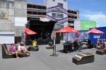
Hmm.  Let me diverge here and give some context on driving in NZ.  In addition to NZ’s aversion to a straight road, and in addition to everyone driving on the wrong side, there are other aspects to driving a car here that make it interesting.  For instance, the solid yellow line down the middle of the road that says you better not pass?  Those lines seem to be applied pretty much at random, and not very often.  One should never ever ever think that the dotted line here means it is safe to pass!  Dotted lines frequently go around blind One-lane Bridge
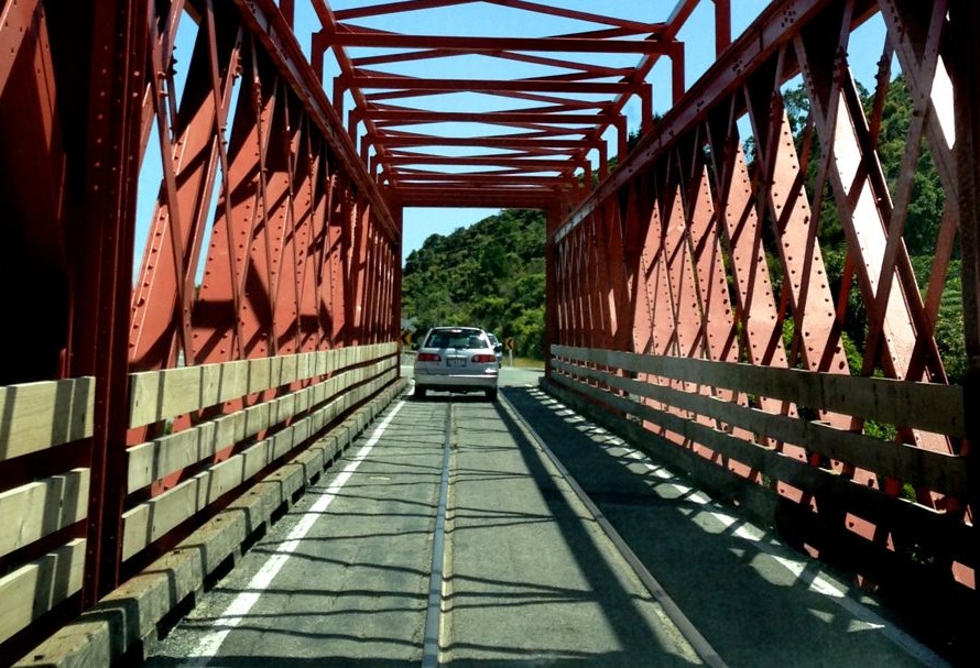
curves.  “Frequently” as in usually.  I trust my eyes only, and I avoid passing except at marked passing lanes.   Another example is NZ’s frequent use of one-lane bridges; some are more interesting than others, such as the one to the left:  like the others, it’s only one lane, but unlike the others, it is also used by trains – those are railroad tracks down the middle!  How does that work??!  Finally, most  roads here are 2-lane, bi-directional, usually narrower than back home, and with little or no berm; and like the US, most freight goes by truck.  However, here Big Mama, haulin'that means semi’s whiz past a couple feet away (feels like inches), at top speed; the wind-blast alone is slightly unsettling.  But it all seems to work (no crashes yet!).

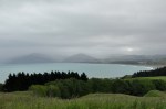
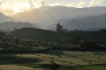
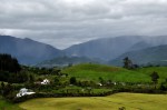
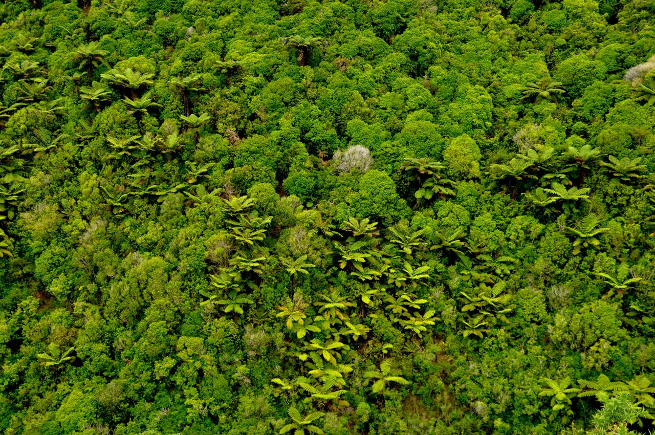
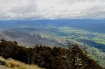
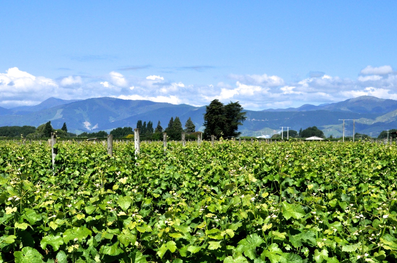
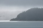
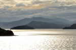
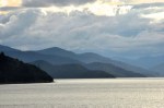
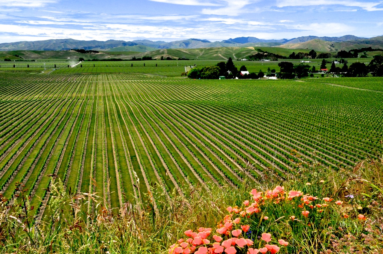
OK, back to my story.  Initially the land around us is rather pastoral; we are not hemmed in by towering mountains.  The view reminds me of the cattle regions of Colorado and Wyoming, with mountains in the distance and the cows up close.  When the mountains do come to meet us, they appear

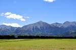
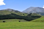
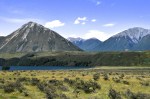
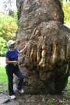
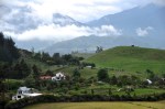
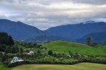
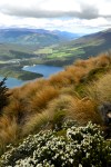
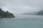
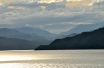
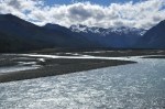
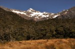
older and weathered, as shown above.  Hey, speaking of older and weathered, Ginger sneaks in a picture of me!  The mountains are covered in scree – a bitch to climb, probably.  They’re not exactly majestic, these mountains, but to this mountain-loving guy, they are beautiful.  As we go further, however, the mountains start to get Getting bigger!bigger and more impressive, as shown here.  The road at the bottom of the picture provides perspective.  Not bad, eh?  Glaciers eons ago carved up these puppies, and we appreciate all that hard work.

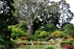
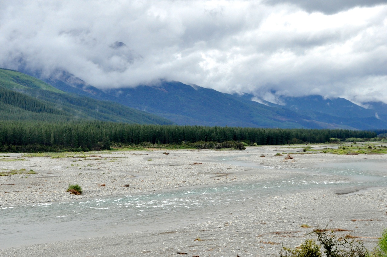
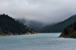
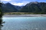
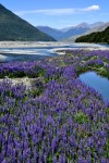
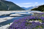
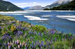
We come to a river plain that we must cross, and it is spectacularly beautiful (and photogenic, may I add).  The river is an impossible turquoise, obviously glacier-fed, but light glinting from the sun and reflections from the sky make it silver or blue depending on where you’re looking.  We stop to stare, and I take a lot of pictures, which I will foist on you.  The lupine is everywhere, creating a riot of color.  Wow.  Look at that river color and the mountains and the lupine.  Hope you enjoy it as much as we did.

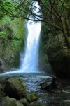
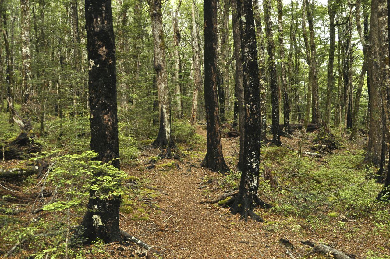
We’re staying in the (very) little town of (of course) Arthur’s Pass, which is very close to the top.  It’s around 5pm, so we have time for a quick hike.  There’s one nearby called Devils Punchbowl, listed as short but steep.  Short is good, but Ginger is not sure she wants steep; I push, so off we go.  Very quickly we see that this should be a nice hike!  After a short walk to a suspension bridge, a gorgeous waterfall is visible off in the distance, and undoubtedly that’s where the trail is going.  I’m excited!  As we get closer, it really is a fabulous waterfall, as seen in the right picture.  The water is falling in beautiful sprays,

and the rainbow moves around.  The trail disappears into the woods and becomes quite steep.  Perhaps in the picture below right you can see that there is a wooden staircase at the end of the rock steps?  I’m not used to stairs on a hiking trail; the commitment to good trails in NZ (Dept of Conservation) is impressive.  Ginger, however, is not a fan of stairs

on a trail, particularly when the risers are not consistent – her arthritic hips complain – and she tells the DOC,  just in case they’re listening, what they can do with their stairs.  She’s actually not sure she wants to go on, and tells me to go ahead, she’ll make up her mind after resting.  So off I go.  When I emerge from the forest, The waterfall
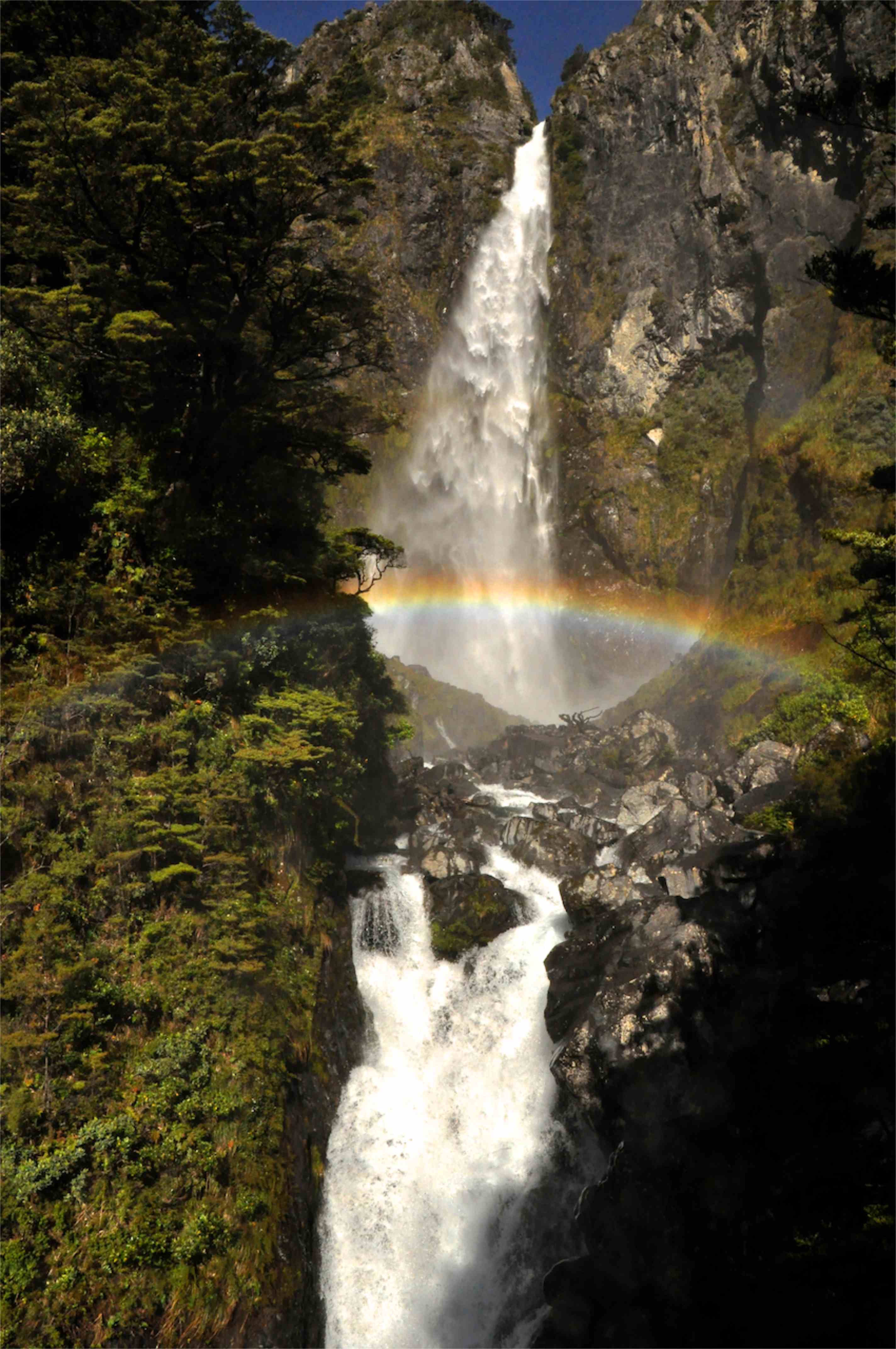
the waterfall is right there and does not disappoint.  It’s really two falls, an upper and lower, as shown.  It’s not possible to get both in the camera frame.  It’s also really hard to photograph – the trail goes to a wood platform that’s built out over the river, which I’m standing on, but the spray is blowing right into me, and I’m getting soaked.  I take a picture, retreat, wipe off the lens, and repeat.  I feel like a shampoo ad.  The rainbow moves around with the spray, and goes bright and dim, but it is always there.  It’s gorgeous, and I wish Ginger could see it.  I start back down the trail, and lo! Ginger is here!  She made it!  We marvel at the beauty together, and she asks whether I’ve noticed that the mist is soaking us.  Eh?  Speak louder, I have water in my ears.  Time to go back before they stop serving dinner.  Ginger counts the stairs on the way down – 352 each way, she tells me.  But it’s worth it, right? I say, ducking just in case.  Below are a few more pictures of the falls.

Mountain
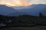
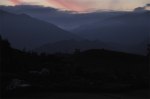
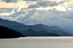
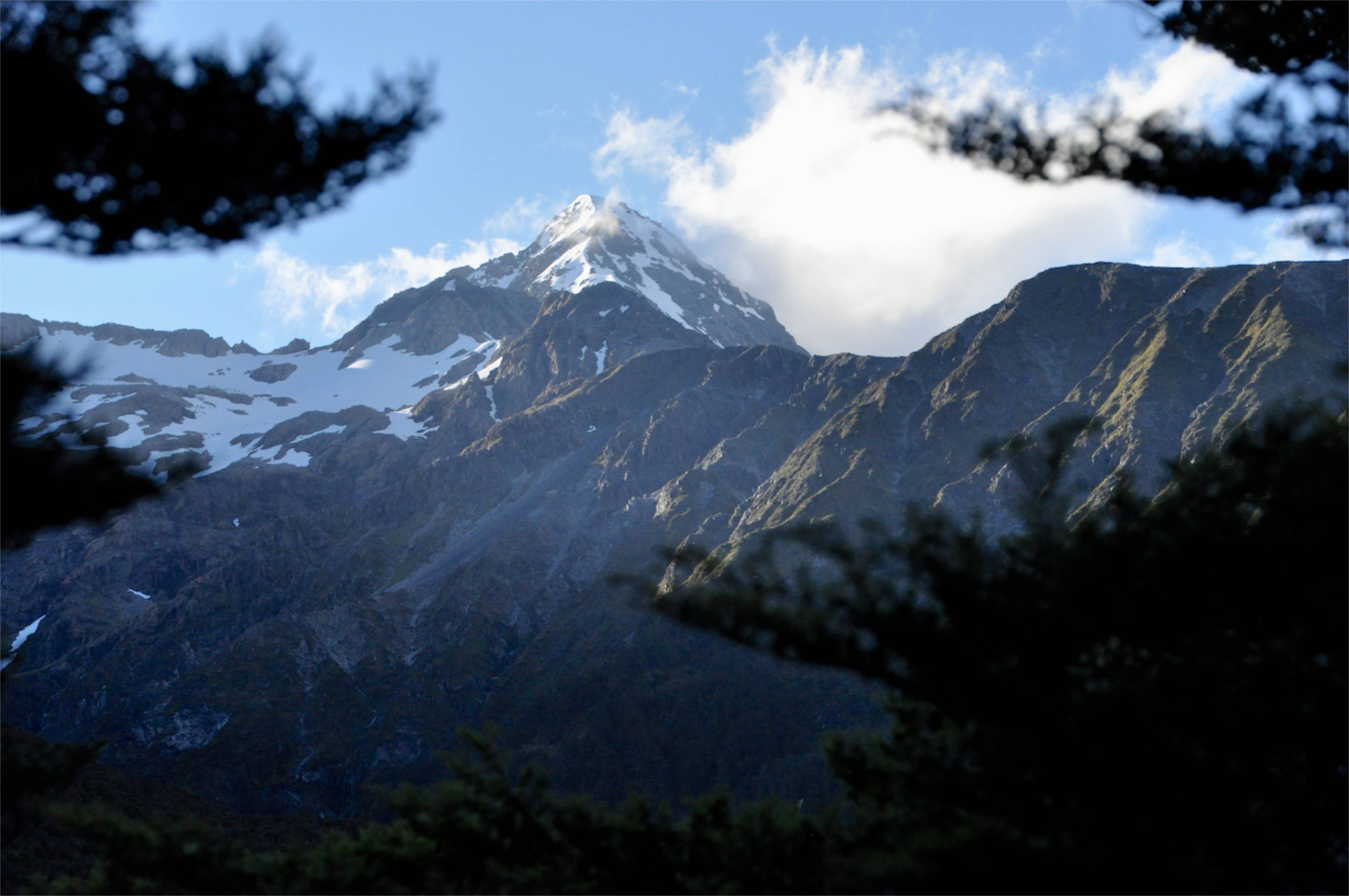
Back at our (rustic) lodge I take a picture of the mountains above us as the sun is setting.  Hmm.  OK, maybe I was wrong earlier about these mountains; majestic does apply here.  It’s an impressive view, and a challenging chunk of rock.

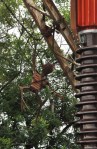
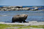
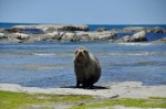
I also see a Kea, the world’s only alpine parrot and Kea
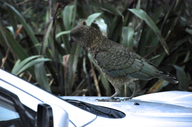
reputedly the most intelligent and entertaining bird on the planet.  It has an inexhaustible curiosity, which leads to mischievous behavior.  Examples, we are told, are pulling the nails holding corrugated-iron roofing on,  eating rubber windshield wipers off of cars, or turning hiker’s boots into a pile of leather strips and shredded laces.  Their cuteness and curiosity and intelligence means they quickly learn how to play to the tourists, but being fed by tourists is also leading to their demise, as they lose the ability to forage for themselves in winter and they are drawn to the dangerous roads.  Total Kea population is about 1-5 thousand birds.

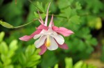
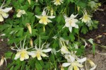
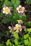
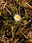
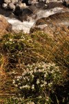
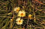
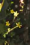
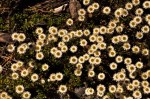
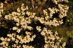
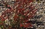
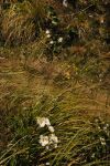
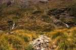
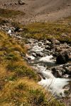
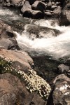
The next day, as we continue westward, we decide to do the short Beasley Valley Track, which goes to the Beasley Chasm, touted for its river cascading over huge boulders and for its views of Mt. Rolleston.  It is a nice hike, as the pictures below show: nice river, nice mountain views, and pretty flowers.

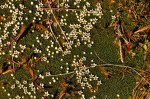
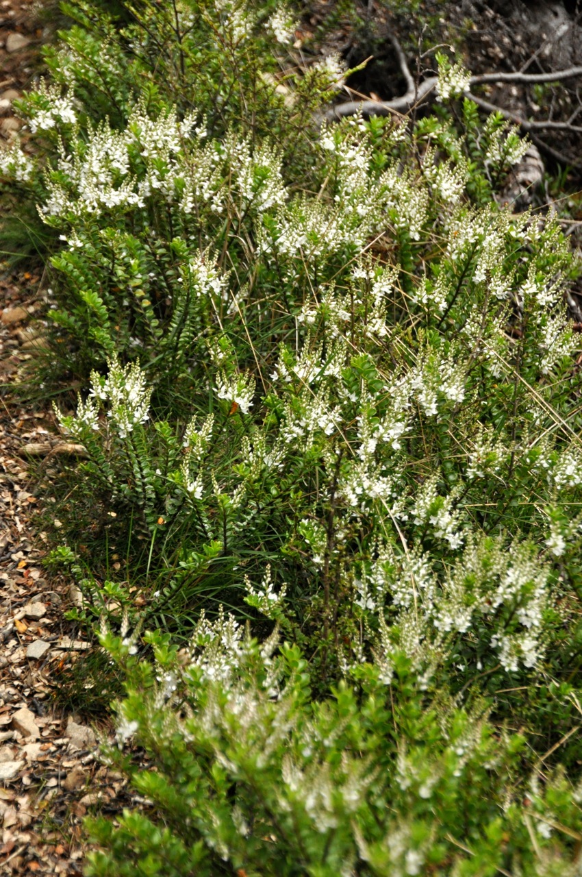
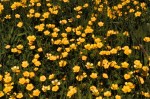
We travel further to the Dobson Nature Walk, right next to the highest point of Arthur’s Pass.  The Nature Walk is short, highlighting subalpine and alpine plants.   It’s a loop, climbing up a hillside, and except for the stream at the bottom, it’s very dry.  It does have a good variety of flowers (most of which we can’t identify), but not in great profusion.  Pictures below:

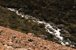
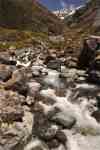
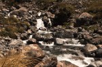
We go for a final hike, the Otira Valley Track.  It follows the Otira River up a deep valley on the north side of Mt Rolleston.  Ginger decides she has had enough hiking, thank you, and is gracious enough to wait while I do it (estimated time is 1.5 hours).  The trail is mostly up, but it isn’t terribly steep.  It is, however, quite tricky; lots of rocks protrude, or you’re crossing scree, or the trail is practically hidden in vegetation, with (unseen) sharp drop-offs to the side.  Also, there are a lot of small waterfalls streaming down the

mountain side and then snaking their way to the river – across the path.  Crossing these small creeks is a bit tricky in parts, tiptoeing across rocks in a narrow path, and sometimes the streams are even hidden beneath the vegetation until you’ve stepped in them.  Thank you Gortex!  The trail is a good test of balance (which, I note, is not as good as it once was).  This effort is rewarded by nice views.  Initially you’re above the pretty, if small, Otira river, but then the trail comes down to it and its delightful happy music.  Pictures below.

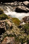
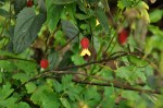
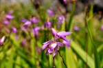
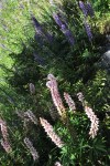
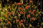
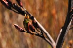
There is a lot of water everywhere, including underfoot.  As a result, there are also a whole lot of gorgeous flowers everywhere.  Most of them I showed you earlier on the Dobson Nature Walk, but the picture to theDaiseys and water 
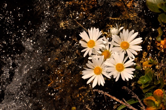
left is just too pretty not to include.  I was actually looking for the white mountain orchid, which a couple ladies coming down the trail were excited about seeing.  Of course I have no idea what the orchid looks like, and, hopeful, I take pictures of a couple of new stalked flowers – but no, I missed it.  The stalked flowers

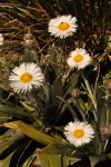
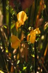
are shown above.  I do want to show some additional pictures of the Mt. Cook Lilly, which you saw earlier but which are plentiful and beautiful.  They’re big, and mis-named: they’re really the largest member of the buttercup family.  Let me tell you, it’s hard to believe that!  They have nothing in common with a buttercup that I can see!  You can find both kinds of buttercups here (yellow buttercups shown on the Dobson Walk), but the Mt. Cook Lilly is truly magnificent, as shown below.

They can grow to be 3 feet tall.  The plants are also interesting in their evolutionary adaptation to this harsh environment.  Like all plants they have stomata in their leaves for transpiration, which in other plants are on the cooler, shaded underside of the leaf to avoid too much water loss.  However, since the Mount Cook lily grows among rocks which heat up during the day, the underside of its leaves are often warmer; so it has stomata on both surfaces of its leaves.  It closes the lower stomata when the rocks warm up, opening the upper ones to the cool air, and then reverses the process at the end of the day.  Pretty smart for a pretty plant.

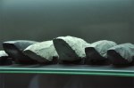
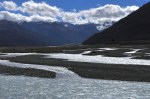
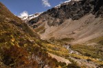
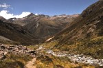
The footbridge across the Otira, shown earlier, is officially the end of the trail.  However, I’ve gotten here early and the view going forward is View going forwardcompelling, as shown below, and I decide to go a little further.  Further is across a huge scree bed, with large and very loose stones, so it’s difficult going and not without some danger of spraining an ankle.  Small scree is like big sand and you can just walk (and slide) across.  You kind of have to tack.  The big scree is a different matter; it’s as much hole as it is rock, and you have to test each stone before putting weight on it.  So going is slow.  Too slow!  I travel a bunch, and that The same view!
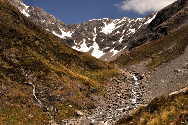
compelling view has not changed much, as you can see!  It would be nice to see around the bend, but it isn’t going to happen, I’m out of time.  So back I go, with a pretty view in the homeward direction as well, as shown in the images below.  A good climb!

Ginger has been very patient in the hot sun-blasted car without water (I took it with me) – so I give her a big kiss (and the rest of my water).  Thanks, sweetie!

Oamaru and Penguins

Oamaru was a port town, once NZ’s 9th largest town, with a bustling trade in grain and timber.  Lamb and mutton were first frozen and sent to the UK from here.  It was a commercial center for NZ’s gold rush days, and an immigration destination.  The town was also blessed with a nearby supply of cream-colored limestone (whitestone) that was easily worked; given the prosperity of the times in the mid-t0-late 1800’s, and the presence of able and imaginative architects and stonemasons, Oamaru became “The Whitestone City”, both in its commercial business buildings and its grain and wool warehouses.  Today it’s a sleepy little town (population <13,000) with one of the finest 19th century streetscapes one can imagine.

Penguin CrossingIt is also the home of both blue penguin and yellow-eyed penguin colonies, the main reason we have come here.  The road signs suggest they’ll be easy to see.

THE PENGUINS

Oh, let’s start with the penguins!  They’re breeding now, with nests on land. The parents leave the nest early to go fishing and come ashore at the end of the day to feed the chicks.  The yellow-eyed penguins come ashore in the late afternoon/evening, the blue penguins at nightfall.  The problem is, the penguins are (purportedly) skittish and will not come ashore if they see humans; and not coming ashore is a negative from the chick’s point of view.  Accordingly, The beachthe viewing platforms for the yellow-eyed penguins are pretty high up on a headlands, as you can see from the picture of the beach there on the left.  A little disappointing not to get any closer, but we’ll see.  There could be hundreds coming ashore.

After waiting for awhile, staring at an empty beach and jockeying for position in the small crowd, someone sees a single penguin come ashore.  Penguin?  Where?  Perhaps you can see from the 2nd beach picture below that this auspicious landing is a little underwhelming; if you look closely, the penguin is that little dot near the center of the picture.  We are not close, although we have brought along a Lone Penguinpair of binoculars (that we share with others in the crowd).  Still, more penguins will be coming; but then to our horror we all see a lone human male who has ignored all the posted signs and is walking on the beach.  Our penguin immediately turns and runs back to the sea and is gone.  The male walks to the edge of the greenery and sits down to wait.  Oh great.  The small crowd discusses lynching, but that means going down to the beach.  After we wait awhile longer with nothing happening, we decide to give up and go for dinner.  As we walk out, we spy another penguin coming ashore, and the path has taken us to a point just opposite his position.  We’re actually pretty close!  Yellow-eyedThe picture to the left shows what a yellow penguin is supposed to look like, and although we’re too far away to see the yellow eye band, we can easily see that this is indeed a yellow penguin.  He’s really cute, with very pink feet.  He’s in no hurry, and we get to see him leisurely strolling in and grooming himself; apparently penguins get air trapped in their feathers that needs to be squeegied out.

Check off seeing the yellow-eyed penguin, but seeing the blue penguins is another matter; they’re the smallest of the penguins, and they come ashore when its dark or nearly dark.  They can be found all along the coast of NZ, including the North Island, but a whole lot of them (two colonies!) are here.  One colony nests somewhere near the Oamaru wharf and is off limits, but apparently penguins will nest anywhere they want, thank you, which means they will nest just about everywhere.  So if you sit patiently along the Oamaru shoreline around dusk you can maybe see a few waddle past.  Well, “patient” and “maybe” is why I don’t like fishing.  Alternatively, for $40 one can sit in the grandstand of the Penguins Crossing visitor center that’s equipped with red lighting (blue penguins don’t see that spectrum) and watch a hundred or so come ashore and walk a few feet in front of you.  Now you’re talking!  The only downside is – no cameras allowed!  Too many idiots with cameras with flashes have ruined it for all.  I am crushed, but this should still be great.  And it is.

We take a daytime tour; there are a lot of penguin nests (50? 60?) actually at and around the visitors center, many in a central courtyard, but they’re off limits and one must keep to the elevated boardwalks that lead to the grandstand.  There is an exception, a room devoted to seeing 4 nests equipped with cameras (and red light).  One can actually lift a flap and look directly into the nests (3 have chicks in them).  And OH MY!  Penguin smell in the nests is pure ammonia and very old fish!  After just a minute my eyes are watering from the ammonia.  These are tough chicks, let me tell you!  They’re also small and fluffy.  A guide at the visitor center tells me there is a penguin under the boardwalk and I hightail it there and lay down to see, and sure enough there is a penguin just a few feet away, getting some fresh air.  He’s cute!

I can take a picture!  He seems to be more a gray color than blue, but apparently he has a head-to-tail iridescent indigo-blue streak down his back that I can’t see.

Evening comes and we get to the grandstand early to get front-row seats.  The penguins have quite a steep climb up from the water, over jumbled and large uneven rocks, with the waves crashing into them.  It looks pretty ouchy, but the guide says the penguins actually like to play with the surf.  Glad I don’t have to make that trip every day!  As it gets dark, the first “raft” comes ashore, about 20-30 penguins.  The penguins hunt alone, but when they approach shore they wait around until a bunch of others show up, and they come ashore as a group.  You can see them (dark shapes on the water) coming in, and then with a wave breaking, “pop” 4 or 5 of them are out and working their way up the rocks.  They are really cute!  They make it up the big rock incline and stop in the rocks just before a flat grassy area that goes past our grandstand and into the central courtyard.  There the raft congregates (those that aren’t going to their nests elsewhere), preening and milling and waiting.  I took a picture of a picture that comes pretty close to showing what this looks Are we we going?  Are we going?like (our rocks are lots bigger!), shown to the left.  The milling continues and tension seems to be building, and suddenly one brave penguin can’t stand it and darts for the safety of the courtyard, the others in close pursuit and looking for all the world like the Keystone Kops, and off they go right in front of us, the group waddling like mad, some occasionally falling on their bellies in their hurry.   There are actually just 2 holes in a fence that they have to navigate through, so the group bunches up and slowly funnels through.  Once inside it’s party time, and there is a whole lot of squeeking and crying and snorting and males fighting over a female and the nests welcoming them home.  Then all is quiet while we wait for the next raft.  Nearly 200 penguins come ashore over the next 90 minutes, and it’s fun to watch each time.

As we leave the center, there are a bunch of people and cars near a streetlight by the side of the road.  And here are three more penguins, with nests on the other side of said road, not sure what to do with the crowd around, but certainly not running away either.  The light is so dim it’s hard to focus the camera, but I watch for the Great Escape to occur – by golly, I’ll get pictures yet!  Everybody is about 20 feet back.  After gathering their courage the 3 Penguiteers nonchalantly saunter across the road until half-way across, and then for some reason there is the mad dash for safety!   Cute!

Penguins aren’t the only birds around.  There was a pretty impressive shag convention nearby as well, as shown.

THE TOWN

Downtown OamaruOamaru looks like any other small NZ town, as this picture shows, until you get near the center and see these fabulous whitestone intricately decorated buildings.  They’re all pretty much from the same era, built over a 20 year period starting around 1865, and they occupy several streets coming up from the wharf to the main business area.  Below are just some of the side streets – it feels like you’re on a movie set!

Below are pictures of some of the business-area buildings, along with a couple of close-ups of details.

The warehouse area is a bit grittier but the buildings are still amazing.

The shopping is also interesting in these old buildings, for instance this art gallery:

The jewelry is paua shell, from abalone.  Pretty stuff.

The Oamaru Gardens is also very nice (and large), giving a sense of the wealth that this city once enjoyed.  We were impressed with their unusual trees and extensive flower gardens, including what must be every color of columbine one can imagine.

STEAMPUNK

We had never heard of Steampunk before, and having seen it, we’re still not sure what it is.   Safe to say sculpture – and far-out psychedelic-like art.  How about fantasy mechanical, or wierd retro functional surreal stuff.  For instance, the futuristic/retro steam locomotive sculpture there in the front has wheels that turn while it emits smoke and flame.

I was more intrigued than Ginger, who was a bit put off by the musty building and its (real) burning-oil fumes.  The gallery consists of a poorly lit basement-like 1st floor, a small moldy basement, and an outside courtyard.  An example of the 1st floor gallery:

OK, let me show you Steampunk art.  I’ll start with some tame stuff:

How about this?

There are a number of projection stations, each on loops, the one in the basement against the wall/floor junction so that the image is bent:

More – art?

I’ll end the Steampunk presentation with the outside courtyard art.

So what can you say about Steampunk?  Maybe strange but interesting … or better, very very strange but interesting.

Next post – a trip over Arthur’s Pass.

Christchurch – Canterbury Museum and Art Center

Before showing you some cool museum stuff, let me first show you the wonders of serendipity.  We were walking in Christchurch’s Hagley Park (where the botanic gardens are located) when at the fringes we stumble onto a forest not of trees but of tents, some still being erected.  As it turns out, Christchurch hosts a big yearly wine festival here, which will be held in two days.  And we can walk to it from our motel room!  We quickly order the online tickets, a good thing since the event sells out not long after.  Close call!  The event was really good.  One can spend the entire day in seminars or the entire day sampling wine – we chose to do some of both, which meant that, alas, we tasted a miniscule fraction of the wines being poured – but greatly enjoyed those we sampled.  I’m not sure NZ makes a bad wine.  One of the very interesting seminars was hosted by Riedel, makers of stemware, who was showing how much the shape of the wine glass affects the sensory perception (and enjoyment!) of the wine.  Yeah yeah, you’re selling glassware, but we are a bit curious.  Oh my gosh!  The effect is in fact huge!  Did not expect that.

OK, the museums as promised.  The Arts Center is still damaged, but the city has rented rooms (and shipping containers!) across (as in, spread out across) the city, and staffed with Arts Center employees so they have something to do.  So think of an art museum spread out the size of a city; if you thought winding your way through a gallery was tiring, try winding your way across many city blocks and climbing flights of stairs!  The Art Center is contemporary art, much of it too out-there for us (think Andy Warhol), but the sculpture below (by Peter Trevelyan) was fascinating.  It protrudes several feet from the

wall, unsupported, and looks like a topographical rendering of hills in the distance.  It is created from 0.5mm mechanical pencil lead, glued invisibly together at their ends.  We are impressed.

Our last show-and-tell is the excellent neo-Gothic damaged-but-still-functioning Canterbury Museum.  It has a nice collection of fossils, several shown here.

The museum’s strengths are its Maori and Antarctic collections.  Whereas other museums we’ve seen have focused on Maori art (see earlier posts of Sept 26 (Auckland Museum [Mostly Maori]) and Dec 5 (Wellington City and WOW!), this museum looks more closely at the daily lives of the Maori – a stone-age, warrior-class people.  It is fascinating.  Apparently the incessant tribal warfare did not occur while the large Moa birds were alive (left picture), Moathe Moa extinction occurring around 1500.  It’s hard to imagine food being scarce in NZ, with its extensive coastline, but remember there aren’t any mammals; no deer or rabbits (although there are seals), so apparently population growth and resource scarcity led to the warfare.  The museum focuses on Maori life from the 1500’s to European settlers arriving in the 1800’s.  From river-mouth locations, the people moved to defensible headlands with good fishing and gardening nearby.  The village was only as big as the fort (pa) allowed; food was important, but survival under constant attack more so.  Island of Motuaro, 1770If you remember from earlier posts, the Maori were vicious.  The picture to the left shows a pa on an island drawn in 1770; even on an island you had to have a pa.  The dioramas below show daily life, a woman weaving a flax rain cape, another preserving birds for storage in the raised structure.  In the background is the pa (picture on left).


The Maori had a very well-developed stone-working technology – much needed for food and warfare.  I confess I remain astounded that cultures like the Maori and the American Indian remained mired in the Stone Age and never discovered metals like copper.  They certainly developed a sophisticated stone culture, with different stones for different tasks.  Jade (pounamu) was the stone of choice for hardness and edge, and became quite a prized material.  Found only on the South Island, when North Islanders saw it being used as an adz and were given some, it didn’t take long for a raiding party to wipe out the gifting tribe.  Some pictures of their stone technology are shown below.
For 300 years warfare was hand-to-hand combat using clubs and spears, examples shown below (the jade was also used for jewelry).  One can imagine, then, the upheaval in this

warrior culture with the availability of European rifles in the 1800’s.  As alluded to in a previous post (Sept 24, The Maori), guns quickly determined dominance and survival, and Maori would trade or sell anything for guns, including a tribe’s most cherished heirlooms – from ancestor-carved boxes to 100-person carved war canoes.  I may or may not have told you about the Maori chief who was invited to visit the king in England and was presented with a fitted and decorated suit of armor.  On his return trip he stopped in Australia and traded the suit for hundreds of rifles, and became a dominant force.

Tools for food gathering were also very primitive, as shown below.  The last two figures show stone tools used for pounding the root of the bracken fern before it could be eaten.

Eating was certainly more adventurous than visiting today’s supermarket; for instance, the outer flesh of the acorn-like fruit of the Kopi (or Karaka) tree was edible when ripe, but the hard inner kernel was highly poisonous.  The toxin could only be removed by steeping in running water or steaming for an extended time; then the kernels could be roasted or pounded into flour.  Hmmm.  Take your time with dinner, sweetie.  I suspect life wasn’t so easy.

I will end this presentation of Maori life by once again showing  examples of their very impressive wood carving and flax weaving culture.  If the Maori made anything from

wood, they extensively and beautifully carved it in fabulous patterns – originally with stone tools (!).  Similarly, making wearable garments (and fishing nets) from the flax plant, including incorporating feathers, was an art in itself, incredibly impressive.  Examples are shown above.  Since I’ve pretty well covered Maori culture in several posts, I will not return to this topic.

It was interesting to see the other side of the NZ coin, the immigration of Europeans to NZ.  Europe had a lot of poor people and encouraged them to leave.  New Zealand wanted them to come.  Below are advertisements from the mid 1800’s selling the joys of leaving.  To get on that ship, you needed to have “working class” skills – and a note from your parish clergy attesting to your character.  The sea voyage to NZ, by the way, was 3 months.  Today we complain about a flight taking a whole day.


The museum has a fascinating section on the exploration of the Antarctic (Christchurch is the official home base for the Antarctic research stations, including the US station).  They have photographs and a lot of original stuff – boots, playing cards, etc – of the earlyArctic Gear explorers.  Following an exploration of the Antarctic region in 1901-04, led by the British Robert Scott, there followed a huge effort to be the first to reach the South Pole.  Shackleton tried it in 1909 using Siberian ponies, and got within 97 miles before the last pony died; short of food he had to turn back.  Scott with 4 others tried it near the end of 1911, each person hauling sleds weighing 180 lbs over the last 350 miles.  They reached the South Pole in the middle of January (remember, seasons are reversed on this side of the equator), only to find they had been beaten by the Norwegian Roald Amundsen a month earlier.  Exhausted and short on food, the Scott party ran into blizzards on their return journey.   Unable to go on, they died in their tent two months later.  The secret to Amundsen’s success was the use of dogs to pull sleds, allowing the men to travel fast with little expenditure of energy – and in Amundsen’s words, “dog can be fed on dog”.  Ouch!  Harsh conditions simplify choices.

The next challenge was to travel across the entire Antarctic continent.  Shackleton tried it Antarctic Motor-Tractorin 1915 in this specially designed tractor – remember what cars were like in 1915?  This tractor had a plywood body, a metal paddle-wheel for propulsion (visible in the rear), and a 9 hp engine.  It apparently was the embodiment of mechanical perversity, and in the first attempt to travel to their base camp, they ended up having to haul it the last 12 miles, where it was abandoned.   The first Antarctic crossing didn’t occur until 1957-58, when the Tucker Sno-catTrans-Antarctic Expedition led by Sir Vivian Fuchs made it across using four of these Tucker Sno-cats.   The Tucker Sno-cat had a top speed of 15 mph and got 3 miles per gallon.  The crossing took 3 months; initial slow going and the looming winter made it a dicey crossing.  In large measure the Expedition was successful due to the the help of Sir Edmund Hillary (of Mt. Everest fame) using three Ferguson tractors (the last picture).  Hillary built a support base at the Ferguson tractorfar end, blazed a vehicle route up the Skelton Glacier and through the Western Mountains, and laid supply depots over 700 miles nearly to the South Pole.  With just enough fuel, Hillary’s party pressed on to the South Pole, the first to get there since Scott’s ill-fated visit in 1912.

I don’t think the South Pole is going to make my bucket list.

Next post – Oamaru and penguins!

Christchurch, the city

Wow.  This was a hard post to write.  What to say about Christchurch.  There were always 2 cities one had to see in the South Island, Queenstown and Christchurch.  If you fly to NZ from overseas, you land either in Auckland or Christchurch; Christchurch is a very important NZ city.  However, if you remember, Christchurch was badly damaged in a huge earthquake in late 2010, and then really brought to its knees by another earthquake in early 2011 (and a third one after that).  But all of that was 3 years ago.  We expected to see a nearly mended Christchurch, and the travel books talk about this and that reopening.

The nature-made pieces of Christchurch are beautiful and seemingly timeless.  The River

Avon wends through the city, and one can take a punt (think poling Venice-like gondolas) through the city or gardens.  The gardens are extensive – one can get lost in them, literally.  Christchurch is called the “Garden City”, and its collection of flora is unrivaled on

the South Island.  In contrast to nature, man-made Christchurch is a very sad story, looking like it was recently bombed.  In residential areas there are frequent empty lots or

houses just starting repair.  We didn’t get to the area near the water, where the ground liquified.  The city center wasn’t hit as hard, but we didn’t need or want to see worse

desolation.  The city center has a lot of big, cleaned up, empty lots, as shown above.  Sitting.  Eerily.  Nothing moving.  Ghost town squares.  It has a whole lot of buildings

Container Wallthat are braced up, as shown above, presumably waiting for decisions to be made or construction to start – or demolition to start.  Shipping containers are big here, as you’ll see later in this post.  Originally these trans-ocean shipping containers were used as protective walls to keep suspect buildings from toppling onto people.  They’re still used for that function, as shown on the left, but more often one sees buildings being supported by steel girders.  It’s hard to tell if the girders are part of the rebuilding process or just a holding action.  There are no construction personnel in those areas.

Much – a whole lot – of the city center is cordoned off, some with construction going on, some just quietly sitting there.  The skyscraper in the left picture below looks fine, from

afar – you can’t get closer – but it is condemned, along with the adjacent buildings.  They’re waiting their turn to come down.  Other skyscrapers look fine as well, but are for sale : for sale “As is where is”, the sign says.  I like the “where is” part; more Kiwi humor: as if you could move it.  Condemned buildings are common, examples below.

For us, the saddest part of Christchurch is its hard-hit neo-Gothic buildings; and in particular, the spiritual heart of the city – its landmark cathedral (historical pictures

above).  As you approach the center, there is a lot of rebuilding activity going on, as shown below, and you think OK, Humpty Dumpty is being put back together.  Let’s see what the

cathedral looks like.  And then you see the cathedral, below.  It can’t (or won’t) be saved,

and will be demolished.  Wow.  That’s their history.  Some of this history is being saved, of course, as shown below.  Just not so much.

So why the slow progress, and why not rebuild the cathedral (with the original stone, even, like in Germany after WWII)?  It’s all about the money.  First, although a portion of everyone’s taxes goes into a disaster fund (NZ does straddle two tectonic plates, see post of Nov 6 on Rotorua), and the fund had a lot of money in it, after the first earthquake that money was gone.  Then came the other quakes.  Second, the city government says “Never again” and issues new building codes, such as buildings must anchor to bedrock.  The insurance companies on the hook say “Wait, the contract says we pay to rebuild like it was, not to these new expensive codes”.  Lawsuits ensue, lawyers have big grins, and nothing gets done.  The last issue is the size of the mess.  There are only 4.5 million people in all of NZ.  If everybody in the country – men, women, children – freely contributed $20 to rebuilding, that’s a whole $90 million.  How many skyscrappers will that build?  So the decision is to let the history go.

The response of the people of Christchurch is the heartwarming part of this story, as they make lemonade with their lemons.  Your shop is ruined and you can’t get money for a rebuild?  No government help?  What do you do?  Well – do it yourself, mate, just do it.  What building materials are available and cheap?  Well, debris (salvage) material for sure,

and it’s free.  The end result shown above isn’t bad!  Hey, it even has a roof!  Here is

another solution: a converted bus, a tarp and some tables.  The one we think is most innovative, and the cafe we supported multiple times, also used discarded detritus; walls made of interwoven wooden pallets (painted a jaunty blue).  There is no roof, the interior

is pure ghetto dolled up with flowers growing from the pallets, but it has a bar, a coffee shop, a cafe, several food stands (operating from converted vans), and a nightclub (the performance stage is the last picture above), with frequent band performances and a weekly movie.  Also weekly there is a farmers market and on another day a flea market.

I saved the best for last.  Another very clever solution goes mainstream in the city, and it’s fabulous.  What other building material is available and cheap (and comes with a roof)?  The city initially used stacked shipping containers to support unstable external building walls.   Sign of the TimesAs the buildings were torn down or supported with girders, the shipping containers were no longer needed.  So entrepreneurs step in ….   Do it yourself with one of these!  Much of the functional city center is now citizen-made temporary buildings made of these containers, as shown in the picture (below, left) of a breakfast cafe.  Breakfast cafeBetter yet, there is now an entire mall downtown made solely of these containers!  Called Re:START, the mall is fascinating, and colorful, and inventive, and fun.  Much of it is two stories tall, with the containers stacked at interesting angles.  The place is clearly temporary – the mall has no roof, just stretched tarps and corrugated steel overhangs in front of the stores – but the mall does have a critical mass; although the stores are small, like any mall you can get almost anything you want here.  Better than most malls, really, there is live entertainment as well.  I’ll show you a bunch of pictures of this fun place, a testament to the resilience and ingenuity of Kiwis in particular, and us humans in general.  It is good to be reminded of the indomitable spirit of our species.

Wait!  Did you notice that last picture??  A bank! Is that acceptance or what!  Look who joined this commercial guerrilla movement!  And there is more than one, see below.

It’s nice to see banks involved in the community.  I confess I see US banks operating more as predators than as helpful community citizens.  So good for you, Christchurch.  I know you will claw back.

Next post – Christchurch  museums.

Waipara

What?  You never heard of Waipara?  Yeah, neither had we.  This smaller-than-little town (population <300) is about an hour north of Christchurch and is home to NZ’s fastest-growing wine region, a region that is sunny, dry, protected from the sea breezes, and in its infancy.  We’re talking pre-tourist infancy; there is almost no nearby lodging.   What is available is often makeshift to meet demand, such as a converted railway carriage.  We do Our roomfind a place, the (somewhat) converted barn of the historic Glenmark Vicarage (1907, at one point abandoned, the house being restored).  The barn is very funky (picture); the kitchen is spare, the beds are upstairs in what was the hayloft, the bathroom is located downstairs, but quirky is OK.  Open the hayloft 2nd floor doors to the outside world (the old pulley still present) and there is a nice breeze.
Some NZ wineries are rather big and make a lot of good, relatively inexpensive wine using machine harvesting and non-picky crushing.  More often the wineries are small family affairs out to make the best possible wine they can using labor-intensive practices like hand harvesting, grape selection, stem removal, and gentle juice expression.  These wines are usually very good (but considerably more expensive).  Both approaches yield quite good wines, mind you, but the  boutique guys are definitely a cut above.  One of the big wineries here is Waipara Hills, making some nice wines.  That’s Ginger entering the building, where we will sample about 10 wines at no cost (and her lips will go numb for several hours).  One can not do too many of these wineries in one day, let me tell you.  It is

hard work!  We diligently find several favorites: Greystone, (their vineyard and one of their old vines shown below) who make a number of good wines, among them a fabulous

“pinotage” under their Muddy Water label; Waipara Springs, where Ginger got her doggy The doggy fixfix (left picture), and the amazing Pegasus Bay (pictures below).  At Pegasus Bay we tasted many yummy wines (and bought a couple of bottles), and sobered up by treating ourselves to lunch at their restaurant (and had a couple of glasses of wine).  Pegasus Bay has one of the finest winery restaurants in New Zealand (the reputation is quite an accomplishment – remember we’re in the boonies, and there is a lot of competition since wineries often work hard at being a gourmet destination).  Perhaps you can see in the pictures below that  lunch looks pretty good.  The setting is French -chateau-like gorgeous as well.  The grounds are as impressive as their wines, and the pictures below only hint at how pretty the gardens are.  All in all, a pleasant if not utterly decadent way to spend a beautiful day.

Next stop – Christchurch.

Kaikoura and Seals

RENTING A HOUSE

Before starting out to the South Island’s East Coast, we back-track to Nelson from our outing at Nelson Lakes in order to rent a house.  Why rent a house, you ask?  Several reasons, really.  One, Ginger is getting tired of living out of a suitcase – we’ve been doing this since May, mind you.  Two, it was always our plan to stay for a number of months in one spot to get the real flavor of NZ.  And finally, we’re spending a significant amount of  money (twice what we would spend in the US!) for lodging in generally small and unimpressive motel rooms.  Renting a furnished house would cut our daily lodging costs more than half, although rentals are for a minimum of 6 months and do not include utilities; still, we think we’ll win the cost battle.  The Nelson area is drop-dead gorgeous, with sun, wineries, beaches, arts, and nearby National Parks.  So here we are.  We looked at several places in Nelson itself, our first choice, but ended up in a fantastic Our Househouse in nearby Ruby Bay.  Not bad, eh?  It’s on a hill – wait ’til you see the views of the bay!  So having rented a house, we immediately leave it to explore the top half of the South Island.  I promise Ginger that after the next couple weeks of exploring, we’ll come back to crash – saving the lower half of the South Island for February (the tail end of the busy summer vacations for Kiwis).  I’ll show off our new place in a later post when we come back.

KAIKOURA

The road down the East Coast is beautiful.  The ocean coast is on one side, big mountains The gorgeous coastpeaking over the hills on the other.  We’re headed toward Kaikoura, a tourist attraction noted primarily for its location – the sea bed drops swiftly away to the very deep underwater Kaikoura canyon, which attracts sea mammals in large numbers.  Consequently this is a great place to get on a

boat to do whale-watching, swim with the dolphins, or swim with the seals – all cool, but none of it inexpensive.  Ginger is not a strong swimmer and has no interest in swimming with fast animals that weigh more than she does, so we’re here just to observe the nearby seal colonies on land.  The first stop is just north of Kaikoura, Ohau Point, home to the South Island’s largest seal colony.  It’s a pretty and rocky coastline, which makes it a great place

for seals to hop out of the water and work on their tans (right picture, 5 of them).  However, there are certain human traits that these seals possess, such as jealousy; apparently some rocks are better than others, and are coveted.  Therefore discussions

ensue, such as the solo on the left picture above, “Hey, you, get offa my rock”, followed by the duet “I’m gonna knock that seal right off of my rock (and send him on his way)”.  It

seems that the high ground has the advantage, and the mouthy challenger thinks better of things.  Finding his place on a lower rung, he can only look covetously at the upper crust.

The seals are fun to watch.  For animals without feet, they move around very well and pretty fast, using their hind flipper to push off; kind of a high-speed undulation.  They’re also pretty cute, like the guy on the right.  There seem to be two types here, dark black and brown; I don’t know the difference.  One is certainly a Sittin on the Rock of the Bayfur seal, of which NZ has a lot.  I’ve captured the interesting interactions of these guys, but the primary activity of the seals is the relatively static and unchanging “sittin on the rock of the bay”, working on that tan.  Not a bad life, I’d say.

I would be remiss if I left you with the impression that all seals are beach bums.  Some can be seen swimming around and honing their skills in a variety of activities, such as the

backstroke (left image) or synchronized swimming routines (right).

Pied ShagThere are other animals of course; birds like the gulls and pied shag, that add color and motion to the relatively static snoozing seal colony.

Turning around we see a very impressive waterfall coming off a mountain that we hadn’t noticed coming in.  We take the Oahu

Stream Walk to it, and not only are we rewarded by the waterfall coming down, but we have company.  An adolescent seal is also enjoying the ambiance, just a few feet away.  He seems unconcerned with our presence, and scratches and preens and rolls around, saying

“isn’t it nice?”  Yes it is.  We’re enchanted, and I take a bunch of pictures.

Finally we reach Kaikoura, and we’re delighted to find that the place is absolutely gorgeous.  In the late Kaidoura Bayafternoon, the view of the bay is amazing.  By morning’s light, it’s still amazing (below).  If an artist painted the color of this water, you would think he was smoking something.  The water is an impossible turquoise, with purple-ish mountains in the background.  The beach is a

pleasant stroll even if it is not sandy.  Some are on the beach playing with the gulls, others

are just chilling, enjoying the scenery and looking picturesque themselves.

Kaikoura has several seal colonies at various indented arms of its peninsula, and off we go to the nearest one.  That area is also quite pretty, with interesting rocks off shore (left

picture above).  Access to the colony is over a very flat (and long) shelf of rock that will be under water shortly as the tide comes in (right picture above), so we don’t have too long before we have to wade out.  We watch what must be a lady seal stretched fetchingly on a rock, preening and scratching and getting things just right.  Sure enough, shortly along

comes another seal, and they seem to have good communication together; no

confrontation, just nose-to-nose “Hi Babe”.  I can just imagine her saying “Honey, could you go get me a yummy octopus?”  Anyway, in fact off he goes, seemingly on a mission.  He climbs out, bounces over the rocks (and you can see how his rear flipper propels him along), and disappears into the deep water, apparently after something.

Other interactions are much more a negotiation over who gets the best rock.  The

encounter shown above is certainly not the “Hi Babe” greeting, right from the onset.  The discussion is animated, the telling arguments made, and resolution followed.  How things were decided I don’t have a clue.  There was no physical contact, or overt threatening, just some careful circling and one seal says “OK, you win”.  No short straw was drawn, no The Dude“rock, scissors, paper” decider.  It was clear, however, that the winner was “The Dude”.

We walk a little further around the peninsula.  Normally the seals are on isolated rocks separated from the mainland by a few yards.  We encounter a seal – a large one – that is snoozing on our side of the rocks; I’ll call him “Brutus”.  Travel books always mention that one should not get within about 50 feet of a seal, since they can get irritated, can move much faster than you think, weigh more than you, and they can bite.  Well, these guys look like they’re more dead than alive, lying there motionless, so I approach Brutus,

moving quietly and cautiously.  Apparently not quietly enough.  Brutus raises up, gathers his flippers underneath him, and looks me directly in the eye, quietly, calmly, and ominously.  “Come a little closer, idiot”, he seems to be saying.  I beat a hasty retreat, and on turning around I see the last picture; Brutus has fallen over, lying on his back and laughing like crazy.  Should be a five-yard penalty for taunting, if you ask me.

As we leave the rock shelf (we have to traverse narrow sea streams by hopping on submerged rocks) we look into the tide pools in the creases of the rock shelf.  There’s seaweed and clams and sand dollars and such, interesting, but not even close to the beauty

of the tide pools in our Acadia National Park in Maine, which has more colorful anemones and sea cucumbers and the like.  Take that, New Zealand!

All this running from seals has made me hungry, so we stop at “The Original World

Famous Kaikoura Seafood BBQ”, established a whole 10 years ago, and proudly recommended by                    (Kiwi humor).  For lunch we share a lobster (Kiwis call them “Crayfish”).  I must say, lobster for lunch is very nice!

Kaikoura is on one side of a peninsula, and we haven’t seen the other side, so we drive to a high lookout.  It is clouding up; a lot (weather on the NZ island is forever changing).  The

bay off in the distance is mostly in cloud, you can see the bustling city of Kaikoura down below, and the other side of the peninsula is seen to be at least as gloriously beautiful as the Kaikoura side, even in the fog (last picture).  New Zealand is one gorgeous country.

We’ve seen enough seal cavorting, so the next day we explore more coast – which is Coastbeautiful as always – and we watch the shags for awhile.  They preen a lot, which is not terribly interesting, but the entertainment occurs after they take to the air.  I love watching their landing.  It is either marked by indecision as to what would be the best spot, or it is just the sheer joy of “skippin’ over the ocean”, like a shag.

Next post – off to Christchurch!

Abel Tasman National Park and Golden Bay

Abel Tasman is NZ’s smallest national park but has an international reputation that draws tons of visitors, mostly to see the coastline. My guidebook says it is fabulously beautiful, with golden sandy beaches, crystal-clear water, lush bushland, granite outcrops and an abundance of wildlife.  Most people hike and kayak and swim and snorkel along the coast, and most of this occurs from the very accessible east side.  We plan to do that too, but for now we’re going to do the road-less-traveled and hike Abel Tasman from the west side, as well as visit Golden Bay.  Golden Bay is at the northwest tip of the South Island, and is backed by the mountains of Kahurangi National Park on 3 sides, with the bay on the 4th.  It is far less accessible, with access in or out being a single, very narrow, very twisty road over a mountain called “Takaka Hill”.  Some hill.  Oh, and because it’s the only road supplying some 6 towns, there’s truck traffic.  LOTS of truck traffic.  LOTS of very BIG truck traffic!  Not to mention lumber trucks carrying big tree sections.  Luckily, we don’t know this, so off we go.  It’s 70 miles away; later, when we look it up, travel time is estimated to be 2 hours.  There is not one straight stretch of road.  The steering wheel is either hard right or hard left, with very little time between the two positions.  A couple of times on severe switchbacks I was afraid I might rear-end myself.  It is, however, quite pretty.  Stopping is usually out of the question, but there are a few spots to pull over.  Alas, I have the camera on the wrong white balance setting, and the pictures are impossibly blue.  Here is one shot going in, and another at the same location

on the way out days later.  NZ is amazing in its ability to have the same view be mesmerizingly and captivatingly different from one moment to the next.

Coming down Takaka Hill, the Golden Bay ocean (left image) and plain (right image) are

gorgeous, although it’s hard to tell from the Picasso Blue Period I’m in.  Closer to the bottom of the hill, without the blue, you can see that this is a pretty place.

These pictures are from the valley floor near the city of Takaka.

Well, as luck would have it, our plans to kayak and horseback ride on Golden Bay are quashed – the continuous lean-in and lean-out jostling as we wound up and down Takaka Hill have done a number on Ginger’s neck; she can hardly turn it, so we’ll have a few quiet days instead.  She does mention, in a gentle way, that perhaps we might take the curves a little bit more slowly the next time (in my defense: we pulled over more times than numerous to let faster cars go by; but the lady makes a strong argument!).

We’re holed up in a cottage outside of town up a gravel road and on a hill.  It’s a simple place with spectacular views (and a lot of spiders, but we rectify that).  Staying here isn’t so bad.  Nearest neighbors are sheep, which come regularly to inquisitively check on us and to baaaaa quietly.  Cows off in the distance give a far-away moooo.   The “boring” view is straight ahead to the water of the bay, which changes color by the hour.  The flax plants attract Tui, which visit throughout the day to feast on its nectar; Tui are amazing birds with their otherworldly, indescribable, transfixing sounds and amazing dark iridescent feathers set off by that white throat ornament.  We love them.

The major delight is the ever-changing Provence-like light on the hills.  The pastoral view is stunning, changing hour-by-hour from one stunning to a different stunning.  The Impressionist painters would have given their left ear for this light.  Not a bad place for us to crash.  I’ll show you some examples below.

Wow.  And wow again.  Of course, the entire 180° view is better than the snippet shown here, but this gives you a good idea of the incredible beauty.  I’ll also add a couple of pictures of the amazing shade-on-shade color from the layers of receding mountains.

Needless to say, the stars out here are also breathtaking.  It’s hard to see stars in today’s overly lighted world, but here in the country darkness, looking at the blazing glory of the infinite universe, it’s beautiful and humbling.  And guess what?  Orion is upside down, standing on his head with his shield for balance, I guess.  It would be interesting to see what the constellations would look like had they been drawn from the southern hemisphere.

As Ginger recovers, we take a short walk on one of the beaches.  We choose a nearby beach Kiwis love their waterrandomly, and we practically have it to ourselves.  Another couple is strolling off in the distance, and a windsurfer is zooming around on this somewhat windy day.  Kiwis do love their water sports!  The water is swimming-pool cool, very comfortable for wading or swimming.  One of the nice touches to a NZ beach is the combination of

beach AND mountains.  It adds to the viewing interest, although the rhythm and sound of the incoming waves don’t really need additional help for our enjoyment.  Not to mention Periwinkle graveyardthe sea shells and pretty polished rocks and interesting driftwood from the very hard and dark wood of some of the NZ trees.

At last Ginger is better, and we have time for a hike in Abel Tasman. We’re entering from the very tail end of the Coast Track.  It’s an up-and-down hike to the first bay, Whariwharangi, and the “up” is probably the Wainui Bayhighest climb of the entire Coast Track.  The good news is that the grade is not especially steep.  We’ll see how far we get.

We start from Wainui Bay, which is itself not too shabby (picture to left).  The trail immediately starts climbing, giving a good overview of the bay, as shown below.

And the trail continues to climb.

The trail circles above a small bay, but there is no obvious way down to it.

We wind through what the Kiwis call “bush” – the original wild cover of NZ (left image below).  The reasonably wide trail is mostly a single, or sometimes two, dirt footpaths in medium-tall grass (right image).  The grass sometimes bends over, obscuring the footpath; it doesn’t seem to be a heavily used trail.

The hillsideThe bush itself is interesting.  It is solid, a mass.  It would be hard to walk through without a path.  The picture shows an adjacent hillside.

The flowers along the trail are gay, bright and pretty.   Most are small, but frequently one encounters impressive lupine  (yellow or pink) and the commanding I-am-so-pretty

foxglove, in pink and in white.

Before we get to the top of the climb, Ginger decides she has had enough and turns back.  The Trail downI’m convinced that the top is not far off, and decide to press ahead.  Sure enough, the top is not far.  This coastal track intersects with an inland track, and the trail is now considerably better – not just a footpath, it’s wide.  Off in the distance is the ocean, and Whariwharangi Bay (shown below), and from here it’s all downhill.  Close but no cigar.  Another time.  Gotta catch up with Ginger.ar Away

Next stop will be Nelson Lakes National Park, in the boonies.  Time to do some real hiking!

Nelson Lakes National Park

Nelson Lakes National Park is centered around 2 glacial lakes, Rotoiti (“little lake”) and Rotoroa (“long lake”), nestled in mountains at the northern limit of the Southern Alps.  We’re spending our time at Rotoiti because it has a town there, St Arnaud, population around 100.  The only town that’s close to this park.  I’m guessing it won’t be too crowded there.  The trip

down is pretty, with mountains and meadows.  A river along the route is a beautiful pale  A turquoise riverturquoise, apparently from glacier run-off.  Most rivers here look like a fisherman’s paradise; too bad we don’t fish!  I can see the pleasure in the skill needed to hook a fish (and then eating it), but I just can’t see me standing still that long in between events.  I could be hiking, with changing views!

Lake Rotoiti is clearly glacial.  In the picture below, one is looking down the glacial bore; the Lake Rotoiti mountains have eroded into a slant, but the effect of the mountains popping up suddenly on two sides is impressive.

Our first walk is around a nearby peninsula that juts into the lake.  It’s an attractive walk.  The path, as shown, is bordered  by a huge variety of mosses and lichens in a great

variety of colors.  There are also quite a few predator boxes!  As we mentioned in an earlier Predator boxpost (Oct 20, NZ Birds, Birds, Birds), early NZ had no mammals except bats, and therefore no predators of birds.  Bird evolution filled this mammal void, resulting in ground-dwelling flightless types.  The introduction of predators was devastating.  NZ is engaged in a huge effort to protect and expand its surviving native birds, much of it with volunteer effort.  In particular there is a strong ongoing program to eradicate introduced mammals like rats and stoats.  We meet three fellows servicing these traps, and one stays to answer our questions.  He says the aim is to effectively eliminate rats from NZ.  I’m incredulous; I think rats and cockroaches will be the ultimate last survivors on this planet.  No no, says our fellow.  Over the last several years their group has killed 12,000 predators in the Nelson Lakes area alone (!), resulting in a substantial growth in the bird population.  Technology will prevail, he says.  Already the new traps are more sophisticated, with gas-cartridge-driven reciprocating bolts killing multiple predators per box, and technology will improve more in the future.  Hmmm, says me.  Maybe.  Thinking about it later, maybe there is a chance; killing is something we humans are good at, after all.  What is heartwarming is the magnitude and commitment of this government/private-citizen initiative, going strong with much enthusiasm and success.  How long has it been since the US has asked its citizens to join in a cause, and gotten a huge response?

We continue our walk, and notice the beech tree trunks are black!  Very black.  I mean, they’re pretty, Black Beech Treesin fact striking, but what is this black stuff?  Are the trees rotting??  It’s a fascinating story, really.  If one looks closely at the black coating, there are also a whole lot of very fine, white, almost silvery hairs extending several inches from the black surface, many with a tiny drop of liquid at the end, as shown in the pictures below.

What is this, you say?  Would you believe those filaments are insect anuses expelling a sweet liquor that feeds a black tree-covering fungus and also supports entire animal ecosystems?  Butt manna?  No?  Would you believe the trees have a virus, those filaments are dripping beech proboscises, and the trees have the flora equivalent of the Black Plague, explaining the trunk color?  Which crazy answer is correct?  Neither you say?  Actually the first.  Mother Nature does have a giggle at times.  Each whitish filament is the anus of a tiny scale insect that lives under the bark of the beech tree and sucks the sap; the insect extracts what it needs from the sap and then excretes a super-concentrated sugar solution through its incredibly long anus. The black fungus feeds on the sugar solution that dribbles down the tree, but it is not alone.  Entire animal ecosystems depend on the sap: Wasp feedingbirds such as the Tui and the Bellbird, bats, lizards, and other insects.   Non-native wasps (like the one in the picture) can completely coat the beech trunks, denying the birds, and so at certain times of the year the predator-trap people switch from killing rats to killing wasps.  One bird, a type of parrot called the weka, absolutely depends on the sap to kick-start its reproductive cycle.  All that from just a little scale insect shaking its booty and pooping a sugar solution!  Y’know, it’s hard to make this stuff up.

This hike was the warm-up.  Tomorrow we climb Mt. Roberts, the mountain to the right of the lake in the left

picture, and straight ahead in the right picture.  It will be tough; it’s a 6 mile loop, but also a 2,000 foot ascent.  We’ll go up the Pinchgut Track, which is labeled “steep”.  The trail name itself is slightly foreboding.  Ginger will see how far she gets.

The trail in beech forestThe trail starts off in a beech forest.  It’s pretty.  Soon we start a gentle climb.  The first overview, the picture to the left, below, shows the peninsula we walked yesterday, and behind it the bustling town of St Arnaud.  It’s there, honest, right at the base of the peninsula.  We’re choosing to climb Mt Roberts rather than the Saint Arnaud Range (the

range on the other side of the lake) for two reasons.  The trail to Mt. Robert zig-zags in and out of the beech forest, so there are early views; for the Saint Arnaud range, you’re in the forest until you’re above the tree-line.  Second, both yesterday and today there are clouds obscuring the top of the Saint Arnaud range (picture above right), whereas Mt. Robert is relatively clear.  There is something dispiriting in climbing to a mountain top and not being able to see a hand in front of your face.  As an aside, from the picture above right, do you notice the angle of the mountain we’re climbing?  The climb quickly stopped being gentle.

The trail on the hillside is crushed gravel, as shown below.  The footing is good, and that is needed!  Not only is the trail steep, but the wind is gusting and can blow you a bit.  Ginger

has been setting walking goals for herself – to the next switchback before stopping – but the switchbacks often stop where they have to, at nasty points with very steep drop-offs.  Maybe you can tell from the picture, above right, that you’re not looking down a cliff face, but it’s sure darn close to vertical!  You would not want the wind to blow you off trail!  I suggest to Ginger that maybe she should set her goal to be the next switchback plus about 20 feet.  She sees the point and quickly agrees.

The view is opening up and we can see the vista off to the side.  It’s impressive!  However,

also impressive are the ominous clouds heading somewhere in a big hurry.  It’s also getting quite chilly, especially with the wind.  We have jackets, of course; good thing.  The trail periodically re-enters the forest, however briefly.  The beeches are perhaps even more

picturesque; they have a coating now of lichen decorating the branches.  The trees are also quite a lot shorter as we climb higher.  Note in the picture on the right, above, that this trail is steep!  The picture on the left, below, gives you a feeling for the exposure and the

steepness of this climb; and there is Ginger, still going up!  And up.  And up.  Below is another view of the steepness of the climb.  Note that I am looking almost straight down

on the just-walked trail below me!  Oh yeah, this is steep.  And there is Ginger, still truckin’.  We do take time to notice the varied and colorful moss and lichen, and the

birdlife – like the very tiny tomtit.  The trail does however continue to go up.  And up.

flowersWe stop to smell the roses, figuratively.  Surely we’ll find the top soon?   The trees are getting shorter and shorter, the light brighter and brighter.  We’re stopping a lot now; Ginger is struggling, her legs are shaky, and it’s cold and windy.  I’m a bit concerned, but she is determined to get to the top, so off we go.  The forest has changed; moss is everywhere, even climbing high up tree trunks.  The lichen hangs everywhere, looking otherworldly.   The trees get shorter and shorter, a good sign.

Stunted treesAnd then looking up it looks pretty open, and then we’re out!  The views are quite spectacular.  The clouds are whipping by just above our heads.  Happily there is a hut nearby (how about that!), and we huddle inside out of the wind to have a late lunch.

Clouds obscure St ArnaudLooking over at the Saint Arnaud range, I’m glad we did Mt. Robert.  The top is indeed in the clouds.  And the view of the range from here is pretty spectacular, don’t you agree?  The wind is present here on Mt. Robert, but it looks like a gale over there with the boiling, roiling clouds.

Well, we’re near the top but the trail keeps going up – thankfully, not as steeply.  The views are great in all directions, although the rounded nature of the top does block some of the view.  Take a look!

We keep hiking until we get to the top and the trail starts down.  I’ll share the views!

Now comes the hard decisions.  It’s getting late, there’s a chance of rain and storm, Ginger is pretty tired, and her knees ad hips are bothering her.  We’re at the top of the climb, but we’ve taken the steep-but-short route up and have only gone 2.5 miles of the 6 mile loop.  It’s all downhill in both directions, but it’s shorter downhill the way we came up – and we know the route; there will be no surprises.  Discretion wins, and we decide to bail and take Ginger, comin downthe known and short route down.  I’ll close with the triumphant Ginger, comin’ down.

We make it down just fine, no problems.  In celebration of conquering this hard climb, I take Ginger out to dinner to St. Arnaud’s fanciest restaurant, where she has a steak, several glasses of good New Zealand wine, and finishes with a big smile.  As they say here, “No problem, mate”!

Next: Back to Nelson – we’ve decided to rent a house there.

The City of Nelson – location, location, location

Nelson is NOT a big city (population 56,000, not counting the seagullsNelson Resident) and has no famous attractions, but it’s a popular tourist destination.  Why is that, you ask?   Besides having New Zealand’s sunniest climate, it is within a few hours drive of some great outdoor attractions – the Golden Bay region and three national parks:  Abel Tasman, Nelson Lakes and Kahurangi.  Not to mention a nearby cluster of excellent wineries and the studios of contemporary artists.  Sounds good to us!

The way to Nelson from Picton takes us through the harbor city of Havelock, the world Havelock restaurantcapital for farming NZ’s green-lipped mussels.  I love mussels, and had my first bucket of them at the Bay of Islands (blog of Sept 29).  A bucket of mussels ended up being like only 12 of them – they’re huge, and tough, and I haven’t ordered them since.  A crushing disappointment!  But here we are in the epicenter of musseldom, so I am going to try again.  Ginger demurs.  Havelock is smaller than tiny, and the restaurant choice is pretty obvious (picture), so off we go.

The mussels come, and as you can see, they are not your Prince Edward little guys.  They’re big, ugly brutes.  Mind, when they’re small they’re kinda cute; but when they’re big Green-lipped musselsyou’re staring at body parts that do not look particularly appetizing.  I try them, hopefully, and yep.  They’re tough.  Not all parts, mind you, but in that mix some serious chewing is required, and I confess it takes away from the pleasure.  I eat this bucket, but the thrill is gone.  Luckily there are other fish in the sea.  Speaking of that, scallops in NZ are also different.  They’re not much bigger than bay scallops in size and come not only with the white disk of muscle meat we’re all familiar with, but also with an attached red-colored gland that contains the eggs and is about the same size as the muscle.  That new part has a totally different texture and taste, but nevertheless the package is tasty.

Nelson, like most small cities in NZ, is a sleepy town; all stores close at 5 or 6, supermarkets Nelson, Sundayclose at 9, streets are largely deserted in the evenings.  The bar scene is more lively, and Friday and Saturday the music plays quite loudly until midnight, when it stops abruptly.  Sunday mornings it’s a ghost town (see picture).  The town itself gives me the feeling that I’m in a Western movie; surely I’ll find horses hitched out front and the bars will have swinging doors.  That’s not the case, but that’s the feeling.

The city does have an interesting cathedral (Christ Church), perched high on a hill.  Gothic in nature, it has good acoustics (I stumbled onto a choral rehersal!) and some beautiful stained glass.

The Nelson Saturday market is impressive, both for its food and for its art.  Below is a small sampling.  Look at that metal fish!  Made of washers and nails.  And those turned bowls and huge burls!  Beautiful.

Nelson has a great beach that goes on forever, and the water is shallow for quite a ways out with occasional sand bars.  Notice the very attractive turquoise hue to the water!  It is stunning.  As you might imagine, there are great seafood restaurants on the waterfront.  Shown is Ginger enjoying lunch, wine and a good view at a wharf restaurant in a nearby suburb.  Just below the restaurant, a local is enjoying lunch as well – a white-faced heron.

Totally NOT

Totally NOT

There are a lot of shallow inlets to the bay, and when the tide is out, the water is out of sight.  We haven’t explored this intriguing effect; eg, walking and wading a mile or more out could be very interesting for shell-hunting and the like. We could probably walk beyond sight of mainland; but what happens when the tide starts coming in?  How fast can you wade?  We have a lot to learn about the sea and tides before we get too adventurous.

Early on I mentioned the wineries.  There are about 25 wineries here, many with excellent Tasman Wineryreputations.  The ones we tried in the restaurants were yummy.  Definitely time for some more winery tours!  Study, study, study.

I also mentioned a strong artist community in Nelson.  There is a big ceramics group here – our main interest – but glass blowing is also a strength.  Let me show you some amazing vases from Hoglund Art Glass.  As in, Wow!

I will close Nelson with a quick note of its small but beautiful gardens containing – like most cities in NZ – roses and flowering bushes and water and streams and – as shown here – very interesting trees.

Next: On to Golden Bay and Abel Tasman National Park.

Marlborough – the Sound, the Wine

There is a certain excitement in leaving the familiar and going to the new.  The pulse quickens.  The Unknown.  The New Page starting to turn.  We are leaving the North Island, which we thought was beautiful, and heading to the South Island, which everyone says is much more beautiful.  We know the South Island has taller mountains.  And Glaciers.  Fjords.  And a lot fewer people.  We hear the wise advice, to always have a full gas tank; civilization is not always nearby.  The smell of adventure is in the air.

Fog is there too.  The first picture is Wellington in the (virtual) rear-view mirror of the ferry.  The right picture is a bit further out, the North Island becoming a foggy memory; literally.

The ferry across the Cook Strait is supposed to be gorgeous.  The route leaving Wellington Harbor passes by land masses on both sides, but that world progressively shrinks as we

enter a foggy cocoon.   Except for the physical presence of the ferry, reality is reduced to an eerie gradient of blue, a cold penetrating wind, and a discomforting sense of sightlessness.  This fog is a tourist’s nightmare.  To get to Picton, our South Island destination, we will pass through the narrow channels of Marlborough Sounds, described as a profusion of spectacular bays, inlets, islands and peninsulas rising abruptly from the water.  It would be a shame to pass through it and yet miss seeing it.

After hours of this cold and formless world,  craggy land masses emerge suddenly from the mist.  At last we can see something!  As we travel on, the view seems to get better.  It

fades in and out, but there is hope.  Perversely, behind the ferry the fog is lifting, the sky showing, the light better.  For perspective, the white boat in the right picture is another

huge car-carrying ferry behind us.

And then the fog mostly lifts, and we have our first real view of the Marlborough Sounds.  The ferry is moving toward the setting sun, the light reflects off the water, and the effect is a bit ethereal.  I could have done better with the circular polarizing lens that I left in storage, a victim of paring down to “the minimum things one needs to carry through life” (we have learned something about this topic; perhaps a good subject for a future reflective post?).  The Sound is spectacular, the sea is liquid mercury, the cloud patterns and colors endlessly varied!  Repetitive waves of mountains beckon to the horizon.  Come, follow me.

We like these pictures, and editing them down to just a few is too hard, so rather than

pick and choose we’re posting them all.  Hope they’re not too repetitive.

The Good LifeWe pass some real outposts, homes obviously with zero road access and zero neighbors to make noise.  Intriguingly pioneer; the homes are surely too small to be getaways for the rich and famous.

All too quickly we arrive at Picton (left picture), a small town that looks much more inviting the next day in sunshine (right picture).  We were impressed by the number of yachts and sailboats in their harbor, which appeared to be about equal to the number of residents.  When I asked if there really was one boat per person, the disappointing answer was no, the boats are mostly owned by wealthy NZ’ers and stored here unused for all but a couple weeks in summer.  Like the world over, the really wealthy seem to own too much that sits unused – and somewhat flaunted.

There are apparently some great hikes along the backbone of the Sound – the Queen Charlotte track – as well as opportunities to hike just pieces of it via water taxis or kayak trips.  Alas, I have sprained my ankle multiple times lately (just a few days ago in Wellington); it isn’t healing very fast and is weak and susceptible, so we’ll do hikes another time.  Parenthetically, getting old sucks.  We’re also anxious to get to Nelson, which we suspect could well become our “roost” city.  We do take a ride along part of the Queen Charlotte drive, which skirts the southernmost Sound.  There is not one straight stretch of road to be had on this drive, but the views are nice, with a lot of hidden, enticing bays.

Before we run off to Nelson, however, there is business to attend to.  We are very close to the Marlborough wine region, the region that put New Zealand wines on the map and redefined Sauvignon Blanc.  This is not to be missed.  And not only for the wines!  The region, with its sheltering mountains and abundant sunshine, is strikingly beautiful.

Our B&B wasn’t too bad either – these images show just a part of their garden.

Let me show you some of the wineries.  There are about 50; unfortunately we didn’t get to all of them. I was somewhat constrained by Ginger’s insistence that I stay sober enough to drive, and we only had 1 1/2 days there.  This definitely calls for a return trip!  This picture shows the Brancott wineryBrancott Estate, the country’s largest winery.  The picture is a bit misleading: the vineyards actually continue to the right and left to give a 180º view, going to the mountains.  In spite of the immensity of the vineyard (they employ 5 separate vintners), they produce very good inexpensive wines, as well as some really good single-vineyard reserve wines.  We were impressed, but not nearly as much as when we tasted the wines of other nearby wineries (many of them boutique).  What you get with the smaller wineries is closer to perfection.  Machine harvesting works, but grapes are damaged, all grapes are accepted, etc.  The smaller wineries can pay much closer attention, damage nothing, select only the best fruit, etc.  And it shows in the wines.  All this attention is, of course, labor intensive; you can can watch the workers in the fields adding their sweat to the wine’s nourishment.

Let me show you some of the wineries we liked.  Like Cloudy Bay, available even in Ohio.

Oh my gosh, a winery we’ve never heard of, and that may be producing the best wines in NZ:  the tiny Hans Herzog Estate, making fabulous wines and still experimenting with single rows of unusual grapes on their tiny acreage.

This is Highfield Estate, a beautiful winery that’s looking a bit neglected, but is still producing fabulous stuff – and in a fabulous location!  It’s currently up for sale due to the death of one partner.  His kids aren’t interested, nor are the offspring of the surviving 85-year-old Japanese partner.  Anyone in for forming a co-op to buy a winery????

Wither Hills – a big winery, but producing some great wines.  Check out the pipette there – we’re doing a Pinot Noir barrel tasting.

OK, I know, I’m boring you.  But I must mention Fromm, and Te Whare, and Seresin.

‘Nuff for now.  We’re off to Nelson!