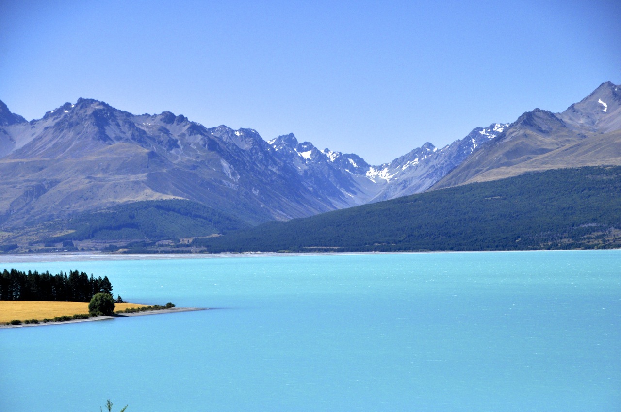
Wanaka and the Rob Roy Valley

Wanaka

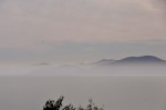
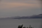
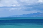
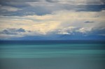
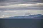
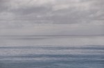
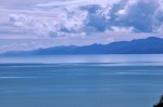
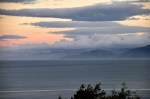
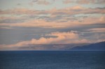
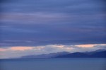
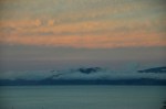
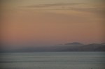
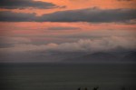
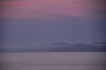
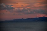
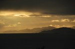
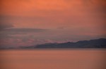
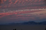
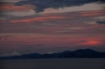
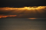
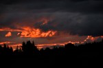
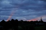
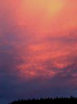
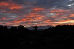
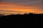
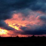
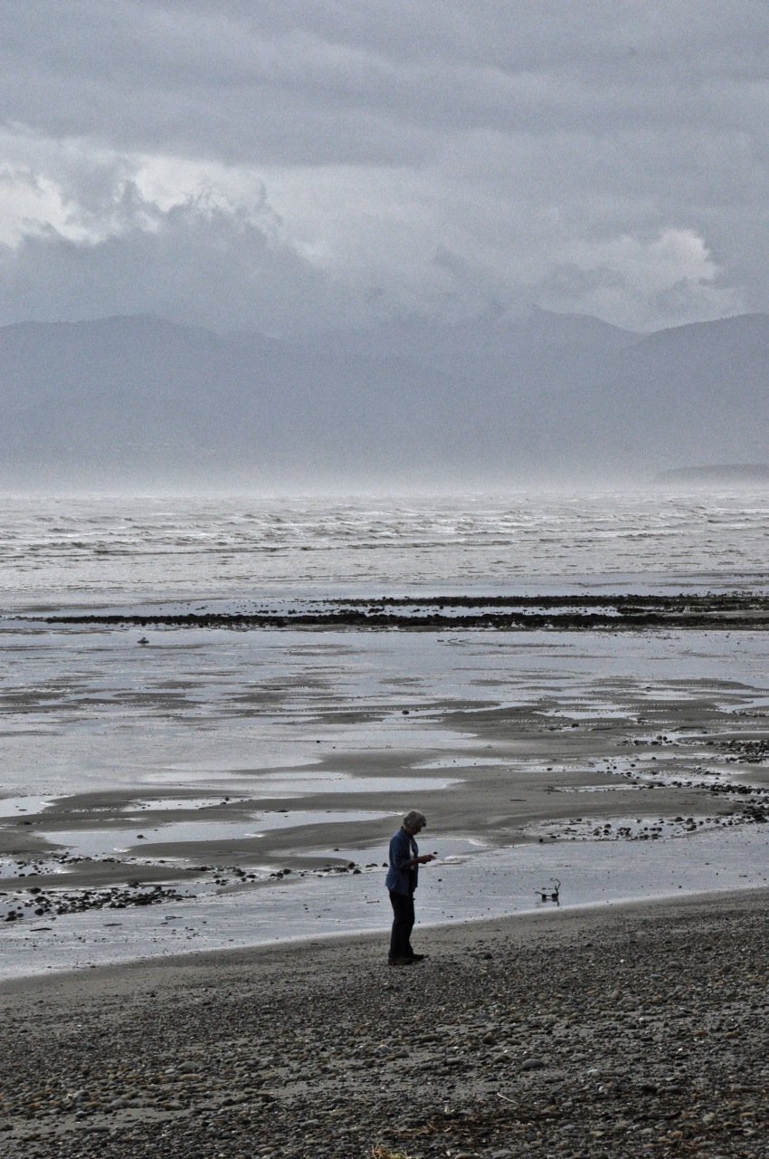
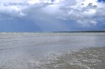
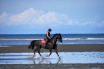
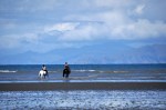
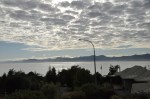
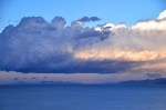
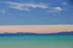
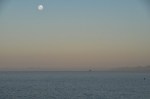
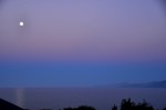
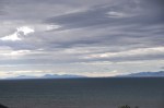
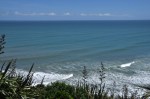
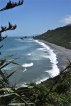
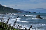
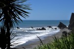
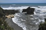
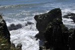
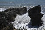
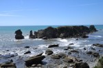
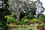
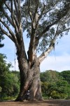
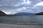
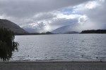
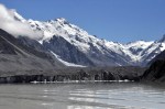
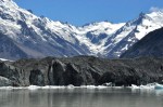
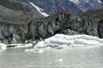
Wanaka is a resort town just an hour north of its better-known neighbor Queenstown, but happily it is not at all like that over-caffeinated tourist mecca.  Wanaka is quieter, with less crowds, less partying, and with far fewer stores hawking testosterone-fueled activities.  I admit Queenstown is prettier (which I’ll show you in a post soon), but Wanaka is pretty enough, Landis Passand a nice place to chill out for a week.  Getting there from Mt Cook takes us through Landis Pass, which is austerely beautiful.  Wanaka itself snuggles up against the lake of the same name, with the high and jagged peaks of Mt. Aspiring National Park visible in the far distance.  The pictures below show you the lake from Wanaka’s long beach (under different weather conditions, I might add!).

Downtown Wanaka
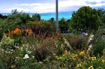
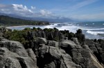
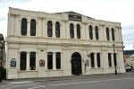
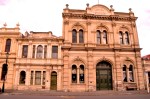
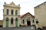
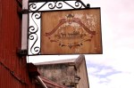
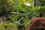
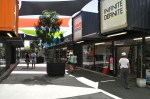
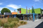
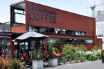
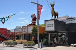
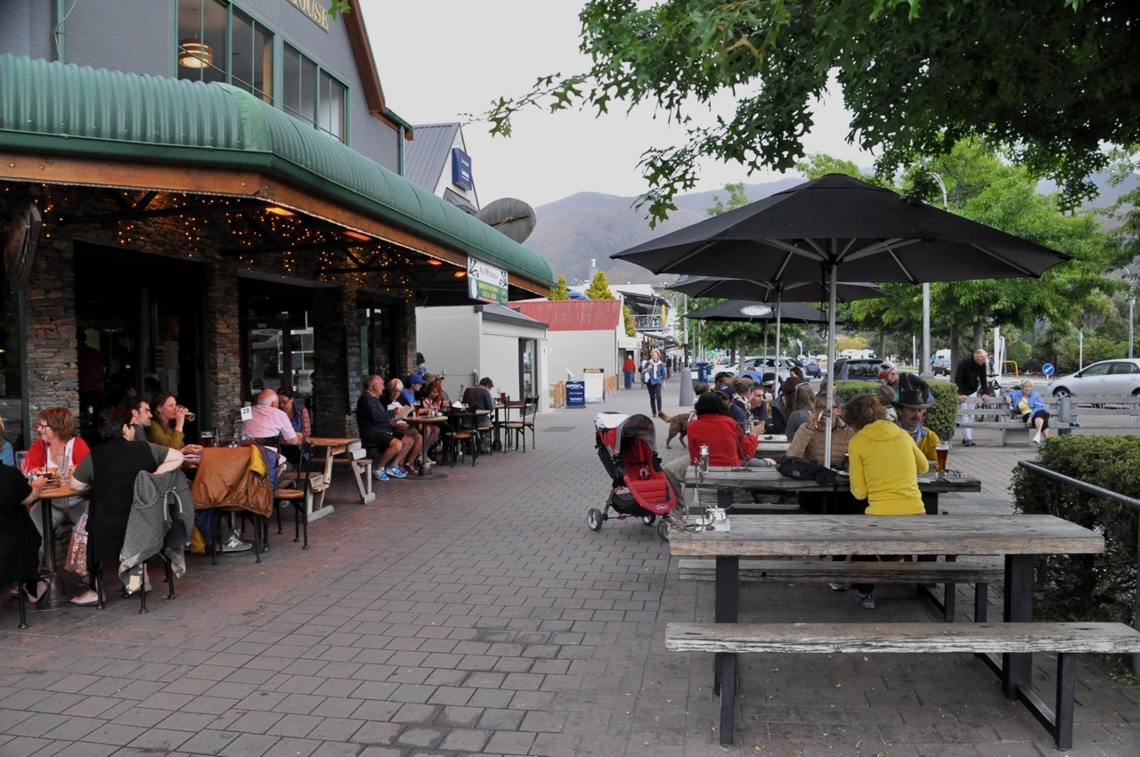
Downtown Wanaka is mostly a couple of streets with more cafes than anything else, displaying its touristy but low-key personality.  There really isn’t much to do in Wanaka other than chill, but it is a nice spot both for chilling and as a base to explore outlying attractions such as the nearby Rippon Vineyard, Central Otago’s oldest vineyard.   For perspective, it was established in 1982, nearly a decade before most of New Zealand’s Rippon Vines (nice location!)
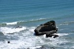
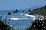
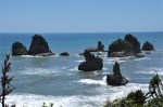
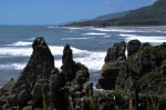
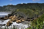
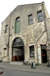
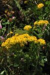
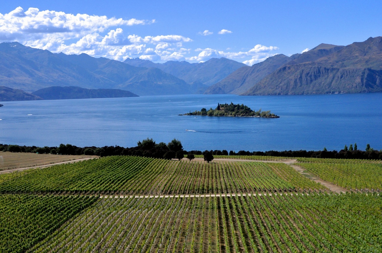
wineries (it’s amazing how young NZ is, in every respect).   If you begin to suspect that we have chosen this region for it’s wines, you’re partly right.  The Central Otago wine region is very far south, at a latitude where grapes would not be expected to do well.  However, the surrounding high mountains apparently retain heat and the valley reaches some of the highest, albeit very variable temperatures, in NZ .  This area produces some of the country’s best Pinot Noir (and Pinot Gris).  A number of small but very good wineries are located near the hamlet of Bannockburn, and an

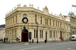
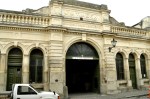
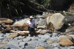
example of this area is shown above.  One particular winery, Mt. Difficulty, was amazing  – magnificent wines, very pricey, but we bought a few bottles anyway.  Didn’t someone tell us that life’s too short to drink cheap wine?  We also had an incredible and memorable lunch in their restaurant overlooking the vines – fabulous duck with their fabulous wines is about as good as it gets.  Some of the wineries in his region are very boutique – for example, Gate 20 Two, making great wines and selling them from their home – their “cellar door”, New Zealand-speak for tasting room, is from a desk in the foyer of their house!

Looks fabulous!
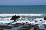
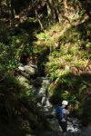
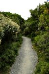
We decide to do a nearby hike, to Diamond Lake.  On the way we see Kiwis enjoying life up in the air, on paragliders.  They glide and soar wherever they want, and it is clear they could stay up there forever; must be good updrafts.  I’m envious, really, but there is something comforting about having feet in contact with earth, and hiking is good too.

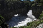
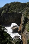
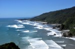
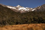
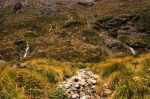
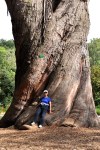
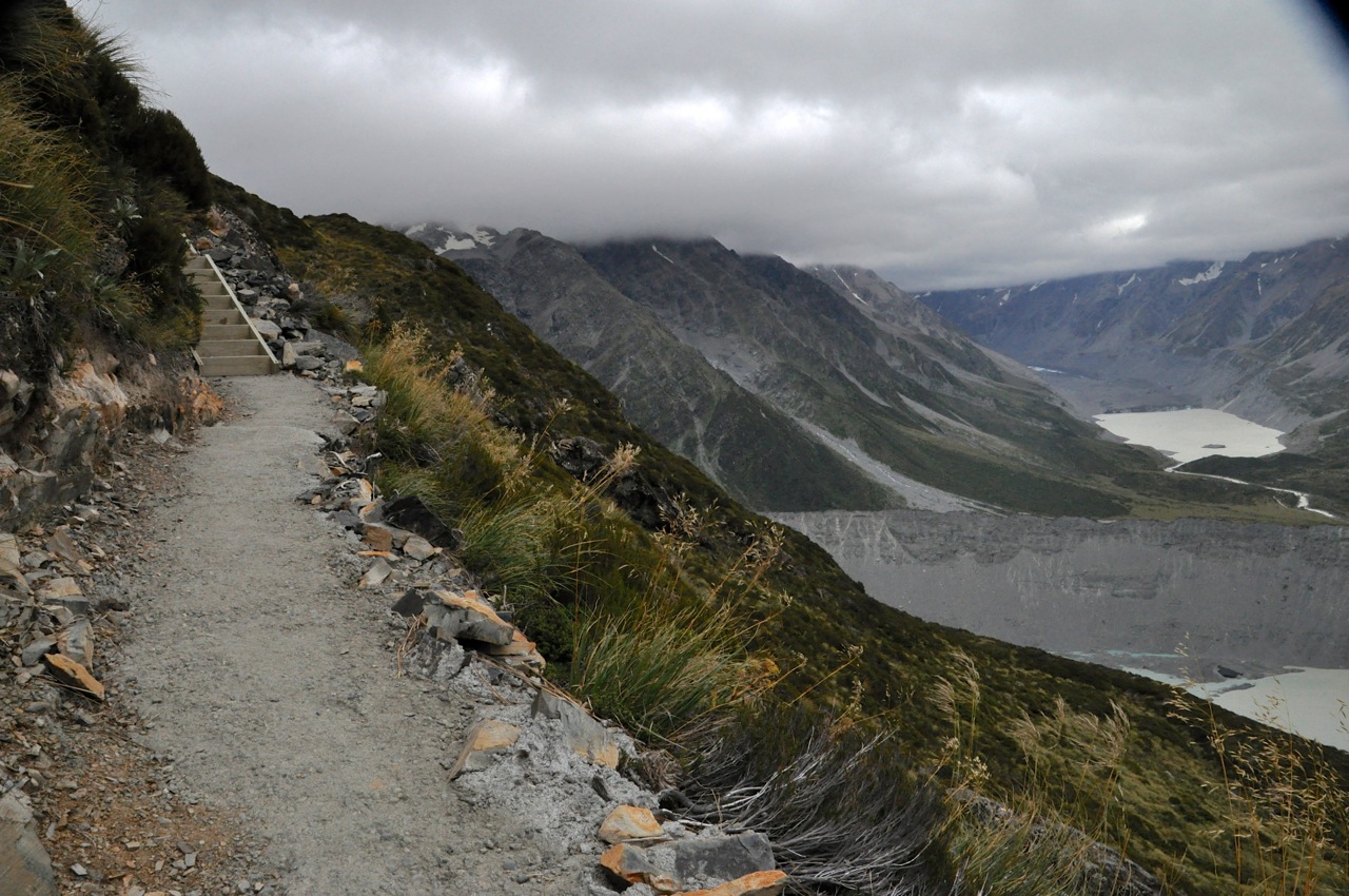
The hike to the lake is flat, and the lake (picture above) is nice, but the overlook beckons.  Unfortunately it is up, and up, using the ubiquitous D.O.C. stairs, and Ginger hates it;

which she voices more Diamond Lake from abovethan once, but gamely carries on.  The overview of Diamond Lake and the nearby mountains is very nice indeed, and worth the climb.  However, the trail Lake Wanaka
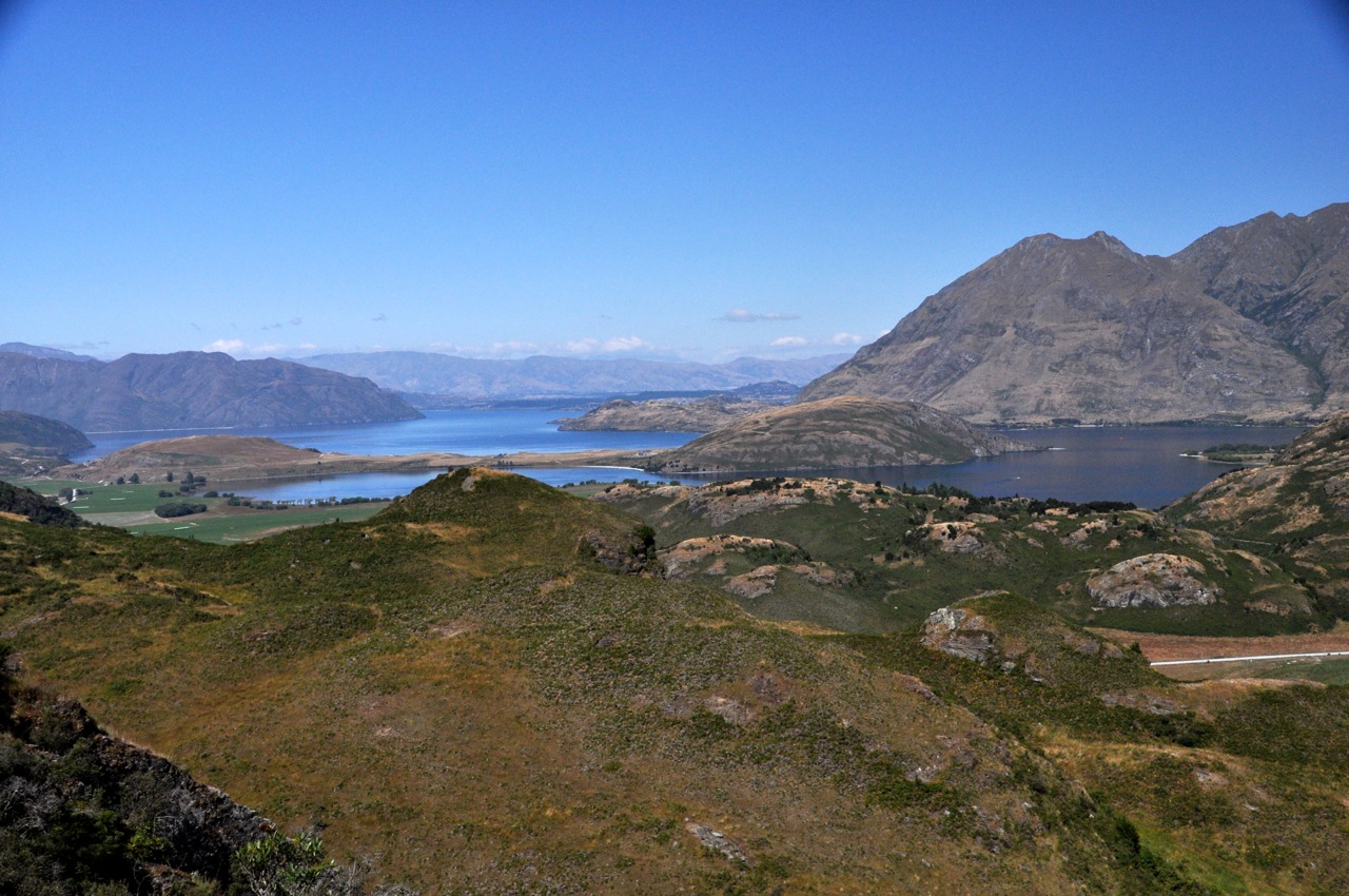
keeps going, beckoning us on.  Alas, it also keeps going up, and after awhile Ginger has had enough – but not before we get a nice overview back towards Wanaka.

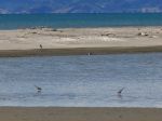
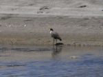
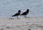
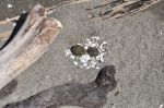
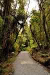
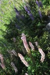
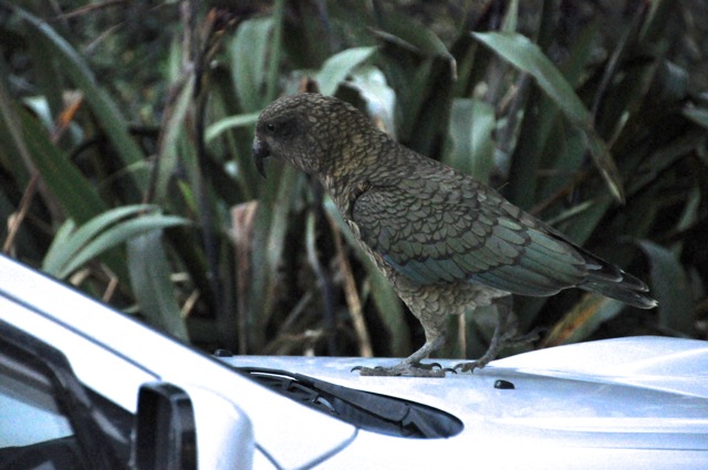
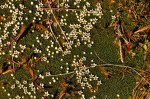
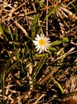
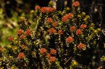
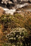
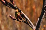
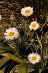
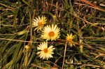
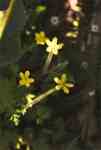
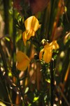
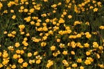
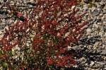
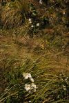
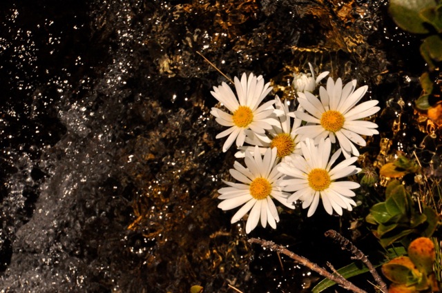
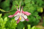
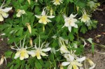
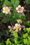
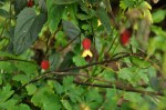
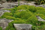
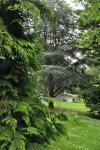
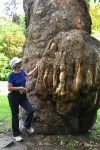
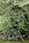
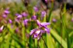
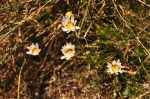
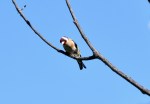
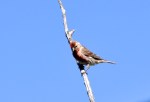
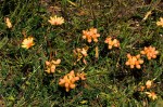
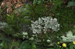
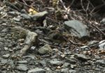
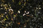
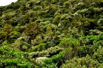
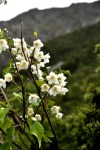
On the hike we’ve also observed some interesting plants and birds along the trail, as shown below.
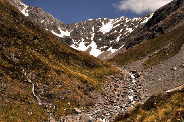
Rob Roy Valley

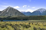
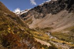
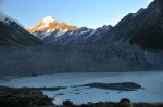
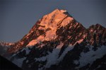
Mt. Aspiring National Park is one of NZ’s largest and is Wanaka’s outdoor playground.  Today we’re off to hike the Rob Roy Valley, listed as “an easy route into a dramatic alpine landscape that includes snowfields, glaciers, sheer rock cliffs and waterfalls”.  Sounds great!  Of course, “easy” is one of those relative terms, isn’t it?

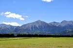
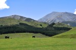
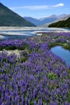
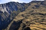
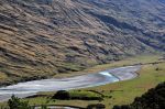
The hour ride to the trailhead is through grazing land surrounded by old dry mountains, with occasional impressive waterfalls.  The view straight ahead isn’t bad either, right

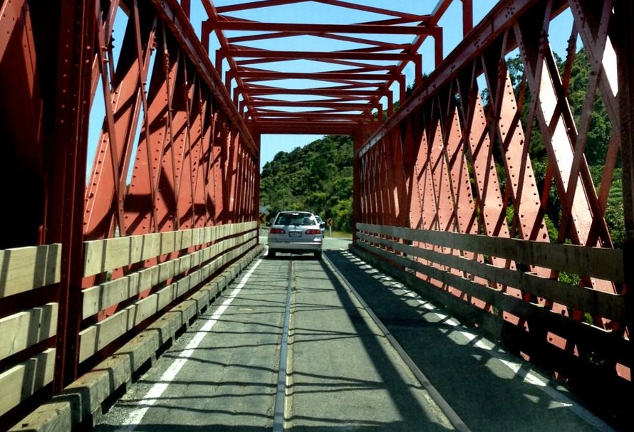
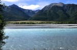
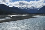
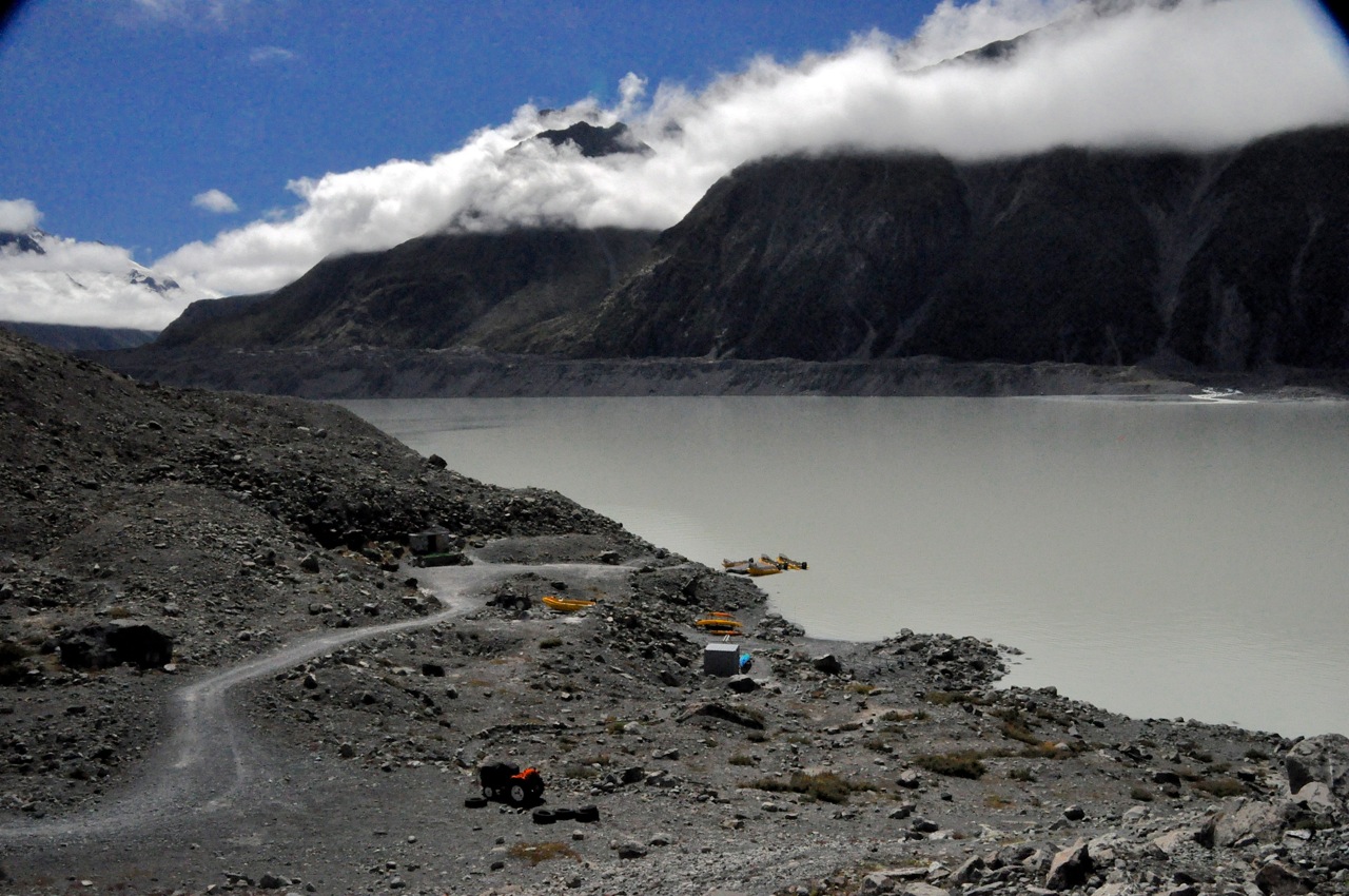
picture.  What we didn’t know then is that the glacier straight ahead is the one we’re going to hike to, and its kinda “up” more than “easy”.  Our road gives way to gravel for 2o miles, and it’s slow going because of the gravel, because we need to navigate past sheep, Not in a hurryand because we need to ford gulleys and streams – like 7 of them.  It’s not trivial!  We’re navigating water and good-sized rocks, and hey!  This is my car!  Not some rental!  Ginger offers suggestions on which rocks or holes to avoid, of course, in a stressed voice, which is very helpful.  Later we read the D.O.C. pamphlet, which says “The last 6 miles … is subject to washouts and flooded creeks which can make it impassable.”  I love the Kiwi understatement; I would think twice about doing this trip on a cloudy day, when getting into the park on this dead-end road was possible, but getting out after a rainfall was not.

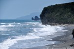
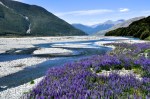
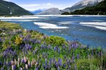
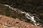
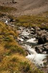
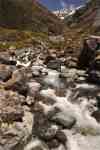
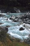
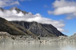
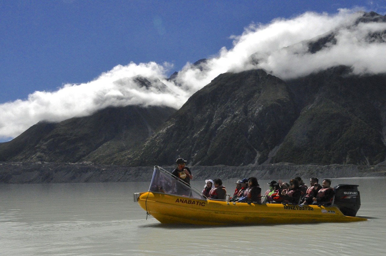
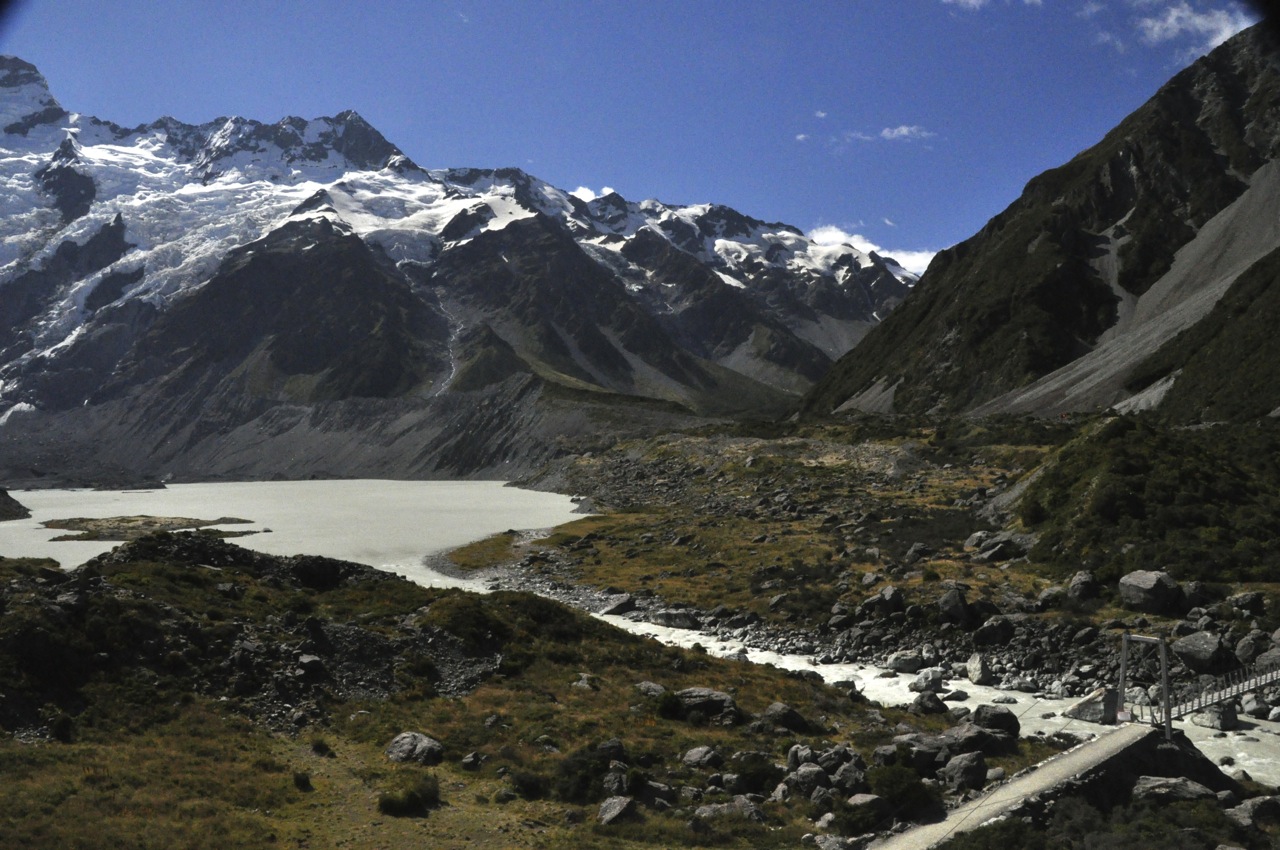
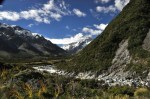
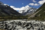
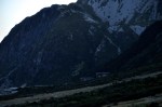
At last we’re at the trailhead, and it’s pretty.  The valley floor and mountains are impressive, the rock-strewn Matukituki River is adding a merry song, and a waterfall drops out of a mountain to complete the picture.

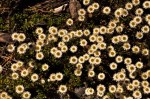
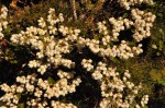
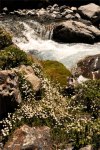
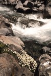
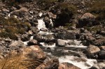
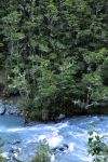
Initially the hike is through an almost-flat wildflower-filled meadow bordered by the Matukituki river crashing into boulders.

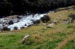
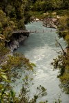
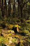
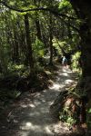
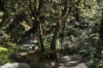
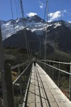
We cross the river over a swing bridge and begin hiking along a beautiful trail that parallels the gorgeous Rob Roy Stream.  The trail is 5 miles up, and not terribly steep, but it is 5 miles up!  However, hiking beside merrily singing water in a very green, very varied beech forest is a delight, as the pictures show!

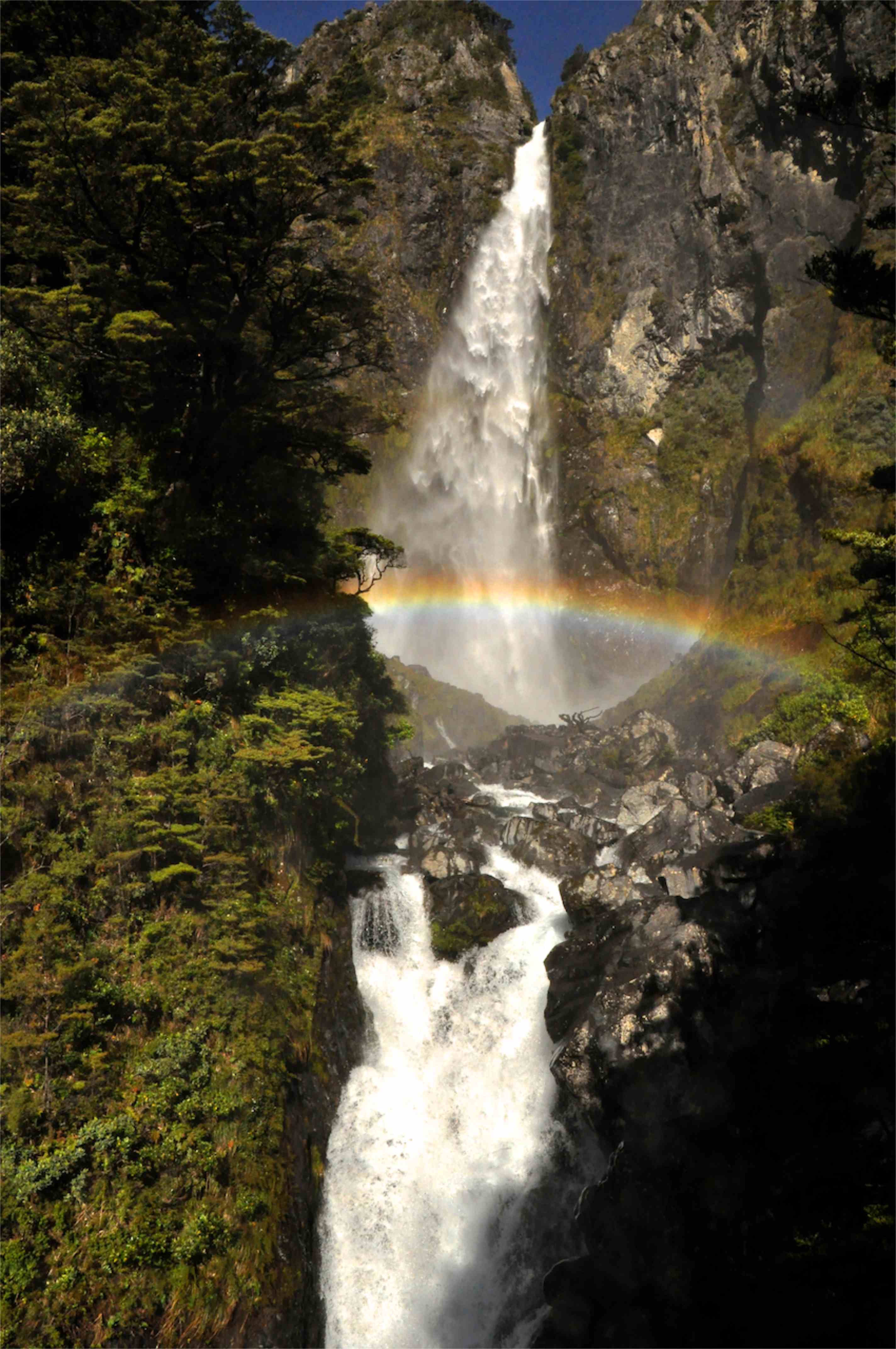
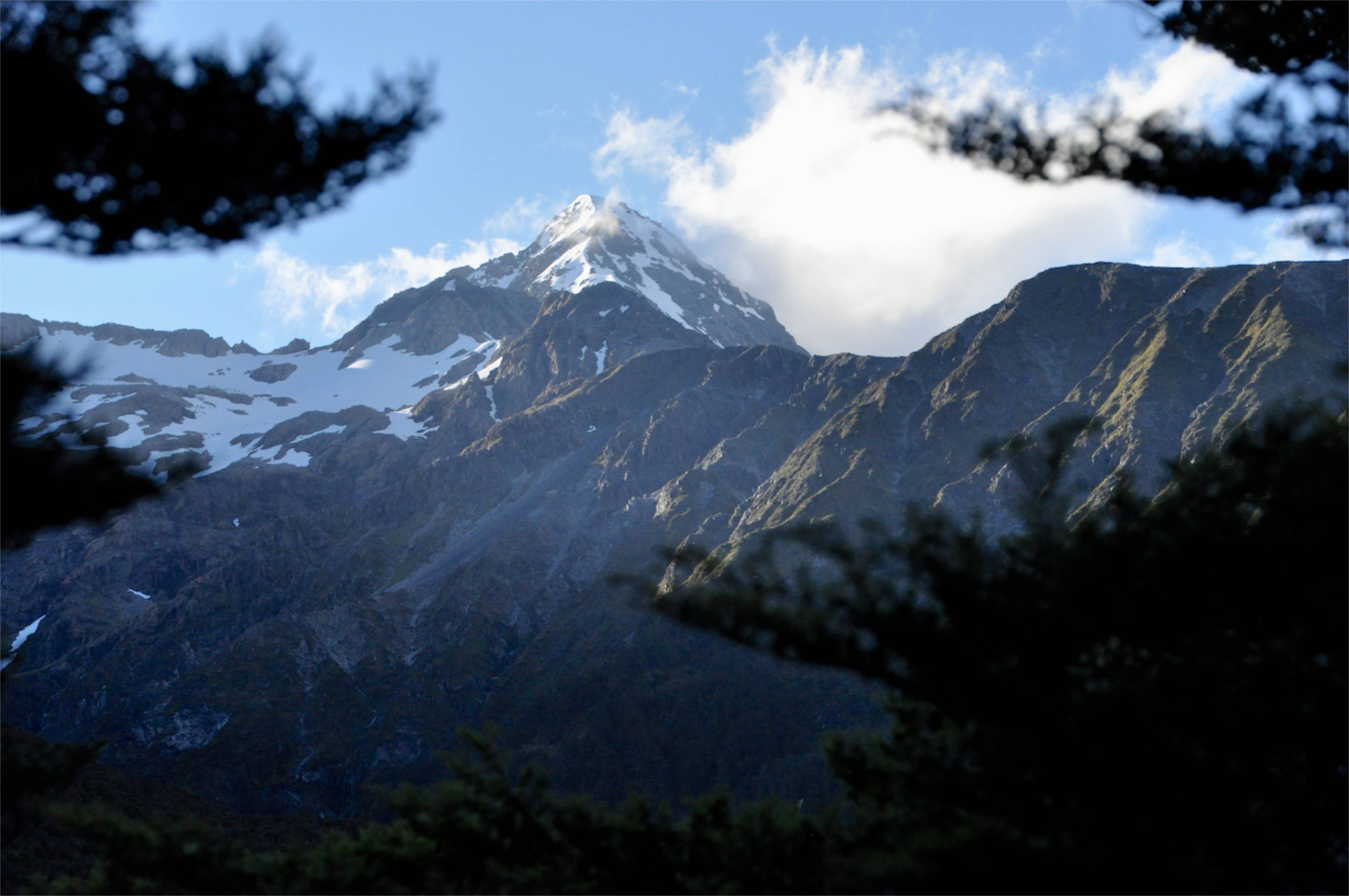
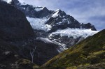
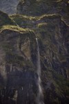
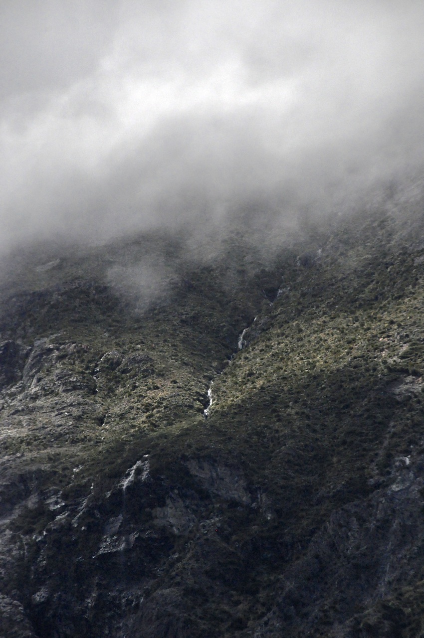
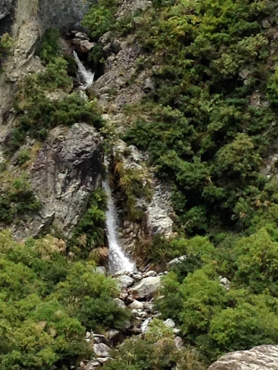
We finally come out of the forest and are greeted by a spectacular view of the Rob Roy Glacier on Mt. Alta.  Oh, maybe you notice the waterfall too?  It’s magnificent!

We disappear into forest again, and reappear with a better view of the waterfall.  The water is falling such a distance, it turns into mist at the end.  We’re captivated!

Nearing the trail end
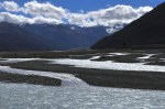
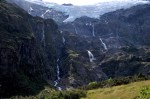
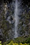
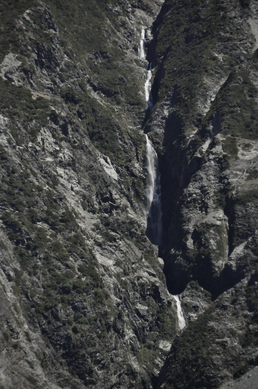
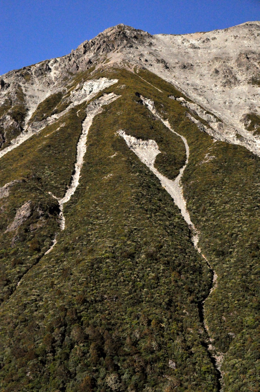
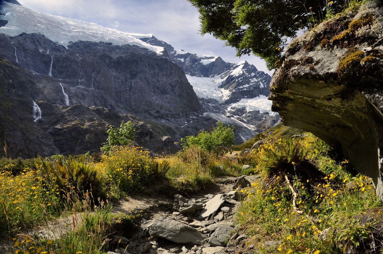
Then a bit more climbing up and down on a rocky trail like the one to the left, and we come to the view shown in the two images below ….  A wall of waterfalls pouring from the melting glaciers.  You need to mentally paste the two images together.

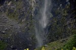
The mountains and waterfalls are truly amazing.  Alas, the trail ends here; we would have to bushwhack to get closer.  I’d love to do that, but it would mean fording the Rob Roy Stream, slowing the earth’s rotation to get more light hours, etc.,etc., so I must be content.  Below are close-up photos of the waterfalls.  It’s hard to know how tall they are, but I’m guessing some of them must be hundreds of feet high.

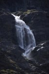
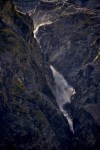
We’re starting to lose light, so it’s time to go.  As we start to hike out, I’m not quite ready to stop looking, so here are a few more views of my favorite two waterfalls.

The trail on the way back now has slanted light, and it’s as pretty as ever.  Maybe prettier.

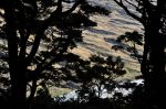
The slanting light of early evening transforms the Matukituki Valley into a play of color and shadow.

The trip out is through the cow pasture, with one cow guarding the gate.  Happily, no bull is in sight.   We moo a greeting and are allowed to leave.

However, it isn’t over yet!  There are more pretty sights on the way out –

and hurdles to overcome.

We thought it was a gorgeous hike.  Hope you liked it too.

Next post, Milford Sound!

Aoraki/Mt. Cook: Tasman Glacier and Hooker Valley

This morning we’re doing that rare thing, for us – taking a commercial tour.  We want to get up close and personal with a glacier, so we’ve booked a bus-hike-boat trip on Tasman Lake where we hope to see some icebergs that have calved from the Tasman Glacier, and hopefully get a close look at the glacier itself.
The weather in this national park is notoriously fickle.  Often a pall of low-lying clouds and rain hangs over the valley, but today it’s supposed to be clear.  From our bedroom balcony the day is starting out cloudy, but as seen below the views are still gorgeous (What a

wonderful wake-up view!).  Fingers crossed for clear skies, we hop on the bus and head toward the glacier.

Tasman glacier moraine plainA short bus ride later we arrive at the trail head (Blue Lakes Trail) and take an easy 20 minute hike across the valley floor.  The sky is clearing, but the land is desolate as far as the eye can see.  As Ginger noted in the previous post, the plain is the moraine from the retreating glacier, the debris is about a mile deep(!), and the fill is very loose.  So in spite of high rainfall, the water just drains through, effectively creating desert conditions on the surface.  It might as well be a moonscape, just gray rock, gravel and dust.

Tasman LakeWe top a moraine wall and there it is – Tasman Lake, an ominous gray color that we weren’t expecting.  The guide tells us the color is from rock flour, ground up rock particles that haven’t settled out yet.  We’ve seen rivers of gray glacial run-off, but never a whole lake of it!  It definitely adds to the forbidding nature of the landscape.  An interesting side note – the river that flows out of Lake Tasman empties into Lake Pukaki (see previous post); on the way, the water sheds the larger rock particles, leaving smaller ones that scatter light to give Lake Pukaki its other-wordly blue color.  Pretty amazing to give the very long and large Pukaki Lake that color, seemingly throughout.

Tasman lake, virtually opaque and with a temperature just above freezing, is devoid of any life and looks it with its cadaverous grayness, but the surrounding mountains and playful clouds are beautiful.  The last two images below show the back side of Mt Cook and its hanging glaciers.

Boat to the glacier frontWe’re heading off to the glacier front in a boat just like this one, and we’ve managed to snag the front seat!  There are icebergs on the lake today, but the wind has blown them all back to the glacier end of the lake.  As part of the safety talk, we are instructed to put our hands in the water for about 30 seconds; it very quickly becomes painful, and we can’t wait to pull our hands out.  Take-away lesson:  do not fall in!

WaterfallAs we motor out, we pass a small waterfall coming out of the clouds.  Pretty, but the main attraction is dead ahead.  Impressive!  The glacier fills the valley floor from side to side; it is crowned with a layer of rock debris, but we can’t begin to estimate its height – the mountains around it are too large to give a sense of scale.  We can’t get too close because 1) a calving chunk could send waves that might dump us into that frigid water (the glacier moves forward at a speedy 9 inches a day), and 2) a piece of the underwater shelf that extends up to 200 feet from the glacier could break off, pop to the surface, and flip the boat.  Definitely undesirable but highly unlikely – but them’s the rules.  Still, we get reasonably near, as shown below.

It’s time to look at some icebergs up close.  First we haul out some little ones.

Our guide fishes one out and passes it around.  We spot a bigger one, and she lets Ron fish this one out, with Ginger hanging on to his belt to keep him in the boat.  The ice floating in the lake is about 300 years old – it has taken that long to move down the glacier escalator – and the ice exists as large, inch-sized crystals, which you can begin to see in the last image above.  The crystals were originally formed under high pressure and low temperature, but once free of the glacier and at lower pressure and higher temperature, the crystals grow and air pockets form, causing the ice to appear whiter.  Some examples of iceberg crystals are shown below.

We were tugging on the iceberg in the picture below when it started to roll, causing the guide to beat a hasty retreat, but the iceberg righted itself (darn!).  It did give us a look at some of the underside, which was perhaps closer to original crystal size.

The air bubbles in the ice were also interesting.

Finally, below are pictures of icebergs with their blue hue.

WaterfallWell, we didn’t see glacier-front calving or shelf flipping, but communing with the icebergs was interesting.  As we hike out to our waiting bus, we notice a nice waterfall on a side mountain that we had missed.  Dime a dozen, eh?

It’s early afternoon, so we decide to do at least part of a hike that we haven’t done (we’ve done most!).  The hike goes down the Hooker Valley to Hooker Lake and, at it’s end, the Hooker Glacier.  More of the same, really, so we won’t go too far.  First, however, another look at the majestic Mt. Cook!  And on the right, the Huddleston Glacier of Mt. Sefton.  Awesome!

Mueller Lake and the first swing bridgeThe Hooker Valley trail goes up before it goes down; in the first picture we’re looking down on Mueller Lake and the first of several swing bridges that we’ll have to cross.  Pictures from the hike follow.

Mountain chessAs we’re hiking out, Ginger comments that the bush on Mt. Wakefield looks a lot like a chess knight.  Yes, it does!

Tomorrow we leave this gorgeous place, but I take a few last shots of the mountains at night, and later, of Lake Pukaki as we depart.  This has definitely been one of the high points of our New Zealand sojourn.

Aoraki/Mt. Cook National Park

The South Island is where NZ’s superlatives lie: it boasts the tallest mountains, largest river, deepest lakes, and wildest and most remote areas (some still unexplored, at least by modern man).  It also has regions that are the country’s driest, wettest, hottest, coldest, and windiest.  We’re going to the tall mountain region, the Aoraki/Mt. Cook National Park.  Aoraki is Maori for “cloud piercer”, and Aoraki is increasingly used instead of Mt. Cook, which is NZ’s tallest mountain at over 12,000 ft.

The drive into this central part of the South Island is definitely scenic.  The plants in the

right picture are tussock.  They’re protected, and quite beautiful, covering huge plains and growing up the sides of mountains.  There are a variety of types, including this red tussock.  Apparently they grow slowly; some plants are centuries old (!).  The plants blow in the wind like waves in the sea.  Mesmerizing.

On the way we pass Lake Tekapo, and are stunned by the amazing blue color of the lake.

It’s an other-worldly blue!  We stop to stare, and we are not alone.  People in RV’s have pulled up, taken out lawn chairs, and are just sitting and wordlessly staring.  A marvelous, incredible color; we are amazed and perplexed by how it could be.

Traveling further, we come to Lake Pukaki and the turn-off to Mt. Cook, and are blown away.  Lake Tekapo was just the warm-up!  The color of Lake Pukaki is other-worldly on steroids!  Surely it is Photoshopped!  Can’t be real!  I rub my eyes, it’s still there.

And to add to the spectacle, the mountains loom gloriously.  It’s a long lake, and the views

View on the way to Mt. Cookare just incredible as we travel toward Mt. Cook for nearly an hour.  For example, this picture to the left.

We’re thinking it can’t get any more spectacular, and then we go around a corner to see a craggy mountainside with a glacier glomming to it and waterfalls/rivers tumbling down.  Wow.  We begin to see why Edmund Hillary trained for Everest here.

We have splurged and are staying in the major (and historic) lodge, the Hermitage – as it turns out, a very good move.  The pictures below show the view from our bedroom balcony.  Awesome!  For perspective, there is a car on the road in the right picture.  Those rocks are big!

I decide to hike to an overview, Kea Point, to take pictures of Mt Cook as the sun sets.  Ginger points out that means hiking back in the dark and she won’t go, but she’s a pessimist.  The view from our room as the sun starts thinking about setting is amazing.

The hike to Kea Point is just a few miles and is uneventful.  The overview is interesting.  As you’ll see in the pictures below, Mt Cook is straight ahead, but in front is an enormous trench (and small lake) created by the retreating Mueller glacier, which is out of sight around a bend.  The wall on the other side is the “lateral moraine”, debris left by the retreating glacier.  It is an impressive wall of debris.  Mt. Sefton is to the side, and the waterfalls from the glaciers are fascinating.  It is impossible to know the scale, but the waterfalls must be hundreds of feet in height.  Finally the sun sets on Mt. Cook, and the view is nice, but not as impressive as I had hoped.  Alas, on the walk back I miss a turn and walk a couple of extra miles, costing me daylight, and I end up twisting the same stupid ankle in the dusk.  Could Ginger have been right?

Aoraki, Cloud SplitterThe next  morning we are greeted by Mt. Cook.  It is posing for us – Aoraki, the Cloud Splitter.  It’s magnificent.  For Maori, the mountains are sacred; I’m not far behind.  Mountains are so old, and so awesome.  In their womb they were simple sediment, compressed under enormous pressure when the world was under water.  They were born by cataclysmic forces of heat and pressure and volcanoes and tectonic plates, brutally thrust upward with unimaginable force to these incredible heights, and aged by wind and water over many millions of years so that we could one day stare at these monuments – these crystallized forces – that silently dwarf humankind’s silly bravado.  I stare at the mountain’s timeless grandeur, and I see America’s backwards politics and petty strutting and our daily big concerns for what they really are – little insignificant blips in the story of this planet.  When there’s a rock like that in front of you, you can only stand there, mouth agape, and make space in your head for something akin to religion; like the Maori.  Below are a few more pictures of this marvelous valley.

That ankle seems to serially sprain, so I decide to have it looked at in the nearby (hour away) town of Twizel – which allows me to drive along Pukaki Lake again.  The sky is different, and the lake color is different, but it is still other-wordly.

Alert!  This is Ginger now.  While husband is off seeking succor for his self-inflicted wounds , I decide to take a short hike through Governors Bush, just a 10 minute walk from the hotel.  It’s cloudy and threatening rain, but my jacket is waterproof, so I head out, expecting an easy walk around a garden-like area.  Instead I discover I’m heading rapidly uphill on some of the DOC’s infamous stairs.  Oh, well, so much for a leisurely morning mosey.  I decide to snap some pics with my iPhone, so Ron can see what he missed.

The walk up this hillside “bush” is a stark contrast to the arid plain below.  Here everything is lush and green, an abundance of ferns and mosses, lichens on rocks, and epiphytes hanging from the tall trees.  I discover later that there is, indeed, plenty of

 rainfall in this area, hence the lushness of Governor’s Bush.  The plain, however, is arid because it lies on a very deep, very porous moraine, and has only a shallow layer of topsoil.  Water simply pours right through, leaving desert conditions in a rainy land!

After a bit of climbing, the path begins to level out (left picture below).  It’s lovely, but dense enough that I don’t think I’ll find any mountain views.  I’m not far from wrong, although I do catch an occasional glimpse of the peaks across that arid plain, and the clouds playing Ring Around the Mountain with Mt. Aoraki.

The DOC has labeled some of the plants and trees.  It’s kind of fun to be able to see their names -Turpentine Scrub, Bog Pine, Bush Snowberry – though I know I won’t remember them for long.

The path meanders through the upland forest for a while, but what goes up must inevitably come down; I round a bend and begin descending through the forest;

the understory becomes more & more densely crowded with ferns, many I’ve never seen before .  Unfortunately, only one kind, seen earlier on the trail, has a name tag (left picture).  Others remain unidentified. 


Later in our travels I see the relatively rare Prince of Wales fern, which looks a great deal like the last fern pictured.

Small waterfall

On the way down the trail I’ve caught glimpses of a waterfall across the river; when I emerge from the woods, I decide to get a better look and bushwack up the river bank to find it.  After some rock scrambling I locate a spot with a clear shot.  The falls is relatively small, but still quite pretty. 


There’s an added bonus – on my way back from the falls, I discover a picturesque stream, incredibly clear, dotted with bunches of yellow monkey flowers.

I head back up the hill to the hotel, pleasantly tired and ready to put my feet up for a bit while I await the return of my wounded warrior.

Well, the local doc thinks the ankle may have a tendon broken, but it feels pretty good moving back and forth (less so side-to-side, but it’s taped to resist that; the doc says to see an orthopod when we get to Wanaka).  She also says I’m OK to go, so I’m off on a hike.  Ginger says she has had enough for one day, so I am on my own.  I decide to do the hike to Mueller Hut – I saw the trail-head on the way to Kea Point.  The hike is listed as “challenging”; just 6 miles RT, but it’s vertical; a 3,000 ft ascent, taking 6-8 hours.  I don’t have that much time by now; it’s 2pm.  However, 1800 ft up is the Sealy Tarns, and I can do that.  That part of the trail is dubbed “stairway to heaven” and includes 2200 steps.  Oh boy.

The trail starts off pretty nicely, as shown in the picture below, top left.  The canopy of trees is mixed, and there are a number of different shrubs and plants with small white flowers.

And then come the steps.  And more steps.  Oh my!  And more steps.  I am impressed by the industry of the DOC (Dept of Conservation) that builds these trails.  The trail is very,

very steep indeed, and steps are an efficient way to go up.  And up we go, oh so efficiently!  Perhaps you can see from the angle of the hill how steep the incline is!  Sometimes I can put my foot on one step and touch 6 steps up with my hand.  That’s not stairs, that’s a ladder!

Since you can see just pieces of the view in these images, here’s a better sample.  It’s pretty up here.

Poured concrete path, 'way up highI continue to go up, and I’m approaching the cloud ceiling, and whoa!  Way up here, nose-bleed height, and the DOC has decided to pour a concrete path on the trail!  Yikes!  Who carried the bags of cement, water and wheelbarrow?  The DOC is impressive indeed – or perverse, I suppose, if you work for them.  Come to think of it, I’ve had bosses like that ….

And then suddenly I round a switchback, and I’m there.  The Sealy Tarn is disappointingly

small – a pond really – but the view around is not bad, shown below.  It’s similar to what you’ve already seen, just from a little higher up.  Can you see the blue ice in the glacier dead ahead of the Sealy Tarn, shown in the last image below?  It’s visible even in this dull overcast light.

Pretty cool.  The trail continues up, a little rougher and sans steps, but this is it for me.  There are pretty flowers around, all white.

Time to go down.  Oh yeah.  This is not going to be fun.  Below are pictures of the trail going down – steps going to steps going to steps, as far as the eye can see.

As you have seen, I am flirting with bad weather on this hike; it has been threatening rain, and on the way down the rain lets loose over the valley, left image below.

I’ve got to make it to that parking lot before it beats me there, so I hurry on.  I make it with just a few raindrops encouraging my pace.  The last image shows the clouds settling in as daylight ends.  What a fun and unique hike!  And the ankle did fine.

Receding hills, view from Ruby Bay balcony

The view of Ruby Bay from our house is gorgeous – and captivating.  The sea is a chameleon, assuming every color you can imagine.  Further, its appearance changes over even short times, as clouds play with the light.  There must be a lot of factors at play to create what we see – clouds, wind, rain, fog, sun angle, tide, humidity, probably temperature, probably others, but mix them together and you have nature’s kaleidoscope.  We are often spellbound – dropping whatever we are doing to gape.  Because the view is partially blocked by houses and light poles etc, I can only cleanly capture certain segments of the view in the camera, and these I will show you over the next few posts – so there will be a lot of photos, and very few words – the pictures don’t need them.  It is hard to believe how the same view can present itself in such fantastically varied and wonderful ways.  The world is amazingly beautiful.  And I must say, there are many many more pictures I could show you of this same view, all different.  I whittled the images down a bunch, and then Ginger made me cut those by half!  We argued more than a bit over a few.  But don’t despair if you want more – there are more segments to share!  Hope you like them as much as we do.

Next posting – view of the distant islands.

Our House in Ruby Bay

I showed you Nelson in an earlier post (The City of Nelson – location, location, location; Dec 27).  Besides being very sunny with a mild climate (it’s near the top of the South Island), it is very close to several National Parks and a goodly number of well-regarded wineries.  We loved it for those reasons, but the clincher was the fact that the area is drop-dead gorgeous.  Before leaving for points south (recent posts), we rented a house to better experience the Kiwi life from something besides a suitcase.  It is a great house, with fabulous views.  Prepare to be impressed.  I think I will do a number of posts just from our neighborhood – you’ll see why.
First, the neighborhood.  We’re in Ruby Bay – a bedroom community without a single store – 3 miles away from the tiny town of Mapua (population < 2,000).  Here the post office and the only small grocery store are one and the same, staffed by the same people.  Mapua does have a handful of restaurants, a gas station, a hairdresser, a drug store, and 3 bar/cafes.  If you really want anything, you have to go into the towns of Richmond or Nelson, 30 minutes away.
Our house in Ruby Bay is up a steep hill; it has a good view of Ruby Bay itself, with

Nelson visible across the bay.  It has 3 BR, 2.5 baths.  Everything is downstairs except for the master bedroom, bath and lounge (Ginger’s study).  The living room and kitchen are quite nice.

There’s also a dining room and (my) study.  There is a downstairs wood-burning stove for heat, but that is it for temperature control.  The Nelson climate is temperate, so no need for AC or furnaces.  There are LOTS of windows that open (no screens), and two of the (glass) walls in the living room open up (to porches), making the house very open-air.  As a corollary, some of our best friends are insects.  The living room glass doors open to a wood

deck that goes the length of the house.  The views from the upstairs (and downstairs)

across the bay are partially obstructed but not bad!  The place has quite a garden, going down the hill, some pictures shown below.  There are also fig, orange, tangerine

and peach trees, and a LOT of lemon trees, loaded with fruit, which we use to make fresh lemonade and limoncello.
One of the advantages of this place is an incredible sunset nearly every day; they last for an incredibly long time, and cover much of the sky (examples below).

Of course, for all of these the transitions were equally beautiful.  Let me show you just one:

View from restaurantOne of the most spectacular sunsets I’ve ever seen occurred while we were at one of the Mapua restaurants on the bay.  The picture left shows the view from the restaurant looking toward Nelson, taken a previous day over lunch.  It is a pretty place, isn’t it?  So we’re having dinner, and the tidal river turns an amazing copper color.  We rush outside, and the world is glowing!  I don’t have my camera, but Ginger has her iphone so we are saved!  The

first picture is looking in the opposite direction toward the sea, and the sky is all but exploding.  The view is not just in that direction; the sunset is 360 degrees beautiful.  I think you will agree it’s spectacular.  We watch it glow and fade, and then go back to our cold dinner – but that’s OK!  A small price to pay for that display.

Ginger finding jewelsAt the base of our hill is the Ruby Bay beach.  At high tide it’s a rocky beach, which Ginger doesn’t mind – she has quite a collection of pretty stones, not to mention shells and sponges.  Unfortunately I don’t have any pictures of the Bay at high tide, just low tide, but the low tide will do.  The Ruby Bay beach is not as gorgeous as the one at Nelson (the Dec 27 post), but it will do!  It has breakers and birds and views.  A couple of views across the bay are shown below.  The weather on our side of the bay can be considerably different from that in Nelson, particularly regarding rain, which can lead to interesting effects – including rainbows, also shown below.

Low tide is when most people come out to play, the “beach” being sandy then.  It’s a great place to exercise dogs and horses and people.

North of us, maybe 10 miles away, is the town of Motueka with a beach that is connected to a very long sand spit that’s a bird sanctuary.  It does have a lot of birds!  Getting up-close pictures isn’t easy, though; the birds are pretty shy, except for the ones attacking us for getting too close to their nests.  The babies are very cute!  I’ll have to add the bird’s names later.  Pictures below.

Finally, I want to show you the first of a number of retrospective studies that I’m going to inflict on you, that show in stunning colors why we love our house.  Now, we have lived with a view of the ocean before, when I worked in Italy.  It was nice to see the ever-changing Adriatic Sea, but we looked out directly into the infinite seascape, and the variations in color were, we know now, limited.  The bay is another story.  There is the open ocean, but in addition there’s the curving bay, with headlands retreating into the distance; and perhaps because of the land, there are clouds everywhere, reflecting light and creating shadows.  Combine water, waves, currents, reflections, shadows, fog, light, land, cloud shapes – and the scene is an ever-changing riot of color, re-inventing itself hour-by-hour, and totally captivating.  We stop and stare a lot.  I’m sure it’s hard to “get it” via words.  The pictures below are my introduction for you, of what I call the overview; a large-view presentation of pretty much the same area, looking out into the ocean, the receding headlands, and some islands, and taken on different days at different times.  It’s a “teaser” for what’s to come – but I think you’ll get the idea. None of these pictures have been altered – you’re looking at Nature in all her glory.

That’s all for now.  In the next few subsequent posts I’m going to simply do a few more detailed retrospectives of Ruby Bay and Nature taken from our balcony.  There will be a lot of pictures.  They will be incredibly beautiful.  You will want to live here.

The West Coast

The Southern Alps and the Tasman Sea define and isolate the West Coast of New Zealand, a 240 mile long, narrow (18 mile wide) strip of land inhabited by just over 30,000 people.  It is the wettest part of NZ, getting 12-30 feet of rain a year (yep, that’s feet), often at tropical intensity for days.  The inhabitants are called “Coasters”; many are descended from gold and coal miners, and with those industries gone, along with timber, there isn’t much left.  Coasters are known for their independent thinking (often at odds with environmentalists) and their intemperate drinking.  There is some tourism – a jade carving (jewelry) industry in the middle and glacier climbing at the end – but it’s mostly people like us driving through with jaws dropping, looking at 240 miles of drop-dead-gorgeous (and empty) beaches.  You’ll see.

HOKITIKA

After making it over Andrew’s Pass, we stopped at one of the three largest cities on the West Coast, Hokitika (population about 3,000).  It’s one of the two main cities for buying “greenstone” jewelry and art, and therefore firmly on the tourist agenda.  Tourist magnetGreenstone, what the Maori call pounamu, is a hard nephrite jade, usually containing a variety of green shades within it.  It is beautiful, and often carved in traditional Maori designs.  The Maori practically worshiped the stone – it took the place of durable metals – and the Maori word for the South Island is Te Wahi Pounamou – “the place of greenstone”.  It is still highly valued.  Mineral claims are jealously guarded (and coveted), and because the Maori retain rights to much of the source, there is some friction.  The export of greenstone is prohibited,  and illegal extraction has stiff penalties – fines up to $200,000 and 2 years in jail.

GreenstoneLooking at the jewelry is a treat!  Each piece is small-scale sculpture, with whirls and curls and twists and cut-outs and negative space.  The picture to the left shows an example of greenstone with its many veins and shades of marbling.  We think it’s beautiful.

In addition to its craft scene, Hokitika has a very nice beach.  The first two pictures below are from our hotel balcony, where we are serenaded by the crashing breakers; the lower right picture from a walk on the beach.

BYO what?Yes, it is a tourist town, but we are impressed by some of the innovation being shown, such as this novel concept at a bar.  We order a pizza to go from down the street, carry it to the WC, order a good bottle of NZ wine from their retail shop, and settle into one of their tables.  How cool is that!

We decide to take a side-trip to the Hokitika Gorge and its acclaimed turquoise Hokitika River.  It’s a scenic drive through farmland and nearby mountains.  A short walk through pretty bush leads to what is indeed a very very turquoise river!  It looks more like someone spilled a whole lot of paint upstream than

real water flowing by.  The color is formed by glacier water entering the river with a load of  ground powder from schist and greywacke rock (major rock of NZ).  Judging by the color, that’s a hard-working glacier!

ALONG THE WEST COAST

Well, in this segment I’m going to “beach you to death” with these pictures.  I am always mesmerized by the ocean – the infinite horizon, the parade of waves slowly moving in, unstoppable, the cresting breakers ominously rearing, the crash as they bash themselves on shore, the sucking retreat.  It’s nature’s slow ballet, danced with power.  To that, add beauty and color, black rock and white spray, wheeling birds and stately headlands, a salty smell and breeze; every sense of your body experiences the ocean.

The West Coast highway runs close to the shore, and around every curve there is another striking and atmospheric beach that beckons.  I stop so frequently to take pictures that Ginger starts to laugh at me.  I am making a big effort to limit the number of photos I’m going to jam into this post, but I’m not being very successful.  Let’s start with just a few pictures of the ocean itself, near and far.

Now I’ll show you a few beach shots.  They’re beautiful, many of them miles and miles long, and there really is practically nobody on them.

PANCAKE ROCKS

This is a bus-tour tourist destination within the Paparoa National Park – a stop-n-go place.  There is a large parking lot,  a souvenir shop, a cafe, a few cabins and cottages to rent on the surrounding hills, and not much else here!  Except, of course, the dark layered and weathered limestone rocks and a pounding surf.  It’s a pretty place.  We were impressed.   Pictures below.

WekaOh, and there in the parking lot we spot a couple of Weka!  They’re chicken-size flightless birds, and we haven’t seen them before.  They must be on vacation, catching the tourist sights like we are.

THE REST OF THE COAST

Well, believe it or not, there is more amazing coast to see as we head further north.  Ho hum.  More beaches.  Dime a dozen.  I’m stopping a lot less, partly because we have in fact seen so many, and partly because we have a ways to travel yet before arriving in Nelson, and Ginger is no longer laughing at me for stopping so much.  Rather the opposite, really.  Luckily, she did not pack the riding crop, but I get the message.  Pictures below.

Ruby Bay, here we come!  Wait ’till you see that pretty part of the world!

Arthur’s Pass

To go from the east coast to the west coast on the South Island, one has to deal with the Southern Alps that run down the spine of the South Island.  There are only 3 roads that make the crossing; we’re taking the highest one, via Arthur’s Pass.  Now that I’ve done that build-up, let me confess: it really doesn’t go that high.  The pass is just a little shy of 3000 ft. Goodness!  Of course the road does start from sea level, but c’mon.  No gasping for oxygen in thin air like the passes in Colorado, where you’re cold even in July.  In NZ’s defense, this is not their high peak region; maybe it makes some sense to build cross roads where the mountains aren’t so tall?

We’re heading “home” to our rented house at Ruby Bay near Nelson.  Time for a break from traveling.  To get there we’ll travel along the west coast, but first we have to jump the hump.  The road up is actually rather gentle without excessive turns; Ginger was a bit apprehensive given our experience going over mountains to Golden Bay (post “Abel Tasman National Park and Golden Bay”, Dec 30).

Hmm.  Let me diverge here and give some context on driving in NZ.  In addition to NZ’s aversion to a straight road, and in addition to everyone driving on the wrong side, there are other aspects to driving a car here that make it interesting.  For instance, the solid yellow line down the middle of the road that says you better not pass?  Those lines seem to be applied pretty much at random, and not very often.  One should never ever ever think that the dotted line here means it is safe to pass!  Dotted lines frequently go around blind One-lane Bridgecurves.  “Frequently” as in usually.  I trust my eyes only, and I avoid passing except at marked passing lanes.   Another example is NZ’s frequent use of one-lane bridges; some are more interesting than others, such as the one to the left:  like the others, it’s only one lane, but unlike the others, it is also used by trains – those are railroad tracks down the middle!  How does that work??!  Finally, most  roads here are 2-lane, bi-directional, usually narrower than back home, and with little or no berm; and like the US, most freight goes by truck.  However, here Big Mama, haulin'that means semi’s whiz past a couple feet away (feels like inches), at top speed; the wind-blast alone is slightly unsettling.  But it all seems to work (no crashes yet!).

OK, back to my story.  Initially the land around us is rather pastoral; we are not hemmed in by towering mountains.  The view reminds me of the cattle regions of Colorado and Wyoming, with mountains in the distance and the cows up close.  When the mountains do come to meet us, they appear

older and weathered, as shown above.  Hey, speaking of older and weathered, Ginger sneaks in a picture of me!  The mountains are covered in scree – a bitch to climb, probably.  They’re not exactly majestic, these mountains, but to this mountain-loving guy, they are beautiful.  As we go further, however, the mountains start to get Getting bigger!bigger and more impressive, as shown here.  The road at the bottom of the picture provides perspective.  Not bad, eh?  Glaciers eons ago carved up these puppies, and we appreciate all that hard work.

We come to a river plain that we must cross, and it is spectacularly beautiful (and photogenic, may I add).  The river is an impossible turquoise, obviously glacier-fed, but light glinting from the sun and reflections from the sky make it silver or blue depending on where you’re looking.  We stop to stare, and I take a lot of pictures, which I will foist on you.  The lupine is everywhere, creating a riot of color.  Wow.  Look at that river color and the mountains and the lupine.  Hope you enjoy it as much as we did.

We’re staying in the (very) little town of (of course) Arthur’s Pass, which is very close to the top.  It’s around 5pm, so we have time for a quick hike.  There’s one nearby called Devils Punchbowl, listed as short but steep.  Short is good, but Ginger is not sure she wants steep; I push, so off we go.  Very quickly we see that this should be a nice hike!  After a short walk to a suspension bridge, a gorgeous waterfall is visible off in the distance, and undoubtedly that’s where the trail is going.  I’m excited!  As we get closer, it really is a fabulous waterfall, as seen in the right picture.  The water is falling in beautiful sprays,

and the rainbow moves around.  The trail disappears into the woods and becomes quite steep.  Perhaps in the picture below right you can see that there is a wooden staircase at the end of the rock steps?  I’m not used to stairs on a hiking trail; the commitment to good trails in NZ (Dept of Conservation) is impressive.  Ginger, however, is not a fan of stairs

on a trail, particularly when the risers are not consistent – her arthritic hips complain – and she tells the DOC,  just in case they’re listening, what they can do with their stairs.  She’s actually not sure she wants to go on, and tells me to go ahead, she’ll make up her mind after resting.  So off I go.  When I emerge from the forest, The waterfallthe waterfall is right there and does not disappoint.  It’s really two falls, an upper and lower, as shown.  It’s not possible to get both in the camera frame.  It’s also really hard to photograph – the trail goes to a wood platform that’s built out over the river, which I’m standing on, but the spray is blowing right into me, and I’m getting soaked.  I take a picture, retreat, wipe off the lens, and repeat.  I feel like a shampoo ad.  The rainbow moves around with the spray, and goes bright and dim, but it is always there.  It’s gorgeous, and I wish Ginger could see it.  I start back down the trail, and lo! Ginger is here!  She made it!  We marvel at the beauty together, and she asks whether I’ve noticed that the mist is soaking us.  Eh?  Speak louder, I have water in my ears.  Time to go back before they stop serving dinner.  Ginger counts the stairs on the way down – 352 each way, she tells me.  But it’s worth it, right? I say, ducking just in case.  Below are a few more pictures of the falls.

MountainBack at our (rustic) lodge I take a picture of the mountains above us as the sun is setting.  Hmm.  OK, maybe I was wrong earlier about these mountains; majestic does apply here.  It’s an impressive view, and a challenging chunk of rock.

I also see a Kea, the world’s only alpine parrot and Keareputedly the most intelligent and entertaining bird on the planet.  It has an inexhaustible curiosity, which leads to mischievous behavior.  Examples, we are told, are pulling the nails holding corrugated-iron roofing on,  eating rubber windshield wipers off of cars, or turning hiker’s boots into a pile of leather strips and shredded laces.  Their cuteness and curiosity and intelligence means they quickly learn how to play to the tourists, but being fed by tourists is also leading to their demise, as they lose the ability to forage for themselves in winter and they are drawn to the dangerous roads.  Total Kea population is about 1-5 thousand birds.

The next day, as we continue westward, we decide to do the short Beasley Valley Track, which goes to the Beasley Chasm, touted for its river cascading over huge boulders and for its views of Mt. Rolleston.  It is a nice hike, as the pictures below show: nice river, nice mountain views, and pretty flowers.

We travel further to the Dobson Nature Walk, right next to the highest point of Arthur’s Pass.  The Nature Walk is short, highlighting subalpine and alpine plants.   It’s a loop, climbing up a hillside, and except for the stream at the bottom, it’s very dry.  It does have a good variety of flowers (most of which we can’t identify), but not in great profusion.  Pictures below:

We go for a final hike, the Otira Valley Track.  It follows the Otira River up a deep valley on the north side of Mt Rolleston.  Ginger decides she has had enough hiking, thank you, and is gracious enough to wait while I do it (estimated time is 1.5 hours).  The trail is mostly up, but it isn’t terribly steep.  It is, however, quite tricky; lots of rocks protrude, or you’re crossing scree, or the trail is practically hidden in vegetation, with (unseen) sharp drop-offs to the side.  Also, there are a lot of small waterfalls streaming down the

mountain side and then snaking their way to the river – across the path.  Crossing these small creeks is a bit tricky in parts, tiptoeing across rocks in a narrow path, and sometimes the streams are even hidden beneath the vegetation until you’ve stepped in them.  Thank you Gortex!  The trail is a good test of balance (which, I note, is not as good as it once was).  This effort is rewarded by nice views.  Initially you’re above the pretty, if small, Otira river, but then the trail comes down to it and its delightful happy music.  Pictures below.

There is a lot of water everywhere, including underfoot.  As a result, there are also a whole lot of gorgeous flowers everywhere.  Most of them I showed you earlier on the Dobson Nature Walk, but the picture to theDaiseys and water left is just too pretty not to include.  I was actually looking for the white mountain orchid, which a couple ladies coming down the trail were excited about seeing.  Of course I have no idea what the orchid looks like, and, hopeful, I take pictures of a couple of new stalked flowers – but no, I missed it.  The stalked flowers

are shown above.  I do want to show some additional pictures of the Mt. Cook Lilly, which you saw earlier but which are plentiful and beautiful.  They’re big, and mis-named: they’re really the largest member of the buttercup family.  Let me tell you, it’s hard to believe that!  They have nothing in common with a buttercup that I can see!  You can find both kinds of buttercups here (yellow buttercups shown on the Dobson Walk), but the Mt. Cook Lilly is truly magnificent, as shown below.

They can grow to be 3 feet tall.  The plants are also interesting in their evolutionary adaptation to this harsh environment.  Like all plants they have stomata in their leaves for transpiration, which in other plants are on the cooler, shaded underside of the leaf to avoid too much water loss.  However, since the Mount Cook lily grows among rocks which heat up during the day, the underside of its leaves are often warmer; so it has stomata on both surfaces of its leaves.  It closes the lower stomata when the rocks warm up, opening the upper ones to the cool air, and then reverses the process at the end of the day.  Pretty smart for a pretty plant.

The footbridge across the Otira, shown earlier, is officially the end of the trail.  However, I’ve gotten here early and the view going forward is View going forwardcompelling, as shown below, and I decide to go a little further.  Further is across a huge scree bed, with large and very loose stones, so it’s difficult going and not without some danger of spraining an ankle.  Small scree is like big sand and you can just walk (and slide) across.  You kind of have to tack.  The big scree is a different matter; it’s as much hole as it is rock, and you have to test each stone before putting weight on it.  So going is slow.  Too slow!  I travel a bunch, and that The same view!compelling view has not changed much, as you can see!  It would be nice to see around the bend, but it isn’t going to happen, I’m out of time.  So back I go, with a pretty view in the homeward direction as well, as shown in the images below.  A good climb!

Ginger has been very patient in the hot sun-blasted car without water (I took it with me) – so I give her a big kiss (and the rest of my water).  Thanks, sweetie!

Oamaru and Penguins

Oamaru was a port town, once NZ’s 9th largest town, with a bustling trade in grain and timber.  Lamb and mutton were first frozen and sent to the UK from here.  It was a commercial center for NZ’s gold rush days, and an immigration destination.  The town was also blessed with a nearby supply of cream-colored limestone (whitestone) that was easily worked; given the prosperity of the times in the mid-t0-late 1800’s, and the presence of able and imaginative architects and stonemasons, Oamaru became “The Whitestone City”, both in its commercial business buildings and its grain and wool warehouses.  Today it’s a sleepy little town (population <13,000) with one of the finest 19th century streetscapes one can imagine.

Penguin CrossingIt is also the home of both blue penguin and yellow-eyed penguin colonies, the main reason we have come here.  The road signs suggest they’ll be easy to see.

THE PENGUINS

Oh, let’s start with the penguins!  They’re breeding now, with nests on land. The parents leave the nest early to go fishing and come ashore at the end of the day to feed the chicks.  The yellow-eyed penguins come ashore in the late afternoon/evening, the blue penguins at nightfall.  The problem is, the penguins are (purportedly) skittish and will not come ashore if they see humans; and not coming ashore is a negative from the chick’s point of view.  Accordingly, The beachthe viewing platforms for the yellow-eyed penguins are pretty high up on a headlands, as you can see from the picture of the beach there on the left.  A little disappointing not to get any closer, but we’ll see.  There could be hundreds coming ashore.

After waiting for awhile, staring at an empty beach and jockeying for position in the small crowd, someone sees a single penguin come ashore.  Penguin?  Where?  Perhaps you can see from the 2nd beach picture below that this auspicious landing is a little underwhelming; if you look closely, the penguin is that little dot near the center of the picture.  We are not close, although we have brought along a Lone Penguinpair of binoculars (that we share with others in the crowd).  Still, more penguins will be coming; but then to our horror we all see a lone human male who has ignored all the posted signs and is walking on the beach.  Our penguin immediately turns and runs back to the sea and is gone.  The male walks to the edge of the greenery and sits down to wait.  Oh great.  The small crowd discusses lynching, but that means going down to the beach.  After we wait awhile longer with nothing happening, we decide to give up and go for dinner.  As we walk out, we spy another penguin coming ashore, and the path has taken us to a point just opposite his position.  We’re actually pretty close!  Yellow-eyedThe picture to the left shows what a yellow penguin is supposed to look like, and although we’re too far away to see the yellow eye band, we can easily see that this is indeed a yellow penguin.  He’s really cute, with very pink feet.  He’s in no hurry, and we get to see him leisurely strolling in and grooming himself; apparently penguins get air trapped in their feathers that needs to be squeegied out.

Check off seeing the yellow-eyed penguin, but seeing the blue penguins is another matter; they’re the smallest of the penguins, and they come ashore when its dark or nearly dark.  They can be found all along the coast of NZ, including the North Island, but a whole lot of them (two colonies!) are here.  One colony nests somewhere near the Oamaru wharf and is off limits, but apparently penguins will nest anywhere they want, thank you, which means they will nest just about everywhere.  So if you sit patiently along the Oamaru shoreline around dusk you can maybe see a few waddle past.  Well, “patient” and “maybe” is why I don’t like fishing.  Alternatively, for $40 one can sit in the grandstand of the Penguins Crossing visitor center that’s equipped with red lighting (blue penguins don’t see that spectrum) and watch a hundred or so come ashore and walk a few feet in front of you.  Now you’re talking!  The only downside is – no cameras allowed!  Too many idiots with cameras with flashes have ruined it for all.  I am crushed, but this should still be great.  And it is.

We take a daytime tour; there are a lot of penguin nests (50? 60?) actually at and around the visitors center, many in a central courtyard, but they’re off limits and one must keep to the elevated boardwalks that lead to the grandstand.  There is an exception, a room devoted to seeing 4 nests equipped with cameras (and red light).  One can actually lift a flap and look directly into the nests (3 have chicks in them).  And OH MY!  Penguin smell in the nests is pure ammonia and very old fish!  After just a minute my eyes are watering from the ammonia.  These are tough chicks, let me tell you!  They’re also small and fluffy.  A guide at the visitor center tells me there is a penguin under the boardwalk and I hightail it there and lay down to see, and sure enough there is a penguin just a few feet away, getting some fresh air.  He’s cute!

I can take a picture!  He seems to be more a gray color than blue, but apparently he has a head-to-tail iridescent indigo-blue streak down his back that I can’t see.

Evening comes and we get to the grandstand early to get front-row seats.  The penguins have quite a steep climb up from the water, over jumbled and large uneven rocks, with the waves crashing into them.  It looks pretty ouchy, but the guide says the penguins actually like to play with the surf.  Glad I don’t have to make that trip every day!  As it gets dark, the first “raft” comes ashore, about 20-30 penguins.  The penguins hunt alone, but when they approach shore they wait around until a bunch of others show up, and they come ashore as a group.  You can see them (dark shapes on the water) coming in, and then with a wave breaking, “pop” 4 or 5 of them are out and working their way up the rocks.  They are really cute!  They make it up the big rock incline and stop in the rocks just before a flat grassy area that goes past our grandstand and into the central courtyard.  There the raft congregates (those that aren’t going to their nests elsewhere), preening and milling and waiting.  I took a picture of a picture that comes pretty close to showing what this looks Are we we going?  Are we going?like (our rocks are lots bigger!), shown to the left.  The milling continues and tension seems to be building, and suddenly one brave penguin can’t stand it and darts for the safety of the courtyard, the others in close pursuit and looking for all the world like the Keystone Kops, and off they go right in front of us, the group waddling like mad, some occasionally falling on their bellies in their hurry.   There are actually just 2 holes in a fence that they have to navigate through, so the group bunches up and slowly funnels through.  Once inside it’s party time, and there is a whole lot of squeeking and crying and snorting and males fighting over a female and the nests welcoming them home.  Then all is quiet while we wait for the next raft.  Nearly 200 penguins come ashore over the next 90 minutes, and it’s fun to watch each time.

As we leave the center, there are a bunch of people and cars near a streetlight by the side of the road.  And here are three more penguins, with nests on the other side of said road, not sure what to do with the crowd around, but certainly not running away either.  The light is so dim it’s hard to focus the camera, but I watch for the Great Escape to occur – by golly, I’ll get pictures yet!  Everybody is about 20 feet back.  After gathering their courage the 3 Penguiteers nonchalantly saunter across the road until half-way across, and then for some reason there is the mad dash for safety!   Cute!

Penguins aren’t the only birds around.  There was a pretty impressive shag convention nearby as well, as shown.

THE TOWN

Downtown OamaruOamaru looks like any other small NZ town, as this picture shows, until you get near the center and see these fabulous whitestone intricately decorated buildings.  They’re all pretty much from the same era, built over a 20 year period starting around 1865, and they occupy several streets coming up from the wharf to the main business area.  Below are just some of the side streets – it feels like you’re on a movie set!

Below are pictures of some of the business-area buildings, along with a couple of close-ups of details.

The warehouse area is a bit grittier but the buildings are still amazing.

The shopping is also interesting in these old buildings, for instance this art gallery:

The jewelry is paua shell, from abalone.  Pretty stuff.

The Oamaru Gardens is also very nice (and large), giving a sense of the wealth that this city once enjoyed.  We were impressed with their unusual trees and extensive flower gardens, including what must be every color of columbine one can imagine.

STEAMPUNK

We had never heard of Steampunk before, and having seen it, we’re still not sure what it is.   Safe to say sculpture – and far-out psychedelic-like art.  How about fantasy mechanical, or wierd retro functional surreal stuff.  For instance, the futuristic/retro steam locomotive sculpture there in the front has wheels that turn while it emits smoke and flame.

I was more intrigued than Ginger, who was a bit put off by the musty building and its (real) burning-oil fumes.  The gallery consists of a poorly lit basement-like 1st floor, a small moldy basement, and an outside courtyard.  An example of the 1st floor gallery:

OK, let me show you Steampunk art.  I’ll start with some tame stuff:

How about this?

There are a number of projection stations, each on loops, the one in the basement against the wall/floor junction so that the image is bent:

More – art?

I’ll end the Steampunk presentation with the outside courtyard art.

So what can you say about Steampunk?  Maybe strange but interesting … or better, very very strange but interesting.

Next post – a trip over Arthur’s Pass.

Christchurch – Canterbury Museum and Art Center

Before showing you some cool museum stuff, let me first show you the wonders of serendipity.  We were walking in Christchurch’s Hagley Park (where the botanic gardens are located) when at the fringes we stumble onto a forest not of trees but of tents, some still being erected.  As it turns out, Christchurch hosts a big yearly wine festival here, which will be held in two days.  And we can walk to it from our motel room!  We quickly order the online tickets, a good thing since the event sells out not long after.  Close call!  The event was really good.  One can spend the entire day in seminars or the entire day sampling wine – we chose to do some of both, which meant that, alas, we tasted a miniscule fraction of the wines being poured – but greatly enjoyed those we sampled.  I’m not sure NZ makes a bad wine.  One of the very interesting seminars was hosted by Riedel, makers of stemware, who was showing how much the shape of the wine glass affects the sensory perception (and enjoyment!) of the wine.  Yeah yeah, you’re selling glassware, but we are a bit curious.  Oh my gosh!  The effect is in fact huge!  Did not expect that.

OK, the museums as promised.  The Arts Center is still damaged, but the city has rented rooms (and shipping containers!) across (as in, spread out across) the city, and staffed with Arts Center employees so they have something to do.  So think of an art museum spread out the size of a city; if you thought winding your way through a gallery was tiring, try winding your way across many city blocks and climbing flights of stairs!  The Art Center is contemporary art, much of it too out-there for us (think Andy Warhol), but the sculpture below (by Peter Trevelyan) was fascinating.  It protrudes several feet from the

wall, unsupported, and looks like a topographical rendering of hills in the distance.  It is created from 0.5mm mechanical pencil lead, glued invisibly together at their ends.  We are impressed.

Our last show-and-tell is the excellent neo-Gothic damaged-but-still-functioning Canterbury Museum.  It has a nice collection of fossils, several shown here.

The museum’s strengths are its Maori and Antarctic collections.  Whereas other museums we’ve seen have focused on Maori art (see earlier posts of Sept 26 (Auckland Museum [Mostly Maori]) and Dec 5 (Wellington City and WOW!), this museum looks more closely at the daily lives of the Maori – a stone-age, warrior-class people.  It is fascinating.  Apparently the incessant tribal warfare did not occur while the large Moa birds were alive (left picture), Moathe Moa extinction occurring around 1500.  It’s hard to imagine food being scarce in NZ, with its extensive coastline, but remember there aren’t any mammals; no deer or rabbits (although there are seals), so apparently population growth and resource scarcity led to the warfare.  The museum focuses on Maori life from the 1500’s to European settlers arriving in the 1800’s.  From river-mouth locations, the people moved to defensible headlands with good fishing and gardening nearby.  The village was only as big as the fort (pa) allowed; food was important, but survival under constant attack more so.  Island of Motuaro, 1770If you remember from earlier posts, the Maori were vicious.  The picture to the left shows a pa on an island drawn in 1770; even on an island you had to have a pa.  The dioramas below show daily life, a woman weaving a flax rain cape, another preserving birds for storage in the raised structure.  In the background is the pa (picture on left).


The Maori had a very well-developed stone-working technology – much needed for food and warfare.  I confess I remain astounded that cultures like the Maori and the American Indian remained mired in the Stone Age and never discovered metals like copper.  They certainly developed a sophisticated stone culture, with different stones for different tasks.  Jade (pounamu) was the stone of choice for hardness and edge, and became quite a prized material.  Found only on the South Island, when North Islanders saw it being used as an adz and were given some, it didn’t take long for a raiding party to wipe out the gifting tribe.  Some pictures of their stone technology are shown below.
For 300 years warfare was hand-to-hand combat using clubs and spears, examples shown below (the jade was also used for jewelry).  One can imagine, then, the upheaval in this

warrior culture with the availability of European rifles in the 1800’s.  As alluded to in a previous post (Sept 24, The Maori), guns quickly determined dominance and survival, and Maori would trade or sell anything for guns, including a tribe’s most cherished heirlooms – from ancestor-carved boxes to 100-person carved war canoes.  I may or may not have told you about the Maori chief who was invited to visit the king in England and was presented with a fitted and decorated suit of armor.  On his return trip he stopped in Australia and traded the suit for hundreds of rifles, and became a dominant force.

Tools for food gathering were also very primitive, as shown below.  The last two figures show stone tools used for pounding the root of the bracken fern before it could be eaten.

Eating was certainly more adventurous than visiting today’s supermarket; for instance, the outer flesh of the acorn-like fruit of the Kopi (or Karaka) tree was edible when ripe, but the hard inner kernel was highly poisonous.  The toxin could only be removed by steeping in running water or steaming for an extended time; then the kernels could be roasted or pounded into flour.  Hmmm.  Take your time with dinner, sweetie.  I suspect life wasn’t so easy.

I will end this presentation of Maori life by once again showing  examples of their very impressive wood carving and flax weaving culture.  If the Maori made anything from

wood, they extensively and beautifully carved it in fabulous patterns – originally with stone tools (!).  Similarly, making wearable garments (and fishing nets) from the flax plant, including incorporating feathers, was an art in itself, incredibly impressive.  Examples are shown above.  Since I’ve pretty well covered Maori culture in several posts, I will not return to this topic.

It was interesting to see the other side of the NZ coin, the immigration of Europeans to NZ.  Europe had a lot of poor people and encouraged them to leave.  New Zealand wanted them to come.  Below are advertisements from the mid 1800’s selling the joys of leaving.  To get on that ship, you needed to have “working class” skills – and a note from your parish clergy attesting to your character.  The sea voyage to NZ, by the way, was 3 months.  Today we complain about a flight taking a whole day.


The museum has a fascinating section on the exploration of the Antarctic (Christchurch is the official home base for the Antarctic research stations, including the US station).  They have photographs and a lot of original stuff – boots, playing cards, etc – of the earlyArctic Gear explorers.  Following an exploration of the Antarctic region in 1901-04, led by the British Robert Scott, there followed a huge effort to be the first to reach the South Pole.  Shackleton tried it in 1909 using Siberian ponies, and got within 97 miles before the last pony died; short of food he had to turn back.  Scott with 4 others tried it near the end of 1911, each person hauling sleds weighing 180 lbs over the last 350 miles.  They reached the South Pole in the middle of January (remember, seasons are reversed on this side of the equator), only to find they had been beaten by the Norwegian Roald Amundsen a month earlier.  Exhausted and short on food, the Scott party ran into blizzards on their return journey.   Unable to go on, they died in their tent two months later.  The secret to Amundsen’s success was the use of dogs to pull sleds, allowing the men to travel fast with little expenditure of energy – and in Amundsen’s words, “dog can be fed on dog”.  Ouch!  Harsh conditions simplify choices.

The next challenge was to travel across the entire Antarctic continent.  Shackleton tried it Antarctic Motor-Tractorin 1915 in this specially designed tractor – remember what cars were like in 1915?  This tractor had a plywood body, a metal paddle-wheel for propulsion (visible in the rear), and a 9 hp engine.  It apparently was the embodiment of mechanical perversity, and in the first attempt to travel to their base camp, they ended up having to haul it the last 12 miles, where it was abandoned.   The first Antarctic crossing didn’t occur until 1957-58, when the Tucker Sno-catTrans-Antarctic Expedition led by Sir Vivian Fuchs made it across using four of these Tucker Sno-cats.   The Tucker Sno-cat had a top speed of 15 mph and got 3 miles per gallon.  The crossing took 3 months; initial slow going and the looming winter made it a dicey crossing.  In large measure the Expedition was successful due to the the help of Sir Edmund Hillary (of Mt. Everest fame) using three Ferguson tractors (the last picture).  Hillary built a support base at the Ferguson tractorfar end, blazed a vehicle route up the Skelton Glacier and through the Western Mountains, and laid supply depots over 700 miles nearly to the South Pole.  With just enough fuel, Hillary’s party pressed on to the South Pole, the first to get there since Scott’s ill-fated visit in 1912.

I don’t think the South Pole is going to make my bucket list.

Next post – Oamaru and penguins!

Christchurch, the city

Wow.  This was a hard post to write.  What to say about Christchurch.  There were always 2 cities one had to see in the South Island, Queenstown and Christchurch.  If you fly to NZ from overseas, you land either in Auckland or Christchurch; Christchurch is a very important NZ city.  However, if you remember, Christchurch was badly damaged in a huge earthquake in late 2010, and then really brought to its knees by another earthquake in early 2011 (and a third one after that).  But all of that was 3 years ago.  We expected to see a nearly mended Christchurch, and the travel books talk about this and that reopening.

The nature-made pieces of Christchurch are beautiful and seemingly timeless.  The River

Avon wends through the city, and one can take a punt (think poling Venice-like gondolas) through the city or gardens.  The gardens are extensive – one can get lost in them, literally.  Christchurch is called the “Garden City”, and its collection of flora is unrivaled on

the South Island.  In contrast to nature, man-made Christchurch is a very sad story, looking like it was recently bombed.  In residential areas there are frequent empty lots or

houses just starting repair.  We didn’t get to the area near the water, where the ground liquified.  The city center wasn’t hit as hard, but we didn’t need or want to see worse

desolation.  The city center has a lot of big, cleaned up, empty lots, as shown above.  Sitting.  Eerily.  Nothing moving.  Ghost town squares.  It has a whole lot of buildings

Container Wallthat are braced up, as shown above, presumably waiting for decisions to be made or construction to start – or demolition to start.  Shipping containers are big here, as you’ll see later in this post.  Originally these trans-ocean shipping containers were used as protective walls to keep suspect buildings from toppling onto people.  They’re still used for that function, as shown on the left, but more often one sees buildings being supported by steel girders.  It’s hard to tell if the girders are part of the rebuilding process or just a holding action.  There are no construction personnel in those areas.

Much – a whole lot – of the city center is cordoned off, some with construction going on, some just quietly sitting there.  The skyscraper in the left picture below looks fine, from

afar – you can’t get closer – but it is condemned, along with the adjacent buildings.  They’re waiting their turn to come down.  Other skyscrapers look fine as well, but are for sale : for sale “As is where is”, the sign says.  I like the “where is” part; more Kiwi humor: as if you could move it.  Condemned buildings are common, examples below.

For us, the saddest part of Christchurch is its hard-hit neo-Gothic buildings; and in particular, the spiritual heart of the city – its landmark cathedral (historical pictures

above).  As you approach the center, there is a lot of rebuilding activity going on, as shown below, and you think OK, Humpty Dumpty is being put back together.  Let’s see what the

cathedral looks like.  And then you see the cathedral, below.  It can’t (or won’t) be saved,

and will be demolished.  Wow.  That’s their history.  Some of this history is being saved, of course, as shown below.  Just not so much.

So why the slow progress, and why not rebuild the cathedral (with the original stone, even, like in Germany after WWII)?  It’s all about the money.  First, although a portion of everyone’s taxes goes into a disaster fund (NZ does straddle two tectonic plates, see post of Nov 6 on Rotorua), and the fund had a lot of money in it, after the first earthquake that money was gone.  Then came the other quakes.  Second, the city government says “Never again” and issues new building codes, such as buildings must anchor to bedrock.  The insurance companies on the hook say “Wait, the contract says we pay to rebuild like it was, not to these new expensive codes”.  Lawsuits ensue, lawyers have big grins, and nothing gets done.  The last issue is the size of the mess.  There are only 4.5 million people in all of NZ.  If everybody in the country – men, women, children – freely contributed $20 to rebuilding, that’s a whole $90 million.  How many skyscrappers will that build?  So the decision is to let the history go.

The response of the people of Christchurch is the heartwarming part of this story, as they make lemonade with their lemons.  Your shop is ruined and you can’t get money for a rebuild?  No government help?  What do you do?  Well – do it yourself, mate, just do it.  What building materials are available and cheap?  Well, debris (salvage) material for sure,

and it’s free.  The end result shown above isn’t bad!  Hey, it even has a roof!  Here is

another solution: a converted bus, a tarp and some tables.  The one we think is most innovative, and the cafe we supported multiple times, also used discarded detritus; walls made of interwoven wooden pallets (painted a jaunty blue).  There is no roof, the interior

is pure ghetto dolled up with flowers growing from the pallets, but it has a bar, a coffee shop, a cafe, several food stands (operating from converted vans), and a nightclub (the performance stage is the last picture above), with frequent band performances and a weekly movie.  Also weekly there is a farmers market and on another day a flea market.

I saved the best for last.  Another very clever solution goes mainstream in the city, and it’s fabulous.  What other building material is available and cheap (and comes with a roof)?  The city initially used stacked shipping containers to support unstable external building walls.   Sign of the TimesAs the buildings were torn down or supported with girders, the shipping containers were no longer needed.  So entrepreneurs step in ….   Do it yourself with one of these!  Much of the functional city center is now citizen-made temporary buildings made of these containers, as shown in the picture (below, left) of a breakfast cafe.  Breakfast cafeBetter yet, there is now an entire mall downtown made solely of these containers!  Called Re:START, the mall is fascinating, and colorful, and inventive, and fun.  Much of it is two stories tall, with the containers stacked at interesting angles.  The place is clearly temporary – the mall has no roof, just stretched tarps and corrugated steel overhangs in front of the stores – but the mall does have a critical mass; although the stores are small, like any mall you can get almost anything you want here.  Better than most malls, really, there is live entertainment as well.  I’ll show you a bunch of pictures of this fun place, a testament to the resilience and ingenuity of Kiwis in particular, and us humans in general.  It is good to be reminded of the indomitable spirit of our species.

Wait!  Did you notice that last picture??  A bank! Is that acceptance or what!  Look who joined this commercial guerrilla movement!  And there is more than one, see below.

It’s nice to see banks involved in the community.  I confess I see US banks operating more as predators than as helpful community citizens.  So good for you, Christchurch.  I know you will claw back.

Next post – Christchurch  museums.