Leaving Milford Sound – the Routeburn Track to Key Summit

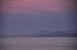
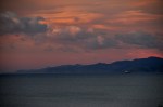
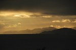
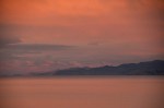
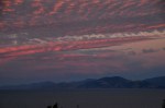
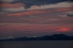
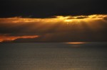
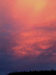
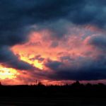
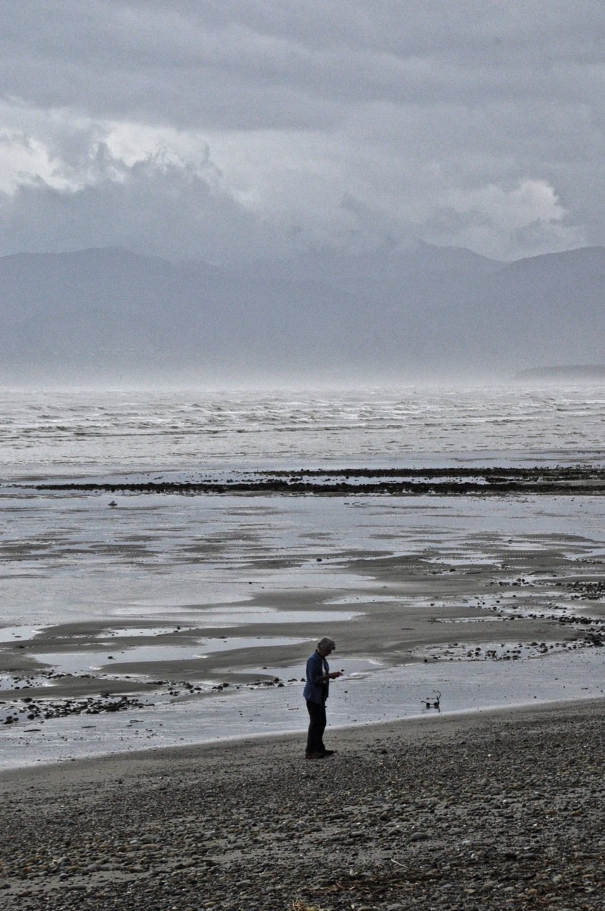
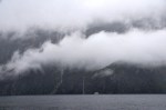
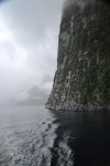
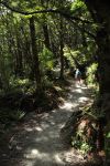
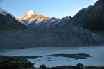
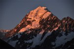
On our way out of Milford Sound we plan to hike a piece of the Routeburn Track, one of the finest of NZ’s “Great Walks” (multi-day tramps).  It’s turning out to be a beautiful sunny day – we don’t know whether to cheer or curse our fate of yesterday (post of April 17, Milford Sound).  We decide to cheer – hard to stay grumpy on a sunny day!

The Routeburn track has an interesting twist.  Remember we took two – admittedly leisurely – days to drive to Milford Sound from just above Queenstown (post of April 13, Fiordland National Park and Milford Sound – Getting There) .  On the other extreme, tour buses from Queenstown drive to Milford Sound and back in one very long day.  The interesting story is that one can use the Routeburn Track to walk from Queenstown to (just above) Milford Sound over the Southern Alps in just 2 (long) days; it’s only 20 miles!  So why not build a short highway across the mountains to link the two tourist destinations?  The answer is twofold – one, Milford Sound already gets plenty of tourists in spite of the travel hurdles.  Two, if they built the highway, the city of Te Anau (Gateway to Milford Sound) would cease to exist.  So NZ wisely embraces the status quo.

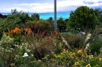
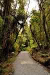
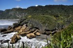
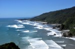
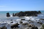
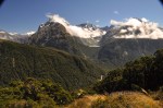
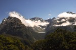
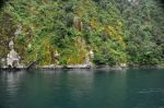
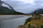
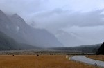
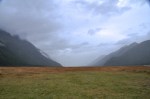
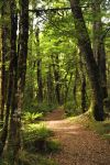
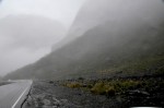
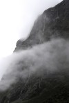
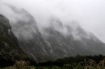
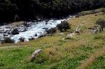
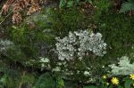
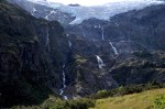
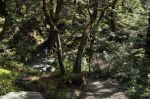
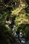
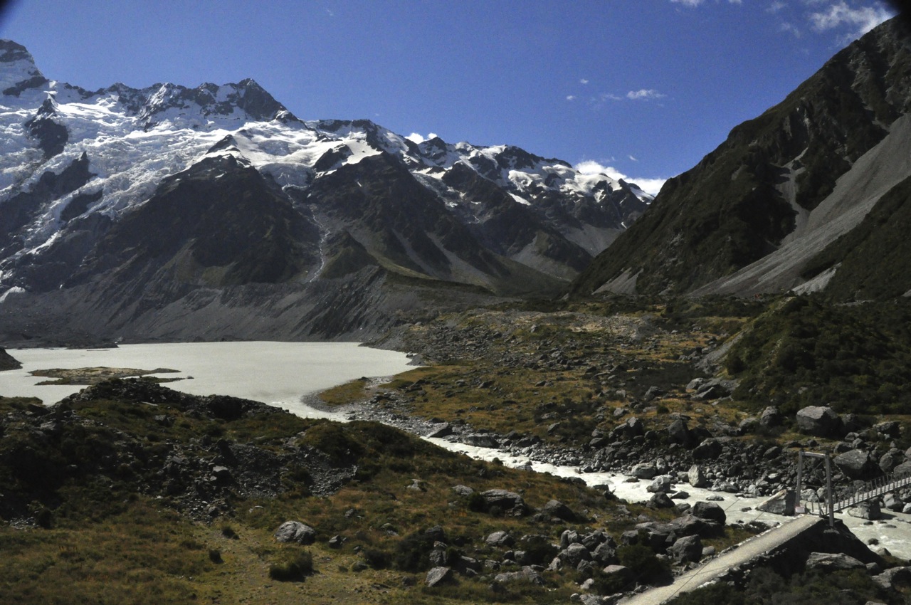
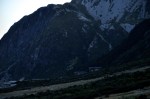
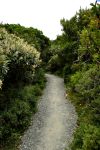
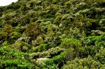
The Routeburn track is very green and pretty, as one might expect from the rainfall.

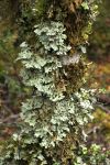
As you can see in that last picture above, the banks of the trail (horizontal and vertical!) are solid with moss and ferns.  Other areas have banks that are chock-a-block full of lichen.  Sometimes the ferns are a solid mass going up the hillsides, just a forest of ferns (picture not shown).  It’s all very colorful!

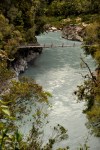
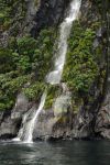
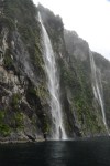
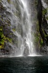
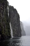
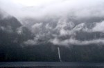
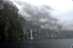
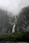
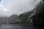
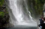
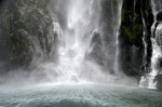
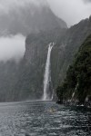
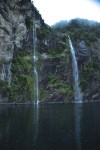
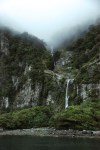
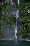
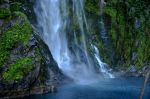
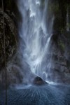
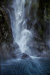
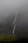
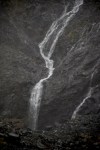
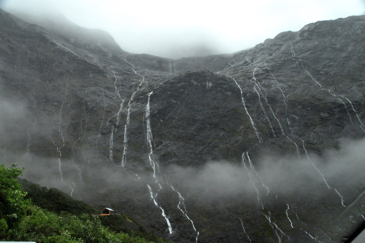
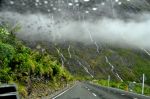
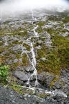
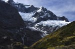
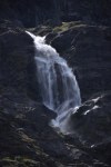
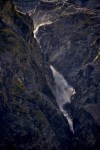
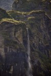
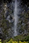
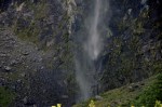
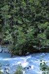
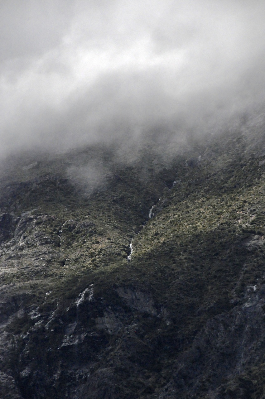
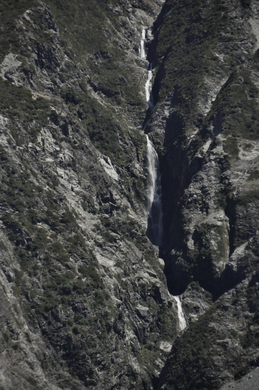
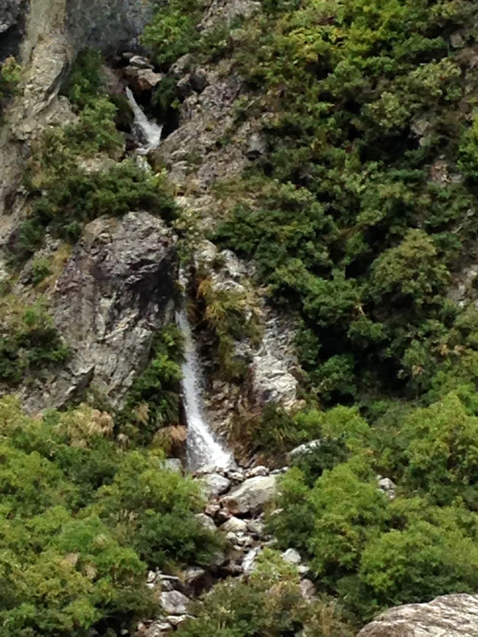
Occasionally we encounter small waterfalls.

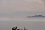
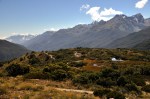
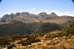
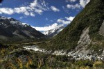
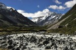
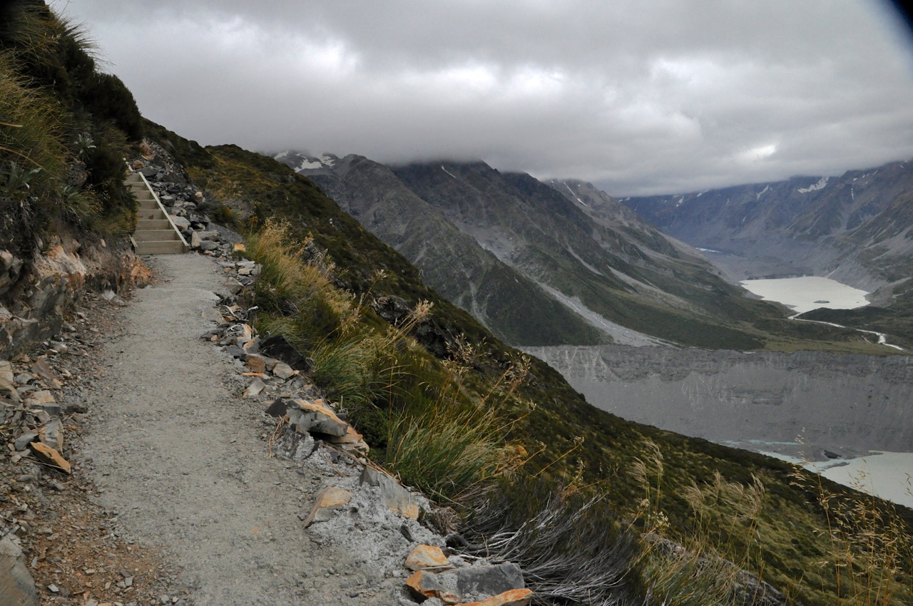
After an hour or so of steady upward climb, Ginger decides this is not her day to hike and turns back.  I’m 9DSC_0046feeling great and will push on.  Soon thereafter the trail to Key Summit splits from the Routeburn.  I take the Key Summit trail which heads up even more steeply.  Soon the forest ends abruptly, the view opens up, and I’m hiking past sub-alpine plants.  The picture to the left, below, looks back at the valley where we started, the other picture is the increasingly pretty view ahead.

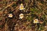
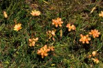
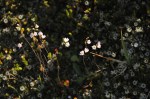
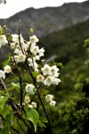
The flora is interesting, with a fuzzy ground cover and a number of small wildflowers like the genetian.

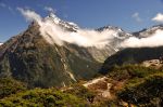
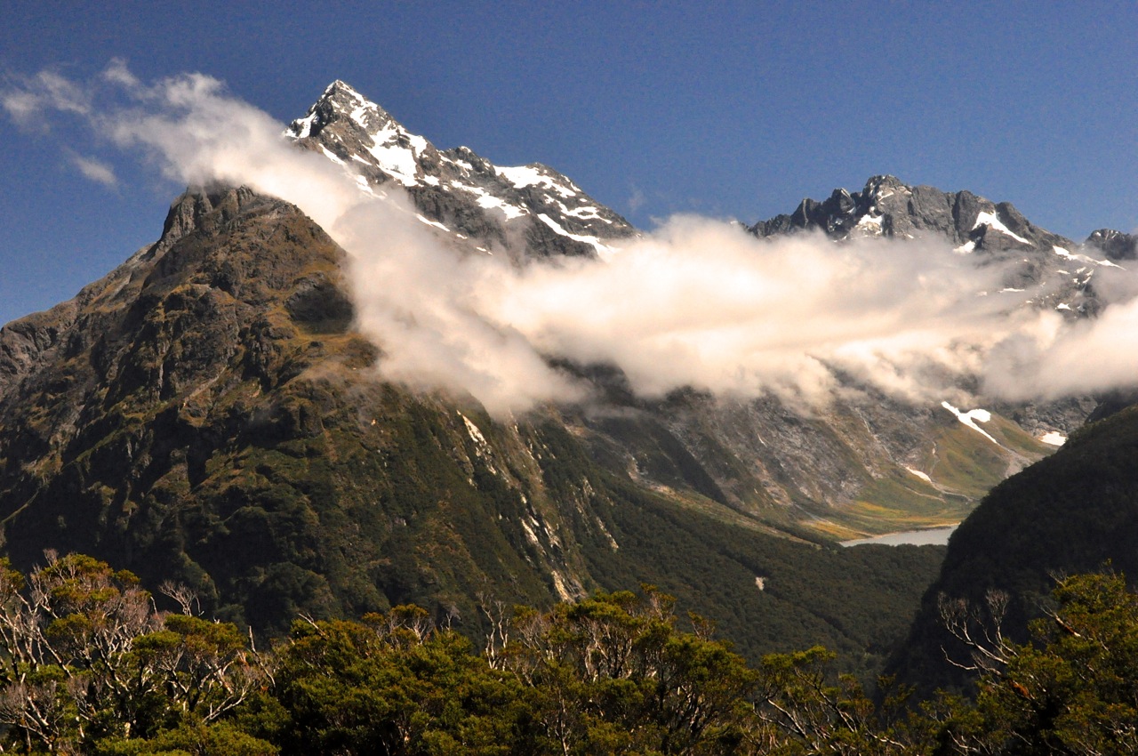
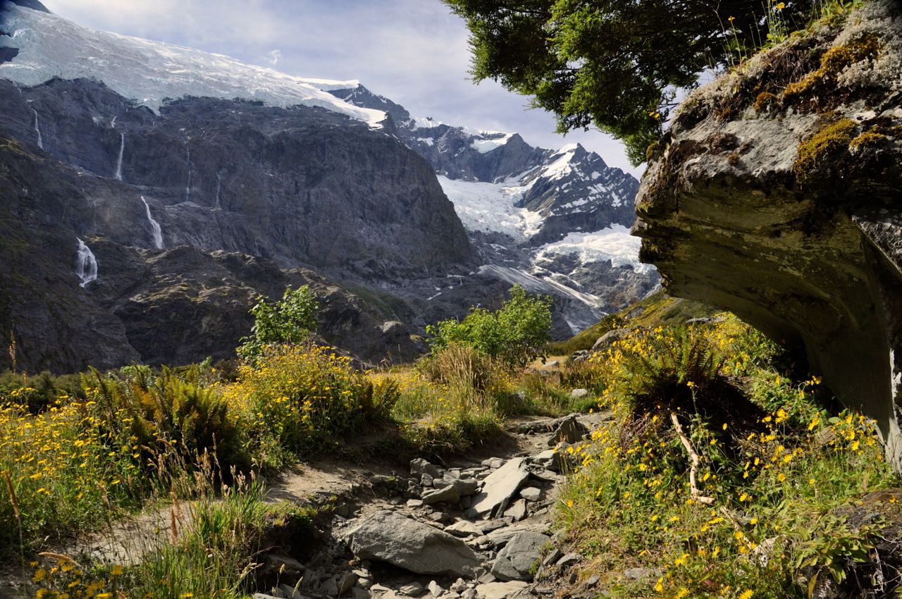
Finally I’m at the top, and it’s quite a pretty view from this small summit, with mountains absolutely surrounding it.  The small tarns and yellow ground cover/grass add to the beauty!

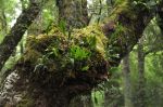
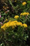
Looking more closely, I see that there is also a lot of red here, adding to the very pleasing palette of colors.  There’s red algae in some of the tarns, red lichen on the rocks, and a thick red moss on most of the tree trunks and limbs.  I’m loving the feast of colors!

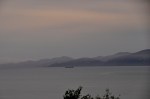
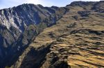
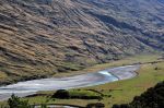
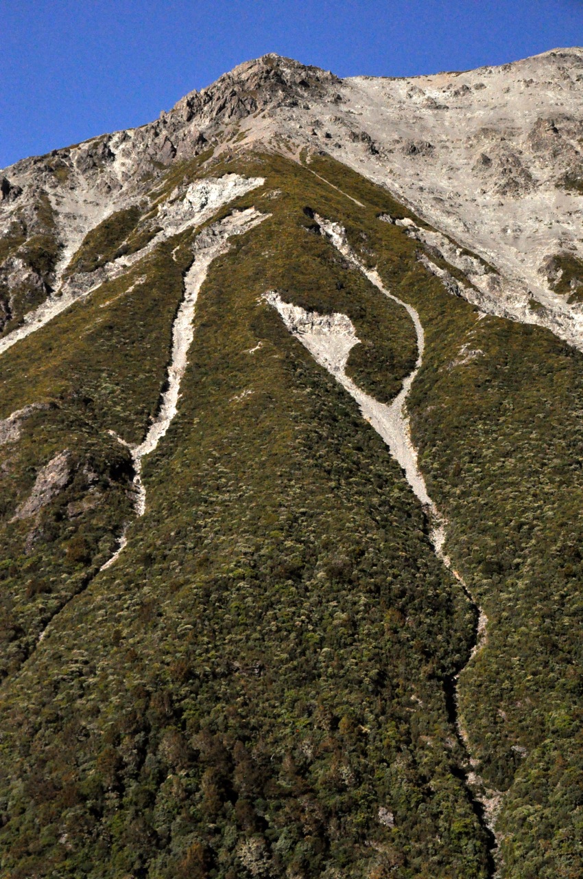
The trail doesn’t really stop here; it seems to wander off in several directions, including a “nature walk”.  I decide to wander as well, going up, of course.  There’s a hill ahead.  One of the advertised “sights” from the Key Summit is the view of three valleys that intersect here, the great conjunction.  You can sense – if not see – them in the pictures below; the first picture shows a valley over the left side of the summit, the next showing that valley joining another and falling away, the third picture showing the joining valley over the right side of the summit, and the last picture hinting at the third valley that’s coming in, but the view is blocked by the hill ahead.

Lake Marian in the cirqueAs I’m walking up the hill, I come to an opening with a bench, and a sign saying there’s a view of Lake Marian.  Sure enough, there’s a glacial cirque with a lake – always a pretty sight!  Alas, there is just a snippet of the lake showing.  As I’m watching, a guide with a customer shows up and says the trail continues up the hill for a better view.  I’m on it!  However, there is no obvious trail anywhere, things seem to Pretty tarns
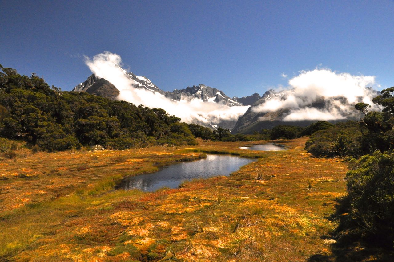
end here.  As I walk up the hill, a trail does emerge – a footpath, really, and not used much.  I do pass some more quite beautiful tarns.  After some climbing the steep footpath then leaves the open tundra to go into a forest of short trees with the red moss.  The trail becomes almost hidden in the plants, and then becomes nothing but mud and roots and hauling yourself up by grabbing tree trunks – you really have to want to go here!  It is also taking me longer than anticipated.

Finally I’m out of the woods, and there is a good view of Lake Marian!  It looks like a pretty fabulous place to pitch a tent, over there.

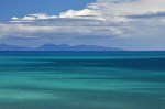
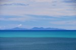
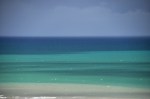
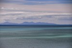
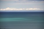
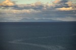
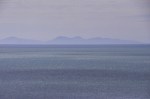
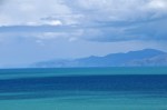
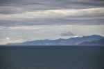
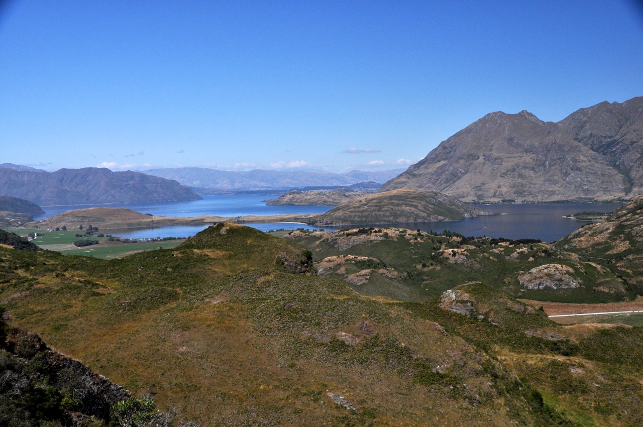
A further benefit is the view up the hill; down in the valley there’s a big lake – probably

Lake Gunn that we visited yesterday.  Key Summit is definitely a pretty place!

Alas, I have taken longer than planned, the long-suffering Ginger is patiently (?) waiting (lucky for me she keeps her Kindle in the car), so even though the path continues up, I’d better go back.  More’s the pity!  The problem with a day hike into NZ’s multi-day Great Walks is that you do the tough vertical climbing to get to the pretty areas,  then once there, with easier hiking and all the best views still ahead, you turn around and go back down.  Still, the half-loaf is worth it (and I didn’t have to carry a heavy backpack).

Below are two pictures taken on the way down of the pretty tarns and the red ground cover with berries.

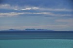
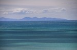
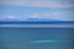
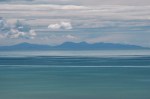
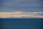
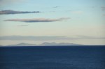
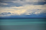
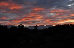
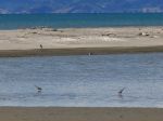
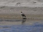
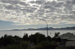
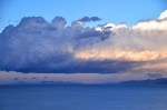
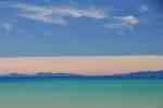
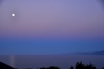
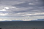
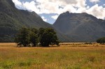
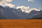
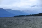
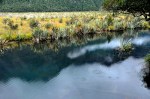
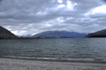
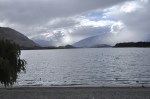
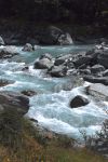
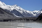
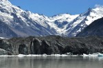
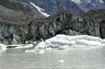
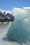
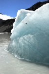
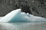
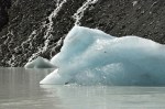
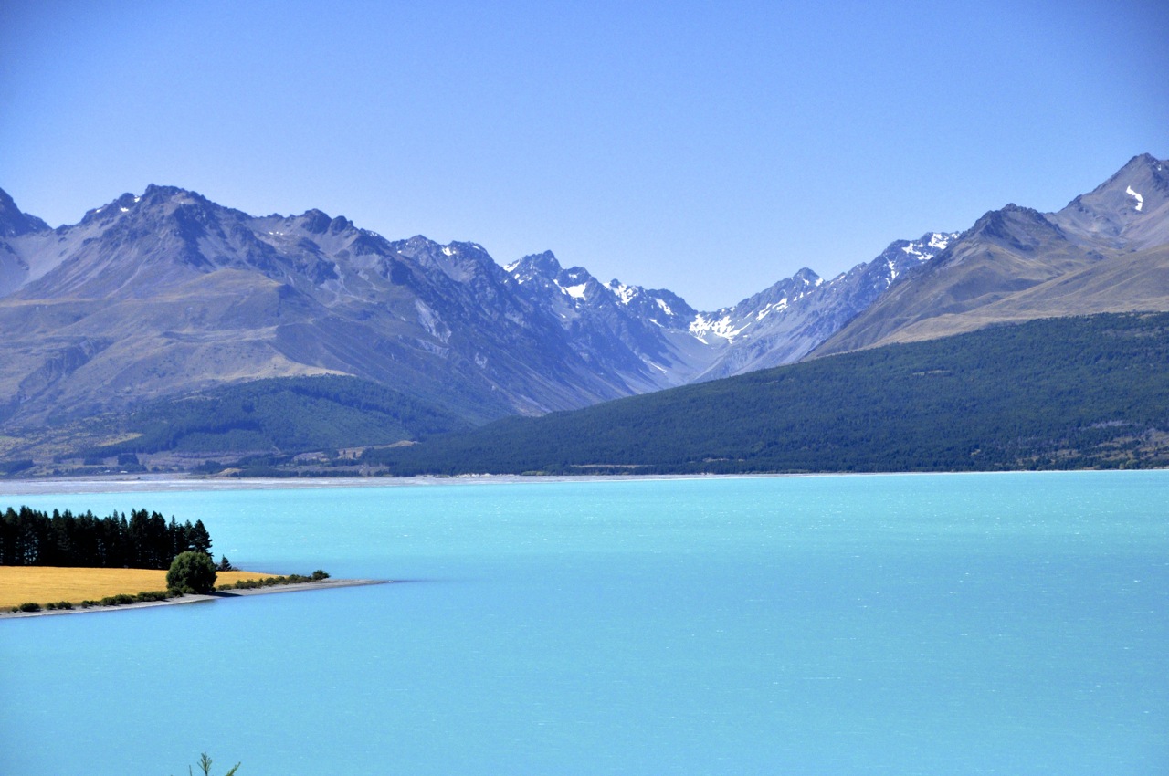
On our way back out Milford Road, we stop at Lake Gunn to see it in the sun – it’s a pretty place, with very clear water.  For comparison I’ve included our picture of Lake Gunn from yesterday.

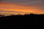
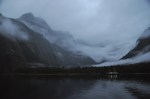
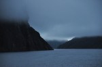
The valleys are also much prettier in sun.

That’s it for Milford Sound!  Hope you enjoyed the trip up Routeburn.  Next stop, the Scottish city of Dunedin.

Milford Sound

Milford Sound is a famous landmark of NZ.  People fly over by plane, or travel by bus or car, or even hike in over the Southern Alps.  It is said that one needs to see Milford Sound on repeat visits: in the sun, in the rain, and under a blanket of snow.  Why one should see it in the rain is not intuitive, but my travel book says that shortly after a big downpour every cliff sports a waterfall (and the place looks even more magical as ethereal mist descends).  I say this to lift our spirits, because it is raining steadily, and the “ethereal mist” is pretty damn depressing.  I know that the famous and massive Mitre Peak is staring me straight in the face in the left picture, but someone ate it.  Still, the view has a somewhat oriental charm to it, just not the OhMyGosh! view I was hoping for.

There are some nice views before departing – a white heron fishing, a near-by waterfall – but note my difficulty in keeping my lens dry.  The minimalism of traveling does not permit many photographic accessories.  A lens hood or underwear, that’s the choice.

Finally we’re off, along with 58 other hardy souls looking a little long-in-the-face as well.  The boat is nice, although its large picture windows are not going to work for taking good photos from inside.  I’ll have to brave the elements outside, and dash inside to clean my lens – along with a lot of other photographers, but everyone plays nice.  The first views are certainly atmospheric; big mountains diving straight into the water, and tall waterfalls appearing out of the clouds.  In gray.  Sigh!  For perspective, look at the other cruise ship in the last picture.

As we motor out, there certainly are waterfalls!  When we get closer to them, there is still some color through the rain and mist, thank goodness.  They’re pretty, take a look.

Part of what is happening here is the presence of many “hanging valleys”.  In the ice age, mile-thick glaciers rumbled cross-wise across mountains and valleys, churning a trough a mile deep.  When the glaciers left, leaving nearly vertical cliffs at the trench edges, the rivers traveling down those valleys now had no choice but to hurtle lemming-like off the cliffs into the waiting Sound (fiord).  In Milford Sound, only a half-mile wide, the effect is impressive; the peaks, we are told, go up 3000 feet (alas, in the fog we only see about 100 feet of that!), and the water of the Sound is over 1000 feet deep.  Where we float, the sides of the glacier-sheared mountains are near-vertical.  What that means for us is that the cruise ships can get within a few feet of the mountainside with no fear of hitting anything, and they do that at the waterfalls with some glee.  Which you’ll see below, as we approach a single waterfall.

I saw what was going to happen and quickly bailed into the cabin, as did ginger (in the blue raincoat).  The prow went into the waterfall; the kid and dad got soaked!  And I mean drowned-rat soaked!  They were dripping their own cascades as they sloshed into the cabin.

There are more waterfalls, which are just everywhere.  It’s like the world has sprung a leak.

I hope you’re enjoying the beauty of these waterfalls!  It’s raining, and I’m having to dash in and out of the cabin to dry my lens.  Soon my lens cloth and then handkerchief are as damp as the lens, and I’m just pushing the wet and smear around.  Reality is probably clearer than what you see in these pictures – but fear not, the mist and fog you see in the pictures may be augmented by my wet lens, but for sure it is really there!

We do another close-encounter with a waterfall, shown below.  The waterfall is truly beautiful, but this time everybody retreats at the last minute.  No takers to experience becoming one with the waterfall!  Which just goes to prove that if history is close enough in time, humanity can learn from its mistakes.

That waterfall was a pretty one!  Alas, you only get to see the static view; the moving view was so much better, with the changing patterns of falling water and those white trails on the water surface zinging out at us at high speed, almost scarily.

We’re heading for a small bay where we’ll moor for the night – what little light we had is beginning to fade.

Surprise, we get to go out and explore before dinner!  On the water.  A few choose to go out in kayaks by themselves.  A couple of young ladies decide to go swimming (!).  We, along with many others, choose to go out in small rubber boats with a guide.  A good choice!  The perspective is slightly  different this close to the water, and we get to see some wildlife here at the end of the day – a NZ pigeon (large, beautiful tree-dwelling birds!), a seal practicing his diving technique, and – lucky us! – a Fiordland crested penguin coming home to his nest!  He is very cute as he hops up the rocks to his burrow.  The last picture is of our bay as twilight deepens.

Well, the day was beautiful in spite of the rain, and the waterfalls were other-worldly, but we are disappointed; the mountains should be towering above us, cathedral-like, for thousands of feet, and we see only glimpses beyond 100 ft up.  Our captain says there is a good chance the clouds will lift by morning.  We cross our fingers and go to sleep.  The late-night passengers take pictures of seals that climb on board at the lower level and sleep on the deck!

The morningThe morning brings the same low cloud cover.  Today we will head first to the mouth of the Sound (the Tasman Sea), and then head for home.  There is a chance the clouds will lift for the trip home!  In fact, the rain has stopped and things are looking lighter, especially up ahead, and certainly the views are brighter and sharper!

As we approach the Tasman Sea, we have clear skies!  As in, practically no clouds overhead at all!  There is hope!

Looking back at the low-lying funkOf course, looking backward, there is still nothing but truncated mountains as far as the eye can see.  Can the funk go away in time?  As we move further out into the Tasman Sea and look back, the cloud situation is amazingly and frustratingly apparent.  In the pictures below, look at those beautiful, commanding mountains towering above the cloud cover!  Yes!  And look at how thin that layer of low-lying white cloud is!  And look at the sun trying to shine through!  This could work!!

Well, it’s hopeful!  As we enter the Sound, the low-lying cloud cover is dauntingly there, but there are also luminous areas where the sun struggles to break through, as shown in the first image below.  As we venture further into the Sound, everything gets clearer and brighter.  The last image, looking backward, shows real sun shinning on where we were.

As we retrace our path of yesterday, we revisit the waterfall close-encounter.  The waterfall is definitely a little smaller, but the view is now even more beautiful, the colors brighter, the rocks more clearly defined.  It is again a magical view in NZ.

As we travel on, it becomes clear that we will not escape our fate of a low cloud ceiling.  The funk is lifting behind us, but not in front, and time is running out.  It is a little frustrating, knowing how thin the obscuring cloud cover is!

Horizontal scar marks from the glacier that formed the SoundWe do pass an interesting part of the Sound, where a protruding wall shows the scour marks of the glacier from so many millions of years ago.  Showing its age with wrinkles, it is.

Well, the weather continues to toy with us as we near our harbor destination; the ever-present cloud cover is getting lighter, but persists, restricting our view to just a few hundred feet up.

Mitre Peak at Milford Sound HarborAnd then we’re at the Milford Sound Harbor and disembark.  We disembark to, of course, the lifting of the funk, at least here.  Well, better late than never, I guess.  Ladies and gentlemen, we present finally, Mitre Peak in all its glory.  OhMyGosh!

Just for comparison, let us show you the before (yesterday) and after (today) pictures of the harbor, and you can judge what we missed!  The before pictures are the first two pictures  from this post.

Well, OK, I groused all through this post about what we missed, didn’t I?  My apologies.  I, of course, wanted it all.  Even so, it was pretty spectacular, wasn’t it?

Next post – Fiordland and the Routeburn Track!

Fiordland National Park and Milford Sound – Getting there

In our March 26th post (Aoraki/Mt. Cook National Park), I remarked that the South Island reportedly has most of the superlative sights in NZ.  Many of those sights lie in Fiordland, New Zealand’s largest, most remote and wildest national park.  It is a region of stunning beauty, boasting some of the tallest waterfalls in the world; its glacier-scoured lakes are the deepest in the country, some nearly 15oo feet deep; its coastline sports 14 glacier-carved fiords, some nearly 25 miles long.  (Note:  the fiords were misnamed as “sounds” by early sailors; a fiord is formed when a glacier grinds its way to the sea [and then melts]; a sound is a sea-drowned river valley).  Fiordland is also an isolated, almost inaccessibly wild land, bordered by the Southern Alps on one side and by steep fiords on the other.  It endures enormous rainfall –  it rains more than 200 days a year.  Milford Sound, where we’re headed, gets 27 feet of that wet stuff annually.  Of its 14 fiords, only 2 (Milford and Doubtful) are relatively easy to visit.  The Maori visited Fiordland but did not live there.  In 2001 the total human population of this vast land was 48 souls.  If you include border towns like Te Anau, the population today is still under 2000.   Isolated, yes, but there’s probably a correlation between low human population and the large numbers of the infamous sand fly (called “black fly” in the US), a tiny, blood-sucking critter with an incredibly vicious bite – they’re more like flying piranhas than insects.  This inhospitable remoteness does have some benefits: some of the animals and plants of the ancient super-continent Gondwana still exist here (eg. living brachiopods, unchanged in 300 million years); and in 1950 the takahe, a flightless bird that had been believed to be extinct for 50 years, was rediscovered in Fiordland.

We can’t wait to see this area.  We spent a bunch of money for an overnight cruise on Milford Sound; now we have to get there.  The plan is to high-tail it to the gateway town of Te Anau, spend the night, and get an early start for a leisurely trip along the 70 miles of Milford Road, billed as one of the world’s finest drives, before boarding our 60-person cruise ship.

We pass near Queenstown, which looks gorgeous in the distance. From the Crown Range

Saddle I think we see vineyards nearby.  Oh yeah, we’ll be back soon to visit!

The trip to Te Anau goes past the very long, very deep and very pretty Lake Wakatipu, then

travels over picturesque fields and mountains.  Te Anau, on the edge of the Fiordland, is much more impressive.  After we wander the town, take in a “fly over Fiordland” documentary (soooooooo much cheaper than paying for the fly-over itself!), and have dinner at a fancy Italian restaurant, there is just time enough to capture a few pictures

of the area as the sun sets.  The impressive views suggest a fabulous tomorrow!  Equally Our restored B&B monasteryfabulous was our B&B; it’s a restored monastery, beautifully done inside.  We were there for too little time to really appreciate it; for example, the outdoor mega-size chess set, the free port and gay laughter we could hear in the upstairs lounge as we went to bed….. darn it, can’t do it all!

The next morning is disappointingly overcast, with rain clouds on the horizon; looks like we’re going to get one of those 200 days of rain.  Drat!  And sure enough, clouds and rain are our companions through some magnificent valleys.  I think the views would be spectacular in shimmering sunlight, but it is still beautiful in the mist.

A popular tour-bus stop (Milford Sound is such a tour-bus mecca!) is Mirror Lakes, right by the highway.  We stop too.  In good weather there are outstanding reflections of the Earl Mountains.  Even in the rain, the view and color is nice.  The cute duck is a NZ Scaup.

We go further to Lake Gunn and decide to do the 2 mile nature walk.  Glad we did – it’s a good insight into the effects of 27 feet of rain!  The walk is a riot of mosses of every kind growing on everything, and plants growing on top of the mosses!  Trees are a vertical extension of the forest floor!  It’s beautiful, as you can see in the many images below, but we were afraid to stand still for long.

We continue, up and up, to the Homer Tunnel, carved nearly a mile through the solid stone of a glacial cirque.  The tunnel was quite an engineering feat, started in 1935 and finished in 1953.  It took so long in part because the downward angle quickly ran into water and in part because of interruptions by several avalanches and WWII.  What is novel to us is that it’s a one-lane road!  While we wait for our turn to go through, we are entertained by the numerous waterfalls pouring down – and the inquisitive and highly intelligent kea, the world’s only alpine parrot.

While we watch a kea on a car roof, it grabs a hard plastic cover over the tailgate hinge and rips about a fourth of it off!  As it works on the remainder, we inform the inhabitants that their car is being eaten.  The man steps out holding a short piece of 2×4 (be prepared?) and swats at the parrot, which nimbly hops to the front of the roof, out of swinging distance, but still on the roof!  Catch me if you can!  I am impressed, and hurry back to my car to make sure the gremlins aren’t there.  The redeeming virtue of the parrots is that they’re so cute!  They walk like sailors newly on land, a rolling gait, and appear fearless.

Inside the Homer TunnelFinally, after a 15 minute wait, it’s our turn, and off we go into the tunnel.  It looks old!  The stop lights governing traffic into this tunnel are only used in summertime; in wintertime, it’s every man for himself, which could mean backing out a loooong way.  I’m betting there are spirited “rock scissors paper” games when 2 cars meet.  Of course in wintertime chains are required, avalanches are a problem, and then you have to wait while maintenance workers in helicopters drop dynamite on the snow overhangs.  Maybe the stoplight wasn’t so bad!

Homer Tunnel exit, with waterfallsWe exit the Homer Tunnel into a whole lot of waterfalls coming from a massive cirque.  Just for perspective, the tunnel exit is the roofed structure in the lower left of the picture.  Waterfalls are absolutely everywhere;  it would be crazy to show close-ups, so just enjoy the overviews as we drive down!


Finally, we visit another tour-bus stop, The Chasm, where the Cleddau River scours rocks into interesting shapes as it falls nearly vertically down a deep, narrow channel.

We’ve now arrived at Milford Sound.  Rainy and overcast!  There were many other hikes to take from the Milford Road, but they were longer and we ran out of time; we board the cruise ship shortly at 4pm and just have time to take a quick look around.  Next post – The famous Milford Sound!

Wanaka and the Rob Roy Valley

Wanaka

Wanaka is a resort town just an hour north of its better-known neighbor Queenstown, but happily it is not at all like that over-caffeinated tourist mecca.  Wanaka is quieter, with less crowds, less partying, and with far fewer stores hawking testosterone-fueled activities.  I admit Queenstown is prettier (which I’ll show you in a post soon), but Wanaka is pretty enough, Landis Passand a nice place to chill out for a week.  Getting there from Mt Cook takes us through Landis Pass, which is austerely beautiful.  Wanaka itself snuggles up against the lake of the same name, with the high and jagged peaks of Mt. Aspiring National Park visible in the far distance.  The pictures below show you the lake from Wanaka’s long beach (under different weather conditions, I might add!).

Downtown WanakaDowntown Wanaka is mostly a couple of streets with more cafes than anything else, displaying its touristy but low-key personality.  There really isn’t much to do in Wanaka other than chill, but it is a nice spot both for chilling and as a base to explore outlying attractions such as the nearby Rippon Vineyard, Central Otago’s oldest vineyard.   For perspective, it was established in 1982, nearly a decade before most of New Zealand’s Rippon Vines (nice location!)wineries (it’s amazing how young NZ is, in every respect).   If you begin to suspect that we have chosen this region for it’s wines, you’re partly right.  The Central Otago wine region is very far south, at a latitude where grapes would not be expected to do well.  However, the surrounding high mountains apparently retain heat and the valley reaches some of the highest, albeit very variable temperatures, in NZ .  This area produces some of the country’s best Pinot Noir (and Pinot Gris).  A number of small but very good wineries are located near the hamlet of Bannockburn, and an

example of this area is shown above.  One particular winery, Mt. Difficulty, was amazing  – magnificent wines, very pricey, but we bought a few bottles anyway.  Didn’t someone tell us that life’s too short to drink cheap wine?  We also had an incredible and memorable lunch in their restaurant overlooking the vines – fabulous duck with their fabulous wines is about as good as it gets.  Some of the wineries in his region are very boutique – for example, Gate 20 Two, making great wines and selling them from their home – their “cellar door”, New Zealand-speak for tasting room, is from a desk in the foyer of their house!

Looks fabulous!We decide to do a nearby hike, to Diamond Lake.  On the way we see Kiwis enjoying life up in the air, on paragliders.  They glide and soar wherever they want, and it is clear they could stay up there forever; must be good updrafts.  I’m envious, really, but there is something comforting about having feet in contact with earth, and hiking is good too.

The hike to the lake is flat, and the lake (picture above) is nice, but the overlook beckons.  Unfortunately it is up, and up, using the ubiquitous D.O.C. stairs, and Ginger hates it;

which she voices more Diamond Lake from abovethan once, but gamely carries on.  The overview of Diamond Lake and the nearby mountains is very nice indeed, and worth the climb.  However, the trail Lake Wanakakeeps going, beckoning us on.  Alas, it also keeps going up, and after awhile Ginger has had enough – but not before we get a nice overview back towards Wanaka.

On the hike we’ve also observed some interesting plants and birds along the trail, as shown below.

Rob Roy Valley

Mt. Aspiring National Park is one of NZ’s largest and is Wanaka’s outdoor playground.  Today we’re off to hike the Rob Roy Valley, listed as “an easy route into a dramatic alpine landscape that includes snowfields, glaciers, sheer rock cliffs and waterfalls”.  Sounds great!  Of course, “easy” is one of those relative terms, isn’t it?

The hour ride to the trailhead is through grazing land surrounded by old dry mountains, with occasional impressive waterfalls.  The view straight ahead isn’t bad either, right

picture.  What we didn’t know then is that the glacier straight ahead is the one we’re going to hike to, and its kinda “up” more than “easy”.  Our road gives way to gravel for 2o miles, and it’s slow going because of the gravel, because we need to navigate past sheep, Not in a hurryand because we need to ford gulleys and streams – like 7 of them.  It’s not trivial!  We’re navigating water and good-sized rocks, and hey!  This is my car!  Not some rental!  Ginger offers suggestions on which rocks or holes to avoid, of course, in a stressed voice, which is very helpful.  Later we read the D.O.C. pamphlet, which says “The last 6 miles … is subject to washouts and flooded creeks which can make it impassable.”  I love the Kiwi understatement; I would think twice about doing this trip on a cloudy day, when getting into the park on this dead-end road was possible, but getting out after a rainfall was not.

At last we’re at the trailhead, and it’s pretty.  The valley floor and mountains are impressive, the rock-strewn Matukituki River is adding a merry song, and a waterfall drops out of a mountain to complete the picture.

Initially the hike is through an almost-flat wildflower-filled meadow bordered by the Matukituki river crashing into boulders.

We cross the river over a swing bridge and begin hiking along a beautiful trail that parallels the gorgeous Rob Roy Stream.  The trail is 5 miles up, and not terribly steep, but it is 5 miles up!  However, hiking beside merrily singing water in a very green, very varied beech forest is a delight, as the pictures show!

We finally come out of the forest and are greeted by a spectacular view of the Rob Roy Glacier on Mt. Alta.  Oh, maybe you notice the waterfall too?  It’s magnificent!

We disappear into forest again, and reappear with a better view of the waterfall.  The water is falling such a distance, it turns into mist at the end.  We’re captivated!

Nearing the trail endThen a bit more climbing up and down on a rocky trail like the one to the left, and we come to the view shown in the two images below ….  A wall of waterfalls pouring from the melting glaciers.  You need to mentally paste the two images together.

The mountains and waterfalls are truly amazing.  Alas, the trail ends here; we would have to bushwhack to get closer.  I’d love to do that, but it would mean fording the Rob Roy Stream, slowing the earth’s rotation to get more light hours, etc.,etc., so I must be content.  Below are close-up photos of the waterfalls.  It’s hard to know how tall they are, but I’m guessing some of them must be hundreds of feet high.

We’re starting to lose light, so it’s time to go.  As we start to hike out, I’m not quite ready to stop looking, so here are a few more views of my favorite two waterfalls.

The trail on the way back now has slanted light, and it’s as pretty as ever.  Maybe prettier.

The slanting light of early evening transforms the Matukituki Valley into a play of color and shadow.

The trip out is through the cow pasture, with one cow guarding the gate.  Happily, no bull is in sight.   We moo a greeting and are allowed to leave.

However, it isn’t over yet!  There are more pretty sights on the way out –

and hurdles to overcome.

We thought it was a gorgeous hike.  Hope you liked it too.

Next post, Milford Sound!

Aoraki/Mt. Cook: Tasman Glacier and Hooker Valley

This morning we’re doing that rare thing, for us – taking a commercial tour.  We want to get up close and personal with a glacier, so we’ve booked a bus-hike-boat trip on Tasman Lake where we hope to see some icebergs that have calved from the Tasman Glacier, and hopefully get a close look at the glacier itself.
The weather in this national park is notoriously fickle.  Often a pall of low-lying clouds and rain hangs over the valley, but today it’s supposed to be clear.  From our bedroom balcony the day is starting out cloudy, but as seen below the views are still gorgeous (What a

wonderful wake-up view!).  Fingers crossed for clear skies, we hop on the bus and head toward the glacier.

Tasman glacier moraine plainA short bus ride later we arrive at the trail head (Blue Lakes Trail) and take an easy 20 minute hike across the valley floor.  The sky is clearing, but the land is desolate as far as the eye can see.  As Ginger noted in the previous post, the plain is the moraine from the retreating glacier, the debris is about a mile deep(!), and the fill is very loose.  So in spite of high rainfall, the water just drains through, effectively creating desert conditions on the surface.  It might as well be a moonscape, just gray rock, gravel and dust.

Tasman LakeWe top a moraine wall and there it is – Tasman Lake, an ominous gray color that we weren’t expecting.  The guide tells us the color is from rock flour, ground up rock particles that haven’t settled out yet.  We’ve seen rivers of gray glacial run-off, but never a whole lake of it!  It definitely adds to the forbidding nature of the landscape.  An interesting side note – the river that flows out of Lake Tasman empties into Lake Pukaki (see previous post); on the way, the water sheds the larger rock particles, leaving smaller ones that scatter light to give Lake Pukaki its other-wordly blue color.  Pretty amazing to give the very long and large Pukaki Lake that color, seemingly throughout.

Tasman lake, virtually opaque and with a temperature just above freezing, is devoid of any life and looks it with its cadaverous grayness, but the surrounding mountains and playful clouds are beautiful.  The last two images below show the back side of Mt Cook and its hanging glaciers.

Boat to the glacier frontWe’re heading off to the glacier front in a boat just like this one, and we’ve managed to snag the front seat!  There are icebergs on the lake today, but the wind has blown them all back to the glacier end of the lake.  As part of the safety talk, we are instructed to put our hands in the water for about 30 seconds; it very quickly becomes painful, and we can’t wait to pull our hands out.  Take-away lesson:  do not fall in!

WaterfallAs we motor out, we pass a small waterfall coming out of the clouds.  Pretty, but the main attraction is dead ahead.  Impressive!  The glacier fills the valley floor from side to side; it is crowned with a layer of rock debris, but we can’t begin to estimate its height – the mountains around it are too large to give a sense of scale.  We can’t get too close because 1) a calving chunk could send waves that might dump us into that frigid water (the glacier moves forward at a speedy 9 inches a day), and 2) a piece of the underwater shelf that extends up to 200 feet from the glacier could break off, pop to the surface, and flip the boat.  Definitely undesirable but highly unlikely – but them’s the rules.  Still, we get reasonably near, as shown below.

It’s time to look at some icebergs up close.  First we haul out some little ones.

Our guide fishes one out and passes it around.  We spot a bigger one, and she lets Ron fish this one out, with Ginger hanging on to his belt to keep him in the boat.  The ice floating in the lake is about 300 years old – it has taken that long to move down the glacier escalator – and the ice exists as large, inch-sized crystals, which you can begin to see in the last image above.  The crystals were originally formed under high pressure and low temperature, but once free of the glacier and at lower pressure and higher temperature, the crystals grow and air pockets form, causing the ice to appear whiter.  Some examples of iceberg crystals are shown below.

We were tugging on the iceberg in the picture below when it started to roll, causing the guide to beat a hasty retreat, but the iceberg righted itself (darn!).  It did give us a look at some of the underside, which was perhaps closer to original crystal size.

The air bubbles in the ice were also interesting.

Finally, below are pictures of icebergs with their blue hue.

WaterfallWell, we didn’t see glacier-front calving or shelf flipping, but communing with the icebergs was interesting.  As we hike out to our waiting bus, we notice a nice waterfall on a side mountain that we had missed.  Dime a dozen, eh?

It’s early afternoon, so we decide to do at least part of a hike that we haven’t done (we’ve done most!).  The hike goes down the Hooker Valley to Hooker Lake and, at it’s end, the Hooker Glacier.  More of the same, really, so we won’t go too far.  First, however, another look at the majestic Mt. Cook!  And on the right, the Huddleston Glacier of Mt. Sefton.  Awesome!

Mueller Lake and the first swing bridgeThe Hooker Valley trail goes up before it goes down; in the first picture we’re looking down on Mueller Lake and the first of several swing bridges that we’ll have to cross.  Pictures from the hike follow.

Mountain chessAs we’re hiking out, Ginger comments that the bush on Mt. Wakefield looks a lot like a chess knight.  Yes, it does!

Tomorrow we leave this gorgeous place, but I take a few last shots of the mountains at night, and later, of Lake Pukaki as we depart.  This has definitely been one of the high points of our New Zealand sojourn.

Aoraki/Mt. Cook National Park

The South Island is where NZ’s superlatives lie: it boasts the tallest mountains, largest river, deepest lakes, and wildest and most remote areas (some still unexplored, at least by modern man).  It also has regions that are the country’s driest, wettest, hottest, coldest, and windiest.  We’re going to the tall mountain region, the Aoraki/Mt. Cook National Park.  Aoraki is Maori for “cloud piercer”, and Aoraki is increasingly used instead of Mt. Cook, which is NZ’s tallest mountain at over 12,000 ft.

The drive into this central part of the South Island is definitely scenic.  The plants in the

right picture are tussock.  They’re protected, and quite beautiful, covering huge plains and growing up the sides of mountains.  There are a variety of types, including this red tussock.  Apparently they grow slowly; some plants are centuries old (!).  The plants blow in the wind like waves in the sea.  Mesmerizing.

On the way we pass Lake Tekapo, and are stunned by the amazing blue color of the lake.

It’s an other-worldly blue!  We stop to stare, and we are not alone.  People in RV’s have pulled up, taken out lawn chairs, and are just sitting and wordlessly staring.  A marvelous, incredible color; we are amazed and perplexed by how it could be.

Traveling further, we come to Lake Pukaki and the turn-off to Mt. Cook, and are blown away.  Lake Tekapo was just the warm-up!  The color of Lake Pukaki is other-worldly on steroids!  Surely it is Photoshopped!  Can’t be real!  I rub my eyes, it’s still there.

And to add to the spectacle, the mountains loom gloriously.  It’s a long lake, and the views

View on the way to Mt. Cookare just incredible as we travel toward Mt. Cook for nearly an hour.  For example, this picture to the left.

We’re thinking it can’t get any more spectacular, and then we go around a corner to see a craggy mountainside with a glacier glomming to it and waterfalls/rivers tumbling down.  Wow.  We begin to see why Edmund Hillary trained for Everest here.

We have splurged and are staying in the major (and historic) lodge, the Hermitage – as it turns out, a very good move.  The pictures below show the view from our bedroom balcony.  Awesome!  For perspective, there is a car on the road in the right picture.  Those rocks are big!

I decide to hike to an overview, Kea Point, to take pictures of Mt Cook as the sun sets.  Ginger points out that means hiking back in the dark and she won’t go, but she’s a pessimist.  The view from our room as the sun starts thinking about setting is amazing.

The hike to Kea Point is just a few miles and is uneventful.  The overview is interesting.  As you’ll see in the pictures below, Mt Cook is straight ahead, but in front is an enormous trench (and small lake) created by the retreating Mueller glacier, which is out of sight around a bend.  The wall on the other side is the “lateral moraine”, debris left by the retreating glacier.  It is an impressive wall of debris.  Mt. Sefton is to the side, and the waterfalls from the glaciers are fascinating.  It is impossible to know the scale, but the waterfalls must be hundreds of feet in height.  Finally the sun sets on Mt. Cook, and the view is nice, but not as impressive as I had hoped.  Alas, on the walk back I miss a turn and walk a couple of extra miles, costing me daylight, and I end up twisting the same stupid ankle in the dusk.  Could Ginger have been right?

Aoraki, Cloud SplitterThe next  morning we are greeted by Mt. Cook.  It is posing for us – Aoraki, the Cloud Splitter.  It’s magnificent.  For Maori, the mountains are sacred; I’m not far behind.  Mountains are so old, and so awesome.  In their womb they were simple sediment, compressed under enormous pressure when the world was under water.  They were born by cataclysmic forces of heat and pressure and volcanoes and tectonic plates, brutally thrust upward with unimaginable force to these incredible heights, and aged by wind and water over many millions of years so that we could one day stare at these monuments – these crystallized forces – that silently dwarf humankind’s silly bravado.  I stare at the mountain’s timeless grandeur, and I see America’s backwards politics and petty strutting and our daily big concerns for what they really are – little insignificant blips in the story of this planet.  When there’s a rock like that in front of you, you can only stand there, mouth agape, and make space in your head for something akin to religion; like the Maori.  Below are a few more pictures of this marvelous valley.

That ankle seems to serially sprain, so I decide to have it looked at in the nearby (hour away) town of Twizel – which allows me to drive along Pukaki Lake again.  The sky is different, and the lake color is different, but it is still other-wordly.

Alert!  This is Ginger now.  While husband is off seeking succor for his self-inflicted wounds , I decide to take a short hike through Governors Bush, just a 10 minute walk from the hotel.  It’s cloudy and threatening rain, but my jacket is waterproof, so I head out, expecting an easy walk around a garden-like area.  Instead I discover I’m heading rapidly uphill on some of the DOC’s infamous stairs.  Oh, well, so much for a leisurely morning mosey.  I decide to snap some pics with my iPhone, so Ron can see what he missed.

The walk up this hillside “bush” is a stark contrast to the arid plain below.  Here everything is lush and green, an abundance of ferns and mosses, lichens on rocks, and epiphytes hanging from the tall trees.  I discover later that there is, indeed, plenty of

 rainfall in this area, hence the lushness of Governor’s Bush.  The plain, however, is arid because it lies on a very deep, very porous moraine, and has only a shallow layer of topsoil.  Water simply pours right through, leaving desert conditions in a rainy land!

After a bit of climbing, the path begins to level out (left picture below).  It’s lovely, but dense enough that I don’t think I’ll find any mountain views.  I’m not far from wrong, although I do catch an occasional glimpse of the peaks across that arid plain, and the clouds playing Ring Around the Mountain with Mt. Aoraki.

The DOC has labeled some of the plants and trees.  It’s kind of fun to be able to see their names -Turpentine Scrub, Bog Pine, Bush Snowberry – though I know I won’t remember them for long.

The path meanders through the upland forest for a while, but what goes up must inevitably come down; I round a bend and begin descending through the forest;

the understory becomes more & more densely crowded with ferns, many I’ve never seen before .  Unfortunately, only one kind, seen earlier on the trail, has a name tag (left picture).  Others remain unidentified. 


Later in our travels I see the relatively rare Prince of Wales fern, which looks a great deal like the last fern pictured.

Small waterfall

On the way down the trail I’ve caught glimpses of a waterfall across the river; when I emerge from the woods, I decide to get a better look and bushwack up the river bank to find it.  After some rock scrambling I locate a spot with a clear shot.  The falls is relatively small, but still quite pretty. 


There’s an added bonus – on my way back from the falls, I discover a picturesque stream, incredibly clear, dotted with bunches of yellow monkey flowers.

I head back up the hill to the hotel, pleasantly tired and ready to put my feet up for a bit while I await the return of my wounded warrior.

Well, the local doc thinks the ankle may have a tendon broken, but it feels pretty good moving back and forth (less so side-to-side, but it’s taped to resist that; the doc says to see an orthopod when we get to Wanaka).  She also says I’m OK to go, so I’m off on a hike.  Ginger says she has had enough for one day, so I am on my own.  I decide to do the hike to Mueller Hut – I saw the trail-head on the way to Kea Point.  The hike is listed as “challenging”; just 6 miles RT, but it’s vertical; a 3,000 ft ascent, taking 6-8 hours.  I don’t have that much time by now; it’s 2pm.  However, 1800 ft up is the Sealy Tarns, and I can do that.  That part of the trail is dubbed “stairway to heaven” and includes 2200 steps.  Oh boy.

The trail starts off pretty nicely, as shown in the picture below, top left.  The canopy of trees is mixed, and there are a number of different shrubs and plants with small white flowers.

And then come the steps.  And more steps.  Oh my!  And more steps.  I am impressed by the industry of the DOC (Dept of Conservation) that builds these trails.  The trail is very,

very steep indeed, and steps are an efficient way to go up.  And up we go, oh so efficiently!  Perhaps you can see from the angle of the hill how steep the incline is!  Sometimes I can put my foot on one step and touch 6 steps up with my hand.  That’s not stairs, that’s a ladder!

Since you can see just pieces of the view in these images, here’s a better sample.  It’s pretty up here.

Poured concrete path, 'way up highI continue to go up, and I’m approaching the cloud ceiling, and whoa!  Way up here, nose-bleed height, and the DOC has decided to pour a concrete path on the trail!  Yikes!  Who carried the bags of cement, water and wheelbarrow?  The DOC is impressive indeed – or perverse, I suppose, if you work for them.  Come to think of it, I’ve had bosses like that ….

And then suddenly I round a switchback, and I’m there.  The Sealy Tarn is disappointingly

small – a pond really – but the view around is not bad, shown below.  It’s similar to what you’ve already seen, just from a little higher up.  Can you see the blue ice in the glacier dead ahead of the Sealy Tarn, shown in the last image below?  It’s visible even in this dull overcast light.

Pretty cool.  The trail continues up, a little rougher and sans steps, but this is it for me.  There are pretty flowers around, all white.

Time to go down.  Oh yeah.  This is not going to be fun.  Below are pictures of the trail going down – steps going to steps going to steps, as far as the eye can see.

As you have seen, I am flirting with bad weather on this hike; it has been threatening rain, and on the way down the rain lets loose over the valley, left image below.

I’ve got to make it to that parking lot before it beats me there, so I hurry on.  I make it with just a few raindrops encouraging my pace.  The last image shows the clouds settling in as daylight ends.  What a fun and unique hike!  And the ankle did fine.

Islands, view from Ruby Bay balcony

The previous post showed views from our balcony looking across the ever-changing Ruby Bay at the hills receding into the distance from Nelson.    This post will do the same thing, only looking out to sea at some islands.  One of the amazing things about this area is the fabulous light – it’s Provence light, the light that lured the Impressionists.  It’s soft, and glowing, and clear (sometimes soft and misty).  I’ll illustrate with some shots from our backyard; everything is just sharp and vibrant!

The combination of that light with clouds and sea is magical.  What follows is just a whole lot of shots (50!) taken of the same area out to sea.  I hope you’re not bored with these.  I can flip through them and be impressed with the changeling world, or I can display one picture and be just as transfixed as when I first captured it.   I’ve included more pictures than last time because Ginger gave up suggesting I decrease the number (passive/aggressive wins again!).  In my defense, I did a lot of work culling these from a much greater number, all different.  I just like them, so please humor me.  To help out, I have ordered them in something like a tonal gradient.  Of course I put a bunch of the best at the end ….

The world is amazingly beautiful, isn’t it?

Oh, I have more to show (the city of Nelson across the bay, with lights on, for instance), but I’m pretty sure Ginger is right and you will tire of this topic.  Besides, we’re off to tour the southern part of the South Island.  Next post is from the high-peak area of the Southern Alps, Mt. Cook.

Receding hills, view from Ruby Bay balcony

The view of Ruby Bay from our house is gorgeous – and captivating.  The sea is a chameleon, assuming every color you can imagine.  Further, its appearance changes over even short times, as clouds play with the light.  There must be a lot of factors at play to create what we see – clouds, wind, rain, fog, sun angle, tide, humidity, probably temperature, probably others, but mix them together and you have nature’s kaleidoscope.  We are often spellbound – dropping whatever we are doing to gape.  Because the view is partially blocked by houses and light poles etc, I can only cleanly capture certain segments of the view in the camera, and these I will show you over the next few posts – so there will be a lot of photos, and very few words – the pictures don’t need them.  It is hard to believe how the same view can present itself in such fantastically varied and wonderful ways.  The world is amazingly beautiful.  And I must say, there are many many more pictures I could show you of this same view, all different.  I whittled the images down a bunch, and then Ginger made me cut those by half!  We argued more than a bit over a few.  But don’t despair if you want more – there are more segments to share!  Hope you like them as much as we do.

Next posting – view of the distant islands.

Our House in Ruby Bay

I showed you Nelson in an earlier post (The City of Nelson – location, location, location; Dec 27).  Besides being very sunny with a mild climate (it’s near the top of the South Island), it is very close to several National Parks and a goodly number of well-regarded wineries.  We loved it for those reasons, but the clincher was the fact that the area is drop-dead gorgeous.  Before leaving for points south (recent posts), we rented a house to better experience the Kiwi life from something besides a suitcase.  It is a great house, with fabulous views.  Prepare to be impressed.  I think I will do a number of posts just from our neighborhood – you’ll see why.
First, the neighborhood.  We’re in Ruby Bay – a bedroom community without a single store – 3 miles away from the tiny town of Mapua (population < 2,000).  Here the post office and the only small grocery store are one and the same, staffed by the same people.  Mapua does have a handful of restaurants, a gas station, a hairdresser, a drug store, and 3 bar/cafes.  If you really want anything, you have to go into the towns of Richmond or Nelson, 30 minutes away.
Our house in Ruby Bay is up a steep hill; it has a good view of Ruby Bay itself, with

Nelson visible across the bay.  It has 3 BR, 2.5 baths.  Everything is downstairs except for the master bedroom, bath and lounge (Ginger’s study).  The living room and kitchen are quite nice.

There’s also a dining room and (my) study.  There is a downstairs wood-burning stove for heat, but that is it for temperature control.  The Nelson climate is temperate, so no need for AC or furnaces.  There are LOTS of windows that open (no screens), and two of the (glass) walls in the living room open up (to porches), making the house very open-air.  As a corollary, some of our best friends are insects.  The living room glass doors open to a wood

deck that goes the length of the house.  The views from the upstairs (and downstairs)

across the bay are partially obstructed but not bad!  The place has quite a garden, going down the hill, some pictures shown below.  There are also fig, orange, tangerine

and peach trees, and a LOT of lemon trees, loaded with fruit, which we use to make fresh lemonade and limoncello.
One of the advantages of this place is an incredible sunset nearly every day; they last for an incredibly long time, and cover much of the sky (examples below).

Of course, for all of these the transitions were equally beautiful.  Let me show you just one:

View from restaurantOne of the most spectacular sunsets I’ve ever seen occurred while we were at one of the Mapua restaurants on the bay.  The picture left shows the view from the restaurant looking toward Nelson, taken a previous day over lunch.  It is a pretty place, isn’t it?  So we’re having dinner, and the tidal river turns an amazing copper color.  We rush outside, and the world is glowing!  I don’t have my camera, but Ginger has her iphone so we are saved!  The

first picture is looking in the opposite direction toward the sea, and the sky is all but exploding.  The view is not just in that direction; the sunset is 360 degrees beautiful.  I think you will agree it’s spectacular.  We watch it glow and fade, and then go back to our cold dinner – but that’s OK!  A small price to pay for that display.

Ginger finding jewelsAt the base of our hill is the Ruby Bay beach.  At high tide it’s a rocky beach, which Ginger doesn’t mind – she has quite a collection of pretty stones, not to mention shells and sponges.  Unfortunately I don’t have any pictures of the Bay at high tide, just low tide, but the low tide will do.  The Ruby Bay beach is not as gorgeous as the one at Nelson (the Dec 27 post), but it will do!  It has breakers and birds and views.  A couple of views across the bay are shown below.  The weather on our side of the bay can be considerably different from that in Nelson, particularly regarding rain, which can lead to interesting effects – including rainbows, also shown below.

Low tide is when most people come out to play, the “beach” being sandy then.  It’s a great place to exercise dogs and horses and people.

North of us, maybe 10 miles away, is the town of Motueka with a beach that is connected to a very long sand spit that’s a bird sanctuary.  It does have a lot of birds!  Getting up-close pictures isn’t easy, though; the birds are pretty shy, except for the ones attacking us for getting too close to their nests.  The babies are very cute!  I’ll have to add the bird’s names later.  Pictures below.

Finally, I want to show you the first of a number of retrospective studies that I’m going to inflict on you, that show in stunning colors why we love our house.  Now, we have lived with a view of the ocean before, when I worked in Italy.  It was nice to see the ever-changing Adriatic Sea, but we looked out directly into the infinite seascape, and the variations in color were, we know now, limited.  The bay is another story.  There is the open ocean, but in addition there’s the curving bay, with headlands retreating into the distance; and perhaps because of the land, there are clouds everywhere, reflecting light and creating shadows.  Combine water, waves, currents, reflections, shadows, fog, light, land, cloud shapes – and the scene is an ever-changing riot of color, re-inventing itself hour-by-hour, and totally captivating.  We stop and stare a lot.  I’m sure it’s hard to “get it” via words.  The pictures below are my introduction for you, of what I call the overview; a large-view presentation of pretty much the same area, looking out into the ocean, the receding headlands, and some islands, and taken on different days at different times.  It’s a “teaser” for what’s to come – but I think you’ll get the idea. None of these pictures have been altered – you’re looking at Nature in all her glory.

That’s all for now.  In the next few subsequent posts I’m going to simply do a few more detailed retrospectives of Ruby Bay and Nature taken from our balcony.  There will be a lot of pictures.  They will be incredibly beautiful.  You will want to live here.

The West Coast

The Southern Alps and the Tasman Sea define and isolate the West Coast of New Zealand, a 240 mile long, narrow (18 mile wide) strip of land inhabited by just over 30,000 people.  It is the wettest part of NZ, getting 12-30 feet of rain a year (yep, that’s feet), often at tropical intensity for days.  The inhabitants are called “Coasters”; many are descended from gold and coal miners, and with those industries gone, along with timber, there isn’t much left.  Coasters are known for their independent thinking (often at odds with environmentalists) and their intemperate drinking.  There is some tourism – a jade carving (jewelry) industry in the middle and glacier climbing at the end – but it’s mostly people like us driving through with jaws dropping, looking at 240 miles of drop-dead-gorgeous (and empty) beaches.  You’ll see.

HOKITIKA

After making it over Andrew’s Pass, we stopped at one of the three largest cities on the West Coast, Hokitika (population about 3,000).  It’s one of the two main cities for buying “greenstone” jewelry and art, and therefore firmly on the tourist agenda.  Tourist magnetGreenstone, what the Maori call pounamu, is a hard nephrite jade, usually containing a variety of green shades within it.  It is beautiful, and often carved in traditional Maori designs.  The Maori practically worshiped the stone – it took the place of durable metals – and the Maori word for the South Island is Te Wahi Pounamou – “the place of greenstone”.  It is still highly valued.  Mineral claims are jealously guarded (and coveted), and because the Maori retain rights to much of the source, there is some friction.  The export of greenstone is prohibited,  and illegal extraction has stiff penalties – fines up to $200,000 and 2 years in jail.

GreenstoneLooking at the jewelry is a treat!  Each piece is small-scale sculpture, with whirls and curls and twists and cut-outs and negative space.  The picture to the left shows an example of greenstone with its many veins and shades of marbling.  We think it’s beautiful.

In addition to its craft scene, Hokitika has a very nice beach.  The first two pictures below are from our hotel balcony, where we are serenaded by the crashing breakers; the lower right picture from a walk on the beach.

BYO what?Yes, it is a tourist town, but we are impressed by some of the innovation being shown, such as this novel concept at a bar.  We order a pizza to go from down the street, carry it to the WC, order a good bottle of NZ wine from their retail shop, and settle into one of their tables.  How cool is that!

We decide to take a side-trip to the Hokitika Gorge and its acclaimed turquoise Hokitika River.  It’s a scenic drive through farmland and nearby mountains.  A short walk through pretty bush leads to what is indeed a very very turquoise river!  It looks more like someone spilled a whole lot of paint upstream than

real water flowing by.  The color is formed by glacier water entering the river with a load of  ground powder from schist and greywacke rock (major rock of NZ).  Judging by the color, that’s a hard-working glacier!

ALONG THE WEST COAST

Well, in this segment I’m going to “beach you to death” with these pictures.  I am always mesmerized by the ocean – the infinite horizon, the parade of waves slowly moving in, unstoppable, the cresting breakers ominously rearing, the crash as they bash themselves on shore, the sucking retreat.  It’s nature’s slow ballet, danced with power.  To that, add beauty and color, black rock and white spray, wheeling birds and stately headlands, a salty smell and breeze; every sense of your body experiences the ocean.

The West Coast highway runs close to the shore, and around every curve there is another striking and atmospheric beach that beckons.  I stop so frequently to take pictures that Ginger starts to laugh at me.  I am making a big effort to limit the number of photos I’m going to jam into this post, but I’m not being very successful.  Let’s start with just a few pictures of the ocean itself, near and far.

Now I’ll show you a few beach shots.  They’re beautiful, many of them miles and miles long, and there really is practically nobody on them.

PANCAKE ROCKS

This is a bus-tour tourist destination within the Paparoa National Park – a stop-n-go place.  There is a large parking lot,  a souvenir shop, a cafe, a few cabins and cottages to rent on the surrounding hills, and not much else here!  Except, of course, the dark layered and weathered limestone rocks and a pounding surf.  It’s a pretty place.  We were impressed.   Pictures below.

WekaOh, and there in the parking lot we spot a couple of Weka!  They’re chicken-size flightless birds, and we haven’t seen them before.  They must be on vacation, catching the tourist sights like we are.

THE REST OF THE COAST

Well, believe it or not, there is more amazing coast to see as we head further north.  Ho hum.  More beaches.  Dime a dozen.  I’m stopping a lot less, partly because we have in fact seen so many, and partly because we have a ways to travel yet before arriving in Nelson, and Ginger is no longer laughing at me for stopping so much.  Rather the opposite, really.  Luckily, she did not pack the riding crop, but I get the message.  Pictures below.

Ruby Bay, here we come!  Wait ’till you see that pretty part of the world!